
Callbach
| coat of arms | Germany map | |
|---|---|---|

|
Coordinates: 49 ° 42 ' N , 7 ° 42' E |
|
| Basic data | ||
| State : | Rhineland-Palatinate | |
| County : | Bad Kreuznach | |
| Association municipality : | Nahe-Glan | |
| Height : | 223 m above sea level NHN | |
| Area : | 5.38 km 2 | |
| Residents: | 348 (Dec 31, 2019) | |
| Population density : | 65 inhabitants per km 2 | |
| Postal code : | 67829 | |
| Area code : | 06753 | |
| License plate : | KH | |
| Community key : | 07 1 33 020 | |
| LOCODE : | DE LLB | |
| Association administration address: | Obertor 13 55590 Meisenheim, Germany |
|
| Local Mayor : | Uwe Mauritz | |
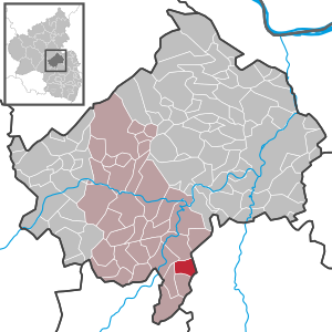
| Location of the local community Callbach in the Bad Kreuznach district | ||
  |
||


Call Bach is one of the municipality near-Glan belonging to local community in the Rhineland-Palatinate district of Bad Kreuznach in Germany .
geography
The street village is located in the North Palatinate Uplands on the Eschelbachtal, a side valley of the Glan . To the west is Meisenheim , in the east Unkenbach and south is Schmittweiler .
The Lindenhof residential area also belongs to Callbach .
history
Callbach was first mentioned in 1293 in a document from Count Heinrich I von Veldenz . The village belonged to the Meisenheim property of the County of Veldenz, which essentially consisted of fiefs from the Archdiocese of Mainz . By inheritance, Callbach and Meisenheim came to Pfalz-Zweibrücken in 1444 . In 1798 Callbach was assigned to the new Donnersberg department, while the part of the Meisenheim Oberamt to the left of the Glans was added to the new Saar department . After the Congress of Vienna Callbach belonged to the Rhine District in the Kingdom of Bavaria , where it remained as Pfalz (Bavaria) until 1946. During the Rhineland-Palatinate administrative reform in 1969, it was reclassified from the Rockenhausen district to the Bad Kreuznach district. In church terms, Callbach still belongs to the Evangelical Church of the Palatinate and the Diocese of Speyer .
- Statistics on population development
The development of the population of Callbach, the values from 1871 to 1987 are based on censuses:
|
|
politics
Municipal council
The council in Callbach consists of eight council members, who in the local elections on May 26, 2019 in a majority vote were elected, and the honorary mayor as chairman.
mayor
Uwe Mauritz is the local mayor. His election was made on August 1, 2019 by the local council after no candidate had run in the local elections on May 26, 2019. He is the successor to Lothar Geib (SPD), who was no longer a candidate.
Culture and sights
Economy and Infrastructure
The federal highway 420 runs through the village . In Staudernheim there is a train station of the Nahe Valley Railway .
literature
- [Günter F. Anthes u. a.]: 700 years of Callbach . Ed .: Local community Callbach. Callbach 1993.
Web links
- Short portrait with a film about Callbach on SWR television
- Literature about Callbach in the Rhineland-Palatinate State Bibliography
Individual evidence
- ↑ State Statistical Office of Rhineland-Palatinate - population status 2019, districts, communities, association communities ( help on this ).
- ↑ State Statistical Office Rhineland-Palatinate (ed.): Official directory of the municipalities and parts of the municipality. Status: January 2018 [ Version 2020 is available. ] . S. 15 (PDF; 2.2 MB).
- ↑ 700 years Callbach, p. 28ff.
- ↑ Winfried Dotzauer: History of the Nahe-Hunsrück area from the beginnings to the French Revolution . Stuttgart 2001, p. 184 .
- ^ Udo Salomon: Meisenheim . Bad Kreuznach 2015, p. 209 f .
- ↑ State Statistical Office Rhineland-Palatinate - regional data
- ^ The Regional Returning Officer RLP: City Council Election 2019 Callbach. Retrieved September 28, 2019 .
- ^ The Regional Returning Officer RLP: direct elections 2019. see Meisenheim, Verbandsgemeinde, fourth line of results. Retrieved September 28, 2019 .
- ^ Citizens' newspaper Meisenheim, official announcements: Report on the meeting of the Callbach municipal council on August 1st, 2019. P. 4, edition 34/2019. August 22, 2019. Retrieved September 28, 2019 .

Abtweiler | Allenfeld | Altenbamberg | Eagle swings | Floodplains | Bad Kreuznach | Bad Sobernheim | Bärenbach | Bärweiler | Becherbach | Becherbach near Kirn | Biebelsheim | Bockenau | Boos | Braunweiler | Brauweiler | Breitenheim | Bretzenheim | Bruschied | Burgsponheim | Callbach | Dalberg | Daubach | Daxweiler | Desloch | Dörrebach | Dorsheim | Duchroth | Eckenroth | Feilbingert | Frei-Laubersheim | Fürfeld | Gebroth | Guldental | Gutenberg | Hackenheim | Hahnenbach | Hallgarten | Hargesheim | Heimweiler | Heinzenberg | Hennweiler | Hergenfeld | Hochstätten | Hochstetten-Dhaun | Horbach | Hüffelsheim | Hundsbach | Ippenschied | Jeckenbach | Kellenbach | Kirn | Cherry red | Königsau | Langenlonsheim | Langenthal | Laubenheim | Listener | Lettweiler | Limbach | Löllbach | Almond | Martinstein | Meckenbach | Meddersheim | Meisenheim | Merxheim | Monzingen | Münchwald | New Bamberg | Niederhausen | Norheim | Walnut | Oberhausen an der Nahe | Oberhausen near Kirn | Oberstreit | Odernheim am Glan | Otzweiler | Pfaffen-Schwabenheim | Pleitersheim | Raumbach | Rehbach | Rehborn | Reiffelbach | Roth | Roxheim | Rudesheim | Rümmelsheim | Saint Catherine | Schloßböckelheim | Schmittweiler | Schneppenbach | Schöneberg | Black earth | Schweinschied | Schweppenhausen | Seesbach | Seibersbach | Simmertal | Summer slump | Spa bridges | Spall | Sponheim | Staudernheim | Stromberg | Tiefenthal | Traisen | Volxheim | Waldböckelheim | Waldlaubersheim | Wallhausen | Warmsroth | Hamlet near Monzingen | Weinsheim | Weitersborn | Windesheim | Winterbach | Winterburg