
Weitersborn
| coat of arms | Germany map | |
|---|---|---|

|
Coordinates: 49 ° 51 ' N , 7 ° 32' E |
|
| Basic data | ||
| State : | Rhineland-Palatinate | |
| County : | Bad Kreuznach | |
| Association municipality : | Kirner Land | |
| Height : | 380 m above sea level NHN | |
| Area : | 3.12 km 2 | |
| Residents: | 221 (Dec. 31, 2019) | |
| Population density : | 71 inhabitants per km 2 | |
| Postal code : | 55629 | |
| Area code : | 06754 | |
| License plate : | KH | |
| Community key : | 07 1 33 113 | |
| Association administration address: | Bahnhofstrasse 31 55606 Kirn |
|
| Website : | ||
| Local Mayor : | Bruno Stemmler | |
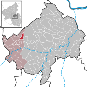
| Location of the community of Weitersborn in the Bad Kreuznach district | ||
  |
||


Weitersborn is a municipality in the Bad Kreuznach district in Rhineland-Palatinate . It belongs to the Kirner Land association.
geography
Weitersborn is located in the southern Hunsrück at an altitude of 380 meters on the edge of the Soonwald above the Kellenbach . 54.6 percent of the district area is forested.
The local community is located with the entire district area in the "Soonwald landscape conservation area".
history
Middle Ages until today
The history of Weitersborn is still largely unexplored. Various burial mounds in the Weitersborner district indicate settlement during Roman times. A Roman stone box comes from one of these burial mounds. Presumably a Roman road passed near this group of burial mounds. The place appears in sources from the 15th century as "Wyttersburen" or "Witersburen" (1484). In 1515 the place is called "Witersborn", 1531 "Weythersborn", from 1555 the place has the current name "Weitersborn". Since the beginning of the 16th century, the ending “buren” (ahd. Buri = dwelling) has been reinterpreted to “born” (well).
The lordship in the Middle Ages cannot be clearly determined. According to a message from 1542, there was a village "Weitersborn under the customs" in the area of the manor of St. Maximin in front of Trier. The assumption that this place name is a desert is doubtful . Probably the current village is meant, especially since the manorial power of this Trier imperial abbey extended very far. Just like Brauweiler and Horbach , Weitersborn was probably an expansion and raw dung settlement from Simmern under Dhaun (today Simmertal ). The high jurisdiction for Weitersborn is likely to have been with a Sponheim count in the high Middle Ages . After the division of the county, this was probably a member of the Sponheim-Kreuznacher line from the middle of the 13th century. In the 14th century, Weitersborn was largely owned by the Sponheim branch of the von Koppenstein family .
Also Fabricius one Weitersborn to the Official Koppenstein where the place along with the villages Henau , black earth , Kellenbach , Königsau , Seesbach , Martin Stone and Mengerschied had the high court Kellenbach formed. It is a sovereign area in which the jurisdiction of the Counts Sponheim, the Lords of Schidtburg, the Ganerbe von Steinkallenfels and the Lords of Kellenbach was exercised in equal parts (1/4). Weitersborn, like Seesbach, Martinstein and Mengigart, was outside the county of Sponheim. However, two families lived there who were subjects of Sponheim and who had to provide services and taxes to the Lords of Koppenstein (1702).
Some other knight families are mentioned for the 14th and 15th centuries, who also had property and sovereign rights in Weitersborn. Towards the end of the 14th century, Frank von Löwenstein acquired a share in the manor and jurisdiction of Weitersborn and Horbach as well as part of the Bailiwick of Simmern under Dhaun. By marriage, rights and property came to Simon Boos von Waldeck , who bought it to enlarge his property in Weitersborner. Heir to the Boos von Waldeck was Melchior von Rüdesheim, who also owned goods and sovereign rights in Martinstein , Merxheim , Weiler , Auen , Gonrather Hof and Hochstetten . After his death, his inheritance was shared between his daughter Barbara, married to Endre von der Leyen , and his granddaughter Maria. She was used as an inheritance because her mother Dorothea Hilchen von Lorch had died in 1512. Maria herself was already widowed at this point, her husband was Adam (III.) Vogt von Hunolstein († 1540). Her father, the famous knight and field marshal Johann (III) Hilchen von Lorch , administered his daughter's inheritance until his death. Thus were the Hunold of stone and the von der Leyen as Ganerbengemeinschaft new local lords in Weitersborn. Besides these families, the gentlemen von Schönborn later had income and rights here.
From around 1650 the place was part of the Martinstein rule , which was part of the imperial knighthood and formerly came from the pledge of the Archbishop and Elector of Mainz. In the 18th century this rule passed to the Margrave of Baden , whereby the administration of the Koppenstein office was connected to the Naumburg office (Becherbach / Bärenbach). In addition to Weitersborn, the Koppenstein office also included Brauweiler, Gehlweiler, Henau, Kellenbach, Schliigart, Schwarzerden and Seesbach.
Information is available for the villages of the “Kellenbach Court” from 1601, which roughly suggests the size of the former villages. Accordingly, there were eight fireplaces in Weitersborn, i.e. permanent houses in which families lived. Henau, Kellenbach and Seesbach had twice the size, while Martinstein four and Königsau only two fireplaces are given.
In the years 1784/85, 66 people emigrated from Weitersborn, with a total of 165 inhabitants at the time. The quota of emigrants from the neighboring town of Seesbach was probably even greater.
After the French occupation of the area on the left bank of the Rhine (1794), the village was assigned to the canton of Kirn in the Rhine-Moselle department under French administration in 1798 . After 1800, Weitersborn belonged to the Mairie Monzingen .
According to a population statistics from 1810, 27 families with a total of 144 residents lived in 25 houses in Weitersborn. Of these, 51 belonged to the Catholic and 93 to the Lutheran denomination. Ecclesiastically, the place always belonged to the parish of Simmern unter Dhaun (today Simmertal). The Catholics had been parish in Seesbach since the Reformation. The chapel in Weitersborn, consecrated to St. Anthony, was first mentioned in 1468.
Weitersborn was until 1968 part of the local authority office Monzingen and until 1970 the same municipality . The place was one of the rural communities in the district that was most severely affected by war destruction in percentage terms.
Around 1950 about half of the population lived from agriculture. This also included a larger group of forest workers who are recorded in the statistics as agricultural workers.
Since the Rhineland-Palatinate administrative reform of 1969/70, Weitersborn has belonged to the community of Kirn-Land.
In 2010 there is still a farm in Weitersborn. Most of the workforce commutes to the near and far.
Well in Weitersborn
A water pipe was built in Weitersborn as early as 1863 and expanded in 1928. In the 1970s, the outstanding quality of the water was recognized and the water supply was expanded to six deep wells (later seven) with an associated elevated tank. The municipalities of Kellenbach, Königsau, Simmertal, Weitersborn, Martinstein and, since 1991, Schwarzerden and Henau are supplied with this water. The operator of these group systems is the Verbandsgemeindewerke Kirn-Land.
Village school
The beginnings of the Weitersborn village school have not yet been explored. The year of construction of the school, which was rebuilt in 1893, is also unknown. This year the school hall, in which all age groups were taught together, and the teacher's apartment were enlarged. Most of the time the school was an evangelical denominational school. Catholic children were taught in the neighboring village of Seesbach.
- In 1895, 44 children were taught in the Weitersborn elementary school.
- In 1938 the school became a community school for Protestant and Catholic children.
- In 1946 the denominational school was reintroduced.
- In 1960, 29 girls and boys attended school.
- In 1965 the 7th and 8th grade were taught in Simmertal.
- In 1968 the school was downgraded to a primary school . The 5th and 6th grades have also been taught in Simmertal since then.
- In 1969 the school in Weitesborn was stopped. The furniture was taken over from the Simmern Unter Dhaun elementary school, where the children were also taught from then on.
- In 1987 the school building was sold by the community. Until the new parish hall was built, the old school was used for meetings and parties. Today the school building is used as a residential building.
Population development
The development of the population of Weitersborn, the values from 1871 to 1987 are based on censuses:

|
|
politics
Municipal council
The municipal council in Weitersborn consists of six council members, who were elected in the local elections on May 26, 2019 in a majority vote, and the honorary local mayor as chairman.
mayor
The local mayor is Bruno Stemmler. In the local elections on May 26, 2019, he was confirmed in his office with 70.77% of the votes.
coat of arms
|
|
Blazon : "In a split shield in front in gold a red sloping bar, behind in blue a silver bowl fountain with split silver water jet." |
|
Justification for the coat of arms: The sloping beam reminds of the former affiliation to Baden . The fountain symbolizes the ending of the place name (-born).
On October 17, 1979, the local council commissioned the graphic designer Brust, Kirnsulzbach, to develop a design for a municipal coat of arms. At its meeting on April 24, 1980, the Council adopted the draft presented. After approval by the State Archives, the Ministry of the Interior in Mainz granted permission on August 18, 1980 to use one's own coat of arms. |
Buildings


The historic village chapel of Weitersborn is located in the lower main street. Little is known for certain about its history. The chapel dates from the 13th century and was initially designed as a small standing church without benches for church visitors. In a small sacristy there is a centuries-old fresco. Due to the similarity to the frescoes in the Seesbach Semendiskapelle, the same artist is assumed. The church consecrated to St. Anthony is first mentioned in 1468. Since the Reformation the Catholics have been parish in Seesbach. Catholics are still allowed to hold church services in the Weitersborn chapel on St. Mark's Day (April 25th) and on one day during the week of the Cross (between Rogate and Ascension), as well as celebrate baptisms, weddings and, immediately after a funeral, the funeral office.
In 1501 the nave was enlarged. The date of this extension could still be read as an inscription on the church in the last century. At the beginning of the 20th century, the church was equipped with wooden benches in the nave and choir, as well as a wooden pulpit, which will be removed from the church in the course of this century. In the 20th century the church was equipped with gas heating and modern chairs.
In 1970/71 the community of Weitersborn added a 33 m² morgue with a small equipment room to the church for around DM 28,000.
In 1990 the chapel was placed under monument protection. In 1991/92 the chapel was renovated inside and out with the voluntary help of many people from Weitersborn. During this renovation, a walled niche in the choir room of the chapel is reopened. In 1993 a citizen of Weitersborn donated a new lead-glazed choir window, which was designed by a Bonn artist. The church is getting a new wooden canopy covered with natural slate.
The Evangelical Church of Weitersborn belongs to the parish Simmern unter Dhaun (Simmertal).
Economy and Infrastructure
There is a village community center in Weitersborn. The federal highway 41 runs in the south . In Martinstein there is a train station on the Bingen – Saarbrücken line . The B 421 runs in the west, via which there is a connection to Frankfurt-Hahn Airport in the north-west.
Personalities
- Friedrich Carl Michael Grosholz , founding father of Bad Vilbeler Urquelle
Web links
- Weitersborn
- TV show here in Germany
- Literature about Weitersborn in the Rhineland-Palatinate state bibliography
Individual evidence
- ↑ State Statistical Office of Rhineland-Palatinate - population status 2019, districts, communities, association communities ( help on this ).
- ↑ Notice board, opposite the school building, 2007
- ↑ State Statistical Office Rhineland-Palatinate - regional data
- ^ The Regional Returning Officer RLP: City Council Election 2019 Weitersborn. Retrieved September 21, 2019 .
- ↑ The regional returning officer RLP: direct elections 2019. see Kirn-Land, Verbandsgemeinde, 17th line of results. Retrieved September 21, 2019 .
- ↑ a b Statistical maps, Verbandsgemeinde Kirn-Land, 2009 (internal documents)
- ↑ Notice board, on the way to the church, 2007

Abtweiler | Allenfeld | Altenbamberg | Eagle swings | Floodplains | Bad Kreuznach | Bad Sobernheim | Bärenbach | Bärweiler | Becherbach | Becherbach near Kirn | Biebelsheim | Bockenau | Boos | Braunweiler | Brauweiler | Breitenheim | Bretzenheim | Bruschied | Burgsponheim | Callbach | Dalberg | Daubach | Daxweiler | Desloch | Dörrebach | Dorsheim | Duchroth | Eckenroth | Feilbingert | Frei-Laubersheim | Fürfeld | Gebroth | Guldental | Gutenberg | Hackenheim | Hahnenbach | Hallgarten | Hargesheim | Heimweiler | Heinzenberg | Hennweiler | Hergenfeld | Hochstätten | Hochstetten-Dhaun | Horbach | Hüffelsheim | Hundsbach | Ippenschied | Jeckenbach | Kellenbach | Kirn | Cherry red | Königsau | Langenlonsheim | Langenthal | Laubenheim | Listener | Lettweiler | Limbach | Löllbach | Almond | Martinstein | Meckenbach | Meddersheim | Meisenheim | Merxheim | Monzingen | Münchwald | New Bamberg | Niederhausen | Norheim | Walnut | Oberhausen an der Nahe | Oberhausen near Kirn | Oberstreit | Odernheim am Glan | Otzweiler | Pfaffen-Schwabenheim | Pleitersheim | Raumbach | Rehbach | Rehborn | Reiffelbach | Roth | Roxheim | Rudesheim | Rümmelsheim | Saint Catherine | Schloßböckelheim | Schmittweiler | Schneppenbach | Schöneberg | Black earth | Schweinschied | Schweppenhausen | Seesbach | Seibersbach | Simmertal | Summer slump | Spa bridges | Spall | Sponheim | Staudernheim | Stromberg | Tiefenthal | Traisen | Volxheim | Waldböckelheim | Waldlaubersheim | Wallhausen | Warmsroth | Hamlet near Monzingen | Weinsheim | Weitersborn | Windesheim | Winterbach | Winterburg