
Rümmelsheim
| coat of arms | Germany map | |
|---|---|---|

|
Coordinates: 49 ° 56 ' N , 7 ° 52' E |
|
| Basic data | ||
| State : | Rhineland-Palatinate | |
| County : | Bad Kreuznach | |
| Association municipality : | Langenlonsheim-Stromberg | |
| Height : | 180 m above sea level NHN | |
| Area : | 3.08 km 2 | |
| Residents: | 1347 (Dec. 31, 2019) | |
| Population density : | 437 inhabitants per km 2 | |
| Postal code : | 55452 | |
| Area code : | 06721 | |
| License plate : | KH | |
| Community key : | 07 1 33 087 | |
| LOCODE : | DE RUH | |
| Community structure: | 2 districts | |
| Association administration address: | Naheweinstrasse 80 55450 Langenlonsheim |
|
| Website : | ||
| Local Mayor : | Hartmut Merkelbach (FWG) | |
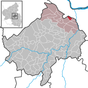
| Location of the local community Rümmelsheim in the Bad Kreuznach district | ||
  |
||

The wine town of Rümmelsheim is a municipality in the Bad Kreuznach district in Rhineland-Palatinate . It belongs to the Langenlonsheim-Stromberg community .
geography
Geographical location
Rümmelsheim is located in the Trollbachtal west of the Nahe just before it flows into the Rhine . In the south is the city of Bad Kreuznach , in the northeast the city of Bingen am Rhein . The Trollbach flows through the village .
Neighboring communities
Neighboring communities of Rümmelsheim are Dorsheim , Waldalgesheim , Münster-Sarmsheim , Waldlaubersheim and Burg-Layen
history
In 1125, Rümmelsheim was first mentioned in a document under the name Rimilisheim . The village, which belonged to the Waldlaubersheim , Genheim and Schweppenhausen properties , was under the administration of the Lords of Bolanden. Partial holdings belonged to the knights from Stein, Löwenstein and Weiterbach.
Layen Castle , which belongs to Rümmelsheim, guarded the road over the Trollbach. Also built in the 12th century, it was rebuilt in 1680.
Until 1772 there was an assistance agreement with the city of Bingen . In 1772 Rümmelsheim was sold to the Bretzenheim rulership . At the time of French rule in the Rhineland (1796–1814), new structures were created in the occupied territories. Rümmelsheim went to Mairie Waldalgesheim. Rümmelsheim had 420 inhabitants at that time.
In the course of the Rhineland-Palatinate administrative reform, Rümmelsheim came to the Langenlonsheim Association in 1970.
- Statistics on population development
The development of the population of Rümmelsheim, the values from 1871 to 1987 are based on censuses:

|
|
politics
Municipal council
The local council in Rümmelsheim consists of 16 council members who were elected in a personalized proportional representation in the local elections on May 26, 2019 , and the honorary local mayor as chairman.
The distribution of seats in the local council:
| choice | SPD | CDU | FWG | total |
|---|---|---|---|---|
| 2019 | - | 5 | 11 | 16 seats |
| 2014 | - | 7th | 9 | 16 seats |
| 2009 | - | 6th | 10 | 16 seats |
| 2004 | 3 | 8th | 5 | 16 seats |
- FWG = Free Voting Group Rümmelsheim e. V.
mayor
The local mayor is Hartmut Merkelbach (FWG). In the local elections on May 26, 2019, he was elected with 80.03% of the vote and is the successor to Jürgen Gumbrich (FWG), who had not run for office after ten years.
Economy and Infrastructure
education
Rümmelsheim has a full-time day care center and a full-time elementary school. Secondary schools and other educational institutions in Bingen , Bad Kreuznach , Hargesheim and Stromberg can be found in the vicinity .
economy
The main commercial area around Rümmelsheim is viticulture. About 138 hectares are cultivated by large and small wineries in Rümmelsheim. There are also a few smaller companies, mainly from the service industry.
Viticulture and trade
Rümmelsheim belongs to the "Nahetal wine-growing area" in the Nahe growing area . There are 18 wine-growing businesses in the village and the area under vines is 114 hectares . About 77% of the cultivated wine are white grape varieties (as of 2007). In 1979 45 companies were still active, the area under vines of 216 hectares has been almost halved since then. With Pieroth Wein AG, one of the largest wine traders in Germany is based in the town.
traffic
The federal motorway 61 is reached after about 1 km at junction 48 (Rümmelsheim / Dorsheim). There is also a (mostly) hourly bus connection to the train stations in Münster-Sarmsheim (regional train) and Bingen (regional and national) as well as a bus connection to Bad Kreuznach . Frankfurt and Frankfurt-Hahn airports can be reached in around 45 minutes by car.
Sons and daughters of the church
- Jakob Diel (1886–1969), German politician and winemaker, operator of Layen Castle
See also
Web links
- Literature about Rümmelsheim in the Rhineland-Palatinate state bibliography
Individual evidence
- ↑ State Statistical Office of Rhineland-Palatinate - population status 2019, districts, communities, association communities ( help on this ).
- ↑ a b State Statistical Office Rhineland-Palatinate - regional data
- ^ The Regional Returning Officer RLP: City Council Election 2019 Rümmelsheim. Retrieved September 15, 2019 .
- ^ The Regional Returning Officer Rhineland-Palatinate: Municipal elections 2014, city and municipal council elections
- ^ The Regional Returning Officer RLP: direct elections 2019. see Langenlonsheim, Verbandsgemeinde, penultimate line of results. Retrieved September 15, 2019 .

Abtweiler | Allenfeld | Altenbamberg | Eagle swings | Floodplains | Bad Kreuznach | Bad Sobernheim | Bärenbach | Bärweiler | Becherbach | Becherbach near Kirn | Biebelsheim | Bockenau | Boos | Braunweiler | Brauweiler | Breitenheim | Bretzenheim | Bruschied | Burgsponheim | Callbach | Dalberg | Daubach | Daxweiler | Desloch | Dörrebach | Dorsheim | Duchroth | Eckenroth | Feilbingert | Frei-Laubersheim | Fürfeld | Gebroth | Guldental | Gutenberg | Hackenheim | Hahnenbach | Hallgarten | Hargesheim | Heimweiler | Heinzenberg | Hennweiler | Hergenfeld | Hochstätten | Hochstetten-Dhaun | Horbach | Hüffelsheim | Hundsbach | Ippenschied | Jeckenbach | Kellenbach | Kirn | Cherry red | Königsau | Langenlonsheim | Langenthal | Laubenheim | Listener | Lettweiler | Limbach | Löllbach | Almond | Martinstein | Meckenbach | Meddersheim | Meisenheim | Merxheim | Monzingen | Münchwald | New Bamberg | Niederhausen | Norheim | Walnut | Oberhausen an der Nahe | Oberhausen near Kirn | Oberstreit | Odernheim am Glan | Otzweiler | Pfaffen-Schwabenheim | Pleitersheim | Raumbach | Rehbach | Rehborn | Reiffelbach | Roth | Roxheim | Rudesheim | Rümmelsheim | Saint Catherine | Schloßböckelheim | Schmittweiler | Schneppenbach | Schöneberg | Black earth | Schweinschied | Schweppenhausen | Seesbach | Seibersbach | Simmertal | Summer slump | Spa bridges | Spall | Sponheim | Staudernheim | Stromberg | Tiefenthal | Traisen | Volxheim | Waldböckelheim | Waldlaubersheim | Wallhausen | Warmsroth | Hamlet near Monzingen | Weinsheim | Weitersborn | Windesheim | Winterbach | Winterburg