
Hackenheim
| coat of arms | Germany map | |
|---|---|---|

|
Coordinates: 49 ° 50 ' N , 7 ° 54' E |
|
| Basic data | ||
| State : | Rhineland-Palatinate | |
| County : | Bad Kreuznach | |
| Association municipality : | Bad Kreuznach | |
| Height : | 180 m above sea level NHN | |
| Area : | 4.31 km 2 | |
| Residents: | 2069 (Dec. 31, 2019) | |
| Population density : | 480 inhabitants per km 2 | |
| Postal code : | 55546 | |
| Area code : | 0671 | |
| License plate : | KH | |
| Community key : | 07 1 33 037 | |
| LOCODE : | DE 82S | |
| Association administration address: | Rheingrafenstrasse 11 55543 Bad Kreuznach |
|
| Website : | ||
| Mayoress : | Sylvia Fels | |
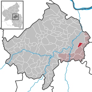
| Location of the local community Hackenheim in the Bad Kreuznach district | ||
  |
||

Hackenheim is a local community in the Bad Kreuznach district in Rhineland-Palatinate, which is characterized by viticulture . It belongs to the Bad Kreuznach community .
geography
On the 220 m above sea level NHN high Kirchberg you have a good view of the Hunsrück , the Rhine-Nahe-Eck up to the Rüdesheimer Rottland, on which the Niederwald monument is enthroned. Behind it, the Rheingau Mountains continue as part of the Taunus with the Kalten Herberge and the Hohe Kanzel above Wiesbaden . Behind it you can see the Feldberg area with the Kleiner Feldberg , the Großer Feldberg and the Altkönig . To the east you can see over the hills of the Rheinhessische Schweiz on clear days to the Odenwald .
To Hackenheim includes the residential places Antoniushof, Bonn Hof, Darmstadt court in the Rose Garden and Weingut Rosenhof.
history
Hackenheim was part of the County of Sponheim . After the Counts of Sponheim died out, the territory was in divided ownership that changed several times. From 1707 Hackenheim belonged completely to the Electoral Palatinate .
During the so-called French period , the place was assigned to the canton of Wöllstein in the Donnersberg department. Due to the agreements reached at the Congress of Vienna in 1815 and a state treaty concluded in 1816 between Hesse , Austria and Prussia , the region and with it the municipality of Hackenheim came to the Grand Duchy of Hesse and was assigned to the province of Rheinhessen by this . After the dissolution of the Rhine-Hessian cantons, the place came to the newly established Bingen district in 1835 and to the Alzey district in 1852 .
- Population development
The development of the population of Hackenheim, the values from 1871 to 1987 are based on censuses:
|
|

politics
Municipal council
The local council in Hackenheim consists of 16 council members, who were elected in the local elections on May 26, 2019 in a personalized proportional representation, and the honorary local mayor as chairman.
The distribution of seats in the municipal council:
| choice | SPD | CDU | FWG | total |
|---|---|---|---|---|
| 2019 | 2 | 5 | 9 | 16 seats |
| 2014 | 3 | 6th | 7th | 16 seats |
| 2009 | 2 | 5 | 9 | 16 seats |
| 2004 | 2 | 5 | 9 | 16 seats |
- FWG = Free Voting Community Hackenheim e. V.
mayor
The local mayor is Sylvia Fels (FWG). In the local elections on May 26, 2019, she was confirmed in office with 59.19% of the votes.
coat of arms
|
|
Blazon : “A divided coat of arms in the base of the shield. The upper half is sheathed in blue and gold. In the lower half, two crossed silver hooks in green. Above this sign against a blue sky is the silver whole figure of St. Michael slaying the dragon. "
It was approved by the Rhineland-Palatinate Ministry of the Interior in 1953 . |
| Justification for the coat of arms: The hooks refer to the place name. The colors blue and gold come from the coat of arms of the Counts of Sponheim. Michael is the patron saint of the local church. |
Partnerships
The municipality maintains partnership relations with Tossiat in France.
Culture and sights
Buildings
See: List of cultural monuments in Hackenheim
Festivals
In addition to the wine festival of the Bad Kreuznach community, which takes place every June in one of the associated communities, there has been the "Rendezvous at the Kapellsche" since 2004. The wine festival on the Kirchberg always takes place in July. In addition, the fair (Kerb) takes place every year in September. The sports club TuS Hackenheim organizes the Kölschstandparty every year on the night of the German Unity Day. The music association, on the other hand, organizes the “dad party” on Father's Day.
Economy and Infrastructure
Viticulture
Hackenheim belongs to the "Bingen wine-growing area" in the Rheinhessen growing area . 14 wine-growing businesses are active in the village, and the area under vines is 146 hectares . About 72% of the cultivated wine are white wine grape varieties (as of 2007). In 1979 there were still 47 farms operating, the vineyard area at that time was 127 hectares.
traffic
- Hackenheim is located directly on the federal highway 428 , the motorway slip road to the A 61 and A 63 is approx. 5 km away.
- Trains from the Alsenz Valley Railway and the Nahe Valley Railway stop in nearby Bad Kreuznach .
education
- kindergarten
- Hackenheim primary school
- Volksbildungswerk Hackenheim
literature
- Joachim Köhler, Sandra Hummel: Historical Hackenheim . Independently published, 2018, ISBN 978-1-983354-62-5 .
Web links
- Internet presence of the local community Hackenheim
- History of Hackenheim on regionalgeschichte.net
- Literature about Hackenheim in the Rhineland-Palatinate State Bibliography
Individual evidence
- ↑ State Statistical Office of Rhineland-Palatinate - population status 2019, districts, communities, association communities ( help on this ).
- ↑ State Statistical Office Rhineland-Palatinate (ed.): Official directory of the municipalities and parts of the municipality. Status: January 2018 [ Version 2020 is available. ] . S. 14 (PDF; 2.2 MB).
- ↑ a b State Statistical Office Rhineland-Palatinate - regional data
- ^ The Regional Returning Officer RLP: City Council Election 2019 Hackenheim. Retrieved September 13, 2019 .
- ^ The Regional Returning Officer Rhineland-Palatinate: Municipal elections 2014, city and municipal council elections
- ^ The Regional Returning Officer RLP: direct elections 2019. see Bad Kreuznach, Verbandsgemeinde, sixth row of results. Retrieved September 13, 2019 .

Abtweiler | Allenfeld | Altenbamberg | Eagle swings | Floodplains | Bad Kreuznach | Bad Sobernheim | Bärenbach | Bärweiler | Becherbach | Becherbach near Kirn | Biebelsheim | Bockenau | Boos | Braunweiler | Brauweiler | Breitenheim | Bretzenheim | Bruschied | Burgsponheim | Callbach | Dalberg | Daubach | Daxweiler | Desloch | Dörrebach | Dorsheim | Duchroth | Eckenroth | Feilbingert | Frei-Laubersheim | Fürfeld | Gebroth | Guldental | Gutenberg | Hackenheim | Hahnenbach | Hallgarten | Hargesheim | Heimweiler | Heinzenberg | Hennweiler | Hergenfeld | Hochstätten | Hochstetten-Dhaun | Horbach | Hüffelsheim | Hundsbach | Ippenschied | Jeckenbach | Kellenbach | Kirn | Cherry red | Königsau | Langenlonsheim | Langenthal | Laubenheim | Listener | Lettweiler | Limbach | Löllbach | Almond | Martinstein | Meckenbach | Meddersheim | Meisenheim | Merxheim | Monzingen | Münchwald | New Bamberg | Niederhausen | Norheim | Walnut | Oberhausen an der Nahe | Oberhausen near Kirn | Oberstreit | Odernheim am Glan | Otzweiler | Pfaffen-Schwabenheim | Pleitersheim | Raumbach | Rehbach | Rehborn | Reiffelbach | Roth | Roxheim | Rudesheim | Rümmelsheim | Saint Catherine | Schloßböckelheim | Schmittweiler | Schneppenbach | Schöneberg | Black earth | Schweinschied | Schweppenhausen | Seesbach | Seibersbach | Simmertal | Summer slump | Spa bridges | Spall | Sponheim | Staudernheim | Stromberg | Tiefenthal | Traisen | Volxheim | Waldböckelheim | Waldlaubersheim | Wallhausen | Warmsroth | Hamlet near Monzingen | Weinsheim | Weitersborn | Windesheim | Winterbach | Winterburg