
Little Feldberg
| Little Feldberg | ||
|---|---|---|
 View from the Großer Feldberg observation tower |
||
| height | 825.2 m above sea level NHN | |
| location | near glassworks ; Hochtaunuskreis , Hessen ( Germany ) | |
| Mountains | Taunus | |
| Dominance | 0.93 km → Großer Feldberg | |
| Notch height | 35 m | |
| Coordinates | 50 ° 13 '18 " N , 8 ° 26' 45" E | |
|
||
| particularities |
Castle Kleiner Feldberg , Limes Germanicus , Taunus Observatory , Neumann Observatory , several transmission towers , DWD - measuring station |
|

The Kleine Feldberg near Glashütten in the Hessian Hochtaunuskreis is 825.2 m above sea level. NHN the second highest elevation in the Taunus . Depending on the interpretation, it is the second highest mountain in the Taunus or the second peak of the highest, the Großer Feldberg .
geography
location
The Kleine Feldberg is 1.4 km southwest of the Großer Feldberg ( 881.5 m ). In addition to this and the Altkönig ( 798.2 m ), it forms the core of the Hochtaunus as part of the Feldberg-Taunus ridge . It is located in the district of 3.2 km (each as the crow flies ) west-southwest located Glashütten . The source of the Weil is on the north flank of the Kleiner Feldberg and that of the Emsbach on the west flank .
Natural allocation
The Kleine Feldberg belongs to the natural spatial main unit group Taunus (No. 30) and in the main unit Hoher Taunus (301) to the subunit Feldberg-Taunuskamm (301.3), whereby its landscape to the north is part of the subunit horse head belonging to the main unit Eastern Hintertaunus (302) Taunus (302.6) and to the south in the main unit Vortaunus (300) and in the sub-unit Altkönig preliminary stage (300.2) into the natural area Königsteiner Taunusfuß (300.20).
Limes and fort
The Kleiner Feldberg fort , which is located near the Upper Germanic-Raetian Limes over the northern flank of the Kleiner Feldberg , dates from the time of the Romans .
Facilities on the summit region
|
Radio mast Kleiner Feldberg
|
|
|---|---|
| Basic data | |
| Place: | Little Feldberg |
| Country: | Hesse |
| Country: | Germany |
| Coordinates : | 50 ° 13 '18.6 " N , 8 ° 26" 47.2 " E |
| Use: | Telecommunications mast |
| Accessibility: | Transmission mast not open to the public |
| Mast data | |
| Data on the transmission system | |
| Waveband : | FM transmitter |
| Send types: | Directional radio , mobile land radio , BOS radio , amateur radio service |
On the summit region of the Kleiner Feldberg there is a meteorological and geophysical observatory , the Taunus Observatory . It was founded in 1913 by the Physikalischer Verein Frankfurt am Main and has been a branch of the Institute for Meteorology and Geophysics (today Institute for Atmosphere and Environment) since the Johann Wolfgang Goethe University in Frankfurt am Main was founded in 1914. For the opening, Kaiser Wilhelm II traveled from his summer residence in Bad Homburg Castle to open the then ultra-modern earthquake station and the “aerological station” for air measurements.
Since 1998 the Hans-Ludwig-Neumann-Sternwarte (Neumann-Sternwarte) has also been located there , operated by the Physikalischer Verein based in Frankfurt am Main.
Also on the summit region is a radio mast for authorities and organizations with security tasks as well as antenna systems from Lufthansa and the amateur radio service for the relay stations 10 m / 70 cm DF0MOT (29.670 MHz coupled with 438.625 MHz), 23 cm DB0MOT (1242.700 MHz) , 70 cm digital mobile radio MARC (438.275 MHz), 70 cm D-STAR (439.4375 MHz), 70 cm TETRA (430.075 MHz) and the remote receivers of the 2 m converter DB0FT (145.600 MHz) Gr . Feldberg.
Other measuring stations on the Kleine Feldberg are operated by the German Weather Service , the Hessian State Office for Nature Conservation, Environment and Geology and the Center for Environmental Research.
Traffic and walking
Something SSW of the small Feldbergs branches off from the trunk road 8 (glassworks Königstein ) via its edge after West Niederreifenberg leading national road 3025 from. From the latter branches off at the Limes mentioned above , the L 3024, which runs over the northern flank of the mountain and then over the southern highlands of the Großer Feldberg near the summit to the L 3004 ( Oberursel - Arnoldshain - Schmitten ). The mountain can be hiked, for example, starting at these roads, but due to the large number of facilities there, its summit region is fenced and closed to the public. The Schmitten-Niederreifenberg Windeck bus stop is located near the Kleiner Feldberg on the L 3024 .

View from the Großer Feldberg observation tower to the Kleiner Feldberg (2015)

View from the Altkönig to the summit of the Kleiner Feldberg u. a. with the two domes of the Hans-Ludwig-Neumann-Observatory
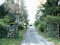
Entrance to the Feldberg Observatory


See also
Individual evidence
- ↑ a b Map services of the Federal Agency for Nature Conservation ( information )
- ↑ Brigitte Schwenzer: Geographical land survey: The natural space units on sheet 139 Frankfurt a. M. Federal Institute for Regional Studies, Bad Godesberg 1967. → Online map (PDF; 4.9 MB)
- ↑ 100 years Taunus Observatory ( Memento of the original from May 21, 2014 in the Internet Archive ) Info: The archive link was automatically inserted and not yet checked. Please check the original and archive link according to the instructions and then remove this notice. , from September 12, 2013, accessed on May 20, 2014, from uni-frankfurt.de
- ↑ Relay status of the Taunus relay group. Taunus Relais Group, accessed on March 31, 2017 .
Web links
- Kleiner Feldberg im Taunus (climate diagram), on klimadiagramme.de