Taunus main ridge
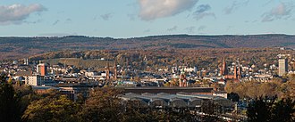
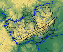
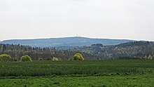
The Taunushauptkamm describes a 75-kilometer-long ridge line in the High Taunus , the geological core of which consists of hard Taunus quartzite veins and separates the steeply sloping Vordertaunus in the south from the gradually sloping mountains of the Hintertaunus in the north. Over large parts of the Taunus main ridge running watersheds of the Upper Rhine and Main in the south to the Middle Rhine -Zuflüssen Wisper and Lahn in the north (the enumerated from southwest to northeast), where some of the flowing southward waters by deep erosion, the rock of the Taunus comb unit at some Broken places so that the watersheds deviate in places by a few kilometers to the north.
In addition, the Taunushauptkamm is also a weather divide , which is particularly noticeable in the winter half-year with calm inversion weather conditions and separates fog in the Upper Rhine Plain from clear weather in the north. In north-westerly weather the Taunushauptkamm absorbs a lot of precipitation and ensures a mild climate for the Rhine-Main area .
course
The Taunus main ridge stretches in a south-west-north-east direction from the Middle Rhine to the Wetterau in the following natural areas:
- 301 High Taunus
- 301.0 Niederwald
- 301.1 Rheingau Mountains
- 301.2 Wiesbaden Hochtaunus
- 301.3 Feldberg- Taunus ridge
- 301.4 Winterstein-Taunus ridge
- 301.5 Nauheim Taunussporn
The Taunushauptkamm takes up the left bank of the Hunsrück ridge with the heights of the Binger Forest .
Niederwald
The Niederwald near Rüdesheim is a section in front of the Rheingau Mountains in the southwest, about three kilometers long in an east-west direction and one kilometer wide. To the northeast, it has a connection to the Taunushauptkamm via the Ebental high plateau . It is separated from it in the northwest by the deeply cut valley of the Eichbach stream flowing through Assmannshausen . The other two borders are formed by the Rhine Valley , which bends roughly at right angles here at Binger Loch . The highest point is the spruce head at 346 meters.
Rheingau Mountains
On the right bank of the Rhine , the Teufelskadrich with a height of 416 m is the first prominent elevation of the Taunus main ridge above the Middle Rhine , the water level of which is 78 m here . The ridge line climbs over the " Forsthaus Kammerforst" to the Zimmer heads for the first time to 500 m , to the northwest the Jägerhorn ( 538 m ) rises .
This is followed by a first incision in the ridge line in which the village of Stephanshausen is located. The watershed describes a semicircle around this place to the north at a height of at least 415 m . This is also the height that the country roads from Rüdesheim , Geisenheim and Oestrich-Winkel have to overcome on the way via Presberg into the Wisper valley (see also: Wispertaunus ).
Then the rising crest over the pass "Gray Stone" again until the Cold hostel , which with 619 m highest mountain in the Rheingau Mountains .
Further over the Erbacher Kopf at a height of 580 m , the ridge descends to a saddle , which the road from Kiedrich to Hausen overcomes in front of the height at a height of 514 m .
The next ascent leads over the Dreibornsköpf ( 548 m ). About the Hans head ( 495 m ) it goes back down until 260 meters after Schlangenbad where the Walluf the mountain masses cut has.
Here the watershed deviates again to the north. The road from Bärstadt in Walluftal to Hausen vor der Höhe overcomes it with a peak height of 486 m and the traffic on the B 260 ("Bäderstraße Taunus") leads over the " Wambacher Stich" and the 470 m high red stone crossing down to Bad Schwalbach in the Aartal .
Wiesbaden Hochtaunus
The Wiesbaden Hochtaunus begins behind the Walluf valley and climbs over the Rotekreuzkopf ( 510 m ) to its highest elevation, the Hohe Wurzel , at 618 m .
This is followed by one of the lowest crossings over the central section of the Taunus main ridge at 421 m : the Iron Hand . This pass is used by the B 54 and the Aartalbahn (see Eiserne Hand station ).
The ridge then leads over the Altenstein ( 501 m ) and the Eichelberg ( 536 m ) to the Jagdschloss Platte , where the B 417 ("Hühnerstraße") reaches its apex at 500 m .
As a result, the ridge line then leads over the Hohe Kanzel ( 592 m ) and its foothills Zieglerkopf ( 515 m ) first up and then down again to the main cut of Niederseelbach . Here, the watershed gives way to the north again due to the erosion work of the Daisbach.
The ridge between Niederseelbach and Idstein has a height of 351 m and is of considerable importance for long-distance traffic. So he is not only on the road Niedernhausen -Idstein also by the Main-Lahn Railway , the A 3 and the high-speed line Cologne-Rhine / Main used.
Feldberg-Taunus ridge
Behind this incision the Feldberg-Taunus ridge begins with the Buchwaldskopf ( 501 m ) and Großem Lindenkopf ( 500 m ), followed by the incision of the Schwarzbach with its source river Dattenbach. Here, too, the watershed deviates to the north again and offers a transition 1 km south of Heftrich at a height of 350 m at the site of the former Alteburg fort , which is now used by the 3273 road.
Further east, between Königstein and Glashütten at 556 m above sea level, the B 8 still leads over the Taunus .
The ridge line itself continues east of the Dattenbach in the Butznickel (462 m) near Schloßborn and the Glaskopf (687 m) near Glashütten and reaches the two highest peaks of the Taunus with the Kleiner Feldberg (825 m) and the Großer Feldberg ( 879 m ) .
On the western flank of this massif , at 688 m, the road from Königstein to Niederreifenberg leads over the “ Red Cross ” pass ; east of the massif is the transition of the road from Oberursel to Schmitten at 669 m at " Sandplacken " .
1 km of the Sandplacken southeast, on Kolbenberg ( 684 m ), the watershed between exits Main and Lahn the ridgeline finally to the north, because from here the opening of the Taunus-eastern flank of Wetterau makes out noticeable.
For the next few kilometers to the Köpperner Tal the course of the ridge line is identical to the course of the Limes . The mountains to be named up to this section of the Erlenbach are all over 600 m high: Klingenkopf ( 683 m ), Eichkopf ( 620 m ), Roßkopf ( 632 m ) and Hollerkopf ( 616 m ).
Then at 400 m the saddle follows , on which the Saalburg with the B 456 lies.
The Erlenbach cuts into the ridge line at 290 m , with the watershed deviating to the north, so that the Taunus Railway and the roads between Wehrheim and Usingen have to rise to at least 350 m .
Winterstein-Taunus ridge

The Winterstein-Taunus ridge begins behind the Köpperner Tal . It begins with the Graueberg ( 456 m ); Then follow Wellenberg ( 450 m ), Saukopf ( 480 m ), Kuhkopf ( 500 m ), the highest point the Steinkopf ( 518 m ) and finally the eponymous Winterstein ( 482 m ). On its eastern flank, the A5 crosses the gap between the Winterstein and the Nauheimer Taunussporn at 270 m just south of the Wetterau service area .
Nauheim Taunussporn
The ridge zone of the Nauheimer Taunussporn with the Eichberg ( 269 m ) and the Johannisberg ( 268 m ) clearly rises out of the Wetterau . These first surveys are in the immediate vicinity of the town center of Bad Nauheim . The Galgenkopf ( 259 m ) rises to the southeast of the A5 .
mountains
→ Main article: List of mountains and elevations of the Taunus
literature
- Alexander Stahr, Birgit Bender: The Taunus - A journey through time . Stuttgart 2007, ISBN 978-3-510-65224-2
- Eugen Ernst: The Taunus - An L (i) worthwhile low mountain range . Frankfurt 2009, ISBN 978-3-7973-1146-7
- Alexander Stahr: The soils of the Taunus ridge. Development-Dissemination-Use-Endangerment . Munich 2014, ISBN 978-3-8993-7180-2
Individual evidence
- ↑ Taunus & Gießen-Koblenzer Lahntal. Attention: Web link without return. Environmental Atlas Hessen of the Hessian State Office for Environment and Geology: The natural areas of Hesse and their main units
- ^ Hessian Land Surveying Office: District map 1: 50,000 Wiesbaden - Rheingaukreis - Untertaunuskreis, 1969 edition
Coordinates: 50 ° 10 ′ N , 8 ° 18 ′ E


