
Schwarzbach (Main)
| Schwarzbach | ||
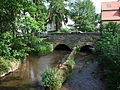
 Schwarzbach in Eppstein |
||
| Data | ||
| Water code | EN : 2496 | |
| location | Germany | |
| River system | Rhine | |
| Drain over | Main → Rhine → North Sea | |
| source | as Dattenbach , 1 km east and above Oberrod 50 ° 13 ′ 56 ″ N , 8 ° 23 ′ 33 ″ E |
|
| Source height | approx. 430 m above sea level NHN | |
| muzzle | near Hattersheim in the Main Coordinates: 50 ° 3 ′ 17 ″ N , 8 ° 30 ′ 31 ″ E 50 ° 3 ′ 17 ″ N , 8 ° 30 ′ 31 ″ E |
|
| Mouth height | approx. 91 m above sea level NHN | |
| Height difference | approx. 98 m | |
| Bottom slope | approx. 3.1 ‰ | |
| length | 31.9 km | |
| Catchment area | 134.76 km² | |
| Discharge at the Eppstein gauge (80.7% of the catchment area) A Eo : 109 km² Location: 14 km above the mouth |
NNQ (Sep. 24, 1997) MNQ 1956–2008 MQ 1956–2008 Mq 1956–2008 MHQ 1956–2008 HHQ (Jan. 2, 2003) |
86 l / s 204 l / s 877 l / s 8 l / (s km²) 11.7 m³ / s 34.8 m³ / s |
| Discharge A Eo : 134.76 km² at the mouth |
MNQ MQ Mq |
239 l / s 1.112 m³ / s 8.3 l / (s km²) |
| Medium-sized cities | Idstein, Hattersheim am Main, Hofheim am Taunus | |
| Small towns | Kriftel, Eppstein, Niedernhausen | |
The Schwarzbach is an almost 32 km long right or northern tributary of the Main in Hesse. The left upper reaches of the Schwarzbach bears the section name Dattenbach .
Surname
In the course of history the brook was known under different names such as Kriftel, Cruofdero, Cruftele or Kruftelam . Other names were or are Goldbach, Dattenbach, Kröftel and Okriftel . It was historically important as the eastern border between Königssondergau and Niddagau . In Roman times that separated Kriftel the Civitas Taunensium ( Wetterau and Vordertaunus) from the Civitas Mattiacorum (around Wiesbaden ).
geography
course
The Schwarzbach rises in the Hohe Taunus under the surname Dattenbach between Glashütten and Oberrod near the federal highway 8 and first flows through the districts of Oberrod and Niederrod , which belong to Idstein, and then crosses the Voraunus in a general southward direction . Below Kröftel is the rabbit mill by the stream. This is said to have served the Schinderhannes as a shelter. The reason was, on the one hand, the remote location and, on the other hand, the fact that the stream there was then the border between Kurmainz and Nassau. On the other side of the stream was the Fuchsmühle, which burned down in the 1980s. Between Kröftel and Vockenhausen, the stream flows through the Dattenbachtal nature reserve between Kröftel and Vockenhausen .
After 16.3 km of flow, it joins the Daisbach south of Vockenhausen with the Daisbach coming from the right and west from the direction of Niedernhausen and drops the surname. For the last 15.6 km to the mouth, only the main name Schwarzbach applies . The name came about because the tanneries there colored the water of the stream black.
The Schwarzbach flows through Hofheim am Taunus , the district town of the Main-Taunus district , the municipality of Kriftel , crosses the Main- Taunus foreland and finally flows into the Main at Okriftel .
The confluence of the Dais and Dattenbach rivers to the Schwarzbach in Eppstein

Schwarzbach in Eppstein

Schwarzbach Bridge in Lorsbach

Listed Schwarzbach Bridge in Eppstein


Tributaries
The tributaries of the Schwarzbach include (viewed downstream, kilometers from the mouth to the source):
| Surname | GKZ | Length in km |
Mouth height meters above sea level. NHN |
Direction of flow | Junction at km (coordinates) | Mouth | comment |
|---|---|---|---|---|---|---|---|
| Silberbach | 24961600 | 7.1 | 180 | Left | 19.858 | Holding | Left tributary |
| Daisbach | 24962000 | 14.8 | 189 | right | 15.6 ( coordinates ) | Eppstein | Right tributary |
| Dattenbach | 24960000 | 15.9 | 189 | Left | 15.6 ( coordinates ) | Eppstein | Second name for the headwaters of the Schwarzbach |
| Wellbach | 24963200 | 2.9 | 180 | Left | 14.7 ( coordinates ) | Eppstein | Left tributary |
| Fischbach | 24964000 | 6.1 | 179 | Left | 14.3 ( coordinates ) | Eppstein | Left tributary, length indication with Krebsbach |
| Heilbach | 24965914 | 1.2 | 174 | right | 13.2 ( coordinates ) | Eppstein |
Data
- The Schwarzbach is a coarse material rich, silicate low mountain range.
- It has an average flow rate (MQ) of 1112.4 l / s.
fauna
In July 2009, 15,000 young salmon were released in the Schwarzbach. The authorities and the environmental associations hope that some of them will manage to return in a few years and spawn at this point. The following animal species also occur in the Schwarzbach : brown trout , grayling , Mühlkoppe , brook loach and stone crab . In addition, on the lower reaches of the rainbow trout , aland , chub , gudgeon , hazel , roach , bitterling , river perch , ruff , pikeperch , marbled goby and signal crab .
freetime and recreation
A planetary path leads along the Schwarzbach from the Kriftel amusement park to the confluence with the Main , depicting the solar system on a scale of 1: 1,000,000,000.
Old railway bridge
About 100 meters northeast of the Hattersheim (Main) train station , the Schwarzbach is crossed by the Taunus Railway ( Frankfurt with Wiesbaden ) on a rather inconspicuous two-arched sandstone bridge. The bridge dates from the original time of the railway in 1839 and is therefore - together with the Nied railway bridge - one of the oldest railway bridges still in operation in Germany. It is based on a design by Paul Camille von Denis . The bridge was renovated with concrete in 1911 . It is a cultural monument due to the Hessian Monument Protection Act .
See also
Individual evidence
- ↑ a b c Topographic Map 1: 25,000 and Google Earth
- ↑ a b WFD kilometrage
- ↑ Hydrological yearbook Rhine area 2008 (PDF; 10 kB)
- ↑ Water body profile and program of measures 2496.1 ( Memento from January 1, 2013 in the web archive archive.today ) ( Notes ) → Overview of all Hessian river systems (PDF, 1.7 MB) Schwarzbach / Hattersheim
- ↑ Hermin Herr: Lexikon vom Hohe Taunus, 1993, ISBN 3-7829-0437-0 , p. 21
- ↑ Hermin Herr: Lexikon vom Hohe Taunus, 1993, ISBN 3-7829-0437-0 , pp. 49–51.
- ↑ Hermin Herr: Lexikon vom Hohe Taunus, 1993, ISBN 3-7829-0437-0 , p. 39.
- ↑ Hermin Herr: Lexikon vom Hohe Taunus, 1993, ISBN 3-7829-0437-0 , p. 21.
- ↑ Page no longer available , search in web archives: Type 5: Coarse material rich silicate low mountain range (PDF; 141 kB)
- ^ Dangerous Freedom, Gesa Fritz, FR July 17, 2009
- ↑ Sport-Angler-Club Taunusfischer e. V.
- ^ Heinz Schomann : Railway in Hessen . Railway buildings and routes 1839–1939. In: State Office for Monument Preservation Hessen (Ed.): Cultural monuments in Hessen. Monument topography Federal Republic of Germany . Three volumes in a slipcase. tape 2.1 . Theiss Verlag, Stuttgart 2005, ISBN 3-8062-1917-6 , p. 546 ff . (Route 035). P. 37.
Web links
- Flood risk management plan for the Schwarzbach / Taunus catchment area , as of April 2013 (PDF, 4.94 MB)
- Water profile and program of measures 2496.1 ( Memento from January 1, 2013 in the web archive archive.today ) ( Notes ) → Overview of all Hessian river systems (PDF, 1.7 MB) Schwarzbach / Hattersheim
- Water profile and program of measures 2496.2 ( Memento from January 1, 2013 in the web archive archive.today ) ( Notes ) → Overview of all Hessian river systems (PDF, 1.7 MB) Schwarzbach / Eppstein
- Marieluise Petran-Belschner: The names of the waters of the Main-Taunus area
- Level at Eppstein on the HLUG side
- Main-Taunus sewage association
- The water ecology of the Schwarzbach over the past 60 years - from poor to good water quality by Hartmut Poschwitz, Nature Conservation Academy Hessen
- Flood risk management plan for the Schwarzbach / Taunus catchment area , as of April 2013, (PDF, 6.03 MB)
- Schwarzbach measure profile - catchment area-related planning level
- Experts examine water bodies: In the Schwarzbach, hiking is getting easier for fish , By STEPHANIE KREUZER, FNP March 13, 2017