List of tributaries of the Main
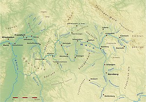
Diagram with the tributaries of the Main (with source rivers)
Diagram of tributaries greater than 40 km

The largest tributary of the Main, the Regnitz, is of particular importance. According to its aquatic characteristics, it can be considered the actual upper reaches of the Main. The following table shows the dominance of the Regnitz at the point of confluence:
| Surname | Water supply |
Catchment area |
length |
|---|---|---|---|
| Main | 42.1 m³ / s | 4416 km² | 142.8 km |
| Regnitz | 51.2 m³ / s | 7523 km² | 162.1 km |
Sortable table of the tributaries (with source rivers) of the Main
- ( EZG larger than 10 km²)
For a better overview and to be able to sort downstream using this column , hyphens have been added to the DGKZ digits after 24 - the code for the Main itself.
| Surname | location | Length [km] |
Catchment area [km²] |
Discharge (MQ) [l / s] |
Mouth on [Main-km] |
Mouth height [m. ü. NHN ] |
Mouth |
section | DGKZ |
|---|---|---|---|---|---|---|---|---|---|
| White main | right | 51.7 | 636.5 | 9200 | 464.0 | 293 | Kulmbach - Melkendorf | QF | 24 |
| Red Main | Left | 55.1 | 519.0 | 4890 | 464.0 | 293 | Kulmbach-Melkendorf | QF | 24-12 |
|
Motschenbach (with Lopper Bach ) |
Left | 7.4 | 20.7 | 458.5 | 286 | Mainleus - Motschenbach | OM | 24-132 | |
| Zentbach | right | 9.0 | 18.1 | 458.3 | 286 | Mainleus- Fassoldshof | OM | 24-134 | |
| Häckergrundbach | right | 5.6 | 14.1 | 452.8 | 281 | Burgkunstadt - Mainklein | OM | 24-1358 | |
| Weismain | Left | 17.8 | 124.8 | 1400 | 448.8 | 278 | Altenkunstadt | OM | 24-136 |
| Rodach | right | 53.0 | 1009.9 | 13390 | 440.1 | 269 | Marketers | OM | 24-14 |
| Scheidsbach | Left | 6.7 | 17.2 | 264 | Michelau in Upper Franconia | OM | 24-1514 | ||
| Biberbach | right | 11.8 | 28.2 | 265 | Michelau in Upper Franconia | OM | 24-1522 | ||
| Schneybach | right | 12.1 | 261 | Lichtenfels - Schney | OM | 24-154 | |||
| Leuchsenbach | Left | 10.3 | 260 | Lichtenfels | OM | 24-1562 | |||
| Weiherbach | right | 6.0 | 258 | Lichtenfels-Kösten | OM | 24-1572 | |||
| Schönbrunn water | Left | 6.1 | 255 | Bad Staffelstein - Grundfeld | OM | 24-1576 | |||
| Lauterbach | Left | 11.5 | 253 | Bad Staffelstein | OM | 24-158 | |||
| Sträublingsbach | Left | 3.0 | 248 | Ebensfeld | OM | 24-1592 | |||
| Kellbach | Left | 9.4 | 248 | Ebensfeld | OM | 24-1594 | |||
| Itz | right | 65.1 | 1029.0 | 9700 | 238 | Baunach | OM | 24-16 | |
| Baunach | right | 53.9 | 426.2 | 2410 | 236 | Baunach | OM | 24-18 | |
|
Güßbach (with Zeilangergraben ) |
Left | 10.6 | 236 | Breitengüßbach | OM | 24-1912 | |||
|
Leitenbach (with Ellernbach ) |
Left | 22.3 | 116.18 | 900 | 234 | Hallstadt | OM | 24-192 | |
| Gründleinsbach | Left | 18.1 | 233 | Hallstadt | OM | 24-194 | |||
|
Regnitz (with Rednitz ) |
Left | 162.1 | 7523.3 | 56590 | 384.1 | 232 | Bamberg / Bischberg | OM | 24-2 |
| Oberhaider Mühlbach | right | 8.1 | 228 | Oberhaid - Staffelbach | OM | 24-3112 | |||
| Ebelsbach | right | 13.2 | 226 | Ebelsbach | OM | 24-3114 | |||
| Krumbach | right | 11.1 | 222 | Zeil am Main | OM | 24-3116 | |||
| Stöckigsbach | Left | 14.6 | 35.3 | 220 | Knetzgau | OM | 24-3118 | ||
|
Nassach (with Höllschwärzgraben ) |
right | 23.9 | 140.5 | 890 | 354.4 | 216 | Hassfurt | OM | 24-312 |
| Water after | right | 12.4 | 353.1 | 216 | Hassfurt-Wülflingen | OM | 24-3132 | ||
|
Seebach (with Steinsfelder Mühlbach ) |
Left | 15.8 | 344.6 | 211 | Gädheim- Ottendorf | OM | 24-314 | ||
| Erleinsbach (Herrenseegraben) | Left | 6.9 | 343.6 | 208 | Grettstadt shelter | OM | 24-3152 | ||
|
Steinach (with Abersfelder Mühlbach and others) |
right | 10.3 | 337.6 | 208 | Sparing | OM | 24-3154 | ||
| Höllenbach | right | 5.0 | Schweinfurt - northeastern part of the city | MD | 24-3155 +? | ||||
| Marienbach | right | 8.9 | Schweinfurt | MD | 24-3156 | ||||
| Unkenbach | Left | 25.7 | 135.2 | 321.3 | 200 | Röthlein- Hirschfeld | MD | 24-316 | |
| Kembach | right | 5.3 | 163.0 | 198 | Wipfeld | MD | 24-3176 | ||
|
Volkach (with Aubach ) |
Left | 26.6 | 127.8 | 670 | 191 | Volkach | MD | 24-318 | |
| Schwarzach | Left | 21.4 | 179.1 | 980 | 188 | Schwarzach am Main | MD | 24-32 | |
| Dettelbach | right | 11.8 | 293.8 | 187 | Dettelbach | MD | 24-332 | ||
| Rodenbach | Left | 7.8 | 287.8 | 182 | Kitzingen- Etwashausen | MD | 24-243335 +? | ||
| Bimbach | Left | 7.4 | 182 | Kitzingen-Etwashausen | MD | 24-3336 | |||
| Sickersbach | Left | 12.5 | 182 | Kitzingen settlement | MD | 24-336 | |||
| Trench | Left | 5.6 | Marktsteft | MD | 24-3392 | ||||
| Breitbach | Left | 18.6 | 152.98 | 500 | 178 | Market wide | MD | 24-34 | |
| Thierbach | Left | 18.2 | 270.0 | 176 | Ochsenfurt -Thierbachtal | MD | 24-352 | ||
|
Schafbach (with Mückenbach ) |
Left | 4.8 | 172 | Ochsenfurt-Goßmannsdorf | MD | 24-3532 | |||
| Jakobsbach | right | 7.4 | 258.5 | 170 | Randersacker | MD | 24-3536 | ||
|
Zwischengemäuerbach (with Reichenberger Bach ) |
Left | 10.1 | 170 | Würzburg - Heidingsfeld | MD | 24-354 | |||
| Pleichach | right | 32.4 | 132.0 | 367 | 251.5 | 167 | Wurzburg | MD | 24-36 |
| Dürrbach | right | 18.1 | 76.5 | 249.3 | Würzburg-Dürrbachau | MD | 24-372 | ||
| Sendelbach | right | 3.0 | 40 | 243.8 | Veitshochheim | MD | 24-3734 | ||
| Retzbach | right | 4.8 | 235.5 | 162 | Zellingen - Retzbach | MD | 24-374 | ||
| Leinacher Bach | Left | 5.5 | 235.2 | 162 | Zellingen | MD | 24-376 | ||
| Wern | right | 63.5 | 601.7 | 2600 | 215.6 | 153 | Gemünden am Main - Wernfeld | MD | 24-38 |
| Franconian Saale | right | 140.0 | 2764.8 | 24200 | 211.1 | 153 | Gemünden am Main | MV | 24-4 |
| Sindersbach | right | 8.2 | 207.8 | 153 | Gemünden am Main-Langenprozelten | MV | 24-512 | ||
| Ziegelbach | Left | 16.7 | 153 | Lohr am Main -Halsbach | MV | 24-5132 | |||
| Buchenbach | Left | 14.5 | 148 | Lohr am Main-Steinbach | MV | 24-514 | |||
|
Lohr (with Lohrbach ) |
right | 23.1 | 217.2 | 3200 | 198.2 | 148 | Lohr am Main | MV | 24-52 |
|
Rechtenbach (with Bischbornbach ) |
right | 11.5 | 148 | Lohr am Main | MV | 24-532 | |||
| Karbach | Left | 13.0 | 184.2 | 144 | Marktheidenfeld rooms | MV | 24-54 | ||
| Hafenlohr | right | 26.5 | 147.4 | 1700 | 182.3 | 143 | Hafenlohr | MV | 24-56 |
| Erlenbach | Left | 7.4 | 143 | Marktheidenfeld | MV | 24-574 | |||
|
Aalbach (with Franzosengraben ) |
Left | 26.1 | 119.9 | 450 | 139 | Wertheim- Bettingen | MV | 24-58 | |
|
Kembach (with Welzbach ) |
Left | 13.6 | 50.67 | 201 | 138 | Wertheim-Urphar | MV | 24-592 | |
| Deaf | Left | 130.6 | 1809.5 | 10060 | 156.6 | 136 | Wertheim | MV | 24-6 |
| Haslochbach | right | 11.7 | 62.84 | 400 | 134 | Hasloch | MV | 24-7112 | |
| Faulbach | right | 8.6 | 146.8 | 129 | Faulbach | MV | 24-7114 | ||
| Torrent | Left | 10.2 | 39.17 | 300 | 142.7 | Wertheim moon field | MV | 24-7116 | |
| Req | Left | 38.3 | 254.7 | 2050 | 125.9 | 125 | Burgstadt | MV | 24-712 |
| Mud | Left | 23.8 | 402.1 | 3440 | 123.3 | 125 | Miltenberg | MV | 24-72 |
| Heubach | right | 6.1 | 12.35 | 120.7 | 122 | Großheubach | MV | 24-732 | |
| Rüdenauer Bach | Left | 3.7 | 120.8 | 121 | Kleinheubach | MV | 24-734 | ||
| Laudenbach | Left | 3.9 | 11.85 | 117.0 | Laudenbach | MV | 24-7352 | ||
| Röllbach | right | 8.1 | 23.4 | 114.5 | 121 | Klingenberg am Main -Röllfeld | MV | 24-736 | |
| Mutterbach | Left | 7.7 | 17.94 | 117 | Woerth am Main | MV | 24-738 | ||
| Mümling | Left | 49.7 | 377.4 | 4044 | 105.7 | 117 | Obernburg am Main | MV | 24-74 |
|
Elsava (with Kaltenbach ) |
right | 24.7 | 156.5 | 1320 | 104.1 | 116 | Elsenfeld | MV | 24-752 |
| New ditch | right | 7.0 | Kleinwallstadt | MV | 24-7532 | ||||
|
Sulzbach (with Leidersbach ) |
right | 10.8 | 95.7 | 113 | Sulzbach am Main | MV | 24-7534 | ||
| Hensbach | right | 8.7 | 109 | Aschaffenburg - Schweinheim | MV | 24-7536 | |||
|
Aschaff (with Kleinaschaff ) |
right | 22.4 | 167.89 | 1530 | 84.1 | 108.5 | Aschaffenburg | AROUND | 24-754 |
| Welzbach | Left | 14.2 | 108 | Aschaffenburg- unfortunately , port | MV | 24-7592 | |||
|
Gersprenz (with Mergbach ) |
Left | 62.2 | 513.0 | 3460 | 77.1 | 101.7 | Stockstadt am Main | AROUND | 24-76 |
| Forchbach | right | 3.4 | 74.0 | 101.7 | Karlstein am Main -Dettingen | AROUND | 24-7712 | ||
| Bald | right | 32.4 | 198.4 | 2010 | 66.8 | 101.7 | Bald on the Main | AROUND | 24-772 |
| Creek ditch | Left | 6.2 | 13.0 | 50.9 | 63.1 | 99.0 | Hainburg - Hainstadt | AROUND | 24-7792 |
| Ship area | right | 5.9 | 21.3 | 69.5 | 60.6 | 99.0 | Hanau - Großauheim | AROUND | 24-7796 |
| Tiny | right | 86.0 | 1058.3 | 10836.3 | 55.5 | 99 | Hanau | AROUND | 24-78 |
| Rodau | Left | 27.6 | 163.9 | 628.1 | 50.0 | 96.6 | Mühlheim am Main | AROUND | 24-792 |
| Braubach | right | 7.5 | 30.6 | 120.2 | 49.5 | 96.6 | Maintal - Dörnigheim | AROUND | 24-794 |
| Hainbach | Left | 6.8 | 13.0 | 43.6 | 41.8 | 95.2 | Offenbach am Main | AROUND | 24-796 |
| Bach from the Buchrain pond | Left | 6.0 | 10.5 | 43.1 | 38.1 | 92.0 | Frankfurt am Main - Oberrad | AROUND | 24-7972 |
| Riedgraben | right | 10.9 | 24.5 | 128.4 | 37.1 | 92.0 | Frankfurt- Ostend | AROUND | 24-7974 |
| Koenigsbach | Left | 13.7 | 27.7 | 84.8 | 32.8 | 92 | Frankfurt- Sachsenhausen | AROUND | 24-798 |
| Nidda | right | 89.7 | 1942.4 | 13064.8 | 24.9 | 88 | Frankfurt- Höchst | AROUND | 24-8 |
|
Liederbach (with Reichenbach ) |
right | 20.9 | 37.5 | 308.2 | 24.0 | 88 | Frankfurt-Höchst | AROUND | 24-92 |
| Kelster | Left | 4.9 | 32.5 | 121.2 | 20.3 | 87.5 | Kelsterbach | AROUND | 24-94 |
|
Schwarzbach (with Dattenbach ) |
right | 31.4 | 134.8 | 1112.4 | 18.5 | 87.5 | Hattersheim | AROUND | 24-96 |
| Weilbach (Main) with Ardelgraben | right | 14.0 | 35.6 | 157.8 | 10.9 | 83.9 | Flörsheim am Main | AROUND | 24-974 |
| Wickerbach | right | 23.8 | 64.9 | 350.9 | 8.1 | 83.9 | Flörsheim am Main | AROUND | 24-98 |
|
Käsbach (with first Käsbach ) |
right | 6.3 | 17.3 | 58.6 | 1.5 | 81.6 | Wiesbaden- Mainz-Kostheim | AROUND | 24-992 |
- ↑ The abbreviations in the section column mean: QF = source flow, OM = Obermain, MD = Maindreieck, MV = Mainviereck, UM = Untermain.
Backwaters of the Main
Source rivers of the Main
- (with confluence locations, height of confluence)
The Main has two source rivers, the White and the Red Main. The two source rivers unite on the western outskirts of Kulmbach - Melkendorf near Steinenhausen Castle . This point forms the origin of the Main ( 50 ° 5 ′ 12.9 ″ N , 11 ° 23 ′ 52.2 ″ E ). As with most rivers (a prominent exception is the Rhine , for example ), the counting of river kilometers does not start at this point, but ends here. The main kilometers are counted backwards, starting at the mouth. Like the Main, the White Main has the river code number 24.
- Weißer Main (right) , Kulmbach - Melkendorf , 293 m above sea level. NHN
- Roter Main (left) , Kulmbach - Melkendorf , 293 m above sea level. NHN
Tributaries of the Main
(with confluence locations, height of confluence)
Tributaries of the Obermain
The area from the source rivers to the height of Bamberg is known as the Obermainland . The most important tributaries are the Rodach , Itz , Baunach and Regnitz .
- Prötschenbach (right) , Mainleus -Pölz, 289 m above sea level. NHN
- Motschenbach (left) , 7.5 km (with Lopper Bach ), 25.28 km², Mainleus-Motschenbach, 286 m above sea level. NHN
- Zentbach (right) , Mainleus-Fassoldshof, 286 m above sea level. NHN
- Rohrbach (right) , Mainleus-Fassoldshof, 285 m above sea level. NHN
- Scheuergrundgraben (left) , Mainleus-Friedrichsberg, 285 m above sea level. NHN
- Forstbächlein (left) , Mainleus-Witzmannsberg, 284 m above sea level. NHN
- Weihergraben (right) , Burgkunstadt -Mainroth, 281 m above sea level. NHN
- Häckergrundbach (right) , Burgkunstadt -Mainklein, 281 m above sea level. NHN
- Steingrabenbach (right) , Burgkunstadt- Theisau , 280 m above sea level. NHN
- Edelweihergraben (left) , Burgkunstadt-Theisau, 280 m above sea level. NHN
- Prüglergraben (left) , Burgkunstadt- Theisau, 279 m above sea level. NHN
- Weismain (left) , Altenkunstadt , 277 m above sea level. NHN
- Schulgraben (left) , Altenkunstadt-Strössendorf, 275 m above sea level. NHN
- Burgkunstadt-Mühlgraben (right) , Burgkunstadt-Weidnitz, 274 m above sea level. NHN
- Zeublitzer Bach (left) , Altenkunstadt-Zeublitz, 274 m above sea level. NHN
- Buchbach (left) , Hochstadt am Main -Burgstall, 273 m above sea level. NHN
- Seeleinsgraben (right) , opposite Hochstadt am Main, 270 m above sea level. NHN
- Zehntgraben (right) , Marktzeuln-Zettlitz, 270 m above sea level. NHN

- Rodach (right) , Marktzeuln, 269 m above sea level. NHN
- Brunnenbach (right) , Michelau in Upper Franconia - Schwürbitz , 268 m above sea level. NHN
- Scheidsbach (left) , Michelau in Upper Franconia, 264 m above sea level. NHN
- Biberbach (right) , Michelau in Upper Franconia, 266 m above sea level. NHN
- Landwehrgraben (right) , Lichtenfels - Schney
- Heinzengraben (right) , Lichtenfels-Schney
- Schneybach ( Krebsbach ) (right) , Lichtenfels-Schney
- Leuchsenbach (left) , Lichtenfels
- Weiherbach (Weihergraben) (right) , Lichtenfels-Kösten
- Lorenzgrund (left) , Lichtenfels- Seubelsdorf
- Siegelbach (left) , Lichtenfels-Reundorf
- Schöntalbach (left) , Bad Staffelstein -Grundfeld
- Krausenbach (Schönbrunner Wasser) (left) , Bad Staffelstein-Schönbrunn
- Roßbach (right) , Bad Staffelstein-Unnersdorf
- Lauterbach (left) , Bad Staffelstein
- Weidigsgraben (right) , Bad Staffelstein-Nedensdorf
- Schmiedsgraben (Brunngraben) (right) , Bad Staffelstein-Nedensdorf
- Schwarzer Graben (left) , Bad Staffelstein-Unterzettlitz
- Brünsigraben (left) , Bad Staffelstein-Unterzettlitz
- Sauerwiesengraben (right) , Ebensfeld- Niederau
- Stöckbach (right) , Ebensfeld-Döringstadt
- Sträublingsbach (left) , Ebensfeld
- Kellbach (left) , Ebensfeld
- Dorfgraben (right) , Ebensfeld-Oberbrunn
- Hetzengraben (left) , Zapfendorf - Unterleiterbach
- Leiterbach (left) , Unterleiterbach
- Klingengraben (left) , Zapfendorf
- Aspach (left) , Zapfendorf
- Laufer Bach (left) , Zapfendorf
- Pain ditch (left) , Breitengüßbach - Unteroberndorf
- Itz (right) , Baunach
- Baunach (right) , Baunach
- Güßbach (left) , Breitengüßbach
- Evil Trench (left) , Kemmern
- Leitenbach (left) , Hallstadt
- Gründleinsbach (left) , Hallstadt
- Regnitz (left) , Bamberg / Bischberg
- Gußbach (left) , Bischberg
- Trosdorfer Bach (left) , Bischberg- Trosdorf
- Viehbach (left) , Viereth-Trunstadt -Viereth
- Oberhaider Mühlbach (right) , Oberhaid - Staffelbach
- Tiefer Graben (left) , Eltmann -Dippach
- Dippacher Mühlbach (left) , Eltmann-Dippach
- Sendelbach (right) , Stettfeld
- Stettfelder Mühlbach (right) , Stettfeld
- Eschenbach (left) , Eltmann-Eschenbach
- Ebelsbach (right) , Ebelsbach
- Fichtenbach (left) , Eltmann
- Lochbach (left) , Eltmann-Limbach
- Steinbach (right) , Ebelsbach-Steinbach
- Schulbach (left) , Eltmann-Limbach
- Stegsgraben (left) , Eltmann-Limbach
- Krumbach (right) , Zeil am Main
- Stöckigsbach (left) , Knetzgau
- Landwehrgraben (right) , Haßfurt- Augsburg
- Sterzelbach (right) , Haßfurt
- Nassach , (right) , Haßfurt
- Wässernach (right) , Haßfurt-Wülflingen
- Bach from the iron source (left) , Wonfurt
- Eltengraben (right) , Theres -Obertheres
- Riedengraben (right) , Theres-Obertheres
- Birkenbach (right) , Theres-Ober / Untertheres
- Grabenmühlbach (right) , Theres-Untertheres
- Kallebergsgraben (right) , Theres-Untertheres
- Esbach (right) , Theres-Untertheres
- Seebach (left) , Gädheim- Ottendorf
- Frauengraben (right) , Gädheim-Ottendorf
- Erleinsbach (left) , Grettstadt -Untereuerheim
- Ufergraben (right) , Gädheim
- Dettelbach (Diebach) (left) , Grettstadt-Untereuerheim
- Mühlgraben (right) , Gädheim
- Pfitschengraben (left) , Gochsheim
- Lehenbach (right) , Schonungen - Forst
- Buchentalgraben (right) , Schonungen
- Steinach (Schonunger Mühlbach) (right) , Schonungen
- Meerbach (right) , Schonungen- Mainberg
- Reichelshofer Graben (left) , Sennfeld
- Langenerlachsgraben (left) , Sennfeld
Tributaries of the Main Triangle
The so-called Maindreieck forms the Main between Schweinfurt , Ochsenfurt and Gemünden . This area appears on the map as an upside-down triangle that is open at the top. The most important tributaries are the Unkenbach , Schwarzach , Pleichach and Wern .
- Höllenbach (right) , Schweinfurt - northeastern part of the city ( 5.0 km )
- Marienbach (right) , Schweinfurt
- Bachwiesengraben (right) , Waigolshausen -Hergolshausen
- Unkenbach (left) , Röthlein- Hirschfeld
- Bebertsgraben (left) , Röthlein-Hirschfeld
- Grundgraben (right) , Waigolshausen-Dächheim
- Bachgraben (left) , Röthlein-Hirschfeld
- Kembach (right) , Wipfeld
- Eschbachgraben (left) , Volkach
- Volkach (left) , Volkach
- Sommerach (left) , Sommerach
- Hölzersgraben (left) , Schwarzach am Main -Gerlachshausen
- Etterswasengraben (left) , Schwarzach am Main-Gerlachshausen
- Schwarzach (left) , Schwarzach am Main-Gerlachshausen / Münsterschwarzach
- Silberbach (left) , Schwarzach am Main
- Wenzelbach (left) , Dettelbach -Mainsondheim
- Dettelbach (right) , Dettelbach
- Tirschgraben (right) , Dettelbach
- Rotamergraben (right) , Mainstockheim
- Riedbach (right) , Mainstockheim
- Seegraben (left) , Albertshofen
- Rodenbach (left) , Kitzingen- Etwashausen
- Bimbach (left) , Kitzingen-Etwashausen
- Rödelbach (left) , Kitzingen settlement
- Sickersbach ( Wehrbach ) (left) , Kitzingen settlement
- Reppendorfer Mühlbach (right) , Kitzingen
- Traugraben (left) , Marktsteft
- Breitbach (left) , Marktbreit
- Steinbachgraben (right) , Frickenhausen
- Thierbach (left), Ochsenfurt -Thierbachtal
- Rappertsmühlbach (right) , Ochsenfurt-Kleinochsenfurt
- Schafbach (left) , Ochsenfurt-Goßmannsdorf
- Lindelbach (right) , Eibelstadt
- Jakobsbach (right) , Randersacker
- Rottendorfer Flutgraben (right) , Randersacker
- Zwischengemäuerbach (left) , Würzburg - Heidingsfeld
- Steinbach (left) , Würzburg- Steinbachtal
- Kühbach (left) , Würzburg-Steinbachtal
- Pleichach (right) , Würzburg
- Dürrbach (right) , Würzburg-Dürrbachau
- Hufgraben (left) , Zell am Main -Oberzell
- Ziegelgraben (Ziegelhüttengraben) (right) , 1.6 km, Veitshöchheim
- Bachwiesengraben (left) , 1.3 km, Margetshöchheim
- Mühlbachsgraben (right) , 0.5 km, Veitshöchheim
- Sendelbach (right) , Veitshöchheim
- Nickelsgraben (left)
- Röthleinsgraben (right)
- Retzbach (right) , Zellingen - Retzbach
- Leinacher Bach (left) , Zellingen
- Güßgraben (right) , Zellingen-Retzbach
- Laudenbach (left) , Karlstadt - Laudenbach
- Leitengraben (right) , Karlstadt- Gambach
- Harrbacher Graben (left) , Gemünden am Main -Harrbach
- Luderbach (left) , Gemünden am Main-Kleinwernfeld
- Wern (right) , Gemünden am Main- Wernfeld
- Hahngraben (right) , Gemünden am Main-Adelsberg
Tributaries of the Main Square
The Mainviereck connects directly to the Main Triangle. The towns of Gemünden , Wertheim , Miltenberg and Aschaffenburg can be seen as corner points of the quadrangle, which is open to the north . The course of the Main encloses the southern part of the Spessart in this area and is around 100 km. The most important tributaries are the Franconian Saale , the Lohr , the Hafenlohr , the Tauber , the Erf and the Mud .
- Klingengraben (left) , Gemünden am Main mass book
- Franconian Saale (right) , Gemünden am Main
- Sindersbach (right) , Gemünden am Main-Langenprozelten
- Ziegelbach (Mühlbach) (left) , Lohr am Main -Halsbach
- Bachgrund (right) , Neuendorf -Nantenbach
- Mätzelsgrund (right) , Neuendorf-Nantenbach
- Steinlesgraben (left) , Lohr am Main-STeinbach
- Buchenbach (left) , Lohr am Main-Steinbach
- Sackenbach (Sackenbacher Ortsbach) (right)
- Lohr (right), Lohr am Main
- Rechtenbach (Kaibach) (right) , Lohr am Main
- Sandgraben (right) , Lohr am Main- Rodenbach
- Berggraben (right) , Lohr am Main-Rodenbach
- Faulgraben (left) , Lohr am Main-Pflochsbach
- Zellergraben (left) , Steinfeld -Waldzell
- Schweppach (right) , Neustadt am Main
- Silberlochbach (right) , Neustadt am Main
- Krebsbach (left) , Neustadt am Main-Erlach am Main
- Gaibach (right) , Neustadt am Main
- Stilt ditch (right) , Rothenfels
- Karbach (left) , Marktheidenfeld rooms
- Hafenlohr (right) , Hafenlohr
- Leitersgraben (right) , Hafenlohr
- Klinggraben (right) , Hafenlohr
- Glasbach (right) , Hafenlohr
- Erlenbach (left) , Marktheidenfeld
- Oak Prince Bach (right) , Marktheidenfeld
- Altfelder Graben (Altenfelder Graben) (right) , Triefenstein separation field
- Klingelsbachgraben (right) , Triefenstein-Trennfeld
- Hartgraben (left) , Triefenstein- Lengfurt
- Bischbach (Mühlbach) (left) , Triefenstein-Homburg
- Weidbach (right) , Triefenstein-Trennfeld
- Hartsgraben (right) , Triefenstein-Trennfeld
- Aalbach (left) , Wertheim- Bettingen
- Kembach (left) , Wertheim-Urphar
- Wittbach (Wittwichsbach) (right) , Kreuzwertheim
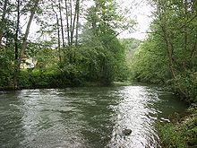
- Tauber (left) , Wertheim
- Höhklinge (left) , 2.4 km, 2.6 km², Wertheim-Besteheid
- Röttbach (right) , Hasloch
- Haslochbach (right) , Hasloch
- Rainbach (left) , Wertheim-Grünenwört
- Untere Au (left) , Wertheim-Grünenwört
- Lower blade (left) , Wertheim-Grünenwört
- Faulbach (right) , Faulbach
- Rosselgraben (right) , Faulbach
- Thorgraben (right) , Stadtprozelten
- Fuchsengraben (left) , Wertheim moon field
- Sellbach (right) , Stadtprozelten
- Landwehrsgraben (left) , Wertheim-Mondfeld
- Wildbach (left) , Wertheim-Mondfeld
- Langergrund (right) , Dorfprozelten
- Tremhof blades (left) , Freudenberg
- Kollenbergergrund (right) , Collenberg -Fechenbach
- Fechenbach (right) , Collenberg-Fechenbach
- Ullersbach (right) , Collenberg-Reistenhausen
- Reissental (right) , Collenberg-Kirschfurt
- Beingraben (left) , Freudenberg
- Dürrbach (left) , Freudenberg
- Haagbach (left) , Freudenberg
- Kälbesbach (right) , Collenberg-Kirschfurt
- Steinerstal (right) , Collenberg-Kirschfurt
- Engler Graben (left) , Bürgstadt
- Hessental (right) , Bürgstadt
- War garden trench (left) , Bürgstadt
- Erf (left) , Burgstadt
- Mud (left) , Miltenberg
- Tannengraben (right) , Großheubach
- Springerbach (left) , Miltenberg
- War trench (left) , Kleinheubach
- Heubach (right) , Großheubach
- Rüdenauer Bach (left) Kleinheubach
- Eiderbach (left) , Kleinheubach
- Klingengraben (left) , Kleinheubach
- Lachentalgraben (right) , Großheubach
- Laudenbach (left) , Laudenbach
- Röllbach (right) , Klingenberg am Main - Röllfeld

- Springbach (left) , Klingenberg am Main- Trennfurt
- Grimmesgrundgraben (left) , Klingenberg am Main-Trennfurt
- Seltenbach (right) , Klingenberg am Main
- Roßgraben (left) , Klingenberg am Main-Trennfurt
- Erstegraben (left) , Wörth am Main
- Hohlberggraben (right) , Erlenbach am Main
- Moosgraben (left) , Wörth am Main
- Mutterbach (left) , Wörth am Main
- Floßgraben (left) , Wörth am Main
- Pfaffenseegraben (left) , Wörth am Main
- Pfitschengraben (left) , Obernburg am Main
- Mümling (left) , Obernburg am Main
- Katzental (left) , Obernburg am Main
- Elsava (right), Elsenfeld
- Rödergraben (left) , Großwallstadt
- Frohnhallengraben (left) , Großwallstadt
- Neuer Graben (right) , Kleinwallstadt
- Föhresgraben (right) , Kleinwallstadt
- Wolfsschlingengraben (right) , Kleinwallstadt
- Sulzbach (right) , Sulzbach am Main
- Altenbach (right) , Aschaffenburg - Obernau
- Flutgraben (left) , Niedernberg
- Hensbach (right) , Aschaffenburg- Schweinheim
- Kühruhgraben (right) , Aschaffenburg
- Welzbach (left) , Aschaffenburg- Unfortunately
Tributaries of the Lower Main
The section from Aschaffenburg to the mouth is known as the Lower Main . The most important tributaries are the Gersprenz , the Kahl , the Kinzig , the Rodau , the Nidda and the Schwarzbach .
- Aschaff (right) , Aschaffenburg
- Hennertsgraben ( Sandgraben ) (right) , Kleinostheim
- Steinbach (right) , Kleinostheim
- Gersprenz (left) , Stockstadt am Main
- Forchbach (right) , Karlstein am Main -Dettingen
- Schleifbach (left) , Seligenstadt- Kleinwelzheim
- Riegelsbach ( left ), Seligenstadt ( 3.2 km )
- Kahl (right) , Kahl am Main
- Bachgraben (left) , Hainburg- Klein-Krotzenburg
- Schifflache (right) , Hanau - Großauheim
- Hellenbach (left) , Hanau- Steinheim ( 4.9 km )
- Kinzig (right) , Hanau
- Birnbaumsgraben ( left ), 1.6 km, east of Mühlheim am Main
- Rodau (left) , Mühlheim am Main
- Braubach (right) , Maintal - Dörnigheim
- Kuhmühlgraben (left) , Offenbach am Main - Waldheim ( 4 km )
- Hainbach (left) , Offenbach
- Brook from Bruchrainweiher (left) , Frankfurt am Main - Oberrad
- Goldbach (left) , Frankfurt-Oberrad
- Riedgraben (right) , Frankfurt- Ostend
- Luderbach (or Königsbach ) (left) , Frankfurt- Sachsenhausen
- Schwarzbach (left) , Frankfurt- Goldstein
- Griesheimer Lachegraben (right) , Frankfurt- Griesheim
- Nidda (right) , Frankfurt- Höchst
- Liederbach (right) , Frankfurt-Höchst
- Pfingsborngraben (Lachegraben) (right) Frankfurt-Höchst / Sindlingen ( 6.5 km )
- Kelster (left) , Kelsterbach
- Welschgraben (right) , Frankfurt-Sindlingen ( 8.6 km )
- Schwarzbach (right) , Hattersheim , 91 m above sea level. NN
- Kastengrundgraben (right), (5.7 km)
- Zwengelgraben (right) (4.4 km)
- Ardelgraben (right) , Flörsheim am Main ( 2.4 km )
- Wickerbach (right) , Flörsheim am Main , 83 m above sea level. NHN
- Käsbach (right) , Wiesbaden- Mainz-Kostheim , 82 m above sea level. NHN
Hainbach near the Offenbach city hall
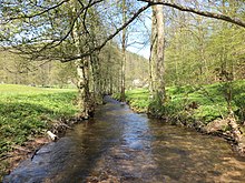
Stream of the Kelster in the town of Kelsterbach
Individual evidence
- ↑ Unkenbach sponsorship of the Heide School ( Memento from September 16, 2011 in the Internet Archive )
- ↑ Fishing Association of Lower Franconia: Our Waters ( Memento of the original from September 25, 2014 in the Internet Archive ) Info: The archive link was automatically inserted and not yet checked. Please check the original and archive link according to the instructions and then remove this notice.
- ↑ a b The rivers in Würzburg (PDF file), at www.wuerzburg.de, accessed on August 24, 2018
- ↑ Level in the main area: Wüstenzell / Aalbach ( Memento of the original from July 18, 2011 in the Internet Archive ) Info: The archive link has been inserted automatically and has not yet been checked. Please check the original and archive link according to the instructions and then remove this notice.
- ↑ Level in the main area: Bürgstadt / Erf ( Memento of the original from July 18, 2011 in the Internet Archive ) Info: The archive link was automatically inserted and not yet checked. Please check the original and archive link according to the instructions and then remove this notice.
- ↑ a b c d Bavarian State Office for the Environment: Directory of brook and river areas in Bavaria , 2012
- ↑ Map services of the Bavarian State Office for the Environment
- ↑ Designation after the field name
- ^ History. Retrieved June 30, 2017 .
- ↑ BayernAtlas - the map viewer of the Free State of Bavaria. Retrieved June 30, 2017 .
- ↑ Name after first recording (1808–1864)
- ↑ Old name
- ↑ a b c d e f Water map service of the Hessian Ministry for the Environment, Climate Protection, Agriculture and Consumer Protection ( information )
