
Itz
| Itz | ||
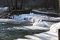
 The Itzquelle at the foot of the Bleßberg |
||
| Data | ||
| Water code | EN : 2416 | |
| location | Germany | |
| River system | Rhine | |
| Drain over | Main → Rhine → North Sea | |
| source | at the foot of the Bleßberg above the village of Stelzen 50 ° 26 ′ 35 ″ N , 10 ° 59 ′ 29 ″ E |
|
| Source height | 673 m above sea level NN | |
| muzzle | below Rattelsdorf in the Main Coordinates: 49 ° 58 '59 " N , 10 ° 52' 5" E 49 ° 58 '59 " N , 10 ° 52' 5" E |
|
| Mouth height | 235 m above sea level NN | |
| Height difference | 438 m | |
| Bottom slope | approx. 5.5 ‰ | |
| length | approx. 80 km | |
| Catchment area | 1029 km² | |
| Discharge at the Schenkenau gauge (91.4% of the catchment area) A Eo : 940.59 km² Location: 20.64 km above the mouth |
NNQ (1976) MNQ 1968–2009 MQ 1968–2009 Mq 1968–2009 MHQ 1968–2009 HHQ (1967) |
780 l / s 2.08 m³ / s 9.33 m³ / s 9.9 l / (s km²) 86.2 m³ / s 230 m³ / s |
| Discharge A Eo : 1029 km² at the mouth |
MQ Mq |
9.7 m³ / s 9.4 l / (s km²) |
| Reservoirs flowed through | Froschgrundsee | |
| Navigable | No | |
The Itz is a right tributary of the Main in southern Thuringia and Upper Franconia . According to the Bavarian Water Act (BayWG), it is a first-order body of water .
geography
The Itztal lies in the sandstone Keuper , Rhät , Lias and Dogger and, together with the surrounding hills, forms the Itz-Baunach hill country of the south-west German step country . The river is deeply deepened into the rock, its valley floor falls from 673 m above sea level. NN at 438 m to 235 m above sea level. NN . The meadow landscape is a cultural landscape in which the grassland dominates and which shapes the image of the Upper Mainland. The Itztal between Coburg and Baunach (14.5 km² FFH area ) as well as the Itz- Baunach -Aue with an area of 123 km² are specially protected landscape protection areas that are characterized by regular flooding. Meadows with rare and threatened species are characteristic of them . In the case of the animals, there are beavers , bullheads , light blue-colored buttonheads and dark blue-colored buttonheads , while the plants are alder and ash species . Almost a quarter of the floodplains are under nature protection .
River course
The river is about 80 kilometers long and has a 1029 square kilometers catchment area. It rises northeast of Eisfeld in the Thuringian Slate Mountains at 673 m above sea level. NN at the foot of the Bleßberg in Stelzen in the Hildburghausen district .
The town of Schalkau is located on the river in the upper Itztal . Immediately after the state border, it is dammed up to the Froschgrundsee in Bavaria to protect against flooding . Then the Itz flows through the Froschgrund between Schönstädt and Oberwohlsbach and the cities of Rödental and Coburg . Further down the fertile lower Itzgrund , it floods the valley again and again when the water is high. Below Rattelsdorf , the Itz flows into the Main between Breitengüßbach and Baunach .
Tributaries
The tributaries are among others
- Weitesfelder Wasser ( right ), mouth between Tossenthal and Bachfeld
- Krellsenbach ( left ), mouth in Bachfeld
- Katzberger Wasser ( Katzberger Graben ) ( right ), mouth above Schalkau
- Gundelswinder water , mouth to Bachfeld
- Truckenthaler Wasser ( left ), mouth in Schalkau
- Kauerbach ( left ), mouth in Schalkau
- Grümpen ( left ), mouth to Almerswind , 12.9 km after the Itz spring, 15.6 km long
- Fernbach ( right ), mouth at the state border Bavaria / Thuringia
- Bettelbach or Parnickelsgraben ( right ), mouth before Weißenbrunn in front of the forest
- Birkertsbach ( right ), mouth in Weißenbrunn vorm Wald
- Effelder ( left ), confluence with the Froschgrundsee
- Pöpelbach ( Pöpelgraben ) ( right ), mouth before Schönstädt
- Fischbach ( left ), mouth at Fischbach
- Fornbachsgraben ( right ), mouth in Mittelberg
- Weimersgraben ( left ), mouth in Mittelberg
- Höllgrund ( left ), mouth before Oberwohlsbach
- Fornbach ( right ), mouth in Unterwohlsbach
- Röthen or Röden ( left ), mouth to Oeslau
- Krebsbach ( left ), mouth near Waldsachsen
- Lauter ( right ), mouth at the Holy Cross Church in Coburg
- Mühlgraben ( right )
- Ketschenbach ( left ), mouth near Ketschendorf
- Lehengraben ( left ), mouth at Creidlitz
- Schleifbach, mouth near the Finkenau
- Beergraben ( right ), mouth in Triebsdorf
- Löchleinsholzgraben ( right ), mouth below Triebsdorf
- Schindlache ( left ), mouth at the Geizen mill
- Füllbach ( left ), mouth at the Geizen mill
- Kleienbach ( left ), mouth below Niederfüllbach
- Augraben ( right ), mouth west of Meschenbach
- Grundgraben ( right ), mouth west of Meschenbach
- Weißenbrunnerbach ( left ), mouth west of Meschenbach
- Siemauer Mühlbach ( left ), mouth at Scherneck
- Wohlbach ( right ), mouth below Scherneck
- Ziegelsdorfer Bach ( right ), mouth below the Erlesmühle
- Steingraben ( left ), mouth at Großheirath
- Ratzengraben ( right ), mouth below Buchenrod
- Wiebach ( right ), mouth near Rossach
- Fuchsgraben ( left ), mouth south of Rossach
- Püchitzer Bach ( left ), mouth below Schleifenhan
- Gaukenbach ( left ), mouth at the Gleußener mill
- Herrether Bach ( left ), mouth at Gleußen
- Rodach ( right ), mouth below Bodelstadt
- Alster ( right ), mouth at Untermerzbach
- Merzbach ( right ), mouth at Untermerzbach
- Dorfgraben ( right ), mouth near Recheldorf
- Eggenbach ( left ), mouth opposite Hemmendorf
- Landsbach ( right ), mouth above Gleusdorf
- Hopfengraben ( left ), mouth opposite Gleusdorf
- Rumpelgraben ( right )
- Kreuzbach ( left ), mouth over a short floodplain west of Medlitz

Froschgrundsee
Itz near Oberwohlsbach

Flood near Gleusdorf

Itz near Rattelsdorf


dialect
The Itz is the namesake of a Main Franconian dialect , Itzgründischen , which is spoken in the valleys of the Itz and its tributaries.
See also
literature
- Georg Aumann, Karl-Ulrich Pachale: The Itz . Series of publications of the historical society Coburg e. V. Volume 15. ISSN 0947-0344
- Johann Kaspar Bundschuh : Itzt . In: Geographical Statistical-Topographical Lexicon of Franconia . tape 3 : I-Ne . Verlag der Stettinische Buchhandlung, Ulm 1801, DNB 790364301 , OCLC 833753092 , Sp. 37-38 ( digitized version ).
Web links
- Level near Coburg, HND Bavaria
- Level at Schenkenau, HND Bavaria
- Ecological expansion of the Itz (information from the Kronach water management office )
- Measures on the Itz (information from the Kronach water management office)
- Cycling on the Itz (information from the Kronach water management office)
Individual evidence
- ↑ Bavarian flood news service (as of September 6, 2011)
- ↑ Level data (MQ) from Schenkenau, increased by the area runoff of the remaining catchment area (4.1 l / s.km²), area runoff determined from level data from Schwürbitz, Schenkenau, Leucherhof, Untermerzbach and Kemmern
- ↑ Determination of the length of the Itz above the Grümpen estuary using a GPS route planner
- ↑ Grümpen - Determination of length using a GPS route planner