Bodelstadt
|
Bodelstadt
Itzgrund municipality
Coordinates: 50 ° 8 ′ 3 ″ N , 10 ° 53 ′ 2 ″ E
|
|
|---|---|
| Height : | 258 m above sea level NN |
| Residents : | 55 (2013) |
| Incorporation : | 1818 |
| Incorporated into: | Schottenstein |
| Postal code : | 96274 |
| Area code : | 09533 |
|
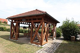
Village square
|
|
Bodelstadt is a district of the Upper Franconian municipality Itzgrund in the Coburg district . It is the oldest documented place in the Coburg district.
geography
Bodelstadt is located southwest of Coburg , about 15 kilometers away, on a slope in the Itzgrund , north of the confluence of the Rodach and Itz . State road 2204, which connects Kaltenbrunn with Seßlach , runs through the village .
history
Bodelstadt celebrates 788 as the year of birth. In the Codex Eberhardi from the 12th century, reference is made to a document from the Fulda Monastery of April 19, 788, which reports on several donations of goods in “Botolfestat” by Count Matto and his brother Megingoz (Counts in Grabfeldgau ). Further mentions were made in 817 and 874 on the occasion of donations to the Margrave of Schweinfurt.
From the trade route in Itzgrund, which connected Nuremberg with the north, a connection route branched off to Schweinfurt and crossed the Itz at Bodelstadt. The settlement created there probably served to secure a ford through the Itz. A moated castle was probably also present. The place name probably goes back to the founder of the settlement "Botolf".
Around 1070 the Countess Alberada von Schweinfurt transferred her possessions in Bodelstadt to the Banz Monastery, which she founded . Except for one aristocratic court, the entire settlement belonged to the monastery. In 1524/25 the settlement was largely destroyed in the course of the peasant wars and later not completely rebuilt. In 1576 Bodelstadt had six properties.
As son and daughter fiefs of the Banzer abbots appear as landlords that von Sternberg , 1624 von Lichtenstein , 1644 von Seckendorf and 1703 the Würzburg prince-bishop von Greiffenclau . His family held the fief until 1807. In 1818 Bodelstadt was incorporated into Schottenstein . At that time the hamlet comprised eight properties with 46 residents.
In 1862 Bodelstadt was incorporated into the newly created Bavarian District Office Staffelstein .
In 1875 Bodelstadt had 45 residents and 27 buildings. The children went to school in Schottenstein, two kilometers away. In 1925 the village had 49 inhabitants and 9 houses. The place belonged to the parish of the Protestant parish church in Schottenstein and the Catholic parish church in Kaltenbrunn. In 1987 the village consisted of 47 inhabitants and 12 houses with 15 apartments. In 1965, a new school was inaugurated north of the village center for the then still independent communities of today's Itzgrund community.
On July 1, 1972, the Staffelstein district was dissolved. Since then, Bodelstadt has been part of the Coburg district . In the course of the Bavarian territorial reform , Schottenstein lost its independence as a municipality on May 1, 1978 and, like its district Bodelstadt, became part of the municipality of Itzgrund.
Population development
|
Web links
Individual evidence
- ↑ a b c d e f Adolf Wickel, Fritz Liebermann: Bodelstadt . In brochure: 1225 Years Itzgrund, pp. 6-10
- ^ A b Walter Schneier: The Coburg Country. 2nd edition, Coburg 1990. p. 213
- ↑ Georg Aumann, Karl-Ulrich Pachale: The Itz . Series of publications of the historical society Coburg e. V. Volume 15, p. 30
- ↑ a b Kgl. Statistical Bureau (ed.): Complete list of localities of the Kingdom of Bavaria. According to districts, administrative districts, court districts and municipalities, including parish, school and post office affiliation ... with an alphabetical general register containing the population according to the results of the census of December 1, 1875 . Adolf Ackermann, Munich 1877, 2nd section (population figures from 1871, cattle figures from 1873), Sp. 1124 , urn : nbn: de: bvb: 12-bsb00052489-4 ( digital copy ).
- ↑ a b Bavarian State Statistical Office (ed.): Localities directory for the Free State of Bavaria according to the census of June 16, 1925 and the territorial status of January 1, 1928 . Issue 109 of the articles on Bavaria's statistics. Munich 1928, Section II, Sp. 1160 ( digitized version ).
- ↑ a b Bavarian State Office for Statistics and Data Processing (Ed.): Official local directory for Bavaria, territorial status: May 25, 1987 . Issue 450 of the articles on Bavaria's statistics. Munich November 1991, DNB 94240937X , p. 299 ( digitized version ).
- ↑ K. Bayer. Statistical Bureau (Ed.): Directory of localities of the Kingdom of Bavaria, with alphabetical register of places . LXV. Issue of the contributions to the statistics of the Kingdom of Bavaria. Munich 1904, Section II, Sp. 1122 ( digitized version ).
- ↑ Bavarian State Statistical Office (ed.): Official place directory for Bavaria - edited on the basis of the census of September 13, 1950 . Issue 169 of the articles on Bavaria's statistics. Munich 1952, DNB 453660975 , Section II, Sp. 1001 ( digitized version ).
- ^ Bavarian State Statistical Office (ed.): Official place directory for Bavaria . Issue 335 of the articles on Bavaria's statistics. Munich 1973, DNB 740801384 , p. 153 ( digitized version ).
