Effelder (river)
| Effelder | ||
|
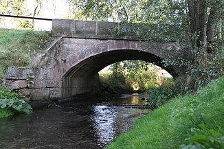
Effelder Bridge in Döhlau |
||
| Data | ||
| Water code | DE : 241616 | |
| location | Germany | |
| River system | Rhine | |
| Drain over | Itz → Main → Rhine → North Sea | |
| source | west of the Fellberg near Steinach in the Thuringian Slate Mountains 50 ° 26 ′ 46 ″ N , 11 ° 6 ′ 15 ″ E |
|
| Source height | approx. 820 m above sea level NN | |
| muzzle | in the Froschgrundsee (indirectly in the Itz ) coordinates: 50 ° 21 '8 " N , 11 ° 1' 47" E 50 ° 21 '8 " N , 11 ° 1' 47" E |
|
| Mouth height | 344.5 m above sea level NN | |
| Height difference | approx. 475.5 m | |
| Bottom slope | approx. 32 ‰ | |
| length | 15.1 km | |
| Catchment area | 44.1 km² | |
| Runoff (88.9% of the catchment area) |
NNQ MNQ MQ MHQ HHQ (2005) |
19 l / s 73 l / s 825 l / s 12.7 m³ / s 20.6 m³ / s |
The Effelder is an approximately 15 kilometer long tributary of the Itz in the districts of Sonneberg ( Thuringia ) and Coburg ( Bavaria ).
geography
course
The Effelder rises at an altitude of around 800 meters west of the Fellberg near Steinach in the Thuringian Slate Mountains . It then flows through the town of Mengersgereuth-Hammern , which stretches about four kilometers in the valley. Below the village, the Effelder continues in an arc in a south-westerly direction. The federal road 89 and the Eisfeld – Sonneberg railway line run in its valley . There are also the towns ofschichtshöhn and Effelder . To the south of Effelder, the Effelder flows through the town of Döhlau, before it crosses the state border to Bavaria and after about one kilometer flows into the Froschgrundsee and thus into the Itz. The area where it flows into the Froschgrundsee is part of the Itztal and Effeldertal nature reserve near Weißenbrunn vorm Wald .
Tributaries
Direct and indirect tributaries from the source to the mouth
- (Stream from) Hausmatzengrund ( left ) east of Kallenberg ( 807.9 m above sea level )
- Großer Köhlersgraben ( left ), flows west of Fellbergbaute
- Kleiner Köhlersgraben ( right )
- Fellgraben ( left ), near Augustenthal
- Glasbach (left), between Mühlkuppe ( 709.1 m above sea level ) and Geiersberg ( 727.1 m above sea level )
- Aschenbach ( right ), near Augustenthal
- (Bach from the) Johannis crucible ( left ) in hammers
- Ehnesbach ( left ), community of Frankenblick
- (Bach from the) Hohetanner Grund ( right )
- Rierschnitz ( right , joins Blatterndorf, municipality of Frankenblick)
- Retschenbach ( right , joins Seltendorf, municipality of Frankenblick)
- Ellenbach or Ellernbach ( left , flows between Rückerswind and Döhlau, municipality of Frankenblick)
Web links
Individual evidence
- ↑ Map service of the Bavarian State Office for the Environment ( Memento from April 8, 2005 in the Internet Archive )
- ↑ Flood Action Plan Main
- ↑ Bavarian flood news service (as of September 6, 2011)
