
Baunach (river)
| Baunach | ||
_bei_Gr%C3%A4fenholz.jpg) The Baunach near Graefenholz (fish ladder and weir at the Graefenholzer Mühle) |
||
| Data | ||
| Water code | EN : 2418 | |
| location |
Hatred Mountains
|
|
| River system | Rhine | |
| Drain over | Main → Rhine → North Sea | |
| source | south of the Gr. Latitude B, northeast of the deciduous hill and east of the village of Leinach 50 ° 13 ′ 50 ″ N , 10 ° 26 ′ 20 ″ E |
|
| Source height | approx. 445 m above sea level NN | |
| muzzle | near Baunach in the Main Coordinates: 49 ° 58 ′ 40 ″ N , 10 ° 51 ′ 25 ″ E 49 ° 58 ′ 40 ″ N , 10 ° 51 ′ 25 ″ E |
|
| Mouth height | 232 m above sea level NN | |
| Height difference | approx. 213 m | |
| Bottom slope | approx. 4 ‰ | |
| length | 53.9 km | |
| Catchment area | 426.23 km² | |
| Discharge at the Leucherhof gauge (89.3% of the catchment area) A Eo : 380 km² Location: 3.3 km above the mouth |
NNQ (May 3, 1954) MNQ 1930–2006 MQ 1930–2006 Mq 1930–2006 MHQ 1930–2006 HHQ (June 26, 1933) |
60 l / s 533 l / s 2.13 m³ / s 5.6 l / (s km²) 25.3 m³ / s 76 m³ / s |
The Baunach is an almost 54 km long right or northern tributary of the Main in Bavaria ( Germany ). Part of the Baunach meadow landscape is under nature protection .
Surname
The qualifier of the name Baunach comes from the Indo-European word bhu (swell), the basic word ach occurs in many water names and means water, water. Overall, Baunach means swelling water .
geography
The Baunach rises in the Haßberg mountains belonging to the Franconian Keuper-Lias-Land and separates the actual Haßberge from the Haßberg Zeilberge of the Itz-Baunach hill country .
course
The Baunach rises in the Sulzfeld Forest south of the Großer Breitenberg, northeast of the leafy hill and east of the village of Leinach. The Baunach flows into the Main in Baunach .

The Baunach in Baunach

The Baunach at the mill in Baunach

DieBaunach in Bundorfer Forst in the Haßberge nature reserve
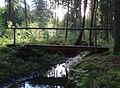
Wooden bridge over diw Baunach in the Bundorfer Forest


Tributaries
The tributaries of the Baunach include (viewed downstream):
| Surname | GKZ |
Length in km |
Direction of flow |
Mouth height meters above sea level. NHN |
muzzle | comment |
|---|---|---|---|---|---|---|
| Sambachgraben | 241812 | Left | 367 | |||
| Höllgraben | 241814 | right | 328 | |||
| Rippbach | 241816 | Left | 322 | Bundorf | ||
| Kimmelsbach | 241818 | right | 314 | Bundorf | ||
| Hainbach | right | 311 | Bundorf | |||
| Tränkleinsgraben (Serrfelder Mühlbach) | 24182 | 6.98 | Left | 306 | Bundorf- Neuses | |
| Stöckacher Mühlbach | right | 302 | Bundorf pigs' heads | |||
| Ermetz | 241832 | 7.83 | Left | 291 | Hofheim i.UFr. -Sulzbach | |
| Dorfbach | Left | 280 | Burgpreppach - common field | |||
| Erlbach | 241834 | Left | 278 | Burgpreppach common field | ||
| Heimbach | 241836 | 7.13 | right | 278 | Burgpreppach common field | |
| Marbach | Left | 275 | Pfarrweisach- Lohr | |||
| Zöschgraben | Left | 273 | Pfarrweisach-Lohr | |||
| Weisach | 24184 | 11.49 | Left | 271 | Pfarrweisach | |
| Leuzendorfer Graben | right | 270 | Pfarrweisach- Kraisdorf | |||
| Albersdorfer Mühlbach | 241852 | 11.73 | right | 268 | Pfarrweisach | |
| Fischbach | Left | 264 | Ebern - Fischbach | |||
| Preppach | 24186 | 10.24 | right | 260 | Ebern- Ruppach | |
| Angernbach | Left | 260 | Boars | |||
| Eichelbach | 241872 | 7.03 | right | 257 | Ebern- Heubach | |
| Silberbach | Left | 256 | Rentweinsdorf - Lind | |||
| Schmitzgraben | right | 254 | Rentweinsdorf | |||
| Seebach | right | 254 | Rentweinsdorf | |||
| Winkelgraben | Left | 254 | Rentweinsdorf- Treinfeld | |||
| Buchholzgraben | right | 253 | Rentweinsdorf | |||
| Brünninggraben | Left | 249 | Reckendorf | |||
| Laimbach | 241876 | 8.19 | right | 248 | Reckendorf | |
| Röthengraben | Left | 248 | Reckendorf-Zeitzenhof | |||
| Knockgraben | 8.19 | right | 247 | Reckendorf | ||
| Hautenbach | right | 247 | Reckendorf | |||
| Seitenbach | right | 246 | Reckendorf | |||
| Ground trench | Left | 244 | Baunach- Leucherhof | |||
| Sendelbach | 241878 | 5.42 | right | 243 | Baunach-Leucherhof | |
| volume up | 24188 | 19.4 | right | 238 | Baunach |
fauna
In Baunach come eel , chub , brown trout , loach , barbel , bream , perch , gudgeon , hazel , pike , carp , nose , rainbow trout , tench , Schneider , common carp , mirror carp , river lamprey , pike , Rutte , Waller , brook trout , grayling and Three-spined stickleback and stone crabs in numerous backwaters .
See also
literature
- Johann Kaspar Bundschuh : Baunach . In: Geographical Statistical-Topographical Lexicon of Franconia . tape 1 : A-egg . Verlag der Stettinische Buchhandlung, Ulm 1799, DNB 790364298 , OCLC 833753073 , Sp. 260 ( digitized version ).
Web links
- Map of the course and catchment area of the Baunach on: BayernAtlas of the Bavarian State Government ( information )
- Level near Lohr, HND Bavaria
- Level at Leucherhof, HND Bavaria
Individual evidence
- ↑ GeoFachDatenAtlas and water services of the Bavarian State Office for the Environment
- ↑ Flood Action Plan Main
- ^ Deutsches Gewässerkundliches Jahrbuch Rheingebiet, Part II 2006 Bavarian State Office for the Environment, p. 83, accessed on October 4, 2017, at: bestellen.bayern.de (PDF, German, 23.6 MB).
- ↑ TOP 10 Bavaria North