Treinfeld
|
Treinfeld
Rentweinsdorf market
Coordinates: 50 ° 3 ′ 45 ″ N , 10 ° 48 ′ 41 ″ E
|
|
|---|---|
| Height : | 255 m above sea level NHN |
| Residents : | 167 (2014) |
| Incorporation : | May 1, 1978 |
| Postal code : | 96184 |
| Area code : | 09531 |
|
City gate
|
|
Treinfeld is a district of the Lower Franconian community Rentweinsdorf in the Haßberge district .
geography
The village is located in the eastern part of the district in the Baunachgrund to the left of the Baunach .
history
The place name probably goes back to the Slavic personal name Dragon, "field place of a Dragon". The first mention was in the 9th century as "Dragenenfelden", which belonged to the "predia ministrorum" of the Itz -Main area. In 1232 "Treinfelt", located on one side of the river, belonged to the parish of Ebern . In 1346 Wolfram von Rotenhan received three parts of the tithe in "Treinuelt". In 1476 the Lords of Rotenhan owned "Treinfeld" including the mill as a Bamberg fief .
In the course of the Thirty Years War , almost all buildings burned down in 1634. In 1644 the village was completely deserted, in 1657 seven people lived in the village again. In 1742 the Rotenhan had subjects in "Trainfeld".
In 1821 Treinfeld became a rural community and in 1862 it was incorporated into the newly created Bavarian District Office Ebern . The rural community consisted of three places Treinfeld and two deserts , the one and a half kilometers away, lifting village and half a kilometer away Treinfeldsmühle . The parish had 146 inhabitants, all Protestants, and 31 residential buildings in 1871. The 129 inhabitants of the main town Treinfeld belonged to the evangelical parish in Rentweinsdorf, 1.0 kilometers away, where the denominational school was also located. In 1900 the place had 129 inhabitants and 25 residential buildings. In 1925, 129 people, 128 of whom were Protestants, lived in 25 residential buildings in the 314.49 hectare community of Treinfeld. The main town had 106 inhabitants and 22 residential buildings. In 1897 Treinfeld was connected to the rail network.
In 1950 Treinfeld had 163 residents and 22 residential buildings. The Catholics belonged to the parish in Ebern. In 1970 there were 121 and 1987 167 inhabitants and 36 residential buildings with 44 apartments. On July 1, 1972, as part of the regional reform, the Ebern district was dissolved and Treinfeld became the new Haßberg district. On May 1, 1978, Treinfeld was incorporated into the Rentweinsdorf community.
traffic
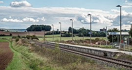
The district road HAS 14 , from Rentweinsdorf to Mürsbach and a municipal road along the Baunach, parallel to the Breitengüßbach – Maroldsweisach railway line , lead through the village. The Rentweinsdorf stop on this railway line is on the southern outskirts.
Attractions
The old gatehouse was built in 1551 as the south gate of the village fortifications. The barns and stables were arranged in the town center in such a way that the outer walls acted like a defensive wall.
Two architectural monuments are listed in the Bavarian list of monuments .
Web links
Individual evidence
- ↑ Population of Sendelbach on the Rentweinsdorf website
- ↑ a b c Werner Schmiedel: Districts Ebern and Hofheim. In: Historical book of place names of Bavaria. Lower Franconia. Volume 2: Districts of Ebern and Hofheim. Commission for Bavarian State History, Munich 1973, ISBN 3-7696-9872-X , p. 53.
- ↑ Discover, experience, enjoy - Verwaltungsgemeinschaft Ebern, September 2017 ( Memento of the original from September 19, 2018 in the Internet Archive ) Info: The archive link was inserted automatically and has not yet been checked. Please check the original and archive link according to the instructions and then remove this notice.
- ↑ Kgl. Statistical Bureau (ed.): Complete list of localities of the Kingdom of Bavaria. According to districts, administrative districts, court districts and municipalities, including parish, school and post office affiliation ... with an alphabetical general register containing the population according to the results of the census of December 1, 1875 . Adolf Ackermann, Munich 1877, 2nd section (population figures from 1871, cattle figures from 1873), Sp. 1298. , Urn : nbn: de: bvb: 12-bsb00052489-4 ( digital copy ).
- ↑ K. Bayer. Statistical Bureau (Ed.): Directory of localities of the Kingdom of Bavaria, with alphabetical register of places . LXV. Issue of the contributions to the statistics of the Kingdom of Bavaria. Munich 1904, Section II, Sp. 1310 . ( Digitized version ).
- ↑ Bavarian State Statistical Office (ed.): Localities directory for the Free State of Bavaria according to the census of June 16, 1925 and the territorial status of January 1, 1928 . Issue 109 of the articles on Bavaria's statistics. Munich 1928, Section II, Sp. 1346 . ( Digitized version ).
- ↑ Bavarian State Statistical Office (ed.): Official place directory for Bavaria - edited on the basis of the census of September 13, 1950 . Issue 169 of the articles on Bavaria's statistics. Munich 1952, DNB 453660975 , Section II, Sp. 1178 . ( Digitized version ).
- ^ Bavarian State Statistical Office (ed.): Official place directory for Bavaria . Issue 335 of the articles on Bavaria's statistics. Munich 1973, DNB 740801384 , p. 187 . ( Digitized version ).
- ↑ Bavarian State Office for Statistics and Data Processing (Ed.): Official local directory for Bavaria, territorial status: May 25, 1987 . Issue 450 of the articles on Bavaria's statistics. Munich November 1991, DNB 94240937X , p. 363 . ( Digitized version ).


