
Red Main
| Red Main | ||
 Course of the Red Main ( interactive map ) |
||
| Data | ||
| Water code | EN : 2412 | |
| location | Germany | |
| River system | Rhine | |
| Drain over | Main → Rhine → North Sea | |
| source | in the Lindenhardt Forest ten kilometers south of Bayreuth near Hörlasreuth ( Creußen ) 49 ° 51 ′ 23 ″ N , 11 ° 31 ′ 59 ″ E |
|
| Source height | 581 m above sea level NN | |
| Confluence with the White Main | to the Main near Schloss Steinenhausen south of Kulmbach Coordinates: 50 ° 5 ′ 13 " N , 11 ° 23 ′ 56" E 50 ° 5 ′ 13 " N , 11 ° 23 ′ 56" E |
|
| Mouth height | 298 m above sea level NN | |
| Height difference | 283 m | |
| Bottom slope | 3.9 ‰ | |
| length | 71.8 km | |
| Catchment area | 519 km² | |
| Discharge at the Unterzettlitz gauge (96% of the catchment area) A Eo : 500.35 km² Location: 3.7 km above the mouth |
NNQ MNQ 1930–1999 MQ 1930–1999 Mq 1930–1999 MHQ 1930–1999 HHQ (1984) |
410 l / s 1.1 m³ / s 4.51 m³ / s 9 l / (s km²) 71.4 m³ / s 322 m³ / s |
| Discharge at the mouth of the A Eo : 519 km² |
MQ Mq |
4.7 m³ / s 9.1 l / (s km²) |
| Medium-sized cities | Bayreuth | |
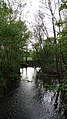
 The Rote Main east of Bayreuth |
||
The Red Main is the less arid, but longer of the two source rivers of the Main . It rises in Franconian Switzerland and unites on the western outskirts of Kulmbach with the right and northern source river Weißer Main . Over a length of 72 kilometers, the Rote Main has a gradient of 283 meters.
It flows through an area with loamy soils and carries a lot of suspended cargo with it, especially after rainfall . Therefore it takes on a reddish-brown color, which has led to its name being added.
geography
source
The Rote Main rises ten kilometers south of Bayreuth near Hörlasreuth ( Creußen ) in the Lindenhardt Forest at an altitude of 581 m above sea level. NN . The headwaters are in the Franconian Switzerland Nature Park - Veldenstein Forest . Geologically it belongs to the Brown Jura . The spring was set in stone in 1907 and the water flows from it via a wooden pipe.
River course


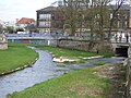
The Rote Main flows first in a south-easterly direction before it bends to the north-east and crosses Creußen . From there he moves north and turns west behind the Hermitage . It crosses the city of Bayreuth from east to west. In the city center he has been put in a concrete bed and partially covered over since the 1970s.
In the vicinity of the Bayreuth Volksfestplatz, the Mühlkanal branches off to the south, which used to drive several mills in the city area. Its flow is kept almost constant with a weir . It runs above ground to the level of Münzgasse, in 1886 it was covered between Münzgasse and Kanalstrasse. At the site of the Münzmühle, which was demolished after 1894, the Royal Bavarian Bank (since 2013: Iwalewahaus ) was built over the canal in 1907-1908. At the western end of the cap it disappeared from 1933 under the " House of German Education ". In the area between these buildings, it was swiveled slightly to the south from 1997-1998 and the newly created run was partially reopened. The Mühlkanal was capped in 1967 along the Kanalstrasse.
The northern arm usually has very little water, but serves as a flood stream when the tide is high and has a very wide bed. The "Riediger map" from 1745 still shows an island in the area between Bahnhofstrasse and Schulstrasse, on a map from 1814 an island is marked at the level of the barracks. After heavy floods in 1907 and 1909, which particularly affected the Neuer Weg district , the river there was widened and canalized from 1913 to 1915. Since 1967/68 it has been partially built over with two parking spaces.
After the urban area, the Rote Main flows strongly meandering through a wide valley towards the northwest, past the villages of Heinersreuth and Neudrossenfeld . On the western outskirts of Kulmbach , near Steinenhausen Castle , it unites with the White Main , which rises in the Fichtel Mountains near Bischofsgrün . The Red Main is 72 kilometers long (source to mouth), the White Main 52 kilometers. In 2009 a bridge was built directly below the confluence of the two headwaters. Information boards on the bridge provide information about the further course of the river, the local hiking and cycling trails and the surrounding area.
Tributaries
The tributaries of the Red Main include (downstream sequence):
- Simmelbach ( right ), 2.2 km
- Eschingbach ( right ), 1.5 km
- Hühnerbach ( right )
- Kupfergraben ( Kaingraben ) ( left )
- Tiefenbach ( left )
- Schwarzbach ( right )
- Metzelersbach ( right )
- Gosenbach ( left ), ( 7.95 km )
- Schliefgraben ( right )
- Schwarzweiherbach ( left )
- Weihersgraben ( left )
- Well ditch ( right )
- Schamelsgraben ( right )
- Mühlwässerlein ( left )
- Schnerfenbach ( right )
- Thiergartenweihergraben ( left )
- Ölschnitz ( right ), ( with Laimbach 14.72 km )
- Gereutbach ( right )
- Bühlersbach ( left )
- Warm Steinach ( right ), ( 24.61 km )
- Mistletoe ( Mistelbach ) ( left ), ( 11.42 km )
- Grünbaumgraben ( right )
- Preuschwitzerin ( left )
- Cottenbach ( right )
- Tannenbach ( left )
- Dühlbach ( left ), ( 7.01 km )
- Seebach ( right )
- Köhlersgraben ( left )
- Rottelbach ( left ), ( 6.93 km )
- Pitch pit ( right )
- Erlgraben ( right )
- Reuthbach ( Rotbach ) ( left ), ( 5.94 km )
- Schellenbach ( right )
- Friesenbach ( left ), ( 8.85 km )
- Aubach ( right )
- Erlenbach ( right )
- Hirtengraben ( left )
- Krummer Lachengraben ( right )
- Proßer Bach ( right )
Before straightening northwest of downtown Bayreuth, the Sendelbach (on the Pauschenberglein) and earlier also the Tappert (on the Mühltürlein) flowed directly into the Red Main.
Red Main river system
Geotope Bodenmühlwand

Near the Bodenmühle, southeast of Bayreuth, the Rote Main has created the so-called Bodenmühlwand, a steep slope about 30 meters high, through erosion on the slope of a river bend . There layers of earth from the middle “Keuper period” (older Upper Triassic ) are exposed . They consist of relatively thick layers of clay , in which individual thin banks of limestone marl ("stone marl ") are inserted. This sequence of the lower middle keuper is known as the estheria layers . The name comes from fossils of the mussel crab species Palaeestheria (formerly Estheria ) minuta , which are contained relatively frequently in these layers. They also contain the remains of coelacids and the scales, teeth and fin spines of primeval sharks, which suggests marine conditions at their time of deposition. In addition, the estheria layers of the Bodenmühlwand are the type locality of the marine dinosaur species Nothosaurus edingerae . The mighty sandstone bank in the uppermost part of the wall, discordant on top of the claystone and marl limestone layers, is already part of the sequence of reed sandstone that was deposited by a river as a result of a sea retreat .
The Bodenmühlwand has been identified by the Bavarian State Office for the Environment as a geoscientifically particularly valuable geotope and has been awarded the official seal of approval " Bavaria's most beautiful geotopes ". See also the list of geotopes in the Bayreuth district .
fauna
Brown trout , grayling , barbel , Mühlkoppe , lamprey , carp , tench , bream , roach , perch , pike , pikeperch , eel and eel rods can be found in the Red Main .
Hiking trails
The Rotmainweg, which the Fichtelgebirgsverein e. V. has created. This main hiking trail is marked with a red M on a white background. It is 60 kilometers long to the confluence with the White Main and runs as follows: Rotmainquelle - Creußen - Eimersmühle - Schlehenberg - Hermitage - Bayreuth - Martinsreuth - Altenplos - Grüngraben - Jöslein - Langenstadt - Affalterhof Katschenreuth - Steinenhausen Castle near Kulmbach.
Others
In August 2018, the Rote Main above Creußen dried up.
gallery
Red Main near Grunauer Mühle

Roter Main in Bayreuth - looking towards the former "Schwarzer Steg"

Rotmaindeckelung at Annecyplatz Bayreuth from the east
Mouth of the Mühlkanal (capped) in the Red Main

Flood at the Mainflecklein in Bayreuth

Bridge over the Red Main near Heinersreuth


Remarks
- ↑ Local name in Bayreuth
literature
- Johann Kaspar Bundschuh : Mayn, the red . In: Geographical Statistical-Topographical Lexicon of Franconia . tape 3 : I-Ne . Verlag der Stettinische Buchhandlung, Ulm 1801, DNB 790364301 , OCLC 833753092 , Sp. 466 ( digitized version ).
- M. Johann Willen: The Teutsche Paradeiß in the excellent Fichtelberg. In: Archive for the history of Upper Franconia. Volume 15, Issue 3, p. 167
- Johann Christoph Pachelbel: Detailed description of the Fichtel mountain lying in the Nordgau. Leipzig 1716, p. 18
- Fichtelgebirgsverein leaflet: The Rotmainweg (detailed description of the route)
- Gustav Schmidt: The Upper Main from the sources to Bamberg. In: Local supplement to the Upper Franconian School Gazette. No. 325/2005
- Franz X. Bogner: The Upper Main. An aerial portrait from Bayreuth to Bamberg. Ellwanger-Verlag, Bayreuth 2006, ISBN 3-925361-57-X
Individual evidence
- ↑ a b Map service of the Bavarian State Office for the Environment
- ↑ Flood news service Bavaria: level data Unterzettlitz , accessed on December 27, 2012 ( memento of the original from September 7, 2007 in the Internet Archive ) Info: The archive link was automatically inserted and not yet checked. Please check the original and archive link according to the instructions and then remove this notice.
- ↑ Flood news service Bavaria: Average discharge (MQ) of the Unterzettlitz level ( page no longer available , search in web archives ) Info: The link was automatically marked as defective. Please check the link according to the instructions and then remove this notice. , extrapolated to the entire catchment area
- ^ Herbert Popp: Bayreuth - rediscovered, a city-geographic excursion guide. Ellwanger Druck und Verlag, Bayreuth 2007, ISBN 978-3-925361-60-9 , p. 97.
- ^ Kurt Herterich: From Bayreuth Castle Tower to Festival Hill . Ellwanger, Bayreuth 2003, ISBN 978-3-925361-47-0 , pp. 31 .
- ↑ Kurt Herterich: From Bayreuth Castle Tower to Festival Hill , p. 29.
- ↑ That's how it used to be in: Nordbayerischer Kurier, April 11, 2017, p. 10.
- ↑ Kurt Herterich: From Bayreuth Castle Tower to Festival Hill , p. 84.
- ^ Herbert Popp: Bayreuth - newly discovered , p. 120.
- ↑ formerly Hühnerbach
- ↑ Olivier Rieppel, Rupert Wild: Nothosaurus edingerae Schultze, 1970: Diagnosis of the Species and Comments on its Stratigraphical Occurrence Stuttgart Contributions to Natural History. Series B: Geology and Paleontology. No. 204. State Museum for Natural History, Stuttgart 1994 ( BHL ).
- ^ Roland Eichhorn, Stefan Glaser, Ulrich Lagally, Johann Rohrmüller: Geotopes in Upper Franconia. Earth science contributions to nature conservation, Volume 2. 2nd edition. Bavarian Geological State Office, Munich 2003, p. 61 ( lfu.bayern.de )
- ↑ Bodenmühlwand. Bavaria's most beautiful geotopes. Bavarian State Office for the Environment (accessed on October 18, 2013)
- ^ District fishing association Bayreuth: Roter Main
- ↑ Creeks partially dried up in: Nordbayerischer Kurier from 18./19. August 2018, p. 17.