
Warm Steinach
| Warm Steinach | ||
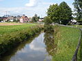
 Warm Steinach in Weidenberg |
||
| Data | ||
| Water code | DE : 24124 | |
| location | Bavaria | |
| River system | Rhine | |
| Drain over | Red Main → Main → Rhine → North Sea | |
| source | near Warmensteinach in the Fichtelgebirge 50 ° 1 ′ 1 ″ N , 11 ° 49 ′ 15 ″ E |
|
| Source height | approx. 788 m above sea level NN | |
| muzzle | in the east of Bayreuth in the Rote Main Coordinates: 49 ° 57 '11 " N , 11 ° 36' 57" E 49 ° 57 '11 " N , 11 ° 36' 57" E |
|
| Mouth height | approx. 346 m above sea level NN | |
| Height difference | approx. 442 m | |
| Bottom slope | approx. 18 ‰ | |
| length | 24.6 km | |
| Catchment area | 87.9 km² | |
| Discharge at the level Untersteinach A Eo : 73.52 km² |
NNQ MNQ MQ Mq MHQ HHQ (1956) |
40 l / s 224 l / s 1.19 m³ / s 16.2 l / (s km²) 13 m³ / s 30.6 m³ / s |
The Warme Steinach is a right tributary of the Red Main in Bavaria .
geography
course


The Warm Steinach, only called Steinach in Bayreuth , rises on the southern slope of the Ochsenkopf in the Fichtelgebirge and flows through Warmensteinach , Sophienthal, Weidenberg , Görschnitz, Untersteinach, Döhlau and the Bayreuth districts of Friedrichsthal and Laineck , where it flows into the Red Main.
Tributaries
|
|
|
River systems
history
Georg Wilhelm von Brandenburg-Bayreuth had the Brandenburger See built in St. Georgen am See and the Döhlauer Graben derived from the Warm Steinach near Döhlau in order to feed it. On the lake, also known as the “Brandenburger Weiher”, naval battles were re-enacted in the 18th century with ships up to 18 meters in length.
Numerous mills were operated with the water from the Warm Steinach. The fulling mill in the Laineck district of Bayreuth was laid out as a marble mill before 1728 and is still in operation as a cutting mill . In Mittlernhammer near Sophienthal and at Döhlauer Graben in Friedrichsthal there are small, privately operated hydropower plants .
gallery

Döhlauer Graben near Friedrichsthal, on the right in the valley floor the Warm Steinach

Steinach weir at the fulling mill in Bayreuth
The Steinach just before it flows into the Red Main

Confluence of the Steinach (from behind) into the Red Main (from the right)

Warm Steinach near Görschnitz


Individual evidence
- ↑ a b Topographic map 1: 10000 Bavaria North
- ↑ Map services of the Bavarian State Office for the Environment
- ↑ Flood Action Plan Main
- ↑ Bavarian flood news service (as of September 6, 2011)
- ↑ Map of Bayreuth, Cities-Verlag, 17th edition
- ↑ Administrative court gives hydropower operators right in: Nordbayerischer Kurier from 16./17. November 2019, p. 17.