
Cussen
| coat of arms | Germany map | |
|---|---|---|

|
Coordinates: 49 ° 51 ' N , 11 ° 38' E |
|
| Basic data | ||
| State : | Bavaria | |
| Administrative region : | Upper Franconia | |
| County : | Bayreuth | |
| Management Community : | Cussen | |
| Height : | 442 m above sea level NHN | |
| Area : | 64.89 km 2 | |
| Residents: | 4992 (Dec. 31, 2019) | |
| Population density : | 77 inhabitants per km 2 | |
| Postal code : | 95473 | |
| Area code : | 09270 | |
| License plate : | BT, EBS , ESB , KEM , MÜB , PEG | |
| Community key : | 09 4 72 127 | |
| City structure: | 38 parts of the community | |
City administration address : |
Bahnhofstrasse 11 95473 Creußen |
|
| Website : | ||
| Mayor : | Martin Dannhäußer ( FW ) | |
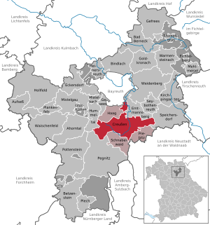
| Location of the city of Creußen in the Bayreuth district | ||
  |
||

Creußen is a town in the Upper Franconian district of Bayreuth and the seat of the Creußen administrative community . It is located in Franconian Switzerland about 13 kilometers south of Bayreuth on federal highway 2 near the A 9 motorway .
geography
topography
Creußen is located in the Franconian Switzerland low mountain range, at the foot of the Fichtelgebirge and in the Upper Palatinate Forest at an altitude of between 426 and 630 meters. The Schlossberg in the east of Creußen is 566 meters above sea level . Electricity is generated on it with wind turbines .
At 630 meters, the Preunersfelder Rangen is the highest point in the Creußen ridge. It extends further south. In Thurndorf, about 9.5 kilometers from Creußen, the highest point of the Schnabelwaider Kitschenrain is the Kalvarienberg with its forest chapel at 647.5 meters.
Creußen is located in the Upper Main-Upper Palatinate hill country. The valley of the Red Main forms the contrast to the hills and terraces of the Creußen ridge. To the west of Creußen is the Lindenhardt Forest. The Creußener Land, which forms the easternmost part of Franconian Switzerland, is also suitable for cross-country skiing in winter . After the Fichtel Mountains and the Franconian Forest, it is one of the safest snow areas in Upper Franconia.
The most important mountains around Creußen are the Kalvarienberg (647 m), the Graubühl (569 m), the Dreiköpfige Tanne (519 m), the Schlossberg (566 m), the Kapf (597 m), the Preunersfelder Rangen (630 m) , the Creussener Berg (475 m), the Tannenberg (597 m), the Funkenberg (580 m), the Kleine Kulm (626 m) and the Hohenmirsberger Platte (614 m).
Community structure
There are 38 officially named parts of the municipality (the type of place is given in brackets ):
|
|
|
|
Neighboring communities
Neighboring communities are (starting from the north clockwise): Emtmannsberg , Speichersdorf , Prebitz , Schnabelwaid , Pegnitz , Hummeltal , Haag and Bayreuth .

Geotopes
- Outcrop in Posidonia schist west of Creußen (geotope number 472A009).
history


Settlement in what was then Radenzgau took place around the year 1000. Creußen was first mentioned in a document as "urbs crusni" in 1003 during the disputes between the later Emperor Heinrich II and the Schweinfurt margrave Hezilo . The emperor, supported by the Würzburg bishop Heinrich , besieged the Creußen castle (castrum crusni), where the margrave and his family had holed up. The sources do not reveal whether the castle was destroyed at that time. The margrave was able to escape secretly through the siege ring (the vernacular reports that he escaped through a secret passage), but was caught near Tiefenthal.
The rule of the burgraves of Nuremberg began in 1251, when the Zoller Friedrich II. Of Nuremberg received the place from the Hohenstaufen King Konrad . In 1358 Creußen was elevated to the status of a city by Emperor Charles IV . From 1500 the city was part of the Franconian Empire . It was devastated in the Hussite Wars and the Thirty Years War .
In 1792 the city fell to Prussia , to whom Margrave Christian Friedrich Karl Alexander had sold his territory. After a brief interlude under French rule (1807-1810), the former principality of Bayreuth , and with it the city of Creußen, was sold to Bavaria . In 1893 large parts were destroyed by fire (Vorderes Tor, Marktplatz, Habergasse).
The most important branch of the economy in the rural town was until the 1930s handicrafts. The city is known for the jugs made there . In the last free Reichstag election on November 6, 1932 , the NSDAP already received 55 percent of the vote in Creußen (33.1 percent of the Reich average).
The metal works of the later mayor and NSDAP local group leader Carl Tabel, founded in 1912, developed into an armaments factory during the Third Reich . The first arms contracts were completed in May 1938, and 166 workers were working in the factory in 1939. From 1942 onwards, in addition to rifles and anti-aircraft guns , parts for battle tanks were also manufactured. In February 1945 the plant employed 1,360 people, including 1,160 slave labor . Their barracks on Thietmarplatz were secured against attempts to escape with a double, 2.20 meter high barbed wire fence and connected to the factory by a tunnel. Another camp ("East Workers Camp" Rosental) was built on Vogelhöhe, the stone barracks of which are still there. The forced laborers came from eight countries, including 14-year-old girls and boys.
On April 14, 1945, the city fell into the hands of the Americans without a fight after the future mayor Friedrich Neuner ran towards their tanks with a white cloth. The next day the Wehrmacht tried to retake the place for three days. Thirteen civilians were killed in the tank attack, eighteen houses, nine barns and five stables were destroyed.
The previously independent municipality of Bühl was incorporated into the city of Creußen on January 1, 1972, and Neuhof was added on January 1, 1977. Gottsfeld, Haidhof, Seidwitz and the Lindenhardt market as well as parts of the dissolved Wolfsbach community followed on May 1, 1978.
On January 1, 2020, the community-free area Lindenhardter Forst-Südost with 272 hectares and the eastern part of the community-free area Lindenhardter Forst-Nordwest with 168 hectares were incorporated, whereby Creussens district area increased from 60.49 to 64.89 km².
Population development
In the period from 1988 to 2018, the city grew from 4655 to 4941 by 286 inhabitants or 6.1%.
politics
City council
The local elections in 2008 and 2014 led to the following allocation of seats in the city council :
| Party / group of voters | 2008 | 2014 |
|---|---|---|
| CSU | 6th | 5 |
| SPD | 3 | 3 |
| Greens and Independent | 1 | 2 |
| Creußen list | 3 | 2 |
| Non-partisan voter group Creußen - Free voters | 2 | 3 |
| Lindenhardter Umlandliste (LUL) | 1 | 1 |
| total | 16 | 16 |
mayor
In the mayoral election on November 11, 2012, Martin Dannhäußer (non-partisan voter group - free voters) won against incumbent Harald Mild (CSU) with 50.9% of the vote. In 2006, Mild was confirmed in office with 90.81% of the votes when he had no opponent.
Town twinning
coat of arms
Blazon : embedding silver and black, in the middle a red clay jug without handles.
The oldest evidence is a building sculpture on the town hall (around 1470), the oldest seal impression is from 1511. In a colored drawing from 1581 the jug appears for the first time in the middle of the shield.
Culture and sights
Buildings

- The parish church of St. Jakobus on Heziloplatz received its present form and most of the baroque interior after its destruction in the Hussite Wars and the reconstruction in 1477. The church tower stands on the foundations of the keep of the former castle .
- Opposite is the former Latin school, which in its heyday enjoyed a great reputation far beyond Creußen.
- The rectory stands on the market square and in front of it the former communal brewery, now a Protestant parish hall.
- The city wall was built with 1358-1361
- the rear gate, in which the Krügemuseum is located,
- the hunger or maleficent tower, which was built as a prison and the
- Markus Tower, built in 1477.
- Habergasse was originally the main street of the city and was designed as a street market. There the horses of the merchants were supplied with oats.
- The town hall was built in 1360 and rebuilt in 1477 after the destruction in the Hussite War. Bread and meat banks along the long side served as stalls.
- The hermitage is the only preserved civil hermitage in Germany. It was built in 1760 by the theologian Johann Theodor Künneth.

museum
In the Krügemuseum important pieces of the Creußen stoneware are exhibited. This stoneware is made from a clay whose composition is no longer known today. The Krügemuseum has been housed in the gatekeeper's room in the northern city gate (rear gate) since 1950. In 2004 it was expanded after the adjacent executioner's house was expanded.
Regular events
- Pope Gregory IV established the festival in honor of his predecessor Pope Gregory I , the patron saint of youth and schools, as a school festival in 830. This festival has been celebrated in Creußen since the 17th century. It takes place every two years on the last weekend before the school holidays on the market square and lasts four days.
- International pottery market
- The market is reminiscent of the tradition of ceramics in Creußen and takes place every year on the second Sunday in July.
traffic

The station Creussen (Oberfr) is at the Schnabelwaid-Bayreuth railway . With trains the relation Bayreuth - Nuremberg every hour.
sons and daughters of the town
- Georg Friedrich Seiler (1733–1807), evangelical theologian and writer
- Christoph Wirth (1870–1950), inventor
literature
- Johann Kaspar Bundschuh : Creußen . In: Geographical Statistical-Topographical Lexicon of Franconia . tape 1 : A-egg . Verlag der Stettinische Buchhandlung, Ulm 1799, DNB 790364298 , OCLC 833753073 , Sp. 553-556 ( digitized version ).
- Hermann Joseph Hiery , Frank Spörrer: Creussen. History of an Upper Franconian town (1800–2000) . City of Creußen, 2003, ISBN 3-926621-26-5 .
- Georg Paul Hönn : Creußen . In: Lexicon Topographicum of the Franconian Craises . Johann Georg Lochner, Frankfurt and Leipzig 1747, p. 235-236 ( digitized version ).
- Pleikard Joseph Stumpf : Creußen . In: Bavaria: a geographical-statistical-historical handbook of the kingdom; for the Bavarian people . Second part. Munich 1853, p. 620 ( digitized version ).
Web links
- City administration
- Kruger Museum
- Creußen: Official statistics of the LfStat
- Remembering instead of forgetting: Forced labor in Creußen 1942–1945 ( VVN-BdA )
Individual evidence
- ↑ "Data 2" sheet, Statistical Report A1200C 202041 Population of the municipalities, districts and administrative districts 1st quarter 2020 (population based on the 2011 census) ( help ).
- ↑ Congregation , accessed June 5, 2020 .
- ↑ Mayor. Creußen community, accessed on June 5, 2020 .
- ^ Community of Creußen in the local database of the Bavarian State Library Online . Bayerische Staatsbibliothek, accessed on January 5, 2020.
- ↑ Karl Müssel: Bayreuth in eight centuries . 1st edition. Gondrom, Bindlach 1993, ISBN 3-8112-0809-8 , p. 13 .
- ↑ Dr. Hans Vollet, Kathrin Heckel: The ruins drawings of the Plassenburg cartographer Johann Christoph Stierlein . 1987.
- ↑ Karl Müssel: Bayreuth in eight centuries , p. 32
- ↑ a b Peter Engelbrecht: The war is over. Spring 1945 in Upper Franconia . Späthling, Weißenstadt 2015, ISBN 978-3-942668-23-1 , pp. 63 ff .
- ↑ Peter Engelbrecht: Exchange mower for woman. Reports from Upper Franconia . 2nd Edition. Boomerang, Bayreuth 2004, ISBN 3-929268-18-3 , p. 66 ff .
- ^ Wilhelm Volkert (ed.): Handbook of Bavarian offices, communities and courts 1799–1980 . CH Beck, Munich 1983, ISBN 3-406-09669-7 , p. 549 .
- ^ Federal Statistical Office (ed.): Historical municipality directory for the Federal Republic of Germany. Name, border and key number changes in municipalities, counties and administrative districts from May 27, 1970 to December 31, 1982 . W. Kohlhammer, Stuttgart / Mainz 1983, ISBN 3-17-003263-1 , p. 675 .
- ^ Government of Upper Franconia: Press release no .: 109/19, October 25, 2019: Creußen, Hummeltal, Haag and Gesees are growing; Unregulated areas in the Lindenhardt Forest are being dissolved.
- ^ Entry on the coat of arms of Creußen in the database of the House of Bavarian History
- ↑ City of short distances. In: nordbayerischer-kurier.de. Retrieved December 15, 2016 .

Maple Valley | Aufseß | Bad Berneck in the Fichtel Mountains | Betzenstein | Bindlach | Bischofsgrün | Creussen | Eckersdorf | Emtmannsberg | Fichtelberg | Gefrees | Gesees | Glassworks | Goldkronach | Hague | Heinersreuth | Hollfeld | Hummeltal | Church ping garden | Flour chisel | Mistelbach | Mistelgau | Pegnitz | Plankenfels | Plech | Pottenstein | Prebitz | Beak woad | Seybothenreuth | Speicherersdorf | Waischenfeld | Warmensteinach | Willow Hill
Unregulated areas of
Bischofsgrüner Forst |
Fichtelberg |
Forst Neustädtlein am Forst |
Glashüttener Forest |
Heinersreuther Forest |
Neubauer Forest North |
Prüll |
Veldenstein Forest |
Waidacher Forest |
Warmensteinacher Forest North
Altenkünsberg | Althaidhof | Ground | Bühl | Creußen (core city) | Bucket mill | Gottsfeld | Großweiglareuth | Hague House | Hagenohe | Hagenreuth | Hammer mill | Hörhof | Hörlasreuth | Kleinweiglareuth | Kotzmannsreuth | Lankenreuth | Latvians | Lindenhardt | Neuenreuth | Neuhaidhof | Neuhaus | Neuhof | Oberhöhlmühle | Oberneueben | Oberschwarzach | Ottmannsreuth Sawmill | Schwürz | Seidwitz | Sorg | Stockmühle | Tiefenthal | Unterhöhlmühle | Untereueben | Unterschwarzach | Aquatic herb