
Mistelbach (Upper Franconia)
| coat of arms | Germany map | |
|---|---|---|

|
Coordinates: 49 ° 55 ' N , 11 ° 31' E |
|
| Basic data | ||
| State : | Bavaria | |
| Administrative region : | Upper Franconia | |
| County : | Bayreuth | |
| Management Community : | Mistelbach | |
| Height : | 408 m above sea level NHN | |
| Area : | 6.13 km 2 | |
| Residents: | 1571 (Dec. 31, 2019) | |
| Population density : | 256 inhabitants per km 2 | |
| Postal code : | 95511 | |
| Area code : | 09201 | |
| License plate : | BT, EBS , ESB , KEM , MÜB , PEG | |
| Community key : | 09 4 72 166 | |
| Community structure: | 6 districts | |
| Address of the municipal administration: |
Chancellery Street 3 95511 Mistelbach |
|
| Website : | ||
| Mayor : | Matthias Mann ( SPD ) | |
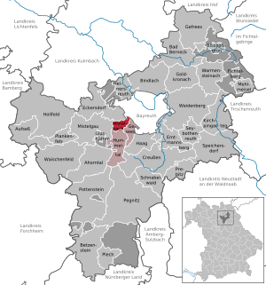
| Location of the municipality of Mistelbach in the Bayreuth district | ||
  |
||

Mistelbach is a municipality in the Upper Franconian district of Bayreuth and the seat of the Mistelbach administrative community . The community is about seven kilometers from Bayreuth .
geography
Community structure
The municipality of Mistelbach has 6 districts :
There are also three wastelands with proper names:
- Village mill
- Trautscheit
- Warmuthsreut
Neighboring communities
Neighboring communities are (starting from the north clockwise): Bayreuth , Gesees , Hummeltal , Mistelgau and Eckersdorf .
Waters
history


Until the church is planted
Mistelbach was first mentioned in writing on May 4, 1125. The Mistelbach family of imperial knights has been attested since 1321 and died out in the male line in 1563. As part of the Prussian principality of Bayreuth since 1792 , Mistelbach fell to France in the Peace of Tilsit in 1807 and became part of Bavaria in 1810.
Population development
In the period from 1988 to 2018, the community grew from 1533 to 1599 by 66 inhabitants or 4.3%. A peak was reached on December 31, 2004 with 1653 inhabitants.
- 1970: 1340 inhabitants
- 1987: 1502 inhabitants
- 1991: 1582 inhabitants
- 1995: 1572 inhabitants
- 2000: 1545 inhabitants
- 2005: 1654 inhabitants
- 2010: 1619 inhabitants
- 2015: 1594 inhabitants
- 2016: 1596 inhabitants
politics
mayor
Mayor is Matthias Mann (SPD).
Municipal council
The 2014 local elections resulted in the following distribution of seats in the local council:
- SPD 5 seats
- CSU 3 seats
- Citizens' Initiative-Pro Mistelbach 3 seats
- Free community of voters 1 seat
coat of arms
Blazon : "On the red background, over two crossed silver knives, there is a notched golden bar." The golden bar in front of the red background goes back to the male line of the von Mistelbach family , which died out in 1563 . The silver knives remind of the saint of the parish church St. Bartholomäus .
Intermunicipal cooperation
The municipality of Mistelbach has been a member of the association for regional development "All around the Neubürg-Franconian Switzerland" since 1999 .
Culture and sights
See also: Ensemble Ortskern Mistelbach (Upper Franconia)
Buildings
- Evangelical Church of St. Bartholomew
- Mistelbach Castle (the castle of the noble free of Mistelbach, new building in 1763)
- Hunting table of the Margrave of Bayreuth in the forest area of Arzloch
Natural monuments
- Arzloch Gorge, geotope no. 472R022
- Hirtenstein, geotope no. 472R153
- Quarter stone, geotope no. 472R020
- Sattlerstein, geotope no. 472R025
Sports
- TSV Mistelbach with five youth teams, two senior teams, an old men team (all football ), women's gymnastics, a tennis team, two table tennis teams , a theater department and a ski department .
- The Mistelbach / Bayreuth hiking enthusiasts conduct long-distance, day and half-day hikes as well as club trips.
Soil monuments
See: List of soil monuments in Mistelbach (Upper Franconia)
traffic
The Bayreuth – Hollfeld local railway ran through the town .
Sons and daughters of the church

- Friedrich Wilhelm Hagen (born March 31, 1767, † April 27, 1837), author, pastor, dean and district school inspector
- Ernst Zindel (born January 23, 1897, † October 10, 1978), aircraft designer
See also
literature
- Johann Kaspar Bundschuh : Mistelbach . In: Geographical Statistical-Topographical Lexicon of Franconia . tape 3 : I-Ne . Verlag der Stettinische Buchhandlung, Ulm 1801, DNB 790364301 , OCLC 833753092 , Sp. 618 ( digitized version ).
- August Gebeßler : City and district of Bayreuth (= Bavarian art monuments . Volume 6 ). Deutscher Kunstverlag, Munich 1959, DNB 451450914 , p. 123-126 .
- Georg Paul Hönn : Mistelbach . In: Lexicon Topographicum of the Franconian Craises . Johann Georg Lochner, Frankfurt and Leipzig 1747, p. 272-273 ( digitized version ).
- Pleikard Joseph Stumpf : Mistelbach . In: Bavaria: a geographical-statistical-historical handbook of the kingdom; for the Bavarian people . Second part. Munich 1853, p. 566-567 ( digitized version ).
Web links
- Entry on the coat of arms of Mistelbach (Upper Franconia) in the database of the House of Bavarian History
Individual evidence
- ↑ "Data 2" sheet, Statistical Report A1200C 202041 Population of the municipalities, districts and administrative districts 1st quarter 2020 (population based on the 2011 census) ( help ).
- ^ Municipality of Mistelbach in the local database of the Bayerische Landesbibliothek Online . Bayerische Staatsbibliothek, accessed on January 5, 2020.
- ↑ About us - The Neubürg at a glance - Neubürg. Accessed June 8, 2020 (German).

Maple Valley | Aufseß | Bad Berneck in the Fichtel Mountains | Betzenstein | Bindlach | Bischofsgrün | Creussen | Eckersdorf | Emtmannsberg | Fichtelberg | Gefrees | Gesees | Glassworks | Goldkronach | Hague | Heinersreuth | Hollfeld | Hummeltal | Church ping garden | Flour chisel | Mistelbach | Mistelgau | Pegnitz | Plankenfels | Plech | Pottenstein | Prebitz | Beak woad | Seybothenreuth | Speicherersdorf | Waischenfeld | Warmensteinach | Willow Hill
Unregulated areas of
Bischofsgrüner Forst |
Fichtelberg |
Forst Neustädtlein am Forst |
Glashüttener Forest |
Heinersreuther Forest |
Neubauer Forest North |
Prüll |
Veldenstein Forest |
Waidacher Forest |
Warmensteinacher Forest North