
Plankenfels
| coat of arms | Germany map | |
|---|---|---|

|
Coordinates: 49 ° 53 ' N , 11 ° 20' E |
|
| Basic data | ||
| State : | Bavaria | |
| Administrative region : | Upper Franconia | |
| County : | Bayreuth | |
| Management Community : | Hollfeld | |
| Height : | 390 m above sea level NHN | |
| Area : | 14.01 km 2 | |
| Residents: | 860 (Dec. 31, 2019) | |
| Population density : | 61 inhabitants per km 2 | |
| Postal code : | 95515 | |
| Area code : | 09204 | |
| License plate : | BT, EBS , ESB , KEM , MÜB , PEG | |
| Community key : | 09 4 72 176 | |
| Community structure: | 14 districts | |
| Address of the municipal administration: |
Hauptstrasse 4 95515 Plankenfels |
|
| Website : | ||
| Mayor : | Harald Wich ( CSU ) | |
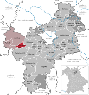
| Location of the community of Plankenfels in the district of Bayreuth | ||
  |
||

Plankenfels is a municipality in the Bayreuth district ( Upper Franconia administrative district ) and a member of the Hollfeld administrative community .
geography
The community is located about 50 km northeast of Nuremberg and 18 km southwest of Bayreuth , in the northeast of the Franconian Switzerland Nature Park . It is also known as the gateway to Franconian Switzerland. The Wiesent flows through it in a north-south direction .
Place Plankenfels
The old town center of Plankenfels is located on the western flank of the Wiesent valley. The Truppach flows into it to the south . To the northeast, somewhat separated, are the newer parts of the village, the Altneuwirtshaus, Hammer and Neuwirtshaus.
Community structure
The community has 14 districts :
|
Altneuwirtshaus and Neuwirtshaus belong to the district of Plankenfels and have not been official districts since 1987 at the latest.
There are the districts of Plankenfels, Schressendorf and Schönfeld.
Neighboring communities
Neighboring communities are (starting from the north clockwise) Mistelgau , Waischenfeld , Aufseß and Hollfeld .
history
Until the church is planted
Plankenfels was created as a border between the episcopal Bamberg and the Kulmbach-Bayreuth area. The Lords of Plankenfels were first mentioned in a document in 1217 and died out in 1538. The place and castle Plankenfels then changed hands several times. In May 1525, Plankenfels was looted and destroyed by the peasant heaps during the Peasants' War. The Lords of Schlammersdorf had lived in Plankenfels since the 17th century . The rule of the barons of Schlammersdorf came with the Rhine Confederation Act in 1806 to Bavaria . As a result of the administrative reforms carried out at the beginning of the 19th century , the independent rural community of Plankenfels was created, to which, in addition to the capital of the same name, the places Altneuwirtshaus, Bockshügel, Eichenmühle , Fräuleinsteig, Hammer, Neumühle, Neuwelt, Neuwirtshaus, Plankenstein, Ringau, Scherleithen, Schlotmühle, Schrenkersberg and Wadendorf belonged. It belonged to the Hollfeld district court , which was transferred to the district office and later district of Ebermannstadt in 1862 . In 1864 the school in Plankenfels is inaugurated. Since 1972 it has only been run as a primary school, and in 2010 the school will be completely closed. Since 1996 the St 2186, which used to run through the village, has been a bypass in the southeast.
Territorial reform of the 1970s
On January 1, 1972, in the course of the municipal reform, the municipality of Löhlitz with its district Schafhof and the village of Kaupersberg were incorporated into the municipality of Nankendorf . On May 1, 1978, Löhlitz and Schafhof were again assigned to the city of Waischenfeld .
Population development
In the period from 1988 to 2018, the municipality grew from 834 to 858 by 24 inhabitants or 2.9%. A peak was reached on December 31, 1999 with 910 inhabitants.
- 1961: 936 inhabitants, with the assignments to Waischenfeld 1133 inhabitants
- 1970: 914 inhabitants, with the assignment to Waischenfeld 1150 inhabitants
- 1987: 798 inhabitants
- 1991: 840 inhabitants
- 1995: 895 inhabitants
- 2000: 909 inhabitants
- 2005: 893 inhabitants
- 2010: 865 inhabitants
- 2015: 898 inhabitants
politics
mayor
Mayor is Harald Wich (CSU). In 2014 he succeeded Luise Goldfuß (electoral community), who held the office for 12 years.
Municipal council
The municipal council (electoral period 2014/20) has eight members.
- Common list of the CSU and constituency Plankenfels with 8 seats
coat of arms
The municipal coat of arms, which has been in use since 1985, reflects the local history: Above the slanted black shield base, covered with three six-pointed silver stars, a soaring blue wolf rises in silver, which is accompanied by a black chess ray at the top right.
The wolf is the heraldic animal of the Lords of Plankenfels. The coat of arms of the Lords of Schlammersdorf was the sloping beam with the three stars. The chess ray was the coat of arms of the Neustetter-Stürmer family, which can be traced back to the Wadendorf district in the 16th century.
Intermunicipal cooperation
The community of Plankenfels has been a member of the association for regional development “Around the Neubürg - Fränkische Schweiz e. V. "
traffic
The community is crossed in a north-south direction by the state road 2191 , the St 2186 leads to Bayreuth.
The Bayreuth-Hollfeld local railway ran through the town until 1974 . As a relic, a railway bridge that has not functioned today still exists.
The Franconian Marienweg runs through Plankenfels .
Culture and sights

Castle south side

Plankenfels Castle

St. Heinrich

graveyard


literature
- Johann Kaspar Bundschuh : Blanckenfels . In: Geographical Statistical-Topographical Lexicon of Franconia . tape 1 : A-egg . Verlag der Stettinische Buchhandlung, Ulm 1799, DNB 790364298 , OCLC 833753073 , Sp. 408 ( digitized version ).
- Johann Kaspar Bundschuh : Plankenfels . In: Geographical Statistical-Topographical Lexicon of Franconia . tape 4 : Ni-R . Verlag der Stettinische Buchhandlung, Ulm 1801, DNB 790364301 , OCLC 833753101 , Sp. 355 ( digitized version ).
Web links
- Entry on the coat of arms of Plankenfels in the database of the House of Bavarian History
Individual evidence
- ↑ "Data 2" sheet, Statistical Report A1200C 202041 Population of the municipalities, districts and administrative districts 1st quarter 2020 (population based on the 2011 census) ( help ).
- ^ Community Plankenfels in the local database of the Bavarian State Library Online . Bayerische Staatsbibliothek, accessed on January 5, 2020.
- ↑ Historical municipality register for the Federal Republic of Germany (1970–1982), page 670
- ^ Wilhelm Volkert (ed.): Handbook of Bavarian offices, communities and courts 1799–1980 . CH Beck, Munich 1983, ISBN 3-406-09669-7 , p. 452 .
- ^ Federal Statistical Office (ed.): Historical municipality directory for the Federal Republic of Germany. Name, border and key number changes in municipalities, counties and administrative districts from May 27, 1970 to December 31, 1982 . W. Kohlhammer, Stuttgart / Mainz 1983, ISBN 3-17-003263-1 , p. 677 .
- ↑ http://www.nordbayerischer-kurier.de/nachrichten/luise-goldfuss-hoert-auf_204577
- ↑ About us - The Neubürg at a glance - Neubürg. Accessed June 8, 2020 (German).
Oak mill | Hammer | Kaupersberg | Meuschlitz | Neumühle | New World | Plankenfels | Plankenstein | Ringau | Scherleithen | Chimney mill | Schrenkersberg | Schressendorf | Wadendorf

Maple Valley | Aufseß | Bad Berneck in the Fichtel Mountains | Betzenstein | Bindlach | Bischofsgrün | Creussen | Eckersdorf | Emtmannsberg | Fichtelberg | Gefrees | Gesees | Glassworks | Goldkronach | Hague | Heinersreuth | Hollfeld | Hummeltal | Church ping garden | Flour chisel | Mistelbach | Mistelgau | Pegnitz | Plankenfels | Plech | Pottenstein | Prebitz | Beak woad | Seybothenreuth | Speicherersdorf | Waischenfeld | Warmensteinach | Willow Hill
Unregulated areas of
Bischofsgrüner Forst |
Fichtelberg |
Forst Neustädtlein am Forst |
Glashüttener Forest |
Heinersreuther Forest |
Neubauer Forest North |
Prüll |
Veldenstein Forest |
Waidacher Forest |
Warmensteinacher Forest North