
Seybothenreuth
| coat of arms | Germany map | |
|---|---|---|

|
Coordinates: 49 ° 54 ' N , 11 ° 42' E |
|
| Basic data | ||
| State : | Bavaria | |
| Administrative region : | Upper Franconia | |
| County : | Bayreuth | |
| Management Community : | Willow Hill | |
| Height : | 420 m above sea level NHN | |
| Area : | 17.44 km 2 | |
| Residents: | 1266 (Dec. 31, 2019) | |
| Population density : | 73 inhabitants per km 2 | |
| Postal code : | 95517 | |
| Primaries : | 09275, 09278 | |
| License plate : | BT, EBS , ESB , KEM , MÜB , PEG | |
| Community key : | 09 4 72 188 | |
| LOCODE : | DE SEY | |
| Community structure: | 8 parts of the community | |
| Address of the municipal administration: |
Rathausplatz 1 95517 Seybothenreuth |
|
| Website : | ||
| Mayor : | Reinhard Preißinger (Free Association of Voters) | |
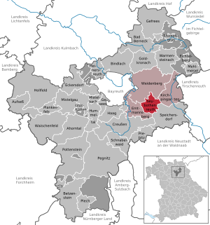
| Location of the municipality of Seybothenreuth in the district of Bayreuth | ||
  |
||

Seybothenreuth is a municipality in the district of Bayreuth ( Upper Franconia administrative region ) and a member of the Weidenberg administrative community .
geography
Community structure
The political municipality Seybothenreuth has eight officially named municipality parts (the type of place is given in brackets ):
|
|
There are the districts Seybothenreuth, Seybothenreuther Forst. The Einöde Einzigenhof is not an officially named part of the municipality.
Neighboring communities
Neighboring communities are (starting from the north clockwise): Weidenberg , Kirchenpingarten , Speicherersdorf and Emtmannsberg .
history
Until the church is planted
Seybothenreuth's origins cannot be documented. The place probably originated at the beginning of the 12th century. The district Döberschütz, a Slavic foundation , was first mentioned in 1150, the district Lessau in 1157. There used to be a fortification on the Burgstall ridge, which was probably built between the years 900–1000.
The former noble palace in Seybothenreuth changed hands frequently. As a manor it was connected to the Göppmannsbühl knight fief. Before 1529 it was owned by von Heydenaab, other noble owners were u. a. those of Flotow, Benkendorf and Lindenfels. It was inhabited by a Swedish captain around the middle of the 17th century and is now owned by farmers.
As the office of the Prussian Principality of Bayreuth since 1792 , Seybothenreuth fell to France in the Peace of Tilsit in 1807 and was sold to the Kingdom of Bavaria in 1810 . In the course of the administrative reforms in Bavaria, today's municipality was created with the municipal edict of 1818 .
German War 1866
.jpg)
On July 29, 1866, in the final phase of the German War, a battle between a battalion of the Bavarian Leib Regiment and an association composed of parts of the Prussian 4th Guard Regiment , the Mecklenburg Dragoons Regiment and a Mecklenburg infantry regiment took place at Goldhügel. Only a remnant of 300 men from the Bavarian battalion managed to withdraw. As a result of being wounded, the Mecklenburgers lost an officer and 14 dragoons and the Prussians lost a fusilier . On the Bavarian side there were three dead (buried in Birk) and 46 wounded. Four Bavarian officers and 210 men were taken prisoner. A memorial stone was erected on the monument path in 1875 as a reminder.
Outsourcing
On May 1, 1978, parts of the area with the towns of Brüderes , Buschmühle and Weißenreuth were ceded to the neighboring municipality of Speichersdorf .
Population development
In the period from 1988 to 2018, the community grew from 746 to 1289 by 543 inhabitants or 72.8%, which is the highest increase in the district in the period mentioned.
politics
Municipal council
After the 2014 election, the municipal council has this distribution of seats:
- CSU 5 seats
- Free community of voters : 4 seats
- ÜWG : 3 seats
mayor
Reinhard Preißinger (Free Association of Voters) has been mayor since 2014. The predecessor was Hans Unterburger (CSU).
Architectural monuments
Economy and Infrastructure
Industry and commerce
Seybothenreuth has two long-established inns with guest rooms, the Gasthof Ruckriegel and the Gasthaus Zum edlen Hirschen. There are also two handicraft businesses with the carpenter's workshops Hammon and Pauscher Bauelemente. With Lauterbach Kießling and utp Umwelttechnik Pöhnl, two manufacturers of small wastewater treatment plants are represented.
The city of Bayreuth takes some of its water requirements from the former artesian Easter fountain near the Wallenbrunn district . Its springs were sealed in 1965 and instead of their three deep wells were built. Five mills and sawmills on the Laimbach and Ölschnitz rivers then suffered performance losses due to the lack of water.
traffic
Trunk roads
Motorways:
- Approx. 15 kilometers to the Bayreuth Süd junction on the federal motorway 9 : Berlin - Leipzig - Bayreuth - Nuremberg - Ingolstadt - Munich
- approx. 15 kilometers to the connection point Bayreuth Nord to the federal highway 70 : Schweinfurt - Bamberg - Bayreuth
- approx. 40 kilometers to the junction Weiden on the federal highway 93 Hof –Weiden– Regensburg - Kiefersfelden ; via the A 6 to Nuremberg
Federal highways:
- Seybothenreuth is (bypass) on the federal road 22 Würzburg - Bamberg - Hollfeld - Bayreuth-Seybothenreuth - Weiden in the Upper Palatinate - Cham .
railroad
On December 1, 1863, the Weiden – Bayreuth line of the Eastern Railway was opened. Seybothenreuth received a train station with a brick, two-story station building and a railway house. The station with five points had a crossing track and a loading track . In 1977 these tracks were dismantled and the station downgraded to a stopping point on the through track.
Currently, the station from Monday to Friday in the approximate 60-minute intervals from is railcar line Weidenberg - pastures of the company Agilis served.
Air traffic
- Approx. Rosenthal Field airfield is located 5 kilometers east in the municipality of Speichersdorf .
- Approx. 15 kilometers to the west on the Bindlacher Berg is the Bayreuth airfield , on which scheduled aircraft on the Frankfurt / Main- Bayreuth- Hof route operated until 2002 . Today it mainly serves as a gliding center.
- The nearest airport with national and international scheduled flights is in Nuremberg ( Nuremberg Airport ).
Personalities
- Konrad Höreth (1905–1973), senior civil servant during the Nazi era and district chairman of the German Labor Front , born in the Draisenfeld district
literature
- Johann Kaspar Bundschuh : Seubethenreuth . In: Geographical Statistical-Topographical Lexicon of Franconia . tape 5 : S-U . Verlag der Stettinische Buchhandlung, Ulm 1802, DNB 790364328 , OCLC 833753112 , Sp. 303 ( digitized version ).
- Georg Paul Hönn : Seybothenreuth . In: Lexicon Topographicum of the Franconian Craises . Johann Georg Lochner, Frankfurt and Leipzig 1747, p. 294 ( digitized version ).
- Pleikard Joseph Stumpf : Seubottenreuth . In: Bavaria: a geographical-statistical-historical handbook of the kingdom; for the Bavarian people . Second part. Munich 1853, p. 648-649 ( digitized version ).
Web links
- Entry on the coat of arms of Seybothenreuth in the database of the House of Bavarian History
Individual evidence
- ↑ "Data 2" sheet, Statistical Report A1200C 202041 Population of the municipalities, districts and administrative districts 1st quarter 2020 (population based on the 2011 census) ( help ).
- ^ Community Seybothenreuth in the local database of the Bayerische Landesbibliothek Online . Bayerische Staatsbibliothek, accessed on January 5, 2020.
- ↑ a b c History at seybothenreuth.de, accessed on March 13, 2020
- ↑ Karl Müssel: Bayreuth in eight centuries . 1st edition. Gondrom, Bindlach 1993, ISBN 3-8112-0809-8 , p. 139 .
- ↑ A detailed account of the battle at von Bagensky: History of the Royal Prussian 4th Guards Regiment on Foot 1860–1889 , Ernst Siegfried Mittler and Son, Berlin 1889, pp. 117–121 with map p. 116
- ^ Federal Statistical Office (ed.): Historical municipality directory for the Federal Republic of Germany. Name, border and key number changes in municipalities, counties and administrative districts from May 27, 1970 to December 31, 1982 . W. Kohlhammer, Stuttgart / Mainz 1983, ISBN 3-17-003263-1 , p. 677 .
- ↑ Bavarian State Office for Statistics and Data Processing (Hrsg.): The municipalities of Bavaria according to the territorial status May 25, 1987. The population of the municipalities of Bavaria and the changes in the acquisitions and territory from 1840 to 1987 (= contributions to Statistics Bavaria . Issue 451). Munich 1991, p. 90 , urn : nbn: de: bvb: 12-bsb00070717-7 ( digitized version - footnote 26).
- ↑ seybothenreuth.de
- ↑ seybothenreuth.de
- ↑ 50 years ago in: Nordbayerischer Kurier of March 13, 2020, p. 8.
- ^ Robert Zintl: Bayreuth and the railway . Gondrom, Bindlach 1992, ISBN 3-8112-0780-6 , p. 43 ff .
- ↑ agilis 2020 timetable , accessed on March 13, 2020

Maple Valley | Aufseß | Bad Berneck in the Fichtel Mountains | Betzenstein | Bindlach | Bischofsgrün | Creussen | Eckersdorf | Emtmannsberg | Fichtelberg | Gefrees | Gesees | Glassworks | Goldkronach | Hague | Heinersreuth | Hollfeld | Hummeltal | Church ping garden | Flour chisel | Mistelbach | Mistelgau | Pegnitz | Plankenfels | Plech | Pottenstein | Prebitz | Beak woad | Seybothenreuth | Speicherersdorf | Waischenfeld | Warmensteinach | Willow Hill
Unregulated areas of
Bischofsgrüner Forst |
Fichtelberg |
Forst Neustädtlein am Forst |
Glashüttener Forest |
Heinersreuther Forest |
Neubauer Forest North |
Prüll |
Veldenstein Forest |
Waidacher Forest |
Warmensteinacher Forest North