
Gesees
| coat of arms | Germany map | |
|---|---|---|

|
Coordinates: 49 ° 54 ' N , 11 ° 32' E |
|
| Basic data | ||
| State : | Bavaria | |
| Administrative region : | Upper Franconia | |
| County : | Bayreuth | |
| Management Community : | Mistelbach | |
| Height : | 450 m above sea level NHN | |
| Area : | 10.44 km 2 | |
| Residents: | 1259 (Dec. 31, 2019) | |
| Population density : | 121 inhabitants per km 2 | |
| Postal code : | 95494 | |
| Area code : | 09201 | |
| License plate : | BT, EBS , ESB , KEM , MÜB , PEG | |
| Community key : | 09 4 72 140 | |
| Community structure: | 7 districts | |
| Address of the municipal administration: |
Pettendorfer Str. 4 95494 Gesees |
|
| Website : | ||
| Mayor : | Harald Feulner ( community of voters ) | |
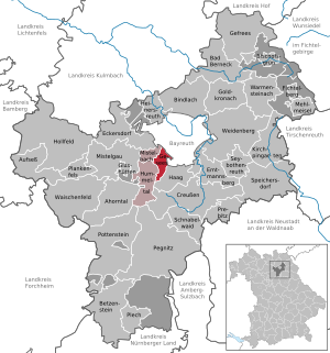
| Location of the community of Gesees in the district of Bayreuth | ||
  |
||

Gesees is a municipality in the Upper Franconian district of Bayreuth .
geography
Geographical location
The place Gesees is located about five kilometers south of Bayreuth in a scenic area on the northern edge of Franconian Switzerland at the foot of the Sophienberg ( 592 m above sea level ).
Neighboring communities
Neighboring communities are (clockwise from the north): Bayreuth , Haag , Hummeltal and Mistelbach .
Community structure
There are 7 parts of the community :
Lichtenheide is not an officially named district.
history
The first documentary mention was in 1321, but the real age is likely to be much higher, as the row graves found there from around 800 AD prove. During renovation work on the church, remains were found that probably come from the Gesees church, which was first mentioned in a document in 1080. The first detailed description of the place is in the land register from 1398 . Together with Mistelgau , Gesees is considered to be the oldest settlement in the Hummelgau . From 1310 Gesees belonged to the rule of the Zollern burgraves of Nuremberg , who later became the margraves of Brandenburg-Bayreuth. From 1500 the village was part of the Franconian Empire . The office of the Prussian principality of Bayreuth , which had been Prussian since 1792 , fell to France in the Peace of Tilsit in 1807 and became part of Bavaria in 1810 . In the course of the administrative reforms in Bavaria, today's municipality was created with the municipal edict of 1818 .
On January 1, 1970, Forkendorf was incorporated into Gesees. On January 1, 2020, a section with a size of 54 hectares was incorporated from the former community-free area Lindenhardter Forst-Nordwest .
politics
The community is a member of the Mistelbach administrative community . The municipal council (2014–2020) consists of twelve members.
- Free voters 5 seats
- CSU 4 seats
- SPD 3 seats
There was no change in the distribution of seats compared to the 2008 election.
mayor
The first mayor is Harald Feulner (FWG).
coat of arms
|
|
Blazon : “Split; front divided by silver and black, above the black bumblebee hat with flying green ribbons, below a silver oak branch with two leaves and an acorn; behind in red the silver church tower of St. Marien zu Gesees. " |
Intermunicipal cooperation
The community has been a member of the association for regional development “Around the Neubürg - Franconian Switzerland e. V. "
Culture and sights

- The village is dominated by the Gothic church of Sankt Marien zum Gesees , which can be seen from afar and is known as the "Crown of the Hummelgau". The church was built as a pilgrimage church in 1410, burned down by the Hussites in 1430 and consecrated again in 1441. It was not until 1583 that the church received a high, pointed tower with four corner turrets ( five-button tower ). When the tower was renewed (1907–1909), the four corner turrets were no longer attached for cost reasons.
- Educational fruit path around the fortified church with some very old and rare types of fruit.
- The Wide Oak, natural monument in the Forkendorf district.
literature
- Johann Kaspar Bundschuh : Gesees . In: Geographical Statistical-Topographical Lexicon of Franconia . tape 2 : El-H . Verlag der Stettinische Buchhandlung, Ulm 1800, DNB 790364298 , OCLC 833753081 , Sp. 315 ( digitized version ).
- Pleikard Joseph Stumpf : Gesees . In: Bavaria: a geographical-statistical-historical handbook of the kingdom; for the Bavarian people . Second part. Munich 1853, p. 565-566 ( digitized version ).
Web links
Individual evidence
- ↑ "Data 2" sheet, Statistical Report A1200C 202041 Population of the municipalities, districts and administrative districts 1st quarter 2020 (population based on the 2011 census) ( help ).
- ^ Community Gesees in the local database of the Bayerische Landesbibliothek Online . Bayerische Staatsbibliothek, accessed on January 5, 2020.
- ^ Wilhelm Volkert (ed.): Handbook of Bavarian offices, communities and courts 1799–1980 . CH Beck, Munich 1983, ISBN 3-406-09669-7 , p. 432 .
- ^ Government of Upper Franconia: Press release no .: 109/19, October 25, 2019: Creußen, Hummeltal, Haag and Gesees are growing; Unregulated areas in the Lindenhardt Forest are being dissolved.
- ↑ http://www.gesees.de/index.php?id=0,96
- ^ Greetings from 1st Mayor Harald Feulner. Mistelbach administrative community , accessed on July 21, 2020 .
- ^ Entry on the coat of arms of Gesees in the database of the House of Bavarian History
- ↑ About us - The Neubürg at a glance - Neubürg. Accessed June 8, 2020 (German).
- ^ Government Vice President Thomas Engel opens the fruit trail on Kirchberg in Gesees. Government of Upper Franconia, May 18, 2018, accessed October 6, 2018 .
Eichenreuth | Forkendorf | Forstmühle | Gesees | Hohenfichten | Chip stain | Thalmühle

Maple Valley | Aufseß | Bad Berneck in the Fichtel Mountains | Betzenstein | Bindlach | Bischofsgrün | Creussen | Eckersdorf | Emtmannsberg | Fichtelberg | Gefrees | Gesees | Glassworks | Goldkronach | Hague | Heinersreuth | Hollfeld | Hummeltal | Church ping garden | Flour chisel | Mistelbach | Mistelgau | Pegnitz | Plankenfels | Plech | Pottenstein | Prebitz | Beak woad | Seybothenreuth | Speicherersdorf | Waischenfeld | Warmensteinach | Willow Hill
Unregulated areas of
Bischofsgrüner Forst |
Fichtelberg |
Forst Neustädtlein am Forst |
Glashüttener Forest |
Heinersreuther Forest |
Neubauer Forest North |
Prüll |
Veldenstein Forest |
Waidacher Forest |
Warmensteinacher Forest North