
Flour chisel
| coat of arms | Germany map | |
|---|---|---|

|
Coordinates: 49 ° 59 ' N , 11 ° 51' E |
|
| Basic data | ||
| State : | Bavaria | |
| Administrative region : | Upper Franconia | |
| County : | Bayreuth | |
| Height : | 621 m above sea level NHN | |
| Area : | 13.23 km 2 | |
| Residents: | 1321 (Dec. 31, 2019) | |
| Population density : | 100 inhabitants per km 2 | |
| Postal code : | 95694 | |
| Area code : | 09272 | |
| License plate : | BT, EBS , ESB , KEM , MÜB , PEG | |
| Community key : | 09 4 72 164 | |
| Community structure: | 10 parish parts | |
| Address of the municipal administration: |
Rathausplatz 95694 flour chisel |
|
| Website : | ||
| First Mayor : | Franz Tauber (Free Mehlmeisel Voting Association) | |
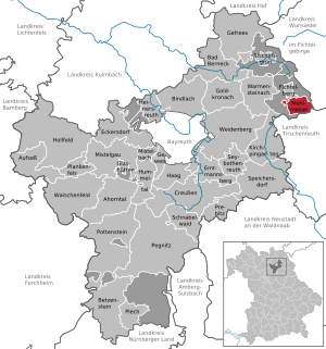
| Location of the community of Mehlmeisel in the Bayreuth district | ||
  |
||

Mehlmeisel is a municipality in the district of Bayreuth , Upper Franconia administrative region , and a state-approved resort .
geography
Geographical location

The scattered settlement Mehlmeisel is located in the Fichtelgebirge Nature Park on the upper reaches of the Fichtelnaab in a valley basin southeast of the Ochsenkopf .
Community structure
The political municipality Mehlmeisel has 10 officially named municipality parts (the type of place is given in brackets ):
|
|
There are the districts Mehlmeisel and Neugrün.
Neighboring communities
Adjacent municipalities and non-municipality areas are:
| Fichtelberg | Fichtelberg area free of parishes | |
| Fichtelberg area free of parishes |
.svg)
|
Nagel ( District of Wunsiedel in the Fichtel Mountains ) |
|
Brand ( District of Tirschenreuth / Upper Palatinate ) |
history
middle Ages
The place was first mentioned in March 1283 as "Welmunzel". It is a sales deed in which the transfer of landgrave lands to the new Wittelsbach office of Waldeck was documented. The text excerpt reads:
"Silva Welmunzel dimidia, adquam pertinent VI villae et alia multa jura, tam in apius quamaliis accidentiis."
Translation:
"The Welmunzel forest, to which six villages and many other rights and other affiliations belong."
The name "Welmunzel" is probably of Slavic origin. However, it remains unclear whether flour chisel is a Slavic settlement. Corresponding archaeological evidence is still lacking. Due to its geographical location, the Mehlmeisel basin was used in the 12th and 13th centuries for beekeeping as a so-called Zeidelweide and for forestry, in particular for charcoal burning.
During the Hussite Wars , the village "Welmansel" was sacked in February 1431 and the old (probably wooden) Laurentius Church was destroyed. The following entry can be found in a diocesan register from 1438:
"Welmansel; Plebanus, Ecclesia devastata. "
In the year another plunder of the area by troops of the Margrave of Brandenburg. The settlements Mehlmeisel, Niederlind (today's Unterlind), Neugrün and Mähring (today a hamlet in the high forest near Oberwarmensteinach) were completely devastated. In historical writings, these places were only referred to as "the four wastes" for a long time.
There were also a number of iron hammers here , such as the Hammer Niederlind or the Hammer Oberlind , which were closed in the 19th century due to unprofitable.
Modern times
The center of Mehlmeisel, that is, the farmsteads around the old village church (today's war memorial chapel), was hit by devastating fire disasters in June 1848 and May 1901.
Mehlmeisel, today in the administrative district of Upper Franconia, belonged to the Barons von Hirschberg since the 15th century and was part of the Electorate of Bavaria. The place was part of the closed Hofmark Ebnath, which was converted into a patrimonial court in 1818 and repealed in 1848.
Until the municipal reform in 1972, Mehlmeisel belonged to the disbanded district of Kemnath and thus to the Upper Palatinate. From 1978 to 1993 there was an administrative association (VG) between the communities of Fichtelberg and Mehlmeisel . After many years of negotiations, this was ended in October 1993 by a state parliament resolution. Mehlmeisel has been an independent municipality again since January 1, 1994.
Population development
In the period from 1988 to 2018, the population fell from 1,435 to 1,312 by 123 or 8.6%. A peak was reached on December 31, 1997 with 1476 inhabitants.
| year | population |
|---|---|
| 1910 | 1262 |
| 1933 | 1349 |
| 1939 | 1361 |
| 1961 | 1618 |
| 1970 | 1615 |
| 1987 | 1461 |
| 1991 | 1424 |
| 1995 | 1445 |
| 2000 | 1447 |
| 2005 | 1391 |
| 2010 | 1353 |
| 2015 | 1321 |
| 2016 | 1335 |
politics
mayor
For mayor was in 2014 with 64.6% of votes Franz Tauber ( CDU Community Mehlmeisel ) selected. His predecessor was Günter Pöllmann (CSU).
Municipal council
The last local elections resulted in the following allocation of seats in the local council :
| Parties and groups of voters | 2008 | 2014 |
|---|---|---|
| CSU | 6th | 6th |
| Mehlmeisel free voter community | 6th | 6th |
| total | 12 | 12 |
religion
Mehlmeisel is a predominantly Catholic community and belongs to the diocese of Regensburg and the dean's office in Kemnath-Wunsiedel.
Culture and sights
Architectural monuments
- Neo-Romanesque Catholic parish church of St. Johannes Baptist in Mehlmeisel, built in 1906/07, expanded in 1951/52
- Baroque pilgrimage chapel Maria Loreto (Hammerkirchl) in the Unterlind district, built in 1686
- War memorial chapel with granite church tower (location of the old village church)
leisure

- Guided walks
- Mountain biking
- Local recreation center Bayreuth house with Klausenturm , forest information center in the Waldhaus Mehlmeisel and fitness trail
- Nordic walking
- Wildlife Park Waldhaus Mehlmeisel with game enclosures for roe deer, red deer and wild boar, fox, badger etc .; since April 2014 outdoor enclosure for lynxes; Petting zoo. It is a branch of the State Garden Show Bayreuth 2016 .
Sports
- Klausenlift (Alpine FIS ski facility)
- Cross-country ski trails in the Nordic Parc Fichtelgebirge
- TSV Mehlmeisel (soccer)
- SG 1904 Mehlmeisel (sport shooting)
Soil monuments
See: List of ground monuments in Mehlmeisel
Organizations
- Mountain rescue service Mehlmeisel
- Catholic Boys' Association Unterlind
literature
- Johann Kaspar Bundschuh : Mühlmeussel . In: Geographical Statistical-Topographical Lexicon of Franconia . tape 3 : I-Ne . Verlag der Stettinische Buchhandlung, Ulm 1801, DNB 790364301 , OCLC 833753092 , Sp. 673 ( digitized version ).
- Richard Schreiber: Mehlmeisel - History from community life. In: Mehlmeisel municipality (ed.): Series of publications on the history of the Mehlmeisel municipality, Volume II. Mehlmeisel 2000.
Web links
- Entry on Mehlmeisel's coat of arms in the database of the House of Bavarian History
Individual evidence
- ↑ "Data 2" sheet, Statistical Report A1200C 202041 Population of the municipalities, districts and administrative districts 1st quarter 2020 (population based on the 2011 census) ( help ).
- ^ Community Mehlmeisel in the local database of the Bavarian State Library Online . Bayerische Staatsbibliothek, accessed on January 5, 2020.
- ↑ www.gemeindeververzeichnis.de , accessed on April 19, 2012
- ^ A b Michael Rademacher: German administrative history from the unification of the empire in 1871 to the reunification in 1990. bay_kemnath.html. (Online material for the dissertation, Osnabrück 2006).

Maple Valley | Aufseß | Bad Berneck in the Fichtel Mountains | Betzenstein | Bindlach | Bischofsgrün | Creussen | Eckersdorf | Emtmannsberg | Fichtelberg | Gefrees | Gesees | Glassworks | Goldkronach | Hague | Heinersreuth | Hollfeld | Hummeltal | Church ping garden | Flour chisel | Mistelbach | Mistelgau | Pegnitz | Plankenfels | Plech | Pottenstein | Prebitz | Beak woad | Seybothenreuth | Speicherersdorf | Waischenfeld | Warmensteinach | Willow Hill
Unregulated areas of
Bischofsgrüner Forst |
Fichtelberg |
Forst Neustädtlein am Forst |
Glashüttener Forest |
Heinersreuther Forest |
Neubauer Forest North |
Prüll |
Veldenstein Forest |
Waidacher Forest |
Warmensteinacher Forest North