
Aschaff
| Aschaff | ||
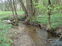
 The Aschaff near Aschaffenburg - Damm |
||
| Data | ||
| Water code | DE : 24754 | |
| location |
Spessart
|
|
| River system | Rhine | |
| Drain over | Main → Rhine → North Sea | |
| origin | Confluence of Autenbach and Kleinaschaff at Waldaschaff 49 ° 58 ′ 21 ″ N , 9 ° 18 ′ 2 ″ E |
|
| Source height | 189 m above sea level NHN (at the confluence) | |
| muzzle | at Mainaschaff in the Main Coordinates: 49 ° 58 '28 " N , 9 ° 6' 18" E 49 ° 58 '28 " N , 9 ° 6' 18" E |
|
| Mouth height | 108.5 m above sea level NHN | |
| Height difference | 80.5 m | |
| Bottom slope | 4.7 ‰ | |
| length | 17 km from the confluence 22.4 km with Kleinaschaff |
|
| Catchment area | 166.57 km² | |
| Discharge at the Goldbach gauge (85.1% of the catchment area) at the A Eo mouth : 142.79 km² Location: 8.4 km above the mouth |
NNQ (1964) MNQ 1958–2006 MQ 1958–2006 Mq 1958–2006 MHQ 1958–2006 HHQ (1981) |
120 l / s 410 l / s 1.35 m³ / s 9.5 l / (s km²) 19.8 m³ / s 65.6 m³ / s |
| Left tributaries | Bessenbach , Nonnenbach , Klingengraben , Röderbach | |
| Right tributaries | Heerbach , Gogelgraben , Laufach , Güntersbach , Hösbach , Goldbach , Glattbach , Lohmgraben | |
 |
||
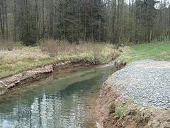
 The Aschaff in Aschaffenburg |
||
The Aschaff is an almost 17 km long right and northern tributary of the Main near Mainaschaff in the Lower Franconian district of Aschaffenburg, together with the source stream Kleinaschaff . It flows in western directions through the Bavarian Spessart .
Surname
The original name ascafa comes from the Old High German word asc for ash and the Indo-European word Ap , which means water. The explanation is “ a stream of ash trees ”. The river gave the communities Waldaschaff and Mainaschaff and the city of Aschaffenburg , between whose districts Damm and Strietwald it flows, their names. The nearby river Elsava (from Elsapha Erlenwasser ) has the same name origin .
geography
course
Spring streams
The Aschaff arises from the confluence of the right Autenbach and left Kleinaschaff. The two source streams unite in the municipality of Waldaschaff at an altitude of 189 m above sea level. NHN .
- The two source streams of the Aschaff
The Kleinaschaff
The Autenbach

Confluence of the Kleinaschaff (left) and Autenbach (right) to the Aschaff (to the rear)


- Kleinaschaff
The Kleinaschaff is the left source brook of the Aschaff and has a catchment area of 7.9 km². It rises from the Aschaff spring in the Waldaschaff forest , near Weibersbrunn . At 4.4 km, the Kleinaschaff is slightly longer than the Autenbach and is officially regarded as the main strand of the Aschaff. It has the same water body number as the Aschaff. Your valley is spanned by the striking Kauppenbrücke .
- Autenbach
The Autenbach is the 3.7 km long right source brook of the Aschaff and has a catchment area of 12.7 km². Although it has the larger catchment area, it is regarded as a branch of the Aschaff.
Further course

After the confluence of the source streams at the village square in Waldaschaff, which was previously piped and has now been exposed again, Aschaff, also known there as Mühlbach, runs through the village and crosses to the north-west of the Bessenbach district . To the west of Weiler Castle , it crosses the A3 . There the Bessenbach, which is about the same size, flows to it from the south .
The A3 now accompanies the river to Hösbach . In the area of this municipality near Hösbach-Bahnhof , the Aschaff crosses the route of the Main-Spessart-Bahn and again the motorway and only the Nonnenbach flows from the left and about 130 m further into the Laufach flowing westwards from the right. On average, it is somewhat richer in water and is the largest tributary of the Aschaff. Then the Aschaff swings on a west-south-west course.
In the further course, Aschaff will continue to be accompanied in parallel by the A3 leading from Würzburg to Frankfurt am Main . In order to comply with the noise limit values after the expansion to six lanes, the traffic route was enclosed there . For this purpose, the river bed was relocated several times and partly straightened. From there, the Aschafal is built up on both sides up to the mountain slopes. The Aschaff then reaches the market town of Goldbach , where it crosses under the motorway again.
The Aschaff then flows into the urban area of Aschaffenburg and separates the districts of Damm on the left and Strietwald on the right. Further downstream, it forms the border between Aschaffenburg and Mainaschaff . After crossing the Main-Spessart railway line and federal highway 8 , the Aschaff finally empties near the sewage treatment plant of the city of Aschaffenburg, but already in the Mainaschaff area, from the right and in a south-westerly direction at 108.5 m above sea level. NHN in the Main .
Aschaff estuary
Before 1920, the old Aschaff ran right through the area of today's sewage treatment plant in the city of Aschaffenburg, where it flowed directly into the Main. It formed the natural border between Mainaschaff and the city of Aschaffenburg.
During the construction of the former Stockstadt / Mainaschaff barrage at the beginning of the 1920s, the mouth of the Aschaff was moved approx. 2 km into the underwater area of the barrage. For this purpose, a new channel was built parallel to the Main, the course of which can still be seen in part between the Main and the cycle path.
At the beginning of the 1970s, the Aschaff estuary was relocated again with the construction of today's Kleinostheim barrage. The Aschaff was particularly heavily polluted by wastewater from the paper industry and carried a lot of suspended matter with it. The nearby, former power station feared that the cooling water extraction would be impaired. Therefore, the Aschaff was led into an artificial, Main-parallel channel below the tapping point via a concrete pipe into the Main. During floods, the water masses were channeled directly into the Main via a dividing structure with a stretcher weir.
In 2001, a new, winding bed was created for the Aschaff over a length of around 600 m. The Aschaff now flows directly into the Main again without a detour via a technical structure that hinders the natural migration of the flowing water animals. At the same time, the previous artificial channel along the cycle path was filled. The trees have been preserved.
Catchment area
The 166.57 km² catchment area of the Aschaff lies in the Spessart and is drained through it via the Main and the Rhine to the North Sea.
It borders
- in the northeast to the catchment area of the Lohrbach , which drains over the Aubach and Lohr into the Main
- in the southeast of the Hafenlohr , which flows into the Main
- in the south to that of the Elsava , which also flows into the Main
- in the southwest to the catchment areas of the two Main tributaries Sulzbach and Hensbach
- in the northwest to that of the Steinbach , also a tributary of the Main
- and in the north to that of the Main tributary Kahl .
The highest elevation in the Steigkoppe with 502 m above sea level. NHN in the northeast of the catchment area.
Tributaries
The tributaries of the Aschaff include (viewed downstream):
| Surname | GKZ | Length [km] |
Mouth height (m above sea level ) |
Direction of flow | Mouth | comment |
|---|---|---|---|---|---|---|
| Autenbach | 24754-12 | 3.7 | 189 | right | Waldaschaff | right source stream |
| Kleinaschaff | 24754 | 4.4 | 189 | Left | Waldaschaff | left source stream (sometimes viewed as part of the Aschaff) |
| Heerbach | 1.2 | 168 | right | Waldaschaff | ||
| Bessenbach | 24754-2 | 8.1 | 157 | Left | Bessenbach - Keilberg | |
| Gogelgraben | 1.5 | 155 | right | Bessenbach-Unterbessenbach | ||
| Nonnenbach | 4.3 | 145 | Left | Hösbach | ||
| Laufach | 24754-4 | 11.4 | 144 | right | Hösbach | |
| Güntersbach | 3.0 | 142 | right | Hösbach | ||
| Hösbach | 24754-6 | 5.1 | 135 | right | Hösbach | |
| Blade moat | 1.4 | 134 | Left | Hösbach | ||
| Roederbach | 4.0 | 130 | Left | Goldbach | ||
| Goldbach | 4.4 | 129 | right | Goldbach | ||
| Glattbach | 4.0 | 126 | right | Aschaffenburg - dam | ||
| Lohmgraben (Lohmühlgraben) | 3.0 | 117 | right | Aschaffenburg dam |
Notes on the table
- ^ Topographic map 1: 10000 Bavaria North
- ↑ Water code number , in Germany the official river code number with a separator inserted after the prefix for better readability, which stands for the common Aschaff
Aschaff river system
Data
The difference in altitude from the source (the Kleinaschaff) to the confluence with the Main near Mainaschaff is 205 meters. The catchment area covers 167.88 km².
Flood


fauna
In the Aschaff there are brown trout , brown lamprey , brook loach , bream , minnow , gudgeon , hazel , pike , arbor , Mühlkoppe , nose , roach and rag .
Mills
From the confluence to the mouth
- Sparrow mill
- Aschaffsteghammer
- Wood mill
- two Goldbacher mills
- Aumühle
- Hazel mill
- Pfaffenmühle
- Granulator
- Mill (in dam)
- Mountain mill
- Schwalbenmühle (oil mill)
- Upper paper mill
- Lower paper mill
See also
Web links
- Course and catchment area of the Aschaff on the UmweltAtlas - basic data for flowing waters Bavarian State Office for the Environment ( information )
- Gauge near Goldbach, HND Bavaria
- The Aschaff , water portraits at Aschaffenburg Water Management Office 2016
Individual evidence
- ↑ a b Storage target in the upper water of the Kleinostheim barrage on the Bavaria Atlas of the Bavarian State Government ( information ).
- ↑ a b Map service of the Bavarian State Office for the Environment ( Memento from April 10, 2005 in the Internet Archive )
- ↑ a b Directory of stream and river areas in Bavaria - Main river area, page 155 of the Bavarian State Office for the Environment, as of 2016 (PDF; 3.3 MB)
- ^ Geological yearbook Rhine area, Part II, Main (accessed on September 6, 2013)
- ↑ Goldbach gauge value increased by the drainage of the remaining catchment area (25.09 km²), determined from the data from the Rück , Hainstadt , Goldbach , Harreshausen , Alzenau , Hanau , Kleinheubach and Frankfurt a. M. Osthafen
- ^ Wolf-Armin von Reitzenstein : Lexicon of Franconian place names. Origin and meaning . Upper Franconia, Middle Franconia, Lower Franconia. CH Beck, Munich 2009, ISBN 978-3-406-59131-0 , p. 26–27 ( limited preview in Google Book search).
- ^ Waldaschaff: Village square is taking shape. August 2, 2018, accessed May 19, 2020 .
- ^ Aschaffenburg Water Management Office ( Memento from May 21, 2008 in the Internet Archive )
- ↑ Flood Action Plan Main. Archived from the original on September 6, 2009 ; accessed on May 11, 2014 .
- ↑ Fishing Association of Lower Franconia: Our waters ( Memento from September 25, 2014 in the Internet Archive )
- ^ Topographic atlas of the Kingdom of Bavaria on this side of the Rhine
- ^ Plan of Aschaffenburg with the surrounding area