Hensbach
|
Hensbach upper course: Obersölchgraben middle course: Gailbach lower course: Häsbach |
||
|
Hensbach in Schweinheim |
||
| Data | ||
| Water code | DE : 247536 | |
| location |
Spessart
|
|
| River system | Rhine | |
| Drain over | Main → Rhine → North Sea | |
| source | southeast of Aschaffenburg -Gailbach 49 ° 56 '17 " N , 9 ° 13' 57" O |
|
| Source height | 326 m above sea level NHN | |
| muzzle | in Aschaffenburg in the Main Coordinates: 49 ° 57 ′ 39 ″ N , 9 ° 7 ′ 58 ″ E 49 ° 57 ′ 39 ″ N , 9 ° 7 ′ 58 ″ E |
|
| Mouth height | 109 m above sea level NHN | |
| Height difference | 217 m | |
| Bottom slope | 25 ‰ | |
| length | 8.7 km | |
| Catchment area | 12.79 km² | |
| Left tributaries | Herbigsbach | |
| Right tributaries | Pfaffengrundbach , Klingersbach , Neuwiesenbach , Dörnbach | |
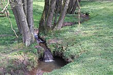
The Hensbach or Gailbach is a 8.7 km long, right and eastern tributary of the Main in the Bavarian Spessart .
geography
course
The Hensbach rises as Obersölchgraben southeast of Aschaffenburg- Gailbach from the Gailbach spring . When this occasionally dries up on dry days, the stream arises from small springs at the foot of the Weißberg (358 m), such as the Siegmundsbrunnen or Siegmannsbrunnen. The Heimatverein set a stone at the Gailbach spring in 2005.
The stream runs in a north-westerly direction through the place where it is called, like this Gailbach . The Pfaffengrundbach , the Bach from the Kaiserbrunnen in the Maihohle, the Klingersbach and the Neuwiesenbach all flow here . On the eastern outskirts of Schweinheim, the Gailbach's largest tributary, Dörnbach, flows from the right . From its mouth, the brook bears the name Hensbach. It is then reinforced by the Herbigsbach and, in the Seebornstrasse, by the stream flowing north from the Seeborn. The Schindgraben joins from the south below Unterschweinheim. The Hensbach now passes under in Aschaffenburg in Oberauer colony , the railway line Aschaffenburg-Miltenberg and from there into his mostly cased last flow period the name Häsbach. Finally it crosses under the State Road 2309 and flows into the Main .
Catchment area
The 12.79 km² catchment area of the Hensbach lies in the Spessart and is drained through it via the Main and the Rhine to the North Sea.
It borders
- in the northeast to the catchment area of the Haibach , which drains into the Main via the Röderbach and the Aschaff
- on the east of Morsbach , who in the Aschaffzufluss Bessenbach opens
- in the southeast to that of the Bessenbach itself and that of the Sulzbach tributary to the Main
- in the south to the Altenbach tributary of the Main
- in the west to that of the Main directly
- and in the north to that of the Kühruhgraben .
The highest point is 432 m above sea level. NHN high Pfaffenberg in the southeast of the catchment area.
Tributaries
- Pfaffengrundbach ( right ), 0.8 km, 0.5 km²
- Klingersbach ( right ), 1.0 km, 0.5 km²
- Scheidegraben ( left )
- Neuwiesenbach ( right ), 0.7 km, 0.35 km²
- Dörnbach ( right ), 1.9 km, 1.5 km²
- Hollerbach ( right )
- Herbigsbach ( left ), 1.0 km, 1.6 km²
- Hennteichgraben ( left )
- Schindgraben ( left )
places
The Hensbach flows through the Aschaffenburg districts:
- Aschaffenburg- Gailbach
- Aschaffenburg- Schweinheim
- Aschaffenburg- Obernau colony
history
Stream changes
Around 1810, a mill canal to the Schipfermühle - later called Reußenmühle - was built from below the Eckertsmühle, which crossed under Obernauer Strasse on the Scherbeninsel and flowed into the Main at about the level of Aschaffenburger Lamprechtstrasse, but no longer exists today. Its course can still be seen in some places in the area, partly in its relief, partly as a narrow strip of land.
Mills
In the 19th century there were still eight water mills on the Hensbach. Their names and today's addresses are given below.
- Dimpelsmühle or Dümpelsmühle (Gailbacher Straße 80)
- Aumühle (Weinbergstrasse 31)
- Dorf- or Kempfenmühle (across from Hensbachstraße 4b)
- Reisertmühle, Eichenmühle (Unterhainstraße 29)
- Mildenberger- or Miltenbergermühle (Unterhainstraße 47)
- Bleidornmühle, lastly Krugsmühle (Unterhainstraße 75)
- Eckertsmühle (Am Häsbach 1a)
- Schipfermühle, later Reußenmühle (Obernauer Straße 8)
See also
Web links
- Map of the catchment area in the basic data for flowing waters of Bavaria, Bavarian State Office for the Environment
Individual evidence
- ↑ a b c Bavaria Atlas of the Bavarian State Government ( notes )
- ↑ Directory of brook and river areas in Bavaria - Main river area, page 155 of the Bavarian State Office for the Environment, as of 2016 (PDF; 3.3 MB)
- ↑ Information sign at the Gailbach spring


