Aubach (Lohr)
|
Aubach ( historically : Wiesenbach ) |
||
|
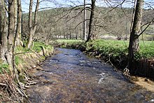
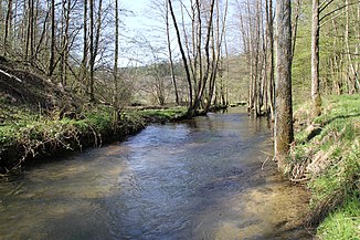
The Aubach after the mouth of the Lohrbach , north of Krommenthal |
||
| Data | ||
| Water code | EN : 24522 | |
| location |
Spessart
|
|
| River system | Rhine | |
| Drain over | Lohr → Main → Rhine → North Sea | |
| source | in the Aubach spring in Wiesen 50 ° 6 ′ 51 ″ N , 9 ° 21 ′ 49 ″ E |
|
| Source height | 398 m above sea level NHN | |
| muzzle | in Partenstein in the Lohr coordinates: 50 ° 2 ′ 18 ″ N , 9 ° 31 ′ 13 ″ E 50 ° 2 ′ 18 ″ N , 9 ° 31 ′ 13 ″ E |
|
| Mouth height | 185 m above sea level NHN | |
| Height difference | 213 m | |
| Bottom slope | 9.5 ‰ | |
| length | 22.4 km | |
| Catchment area | 128.29 km² | |
| Left tributaries | Wiesbüttgraben | |
| Right tributaries | Welzbach , Birklerbach , Mühlgraben , Röhrengrundgraben , Lohrbach | |
|
The mouth of the Aubach (right) into the Lohr (left), in Partenstein |
||
The Aubach is a twenty-two kilometer long river in the Bavarian Spessart . It rises in meadows in the district of Aschaffenburg and flows into the Lohr from the right and west near Partenstein in the district of Main-Spessart .
Surname
The original name Wiesenbach goes back to the earlier words wise for meadow and bach for brook . The name of the stream and the place Wiesen have the same origin. The name of the brook was partly transferred to Wiesthal . The current form of Aubach is a synonym .
geography
Aubach spring

The Aubach rises at about 398 m above sea level. NHN in meadows in the Aubach spring set in sandstone . It is one of the largest springs in the Spessart. After a few meters, the Aubach joins from the right with its second, 2 km long source stream, the Wiesbüttgraben . This rises from the Wiesbüttsee at 436 m , a high moor in the Spessart. This Wiesbüttgraben is often shown on maps as the upper reaches of the Aubach, but in summer it often has little or no water at all, so that the dry stream bed is only fed with water from the Aubach spring in meadows. Accordingly, the Wiesbüttsee is also seen as the upper Aubach spring.
course
After its source, the Aubach flows through the village of Wiesen, where it used to run a flour mill. Behind the village it crosses the state road 2305 ( German holiday route Alps – Baltic Sea ) and continues to the southeast through an untouched valley that is part of the Spessartwiesen nature reserve . At the edge of the Wiesen forest it reaches the border with the Main-Spessart district and flows into the area of the market town of Frammersbach .
In the Habichsthal district , the Aubach flows into the Mühlgraben at the former village mill . Somewhat below it feeds the Aubachsen there . The left mountain slopes belong to the community-free area of Frammersbacher Forst , those on the right to Heinrichsthaler Forst . At the lakes, the Aubach flows into the municipality of Wiesthal .
The valley is accompanied by the MSP 21 district road and the stream runs through the village of Wiesthal. Below it, after about 14 km from the west, its largest tributary flows into it, the Lohrbach coming from Heinrichsthal , and it then continues roughly in its direction. After the Krommenthal district, it is spanned twice by viaducts of the Main-Spessart Railway . The railway line and the state road 2317 continue through the Aubach valley. The mountain slopes in the Partenstein Forest lie on both sides .
In the likewise to the reserve Spessart meadows belonging Langetalwiesen the stream and the right arm divides flows by an applied open natural stone channel at Kahltal-Spessart-cycle path . In Partenstein below the Bartenstein Castle , this joins the left and the Aubach then flows out at an altitude of 185 m above sea level. NHN from the right and west into the Lohr .
In some older maps the Aubach is shown as a left tributary of the Lohrbach .

Tributaries
- Wiesbüttgraben ( left source stream , temporarily dry), 2.4 km, 6.1 km²
- Welzbach ( right , temporarily dry), 0.4 km, 1.2 km²
- Birklerbach ( right ), 1.7 km, 7.4 km²
- Mühlgraben ( right ), 0.9 km, approx. 6 km²
- Röhrengrundgraben ( right ), 1.5 km, 2.4 km²
- Lohrbach ( right ), 11.3 km, 53.5 km²
Lohr river system
Aubachseen
The Aubachsen lie in the Aubach valley between the places Habichsthal and Wiesthal . There are three small lakes on the left bank of the Aubache, which also feeds them. The upper and middle lake is in the district of Frammersbach , the lower one belongs to Wiesthal. Pikeperch , trout , tench , carp , eel , pike and white fish can be found in the water . The lakes have an area of 13 hectares , hold around 56,000 m³ of water and are leased by the Frammersbach fishing club. The fisherman's hut there is managed.
Between 1972 and 1978 the three lakes were created by the entrepreneur Emil Kirsch. A memorial stone on the upper lake commemorates him. He bought and exchanged 144 plots of land in a meadow area and also had to relocate the Aubach. The shell work was completed within six months. Kirsch wasn't sure whether the excavated area would hold the water or it would seep away.
history
Mills
- Mill in meadows
- Mill below meadows
- Fleckenstein mill
- Glory Mill (Mühlhansenmühle)
- Little mill
- Hammer mill
- Altmühle
- Neumühle
See also
Web links
- The Aubach on the BayernAtlas
- Map of the catchment area in the basic data for flowing waters of Bavaria, Bavarian State Office for the Environment
Individual evidence
- ↑ a b BayernAtlas of the Bavarian State Government ( notes )
- ↑ a b Directory of stream and river areas in Bavaria - Main river area, page 119 of the Bavarian State Office for the Environment, as of 2016 (PDF; 3.3 MB)
- ^ Wolf-Armin von Reitzenstein : Lexicon of Franconian place names. Origin and meaning . Upper Franconia, Middle Franconia, Lower Franconia. CH Beck, Munich 2009, ISBN 978-3-406-59131-0 .
- ↑ The lake has a natural overflow that directs the water over the Wiesbüttgraben into the Aubach valley.
- ↑ Street name on the Welzbach
- ↑ Popular excursion destination attracts walkers. August 6, 2014, accessed May 30, 2020 .


