Laufach (river)
| Laufach | ||
|
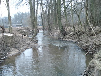
The Laufach to the Weyberhöfen , shortly before entering the Aschaff opens |
||
| Data | ||
| Water code | DE : 247544 | |
| location |
Spessart
|
|
| River system | Rhine | |
| Drain over | Aschaff → Main → Rhine → North Sea | |
| origin | The confluence of Seebach (left) and Schwarzbach (right) near Hain in the Spessart 50 ° 0 ′ 39 ″ N , 9 ° 19 ′ 24 ″ E |
|
| Source height | 199 m above sea level NHN (at the confluence) | |
| muzzle | at the Weyberhöfe from the right into the Aschaff coordinates: 50 ° 0 '9 " N , 9 ° 13' 52" E 50 ° 0 '9 " N , 9 ° 13' 52" E |
|
| Mouth height | 144 m above sea level NHN | |
| Height difference | 55 m | |
| Bottom slope | 7.3 ‰ | |
| length | 7.5 km from the confluence 11.4 km with Seebach |
|
| Catchment area | 55.97 km² | |
| Left tributaries | Erlenbach , Erbigsbach , Hembach | |
| Right tributaries | Beibuschbach , Sailaufbach | |
|
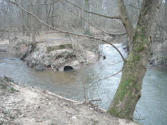
Confluence of the Laufach (left) into the Aschaff (right) |
||
The Laufach is a right and the largest tributary of the Aschaff in the Lower Franconian district of Aschaffenburg in the Spessart . It arises in Hain im Spessart through the confluence of the left Seebach and the right Schwarzbach .
Surname
The name " Laufach " is made up of the Old High German words Lauf in the sense of rapids and aha for water . The body of water gave the municipality of the same name its name.
geography
Spring streams
Seebach
The Seebach rises in the Hain forest in the Spessart at the foot of the Miesberg (470 m), northwest of Rothenbuch , from several sources. It flows below the federal highway 26 to the northwest, flows through some ponds and runs past the old forest mill to Hain im Spessart . At around 3.9 km, the Seebach is the longer source stream.
Schwarzbach
The approximately 3.1 km long Schwarzbach rises at the foot of the Schwarzkopf (460 m) southeast of Hain. It runs in the direction of the Schwarzkopf tunnel . There further streams flow to it. The Schwarzbach crosses under the railway line and merges in Hain with the Seebach to Laufach .
course
From the confluence, the Laufach flows west through the municipality of Laufach and here, after Hain, where it originated, it reaches the village of the same name, where it divides into two arms that reunite in the center of the village at the traffic circle near the St. Thomas-More-Church . Shortly thereafter, a stream flows in from the left and right. Further to the west, the stream crosses the Hammer residential area. Then it divides into two arms in the district of Frohnhofen , which in turn unite beyond the municipality boundary to Sailauf at Weyberhöfe Castle . Here also opens equal right their biggest inflow of Sailaufbach , and changes to the area of the market Hosbach where the Laufach after a few hundred meters east of the village and next to the A 3 from the right in the Aschaff flows for posting on Laufach- Moves westward.
Since the Laufach has more water at its mouth than the Aschaff, it is incorrectly referred to as Aschaff in some maps.
Catchment area
The catchment area of the Laufach borders in the north-west and north on that of the Kahl , from north-east to south-east the Lohr competes across a high mountain ridge , then the Hafenlohr for short . In the south and west, the receiving Aschaff itself drains beyond the watershed, which is often less pronounced in the west .
The highest point, which is just in the catchment area, is an unnamed knoll in the north, 507 m above sea level. Reached NHN , about one kilometer north of the summit of the Steigkoppe ( 502 m above sea level ). In the east the watershed to Lohr runs over 460.4 m above sea level. NHN heights Schwarzkopf . The highest point on the southern edge of the catchment area is set back on the Miesberg at 484 m above sea level. NHN .
Tributaries
- Beibuschbach , from the right in the village of Laufach at 176 m above sea level. NHN
- Erlenbach , from the left in the village of Laufach, not 50 m further
- Erbigsbach , from the left at the Hammer von Laufach residential area at 164 m above sea level. NHN
- Hembach , from the left near Laufach- Frohnhofen
- Sailaufbach , from the right at Sailauf - Weiberhof at 148 m above sea level. NHN
Aschaff river system
traffic
The B 26 enters the valley with the Seebach stream on the left and follows the Laufach , mostly on the right, to the mouth. Mainly running on the other side, the Main-Spessart-Bahn pulls up from there into the valley and leaves it above Hain through the almost one kilometer long Schwarzkopf tunnel over into the Lohr valley system .
See also
Web links
- The Laufach on the BayernAtlas
- Map of the catchment area in the basic data for flowing waters of Bavaria, Bavarian State Office for the Environment
Individual evidence
- ↑ a b According to the contour line image on the BayernAtlas of the Bavarian State Government ( notes ).
- ↑ a b BayernAtlas of the Bavarian State Government ( notes )
- ↑ Directory of brook and river areas in Bavaria - Main river area, page 155 of the Bavarian State Office for the Environment, as of 2016 (PDF; 3.3 MB)
- ^ Wolf-Armin von Reitzenstein : Lexicon of Franconian place names. Origin and meaning . Upper Franconia, Middle Franconia, Lower Franconia. CH Beck, Munich 2009, ISBN 978-3-406-59131-0 , p. 129 ( limited preview in Google Book search).
- ↑ Germany 2010/2011: ADAC Reise Atlas 1: 200000 © 2009 MairDumont Media, D-73751 Ostfildern (2.)


