Sailaufbach
|
Sailaufbach ( Historically : The Sailauf ) |
||
|
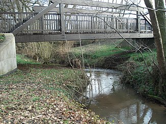
The Sailaufbach at the Weyberhöfen |
||
| Data | ||
| Water code | DE : 2475442 | |
| location |
Spessart
|
|
| River system | Rhine | |
| Drain over | Laufach → Aschaff → Main → Rhine → North Sea | |
| source | in the Sailauf forest west of the Steigkoppe 50 ° 2 ′ 32 ″ N , 9 ° 17 ′ 34 ″ E |
|
| Source height | 312 m above sea level NHN | |
| muzzle | at the Weyberhöfe in Laufach Coordinates: 50 ° 0 '20 " N , 9 ° 14' 18" E 50 ° 0 '20 " N , 9 ° 14' 18" E |
|
| Mouth height | 148 m above sea level NHN | |
| Height difference | 164 m | |
| Bottom slope | 26 ‰ | |
| length | 6.4 km | |
| Catchment area | 17.4 km² | |
| Right tributaries | Upper Steinbach , Eichenberger Bach , Erlenbach | |
|
The mouth of the Sailaufbach (left) into the Laufach (right) |
||
The Sailaufbach or the Sailauf is a low mountain range in the Bavarian Spessart . It is a right and northwest tributary of the Laufach in the Lower Franconian district of Aschaffenburg and, with its length of almost six and a half kilometers, its largest tributary.
Surname
The original name of the water body " Sailauf " consists of the Middle High German words sîgen and loufe . They mean sinking watercourse . The brook gave the place Sailauf its name.
geography
course
The Sailaufbach rises at an altitude of 312 m above sea level. NHN at the foot of the Eselshöhe ridge in a valley southwest of the Englander . Its source is located on the western slope of the Steigkoppe ( 502 m ) in an exclave of the municipality of Sailauf in the Sailauf forest . It flows in a south-westerly direction past a quarry where the well-known Sailaufit was found.
The stream then reaches Obersailauf . There the Obere Steinbach flows and the Sailaufbach flows through the place directly next to the district road AB 2. In Mittelailauf it flows into its largest tributary, the Eichenberger Bach , which is incorrectly referred to on some maps as the upper reaches of the Sailaufbach.
The Sailaufbach then runs through Untersailauf , where it takes up the Erlenbach . At the Weyberhöfen it crosses under the federal highway 26 and it flows out at 148 m above sea level. NHN in the Laufach .
Tributaries
- Oberer Steinbach ( right )
- Eichenberger Bach ( right )
- Erlenbach ( right )
Aschaff river system
history
Mills
- Mill in Obersailauf
- Wenzelmühle (Burkartsmühle)
- Miner's Mill
- Fuchsmühle (meadow mill)
- Oil mill
fauna
In Sailaufbach come brook and rainbow trout before.
See also
Web links
Individual evidence
- ↑ a b c District map Alzenau: Topographic map 1: 50,000
- ↑ a b c d BayernAtlas of the Bavarian State Government ( notes )
- ^ Wolf-Armin von Reitzenstein : Lexicon of Franconian place names. Origin and meaning . Upper Franconia, Middle Franconia, Lower Franconia. CH Beck, Munich 2009, ISBN 978-3-406-59131-0 , p. 196 ( limited preview in Google Book search).
- ↑ Topographical Atlas of the Kingdom of Bavaria on this side of the Rhine from 1860

