
Kelsterbach
| coat of arms | Germany map | |
|---|---|---|

|
Coordinates: 50 ° 4 ′ N , 8 ° 32 ′ E |
|
| Basic data | ||
| State : | Hesse | |
| Administrative region : | Darmstadt | |
| Circle : | Gross-Gerau | |
| Height : | 104 m above sea level NHN | |
| Area : | 15.37 km 2 | |
| Residents: | 17,029 (Dec. 31, 2019) | |
| Population density : | 1108 inhabitants per km 2 | |
| Postal code : | 65451 | |
| Area code : | 06107 | |
| License plate : | GG | |
| Community key : | 06 4 33 007 | |
City administration address : |
Mörfelder Strasse 33 65451 Kelsterbach |
|
| Website : | ||
| Mayor : | Manfred Ockel ( SPD ) | |
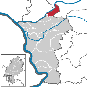
| Location of the city of Kelsterbach in the Groß-Gerau district | ||
  |
||

Kelsterbach is a town in the Groß-Gerau district of Hesse with 17,029 inhabitants (as of December 31, 2019). It is located on the southwestern outskirts of Frankfurt am Main in an arch on the left bank of the Main , directly at the mouth of the Kelster (colloquially also known as the Kelsterbach ).
The originally largely agricultural village underwent major changes after the construction of the Frankfurt – Mainz railway line at the beginning of the 20th century. The settlement of large factories and the proximity to the chemical plants in Höchst am Main and Griesheim resulted in a large increase in population. In the decades after the Second World War , many companies were added that are related to the nearby Frankfurt Airport . The city is an important location for logistics service providers and chemical production.
As of June 30, 2014, the city of Kelsterbach had a high proportion of foreigners (registered residents without German citizenship ) of 31.0 percent and thus has the second-highest proportion of all Hessian municipalities after Offenbach am Main .
geography

Kelsterbach from Sindlinger Mainufer
|
Geographical location
The city is located on the left or east and south-east banks of the Main River and west of the Frankfurt City Forest . The original town center, generally known as Unterdorf , in the north of the urban area, is sharply demarcated from the much larger settlement area , generally known as Oberdorf , which only emerged with the construction of the railway line and industrialization at the beginning of the 20th century above the 17 meter high Kelsterbach terrace , which stretches eight kilometers to the west from the Frankfurt city forest. Kelsterbach is part of the Frankfurt metropolitan area and the Frankfurt / Rhine-Main metropolitan area .
Neighboring communities
Kelsterbach borders in the west on Okriftel , a district of Hattersheim am Main ( Main-Taunus-Kreis ), in the north on the districts Sindlingen , Höchst and Schwanheim of the independent city of Frankfurt am Main , in the east and south on the area of Frankfurt Airport and in the southwest to the city of Raunheim .
City structure
Although the old town on the Main is popularly referred to as Unterdorf , while the location above the Kelsterbacher Terrasse is called Oberdorf , officially there are no districts.
history
Stone age
For some time Kelsterbach was considered to be the place where the oldest anatomically modern man in Europe was found. The alleged skull of a Cro-Magnon, known as Lady von Kelsterbach and dated to an age of 32,000 years, disappeared without a trace in connection with the scandal surrounding the anthropologist Reiner Protsch in 2004 and was probably a fake.
Microliths were found in the area of the Kelsterbach terrace from the Mesolithic . It remains to be seen whether these are traces of settlement. Numerous ceramic finds dating back to all epochs of the Neolithic do not necessarily prove permanent settlement either.
Metal times
A settlement for the Bronze Age is likely. The first valuable finds from the early period of this era came to light as early as 1937. In 1972, when the Kelsterbacher Spange was built on the edge of the Kelsterbacher Terrasse between the Roman Aisle and the Schwedenschanze, several Bronze Age find complexes were cut. From this it is concluded that there was a settlement from the Middle to Late Bronze Age about 10–15 meters above the Main . There are also traces of settlement from the earlier Iron Age (700–450 BC).
Romans
Earlier finds gave reason to suspect a Roman settlement of the 3rd century in the Kelsterbacher Main valley. Brick pieces and coins found in the corridor on the Weilsee in 1973 in Roman cremation graves gave rise to geophysical investigations in 2001 and 2003. This revealed building structures. The Institute for Archaeological Sciences at the Johann Wolfgang Goethe University in Frankfurt am Main carried out extensive excavations in 2004 and 2005. A building with a fountain came to light , which is interpreted as a small villa and is dated to 200–220 AD. After the fall of the Limes around 260 it was abandoned.
middle Ages
Because of the name is a Frankish founding Gelsterbach suspected ( Gelster = loud rustling). The basis of this designation can hardly be taken as a sparse trickle flowing stream, which rises in the Schwanheimer meadows, even if it should have carried significantly more water earlier.
The oldest written mention of Gelsterbach can be found, as for many other places, in the Lorsch Codex (approx. 850 AD). For many centuries Kelsterbach then belonged to the Dreieich Wildbann , whose central administration was located at Hayn Castle . Even after territorial rule was transferred to Ysenburg in 1433, the royal hunting rights continued to exist. Kelsterbach belonged to the county of Langen, from 1523 to the Isenburg-Ronneburg sub- county .
Early modern age


Count Anton I von Ysenburg-Ronneburg converted to Lutheranism in 1533 , but only tied the population to the lordly faith after the Peace of Augsburg . When the inheritance was divided in 1565, Count Wolfgang von Ysenburg-Ronneburg took over the part of the country in which Kelsterbach was located. In 1566 he began building the Kelsterbach Castle , which lasted 21 years , the appearance of which has been passed down primarily through an engraving by Matthäus Merian . The seat of the Langen office was moved to Kelsterbach. When the sovereign converted to faith, Kelsterbach became Calvinist in 1583 . In that year the count also founded the first school. After his death in December 1597, he was buried in the Kelsterbach castle chapel. He was succeeded by his brother Heinrich , who survived Wolfgang by 4 years. He was Lutheran and returned the territory he ruled to Lutheranism. This led to considerable tension in the Ysenburg Count House. In view of his imminent death, Heinrich negotiated a contract with the Lutheran Landgrave Ludwig V of Hesse-Darmstadt , according to which the Kelsterbach office should fall to Hesse-Darmstadt after his death in order to prevent a return to the Reformed faith. The secret sale of the Kelsterbach office led to a protracted legal dispute before the Imperial Court of Justice between the county of Ysenburg-Büdingen and the Landgraviate of Hessen-Darmstadt , which lasted from 1601 to 1711 and ultimately ended with the complete defeat of the house of Ysenburg-Büdingen. In the meantime, the Kelsterbach Castle was destroyed by the Swedes in the Thirty Years' War . Landgrave Ernst Ludwig planned to develop Kelsterbach into a craft town due to its convenient location. From 1699 to 1712, the spacious Neukelsterbacher Strasse , which still exists today, was built with two-storey residential and workhouses in which Calvinist refugees were to be settled. Various problems led to the failure of this project.
In the middle of the 18th century, Landgrave Ludwig VIII took over a previously private faience factory in order to turn it into a porcelain factory . The porcelain painter Christian Daniel Busch, trained in Meissen , was commissioned to manage it. The most famous porcelain artist working in Kelsterbach was Carl Vogelmann. Kelsterbacher Porzellanmanufaktur existed only from 1761 to 1768. Products manufactured there are u. a. Exhibited in the Grand Ducal Hessian Porcelain Collection in Darmstadt . In 2011, the collection items with Kelsterbach porcelain were shown in the Prinz-Georg-Palais in Darmstadt on the occasion of the 250th anniversary of the manufactory.
In 1756 the official seat was relocated to Mörfelden , the name Amt Kelsterbach still remained.
Modern times
The statistical-topographical-historical description of the Grand Duchy of Hesse reports on Kelsterbach in 1829:
"Kelsterbach (L. Bez. Langen) Lutheran parish village; is on the Main and 3 1 ⁄ 2 St. von Langen, and has 92 houses and 930 inhabitants, who up to 24 Cath., 1 Reform. and 46 Jews are Lutheran. The community used to be divided into Alt- and Neukelsterbach. There is a faience and earthenware factory, a tobacco factory, several brick huts and a second-class border customs office. Two cattle and grocer's markets are held annually. - The place appears in the 9th century under the name Gelsterebach . From Falkenstein and Isenburg, the noble, now extinct von Schwalbach family took the bailiwick as a fief, but sold it back to Isenburg in 1454. A line of the Counts of Isenburg named after Kelsterbach, which was founded by Philipp, who also died there in 1526. Through his grandson, Heinrich, the entire Kelsterbach office was acquired by Hesse in 1600, and between 1604 and 1629 the female heirs of Count Heinrich von Isenburg also ceded their rights to Hesse. On the Main, not far from Kelsterbach, before the Reformation the St. Martin's Church stood in the open, into which the place was parish before it was raised to a special parish. The Altenmünster monastery in Mainz had a farm here, but in 1318 it was given in exchange to Philipp von Falkenstein. The castle was very devastated during the Thirty Years' War. "
In the year 1821 founded Hessian-Darmstadt administrative district Groß-Gerau, already in 1832 transferred to the district Groß-Gerau , the administrative districts were reorganized and the former Kelsterbach office was split up. From then on, Kelsterbach shared the history and territorial allocation of the Groß-Gerau district to this day. The official seat was now in Langen . The responsible local and regional court was also located there . Later, from 1957, the Frankfurt am Main district court was responsible for Kelsterbach and the Rüsselsheim district court has been responsible since 1971 .
In 1899 the Süddeutsche Waggonfabrik AG was founded with a loan from Commerzbank for 1.2 million marks. It builds its plant and company headquarters on a site between Rüsselsheimer Strasse and the Mainz – Frankfurt railway line , immediately southwest of the Kelsterbach train station and southwest of Helfmannstrasse. The wagon factory supplied, among others, the Hejaz Railway and the Württembergische Eisenbahn-Gesellschaft for their Amstetten – Laichingen railway with passenger and freight wagons . The factory had to close again after just three years and by then had built around 500 cars. Structural remnants of the wagon factory are the workers' housing estate at Helfmannstrasse , built in 1899/1900 , an ensemble of nine apartment buildings , today cultural monuments according to the Hessian Monument Protection Act , and the former administration building of the factory, today environmental and neighborhood house.
After the wagon factory was liquidated in 1903, the United Kunstseidenfabrik AG , founded in Frankfurt am Main in 1890, with production buildings and company headquarters, was taken over by the Vereinigte Glanzstoff AG in 1928 . This industrial company with at times over 2600 employees determined the further development of the place for almost a hundred years.
During World War II there was a transit camp in Kelsterbach for foreign forced laborers , most of whom came from Eastern Europe . Hence it was also called the Russian camp . The warehouse was located near the motorway at the former substation .
Significant areas of the district were lost when the Zeppelinheim community was founded in 1938. Kelsterbach received city rights in 1952 . Through membership in the Frankfurt Umlandverband, founded in 1975 , the contemplated incorporation into the city of Frankfurt could be averted, but in 1977, as part of the regional reform in Hesse, due to the increasing expansion of the south-bordering Frankfurt airport, further district area had to be given up: The 733 hectare portion of Kelsterbach on Airport grounds fell to the city of Frankfurt. Since this threatened to lose an important financial source, a “benefit compensation payment” was agreed. The expansion of the airport area continued with the construction of the northwest runway in 2011 and is again increasingly calling into question municipal independence.
Territorial history and administration
The following list gives an overview of the territories in which Kelsterbach was located and the administrative units to which it was subordinate:
- before 1604 Holy Roman Empire , Grafschaft Isenburg-Ronneburg , Amt Langen
- after 1604: Holy Roman Empire , Landgraviate of Hesse , Upper County of Katzenelnbogen , Kelsterbach Office
- from 1803: Holy Roman Empire, Landgraviate Hessen-Darmstadt, Principality of Starkenburg , Kelsterbach Office
- from 1806: Grand Duchy of Hesse , Principality of Starkenburg, Kelsterbach Office
- from 1815: German Confederation , Grand Duchy of Hesse, Province of Starkenburg , Kelsterbach Office
- from 1821: German Confederation, Grand Duchy of Hesse, Starkenburg Province, Langen District District (separation between justice ( Langen District Court ) and administration)
- from 1832: German Confederation, Grand Duchy of Hesse, Province of Starkenburg, District of Groß-Gerau
- from 1848: German Confederation, Grand Duchy of Hesse, Darmstadt administrative district
- from 1852: German Confederation, Grand Duchy of Hesse, Province of Starkenburg, District of Groß-Gerau
- from 1866: Grand Duchy of Hesse, Starkenburg Province, Groß-Gerau district
- from 1871: German Empire , Grand Duchy of Hesse, Starkenburg Province, Groß-Gerau district
- from 1918: German Empire, People's State of Hesse , Starkenburg Province, Groß-Gerau district
- from 1938: German Empire, People's State of Hesse, Groß-Gerau district (In the course of the regional reform in 1938 , the three Hessian provinces of Starkenburg, Rheinhessen and Upper Hesse are dissolved.)
- from 1945: American occupation zone , Greater Hesse , Darmstadt administrative district, Gross-Gerau district
- from 1949: Federal Republic of Germany , State of Hesse , Darmstadt district, Groß-Gerau district
population
Population structure
According to the 2011 census , there were 13,312 residents in Kelsterbach on May 9, 2011. These included 3684 (27.7%) foreigners of whom 2063 came from outside the EU , 1220 from other European countries and 401 from other countries. Of the German residents, 13.7% had a migration background . The inhabitants lived in 6545 households. Of these, 2526 were single households , 1584 couples with children and 1680 couples without children, as well as 435 single parents and 229 shared apartments .
Population development
Source: Historical local dictionary
| • 1606: | 34 people and house seats |
| • 1629: | 20 house seats |
| • 1694: | 113 inhabitants |
| • 1791: | 338 inhabitants |
| • 1806: | 750 inhabitants, 97 houses |
| • 1829: | 930 inhabitants, 92 houses |
| • 1867: | 1347 inhabitants, 193 houses |
| Kelsterbach: Population from 1791 to 2015 | ||||
|---|---|---|---|---|
| year | Residents | |||
| 1791 | 338 | |||
| 1806 | 750 | |||
| 1829 | 930 | |||
| 1834 | 1,041 | |||
| 1840 | 1,031 | |||
| 1846 | 1,125 | |||
| 1852 | 1,256 | |||
| 1858 | 1,213 | |||
| 1864 | 1,301 | |||
| 1871 | 1.306 | |||
| 1875 | 1,419 | |||
| 1885 | 1,784 | |||
| 1895 | 1.914 | |||
| 1905 | 3,102 | |||
| 1910 | 4.012 | |||
| 1925 | 4,729 | |||
| 1939 | 5,829 | |||
| 1946 | 6,699 | |||
| 1950 | 8,373 | |||
| 1956 | 9,679 | |||
| 1961 | 11,228 | |||
| 1967 | 13,517 | |||
| 1970 | 14,954 | |||
| 1972 | 15,346 | |||
| 1976 | 14,260 | |||
| 1984 | 13,428 | |||
| 1992 | 14,228 | |||
| 2000 | 14,300 | |||
| 2005 | 13,854 | |||
| 2010 | 13,341 | |||
| 2011 | 13,312 | |||
| 2015 | 15,359 | |||
| Data source: Historical municipality register for Hesse: The population of the municipalities from 1834 to 1967. Wiesbaden: Hessisches Statistisches Landesamt, 1968. Further sources:; 1972 :; 1976 :; 1984 :; 1992 :; 2000 :; 2005 :; 2010 :; 2011 census; 2015: | ||||
Religious affiliation
Source: Historical local dictionary
| • 1829: | 859 Lutheran (= 92.37%), one Reformed (= 0.11%), 46 Jewish (= 4.95%) and 24 Catholic (= 2.58%) residents |
| • 1961: | 6685 Protestant (= 59.54%), 3613 Catholic (= 32.18%) residents |
| • 2011: | 3700 Protestant (= 27.8%), 3030 Catholic (= 22.8%), 170 Free Churches (= 1.2%), 800 Orthodox (= 6.0%), 1210 non-believers (= 9.1%), 4,380 other (= 33.0%) residents |
Gainful employment
The municipality in comparison with the district, administrative district Darmstadt and Hesse:
| year | local community | district | Administrative district | Hesse | |
|---|---|---|---|---|---|
| Employees subject to social security contributions | 2017 | 7,389 | 98,042 | 1,695,567 | 2,524,156 |
| Change to | 2000 | −35.6% | + 5.4% | + 16.1% | + 16.0% |
| of which full-time | 2017 | 78.2% | 75.9% | 72.8% | 71.8% |
| of which part-time | 2017 | 21.8% | 24.1% | 27.2% | 28.2% |
| Only marginally paid employees | 2017 | 790 | 13,048 | 224.267 | 372.991 |
| Change to | 2000 | + 0.9% | −9.6% | + 9.0% | + 8.8% |
| Branch | year | local community | district | Administrative district | Hesse |
|---|---|---|---|---|---|
| Manufacturing | 2000 | 9.4% | 43.8% | 27.0% | 30.6% |
| 2017 | 5.1% | 33.2% | 20.4% | 24.3% | |
| Commerce, hospitality and transport | 2000 | 74.7% | 27.6% | 26.4% | 25.1% |
| 2017 | 55.8% | 27.9% | 24.7% | 23.8% | |
| Business services | 2000 | 11.3% | 14.0% | 25.1% | 20.2% |
| 2017 | 29.7% | 19.9% | 31.6% | 26.1% | |
| other services | 2000 | 4.5% | 13.7% | 20.1% | 22.5% |
| 2017 | 9.5% | 18.6% | 23.0% | 25.4% | |
| Other (or without assignment) | 2000 | 0.1% | 1.0% | 1.4% | 1.5% |
| 2017 | 0.0% | 0.5% | 0.3% | 0.4% |
Religions
In Kelsterbach there are three parishes of the Evangelical Church in Hesse and Nassau : the Christ parish , the peace parish , and the St. Martin parish . The parish Herz-Jesu , which celebrates services in the Herz-Jesu-Kirche and in the Sankt-Markus-Kirche, belongs to the dean's office Rüsselsheim in the diocese of Mainz of the Catholic Church .
politics
City Council
The current result according to the local election on March 6, 2016 .
| Parties and constituencies | 2016 | 2011 | 2006 | 2001 | 1997 | |||||||
|---|---|---|---|---|---|---|---|---|---|---|---|---|
| Share a | Seats | Share a | Seats | Share a | Seats | Share a | Seats | Share a | Seats | |||
| Social Democratic Party of Germany | SPD | 39.5 | 12 | 44.8 | 17th | 55.2 | 20th | 58.3 | 22nd | 55.4 | 20th | |
| Kelsterbach voter initiative | WIK | 20.6 | 6th | 21.3 | 8th | 12.7 | 5 | 13.4 | 5 | 18.2 | 7th | |
| Christian Democratic Union of Germany | CDU | 17.8 | 6th | 20.2 | 7th | 26.2 | 10 | 22.7 | 8th | 20.5 | 8th | |
| List of Independent Citizens | D&C | 10.8 | 3 | - | - | - | - | - | - | - | - | |
| The left | THE LEFT | 4.2 | 1 | 4.0 | 1 | - | - | - | - | - | - | |
| Free voters | FW | 3.8 | 1 | 7.7 | 3 | - | - | - | - | - | - | |
| Free Democratic Party | FDP | 1.9 | 1 | - | - | - | - | - | - | - | - | |
| European Union Kelsterbach | EUK | 1.6 | 1 | 2.0 | 1 | 5.9 | 2 | 5.5 | 2 | 5.9 | 2 | |
| percentage of invalid votes | 2.4 | 3.7 | 2.5 | 3.0 | 4.0 | |||||||
| Seats of the city council as a whole | 31 | 37 | 37 | 37 | 37 | |||||||
| voter turnout | 45.0% | 45.7% | 42.7% | 50.2% | 69.5% | |||||||
mayor
The full-time mayor was Erhard Engisch (SPD) until April 30, 2008. He was directly elected in 1997 as the city's first mayor. In the 2003 election he was confirmed in office. In February 2008, however, he announced his resignation. Until a new mayor was elected, official business was carried out on a provisional basis by the First City Councilor Manfred Ockel (SPD), who was elected mayor of the city of Kelsterbach on October 1, 2008 with 84.3% of the votes, with a turnout of 31.6%. Ockel was re-elected in June 2014.
magistrate
In addition to the full-time mayor Manfred Ockel (SPD), the eight-person committee includes: First City Councilor Kurt Linnert (SPD), Ursula Will (SPD), Bernd Erik Wiegand (SPD), Alfred Wiegand (CDU), Paul Stein (CDU), Hans Schuler (WIK), Annerose Tanke (WIK) and the youngest city councilor Rahul Kumar (FDP).
badges and flags

coat of arms
Blazon : "In black, a silver oak branch with three golden acorns."
The coat of arms of the former municipality of Kelsterbach in the Groß-Gerau district was approved by the Hessian Minister of the Interior in 1925 . In its current form it was designed by the heraldist Georg Massoth.
As with many of the region's coats of arms, the oak branch stands for the former affiliation of the place to the Dreieich Wildbann . The colors black and silver go back to the Counts of Isenburg , the former local lords. In the past, the oak branch was also represented as growing out of a mountain of three .
flag
On March 31, 1952, the now city of Kelsterbach was granted the right to fly a flag by the Hessian Minister of the Interior, which is described as follows:
"The city coat of arms on the widened, white central panel of the red-white-red flag cloth."
Town twinning
-
 Baugé , ( Maine-et-Loire Department ), France, since August 31, 1979
Culture and sights
Apple variety
In 2018 the apple variety Ruhm from Kelsterbach was named " Hessian local variety of the year " by the Landesgruppe Hessen des Pomologen -verein e. V. named. The aim is to draw attention to old fruit varieties that are worth preserving in Hessen. Corresponding campaigns and public relations work are carried out every year, such as maintenance measures on old trees, rice extraction and delivery to tree nurseries, planting campaigns as well as lectures and exhibitions.
societies
There is a lively club life (approx. 90 clubs and organizations) in the sports facilities and the urban premises. Kelsterbach is therefore also called the city of clubs . In addition to many cultural events, Kelsterbach is known far beyond the city limits for its traditional curb on the first Sunday in September, which is still carried today by a large number of so-called Kerweborsch . The old town festival one week later is also largely shaped by the participation of the local associations. The local soccer club Viktoria Kelsterbach already played in the Hessenliga .
The Kelsterbach clubs, organizations and associations also organize their own events in the field of sports, music and singing, but they are also active in training and further education, hobby art and various fields of public and social life. The DLRG Kelsterbach, which has one of the most successful teams in lifeguarding, is also there.
Economy and Infrastructure
Land use
The municipal area covers a total area of 1538 hectares, of which in hectares are:
| Type of use | 2011 | 2015 | |
|---|---|---|---|
| Building and open space | 336 | 326 | |
| from that | Living | 136 | 135 |
| Business | 110 | 116 | |
| Operating area | 61 | 59 | |
| from that | Mining land | 13 | 13 |
| Recreation area | 28 | 27 | |
| from that | Green area | 25th | 24 |
| traffic area | 204 | 436 | |
| Agricultural area | 236 | 233 | |
| from that | moor | 0 | 0 |
| pagan | 0 | 0 | |
| Forest area | 574 | 360 | |
| Water surface | 77 | 77 | |
| Other use | 20th | 20th | |
traffic
Road traffic
Kelsterbach has a junction with the A 3 , via the B 40a and a motorway slip road you can quickly get to the A 66 . The B 43 leads through the urban area of Kelsterbach. Since the spring of 2010, the B 43 has been downgraded to a local road due to the location of Kelsterbach and has now become the responsibility of the city. Those responsible in the city have drawn up a comprehensive new traffic regulation, which should ensure that all heavy goods traffic (from 3.5 tons) are diverted via the B 40, the Airportring and Okrifteler Straße. In this way, those responsible want to ensure that the heavy through traffic on the old B 43 is prevented and that the target traffic destined for the Kelsterbach industrial areas reaches via the Kelsterbach Süd junction of the A 3 Kelsterbach.
railroad

The Mainbahn runs through Kelsterbach , from which the airport route to Frankfurt am Main Airport branches off at Kelsterbach station .
The S-Bahn lines S8 and S9 run on both routes . These lead to Frankfurt airport within three minutes , to Frankfurt main station in fifteen minutes and to the state capital Wiesbaden in 30 minutes .
Transportation
Four bus routes operated by the local public transport company of the Groß-Gerau district (LNVG GG) and one traffiQ route from Frankfurt am Main operate in Kelsterbach . The lines were awarded to the companies Regionalverkehr Kurhessen (RKH) and Autobus Sippel as part of tenders .
| Line number | ordering company | contractor | Lines |
|---|---|---|---|
| 68 | traffiQ | Autobus Sippel | Frankfurt-Schwanheim - Kelsterbach Comprehensive School |
| 72 | LNVG GG | RKH | (Ginsheim -) Bischofsheim - Rüsselsheim - Raunheim - Kelsterbach - Frankfurt Airport |
| 73 | LNVG GG | RKH | City bus Kelsterbach Friedhof - City Hall - Frankfurt am Main Airport |
| 74 | LNVG GG | RKH | City bus Kelsterbach Sportpark - City Hall - Berliner Strasse |
| 75 | LNVG GG | RKH | City bus Kelsterbach (Friedhof -) Sportpark - Town Hall - Berliner Straße (- Niederhölle) |
| 78 | LNVG GG | RKH | City bus Raunheim Raunheim train station - Mönchhof industrial park - Kelsterbach train station |
Bike trails
Several cycle paths run along the banks of the Main :
- The Hessian long -distance cycle route R3 (Rhein-Main-Kinzig-Radweg) leads under the motto In the footsteps of the late rider . along the Rhine , Main and Kinzig via Fulda to Tann in the Rhön . On the section to Eltville am Rhein - Hochheim am Main , the R3 leads over the Rheingau Riesling Route .
- The regional theme routes Regional Park Routes Southwest and the Rhein-Main amusement route 3 "On the way between Mainspitze and Mönchbruch" (46 km).
Leisure and recreation
The beautifully landscaped banks of the Main , the south park, which is heavily frequented in summer, and an extensive urban forest with a lake and game reserve are available for local recreation . With the exception of the banks of the Main, Fraport AG will largely use these areas for the expansion of Frankfurt Airport approved by the planning authority at the end of 2007. - Above the Kelstergrund - not far from the swimming pool - the location of the Schwedenschanze is known, from which the Swedes are said to have shot at the castle during the Thirty Years' War. Kelsterbach had a large combined indoor and leisure pool, which was closed in March 2008 and has since been replaced by a new and smaller sports and leisure pool.
education

There is one of the largest and most modern city libraries in the Groß-Gerau district (Hessian Library Prize 2008) as well as an integrated comprehensive school , several elementary schools and a special school . As the only municipality in Hesse that belongs to the district (apart from the cities with 50,000 or more inhabitants with a special status), Kelsterbach is still sponsored by schools. The seven church-run kindergartens are coordinated and financially supported by the city. A youth center is housed in the former castle.
Local supply
Except for grocery stores, there are hardly any significant shopping opportunities on site at the moment, but a shopping center is under construction (as of 2008).
energy
In the course of the construction of the north-south line , a very large substation was built in the forest south of Kelsterbach in 1926. This belongs to RWE AG and today has voltage levels 380, 220 and 110 kV.
The substation was built as an important junction in the high voltage network of the Rhine-Main area and was therefore the starting point for numerous important 110 and 220 kV lines. Since 1927 there was a 110 kV line to the former Dettingen power station , which also provided a connection to the Bayernwerk . Additional 110 kV lines lead to the Höchst industrial park . The substation was an important distribution hub on the 220 kV level. It had a connection to the north-south line, completed in this section in 1926, and to a 220 kV line, which had connected the Koepchenwerk in Herdecke via Limburg since 1936 and continued through the Odenwald into the Stuttgart area and on to Waldshut -Tiengen ( Black Forest line ). Another 220 kV lines connected the substation with Adam Opel AG in Rüsselsheim and, since 1950, with Bayernwerk in Aschaffenburg .
Due to the expansion of Frankfurt Airport, the high-voltage lines coming to this substation in the south had to be re-laid several times. After the construction of the west runway were from Mönchbruch to A 3 low Singlesided masts erected.
The substation was completely rebuilt between 2006 and 2007, with the large outdoor switchgear dismantled and a modern indoor switchgear built. The 220 kV line in the direction of Koblenz was converted into a 380 kV line and the Kelsterbach substation was upgraded to 380 kV operation. All lines leading to the substation now end at terminal masts with cable entries, the substation is now fed exclusively via underground cables . The lines to Pfungstadt ( north-south line ), Limburg and Oberursel were dismantled, also because they are already old. The lines leading to Bavaria were partially dismantled in the early 2000s.
Established businesses
Kelsterbach benefits from and at the same time suffers from its proximity to Frankfurt Airport , the Kelsterbach-Süd industrial park is directly adjacent to the airport. Numerous logistics service providers have branches here, among others
- Lufthansa Systems GmbH (IT service provider in the logistics sector with headquarters in Kelsterbach) - now trading as IBM Germany Aviation Industry Services GmbH
- Schenker Deutschland AG (headquarters of the German subsidiary of Schenker AG )
- Condor flight service
- Hellmann Worldwide Logistics
- Nippon Express (Germany) GmbH
- FedEx
- DSV
On the 110 hectares large Mönchhof site , the former refinery site from Caltex on the river Main is opened up a new industrial and commercial area by Fraport AG, to become the first company in the - have settled - mainly less labor-intensive logistics companies. A total of up to 6,000 jobs are to be created here.
Personalities
Among others come from Kelsterbach:
- Dieter Becker (* 1940), politician (SPD)
- Adelino Filipe Carrapatoso Cunha, Chemical Engineering Scientist at FEUP, Porto, Portugal
- Balthasar Helfmann (1848–1896), building contractor ( Hochtief AG)
- Philipp Helfmann (1843–1899), building contractor (Hochtief AG)
- Ludwig Herpel (1887–1934), economist
- Kai Hundertmarck (* 1969), cyclist and triathlete
- Dagmar LAY.D. (* 1962), country singer
- Gert Georg Wagner (* 1953), economist and social scientist
literature
- City of Kelsterbach. Signpost . 9th edition. Mering: WEKA, Informationsschriften- und Werbefachverlag, 2001, 32 pp.
- Alexander Heising: Deer cult in Kelsterbach. The Roman building "On the stone wall" and the interpretation of possible cult practices in the province of Germania superior. Local history contributions to the history of Kelsterbach 18, ed. Volksbildungswerk Kelsterbach e. V., 2008, ISBN 978-3-00-026425-2 .
- Literature about Kelsterbach in the Hessian Bibliography
- Literature by and about Kelsterbach in the catalog of the German National Library
Web links
|
Further content in the sister projects of Wikipedia:
|
||
|
|
Commons | - multimedia content |
|
|
Wiktionary | - Dictionary entries |
|
|
Wikisource | - Sources and full texts |
|
|
Wikivoyage | - Travel Guide |
- Website of the city of Kelsterbach
- Kelsterbach In: Website of the district of Groß-Gerau
- Kelsterbach, district of Groß-Gerau. Historical local dictionary for Hessen. In: Landesgeschichtliches Informationssystem Hessen (LAGIS).
- Information on the community of Kelsterbach. In: Hessisches Gemeindelexikon. HA Hessen Agentur GmbH , 2016.
- Link catalog on Kelsterbach at curlie.org (formerly DMOZ )
Individual evidence
- ↑ Hessian State Statistical Office: Population status on December 31, 2019 (districts and urban districts as well as municipalities, population figures based on the 2011 census) ( help ).
- ↑ Relevant population figures (as of June 30, 2014) for the election of the Foreigners' Advisory Council on November 29, 2015. (No longer available online.) Hessian State Statistical Office, archived from the original on September 13, 2015 ; accessed on August 18, 2015 .
- ^ A Roman building in Kelsterbach, Groß-Gerau district. Teaching excavation in 2004 and 2005. (No longer available online.) Institute for Archaeological Sciences at the University of Frankfurt, archived from the original ; accessed in March 2019 .
- ↑ Alexander Heising : Deer cult in Kelsterbach. Local history contributions to the history of Kelsterbach 18, Kelsterbach 2008 ISBN 978-3-00-026425-2 .
- ↑ Stadtgewässer on frankfurt.de , accessed on February 22, 2014
- ^ Minst, Karl Josef [trans.]: Lorscher Codex (Volume 5), Certificate 3673 (Reichsurbar; Villages around the Reichsforst Dreieich). In: Heidelberg historical holdings - digital. Heidelberg University Library, p. 254 , accessed on May 11, 2016 .
- ^ FAZ of April 2, 2011, page 63: Declarations of love on the prince's table
- ↑ See: here .
- ↑ a b c Georg W. Wagner: Statistical-topographical-historical description of the Grand Duchy of Hesse: Province of Starkenburg , Volume October 1, 1829, p. 121 ( online at Google Books )
- ↑ Detlef Krause: The Commerz- und Disconto-Bank 1870-1920 / 23: banking history as system history. Stuttgart 2004, p. 191.
- ^ Walter Rothschild: Kelsterbach Carriage and Wagon Works . In: HaRakevet 89 (June 2010), p. 7 - with further references.
- ^ Route of industrial culture Rhein-Main - Hessian lower Main: Hochheim am Main, Flörsheim am Main, Raunheim and Kelsterbach.
- ↑ Information board in the courtyard of the Environment and Neighborhood House (former administration building).
- ↑ Granting the right to use the designation "city" to the municipality of Kelsterbach, district of Groß-Gerau, administrative district of Darmstadt on May 13, 1952 . In: The Hessian Minister of the Interior (ed.): State Gazette for the State of Hesse. 1952 No. 22 , p. 421 , point 540 ( online at the information system of the Hessian state parliament [PDF; 3,9 MB ]).
- ↑ Law on the reorganization of the Offenbach district (GVBl. II 330-33) of June 26, 1974 . In: The Hessian Minister of the Interior (ed.): Law and Ordinance Gazette for the State of Hesse . 1974 No. 22 , p. 316–318 , § 12 ( online at the information system of the Hessian state parliament [PDF; 1.5 MB ]).
- ^ Border change and dispute agreement on October 14, 1975 with Frankfurt / M.
- ↑ Walter Keber: Kelsterbach is my life - Friedrich Treutel's political life. Page 34 f., Accessed November 2012 (PDF; 3.4 MB)
- ↑ a b c d Kelsterbach, Groß-Gerau district. Historical local dictionary for Hessen. (As of May 24, 2018). In: Landesgeschichtliches Informationssystem Hessen (LAGIS).
- ^ Michael Rademacher: German administrative history from the unification of the empire in 1871 to the reunification in 1990. State of Hesse. (Online material for the dissertation, Osnabrück 2006).
- ^ Grand Ducal Central Office for State Statistics (ed.): Contributions to the statistics of the Grand Duchy of Hesse . tape 1 . Großherzoglicher Staatsverlag, Darmstadt 1862, DNB 013163434 , OCLC 894925483 , p. 43 ff . ( Online at google books ).
- ↑ a b List of offices, places, houses, population. (1806) HStAD inventory E 8 A No. 352/4. In: Archive Information System Hessen (Arcinsys Hessen), as of February 6, 1806.
- ^ Population according to nationality groups: Kelsterbach, Stadt. In: Zensus2011. Bavarian State Office for Statistics , accessed in May 2015 .
- ↑ Migration background in%: Kelsterbach, city. In: Zensus2011. Bavarian State Office for Statistics , accessed in May 2015 .
- ^ Households by family: Kelsterbach, Stadt. In: Zensus2011. Bavarian State Office for Statistics , accessed in May 2015 .
- ↑ Hessen-Darmstadt state and address calendar 1791 . In the publishing house of the Invaliden-Anstalt, Darmstadt 1791, p. 121 ( online at HathiTrust's digital library ).
- ^ Ph. AF Walther : Alphabetical index of the residential places in the Grand Duchy of Hesse . G. Jonghaus, Darmstadt 1869, OCLC 162355422 , p. 46 ( online at google books ).
- ^ Local elections 1972; Relevant population of the municipalities on August 4, 1972 . In: The Hessian Minister of the Interior (ed.): State Gazette for the State of Hesse. 1972 No. 33 , p. 1424 , point 1025 ( online at the information system of the Hessian state parliament [PDF; 5.9 MB ]).
- ↑ Local elections 1977; Relevant population figures for the municipalities as of December 15, 1976 . In: The Hessian Minister of the Interior (ed.): State Gazette for the State of Hesse. 1976 No. 52 , p. 2283 , point 1668 ( online at the information system of the Hessian state parliament [PDF; 10.3 MB ]).
- ^ Local elections 1985; Relevant population of the municipalities as of October 30, 1984 . In: The Hessian Minister of the Interior (ed.): State Gazette for the State of Hesse. 1984 No. 46 , p. 2175 , point 1104 ( online at the information system of the Hessian state parliament [PDF; 5.5 MB ]).
- ↑ local elections 1993; Relevant population of the municipalities as of October 21, 1992 . In: The Hessian Minister of the Interior (ed.): State Gazette for the State of Hesse. 1992 No. 44 , p. 2766 , point 935 ( online at the information system of the Hessian state parliament [PDF; 6.1 MB ]).
- ↑ a b community data sheet : Kelsterbach. (PDF; 222 kB) In: Hessisches Gemeindelexikon. HA Hessen Agency GmbH
- ^ The population of the Hessian communities (June 30, 2005). (No longer available online.) In: Hessisches Statistisches Landesamt . Archived from the original .
- ^ The population of the Hessian communities (June 30, 2010). (No longer available online.) In: Hessisches Statistisches Landesamt . Archived from the original .
- ↑ Population figures : Kelsterbach, city. In: Zensus2011. Bavarian State Office for Statistics , accessed in May 2015 .
- ^ The population of the Hessian communities (June 30, 2015). (No longer available online.) In: Hessisches Statistisches Landesamt . Archived from the original .
- ^ Religious affiliation : Kelsterbach, city. In: Zensus2011. Bavarian State Office for Statistics , accessed in May 2015 .
- ↑ Christ Church Congregation on the Internet ( Memento from September 5, 2013 in the Internet Archive ) (Retrieved November 2012)
- ↑ Friedensgemeinde on the Internet (accessed in Nov. 2012)
- ↑ Parish Herz Jesu on the Internet (accessed in Nov. 2012)
- ^ Result of the municipal election on March 6, 2016. 433007 Kelsterbach, Stadt. Hessian State Statistical Office, accessed in April 2016 .
- ^ Result of the municipal election of March 27, 2011. 433007 Kelsterbach, Stadt. Hessian State Statistical Office, accessed in October 2019 .
- ^ Result of the municipal elections of March 26, 2006. 433007 Kelsterbach, St. Hessisches Statistisches Landesamt, accessed in October 2019 .
- ↑ a b Results of the municipal elections of 2001 and 1997. (No longer available online.) Hessian State Statistical Office, archived from the original ; accessed in October 2019 .
- ^ Direct elections in Kelsterbach, city. Hessian State Statistical Office, Wiesbaden, 2016, accessed on October 11, 2017 .
- ↑ The magistrate. City of Kelsterbach, accessed April 4, 2017 .
- ^ Hessisches Staatsarchiv Darmstadt inventory R 6 C No. 133
- ^ Klemens Stadler : Deutsche Wappen, Volume 3 ; Angelsachsen-Verlag, Bremen 1967, p. 55.
- ↑ Granting of the right to fly a flag to the city of Kelsterbach in the district of Groß-Gerau, administrative district of Darmstadt on March 31, 1952 . In: The Hessian Minister of the Interior (ed.): State Gazette for the State of Hesse. 1952 No. 15 , p. 280 , point 352 ( online at the information system of the Hessian state parliament [PDF; 2.7 MB ]).
- ↑ Hessisches Statistisches Informationssystem In: Statistics.Hessen.
