Neuendorf (Lower Franconia)
| coat of arms | Germany map | |
|---|---|---|

|
Coordinates: 50 ° 2 ′ N , 9 ° 39 ′ E |
|
| Basic data | ||
| State : | Bavaria | |
| Administrative region : | Lower Franconia | |
| County : | Main-Spessart | |
| Management Community : | Lohr am Main | |
| Height : | 156 m above sea level NHN | |
| Area : | 9.65 km 2 | |
| Residents: | 822 (Dec. 31, 2019) | |
| Population density : | 85 inhabitants per km 2 | |
| Postal code : | 97788 | |
| Area code : | 09351 | |
| License plate : | MSP | |
| Community key : | 09 6 77 164 | |
| Community structure: | 2 districts | |
| Address of the municipal administration: |
Kirchplatz 3 97788 Neuendorf |
|
| Website : | ||
| First Mayor : | Karlheinz Albert ( Free Voters / Village Community) | |
| Location of the community Neuendorf in the Main-Spessart district | ||
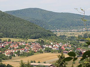
Neuendorf is a municipality in the Lower Franconian district of Main-Spessart and a member of the Lohr am Main administrative community .
geography
Geographical location
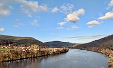
Neuendorf is located in the Würzburg region in the Vor Spessart region and is separated from the Main to the south . It lies between the cities of Gemünden am Main and Lohr am Main . The topographically highest point of the municipality district is located at 530 m above sea level. NN at the summit of the Sohlhöhe , at the upper basin of the pumped storage power plant , the lowest is in the Main at 152.4 m above sea level. NN .
Community structure
There are two districts:
- Nantenbach
- Neuendorf
Both districts are in the Neuendorf district .
Neighboring communities
| City of Gemünden am Main |
||

|
||
| City of Lohr am Main |
Surname
etymology
The name Neuendorf consists of the Middle High German words niuwe , which means "new", and village . The name "New Village" was derived from the formation of a new village.
Earlier spellings
Earlier spellings of the place from various historical maps and documents:
|
|
history
Until the church is planted
The oldest surviving mention of the place comes from May 27, 1325. Nantenbach is the older part of the community.
Neuendorf belonged to the Partenstein office . This had changing masters: First the Counts of Rieneck , since about 1277 the Archbishops of Mainz and the Lords and Counts of Hanau together, from 1684 only the Archbishopric. Compulsory labor had to be done temporarily to the Partenstein and Hohenroth offices. As an acquisition of the inhabitants, agriculture dominated on poor soil on red sandstone .
As part of the Archbishopric of Mainz, Neuendorf fell to the newly formed Principality of Aschaffenburg in the Reichsdeputationshauptschluss 1803 , with which (now a department of the Grand Duchy of Frankfurt ) it came to Bavaria in 1814 . In the course of the administrative reforms in Bavaria, today's municipality was created with the municipal edict of 1818 .
Administrative history
In 1862 the district office Lohr am Main was formed, on whose administrative area Neuendorf was located. In 1939, as everywhere in the German Reich, the designation district was introduced. Neuendorf was then one of the 26 communities in the Lohr am Main district . With the dissolution of the district of Lohr am Main, Neuendorf came to the newly formed district of Mittelmain on July 1, 1972, which ten months later received its final name, district of Main-Spessart .
In the course of the regional reform in Bavaria , Neuendorf was able to maintain its independence. The community was assigned to the administrative community Lohr am Main. Neuendorf is now the municipality with the lowest number of inhabitants in the district.
Religions
In terms of church, Neuendorf and Nantenbach used to belong to the Roman Catholic parish of Lohr am Main , and later to Langenprozelten . In 1717 a small branch church was built in Neuendorf, which was expanded to its present size in 1928/1929. Saint Sebastian is the church patron . The parish has had its own clergyman for 70 years. The proportion of Catholics in the village population is around 90 percent.
Population development
In the period from 1988 to 2018, the number of inhabitants fell from 871 to 830 by 41 inhabitants or 4.7%.
- 1961: 685 inhabitants
- 1970: 754 inhabitants
- 1987: 868 inhabitants
- 1991: 875 inhabitants
- 1995: 913 inhabitants
- 2000: 972 inhabitants
- 2005: 949 inhabitants
- 2010: 834 inhabitants
- 2015: 830 inhabitants
politics
mayor
Mayor has been Karlheinz Albert (Free Voters Village Community Neuendorf) since May 1, 2008; he was elected for a further six years on March 15, 2020 with 91.0% of the vote. His predecessor was Konrad Rauch (CSU / Independent Citizens).
The mayor's representatives are:
- Second Mayor Bernhard Ries (Free Voters Village Community Neuendorf)
- Third Mayor Oliver Ebert (CSU / Independent Citizens)
coat of arms
The community has had its own coat of arms since 1981.
In the explanation of this it says: “ The history of Neuendorf was largely shaped by the Counts of Rieneck, who are remembered in the municipal coat of arms by the colors red and gold. The Neuendorf church, built in 1717, is dedicated to Saint Sebastian. This patronage is represented by the crossed arrows as the symbol of this saint. The paring knife is a reminder of the more than three hundred year old tradition of the barrel hoop cutter and woodworking in Neuendorf and Nantenbach. On the opposite side of the Main from Neuendorf are the ruins of the former Schönrain monastery , which was used as a palace and administrative building by the Counts of Rieneck after its abolition in the 16th century. The tin cut in the coat of arms indicates this monastery or palace complex. "
The Schönrain ruin is not in the Neuendorfer district, but is still the community's landmark. A Schönrainstrasse in the village refers to this and the festival hall is named "Schönrainhalle".
Architectural monuments
Soil monuments
Economy and Infrastructure
Economy including agriculture and forestry
Until seven decades ago Neuendorf was a purely agriculturally oriented village, the small farmers improved their livelihood through forest work, cutting tires, peeling bark, and transporting wood to the sites on the Main. In the twenties, home tailoring gained a foothold in Neuendorf and ensured an economic boom. Agriculture declined between 1950 and 1960 as there were better earning opportunities, especially in nearby Lohr am Main. Today the place has only one full-time farmer. According to official statistics, in 1999 there were four agricultural holdings with an agriculturally used area of 89 ha, of which 53 ha were arable land and 34 ha were permanent green areas. This has resulted in a structural change from a formerly agricultural community to a residential community.
A metal processing (bent wire parts) company, a company specializing in attachments to machines, a concrete plant - mainly for prefabricated ceilings - and a body shop should be mentioned at industrial locations. In 1998, according to official statistics, there were no employees at the place of work in the manufacturing sector or in trade and transport who were subject to social insurance contributions. There were a total of 348 employees at the place of residence subject to compulsory social insurance.
Neuendorf is a wooded community. In the 965 hectare district, 171 hectares of the approximately 700 hectare forest area are owned by the municipality. For this purpose, the municipality has expanded 8.5 kilometers of forest roads that can be used by trucks.
Infrastructure
The water supply from 1901 was thoroughly renovated between 1972 and 1978. The municipal drainage facilities have also been renovated in sections since 1960. The wastewater system was put into operation in 1994 with the completion of the main collecting canals and the sewage treatment plant. The cemetery was enlarged in 1953 and 1970 and renovated in the old part of the cemetery a few years ago. In 1995 a new building area "Am Thürlein" with 42 building sites was developed.
traffic
With the new construction of the Nantenbacher bend with the main valley bridge Nantenbach in the course of the Aschaffenburg-Würzburg railway line and the construction of the bypass in the course of the federal highway 26 , the face of the community has changed significantly. Neuendorf had its own train station from 1901 to 1982. Today the community is served by public transport buses on the B26. The community is included in the Bavarian village renewal program. During the village beautification measures, Frankenstrasse was last rebuilt in 2001/2002. In recent years, with the help of the Würzburg Road Construction Office, a continuous cycle path connection along the Main to Gemünden am Main and Lohr am Main has been built. A modern town hall with a multi-purpose room for local clubs, a new kindergarten as well as the sports field newly built by SV Neuendorf and the sports home are intended to support the community spirit and diverse activities in the community.
Education and culture
The school-age children in grades one to eight were taught in the community school in Neuendorf until 1967. In the course of the reorganization of the school, from 1967 years five and eight were schooled in Langenprozelten; years one and four stayed in Neuendorf until 1974. Today all Neuendorfer children go to primary school or to secondary schools in Lohr am Main or Gemünden.
The music band, the Fränkische Trachtenkapelle, the "Schönrain Echo", the sports club, a Fasenachtsverein, the volunteer fire brigade , a Red Cross community, a "mixed choir", the fruit and horticultural association , the ComputerClub Neuendorf and FC Bayern all take part in the local culture Munich fan club Neuendorf and the Kolping family. A multi-purpose hall ("Schönrainhalle"), which was completely renovated in 2002/2003, is available for larger events.
A partnership with Neuendorf in Switzerland has existed since the 1980s .
Web links
- Homepage of the community Neuendorf
- Schönrain ruins
- Entry on the coat of arms of Neuendorf (Lower Franconia) in the database of the House of Bavarian History
Individual evidence
- ↑ "Data 2" sheet, Statistical Report A1200C 202041 Population of the municipalities, districts and administrative districts 1st quarter 2020 (population based on the 2011 census) ( help ).
- ↑ http://www.bayerische-landesbibliothek-online.de/orte/ortssuche_action.html ? Anzeige=voll&modus=automat&tempus=+20111119/212603&attr=OBJ&val= 1735
- ↑ a b Wolf-Armin von Reitzenstein : Lexicon of Franconian place names. Origin and meaning . Upper Franconia, Middle Franconia, Lower Franconia. CH Beck, Munich 2009, ISBN 978-3-406-59131-0 , p. 157 ( limited preview in Google Book search).


