
Rechtenbach
| coat of arms | Germany map | |
|---|---|---|

|
Coordinates: 49 ° 59 ' N , 9 ° 31' E |
|
| Basic data | ||
| State : | Bavaria | |
| Administrative region : | Lower Franconia | |
| County : | Main-Spessart | |
| Management Community : | Lohr am Main | |
| Height : | 338 m above sea level NHN | |
| Area : | 7.27 km 2 | |
| Residents: | 1004 (Dec. 31, 2019) | |
| Population density : | 138 inhabitants per km 2 | |
| Postal code : | 97848 | |
| Area code : | 09352 | |
| License plate : | MSP | |
| Community key : | 09 6 77 172 | |
| Community structure: | 1 district | |
| Address of the municipal administration: |
Hauptstrasse 41 97848 Rechtenbach |
|
| Website : | ||
| Mayor : | Christian Lang (list of citizens) | |
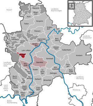
| Location of the municipality of Rechtenbach in the Main-Spessart district | ||
  |
||

Rechtenbach is a municipality in the Lower Franconian district of Main-Spessart and a member of the Lohr am Main administrative community .
geography
Geographical location
Rechtenbach is located in the Würzburg region in the Spessart . The topographically highest point of the municipality is at 536.6 m above sea level. NN (location) on the Weickertshöhe , the lowest is on the B 26 just before Lohr at 203 m above sea level. NN (location) .
Community structure
There is only one place, the village of Rechtenbach, but two districts : Rechtenbach and Rothenberg ( free of parishes until the end of 2013 ).
The district of Rechtenbach is divided into two parts by the so-called Weickertshöhe (in the community-free area of Forst Lohrerstraße ), namely the unpopulated Weickertswiese in the northwest and the inhabited community area in the southeast with the village of Rechtenbach.
The Rothenberg district is divided into nine historical forest divisions.
Neighboring communities
|
Partensteiner Forst ( non- parish area) |
||
.svg)
|
City of Lohr am Main |
|
|
Forst Lohrerstraße (community-free area) |
Surname
The community takes its name from the Rechtenbach of the same name , which flows into the Main in Lohr am Main.
history
Until the church is planted
Rechtenbach was mentioned for the first time on August 18, 1522 in a document from Count Philipp von Rieneck and was an industrial settlement in which flat glass was produced for the mirrors of the Lohr state manufacture until 1791. Rechtenbach came to the newly formed Principality of Aschaffenburg as part of the Archbishopric Mainz in the Reichsdeputationshauptschluss 1803 , which became a department of the Grand Duchy of Frankfurt from 1810 . In 1814 Rechtenbach fell to Bavaria . In the course of the administrative reforms in Bavaria, today's municipality was created with the municipal edict of 1818 .
Administrative history
In 1862 the district office Lohr am Main was formed, on whose administrative area Rechtenbach was located. In 1939, as everywhere in the German Reich, the designation district was introduced. Rechtenbach was then one of the 26 communities in the Lohr am Main district . With the dissolution of the district of Lohr am Main, Rechtenbach came to the newly formed district of Mittelmain on July 1, 1972, which ten months later received its final name, district of Main-Spessart .
As of January 1, 2014, the uninhabited community-free area of Rothenberg was incorporated. This increased the area of the municipality from 2.09 to 7.27 km². As a result of the incorporation, the community area became a contiguous area and the former uninhabited exclave Weickertswiese in the northwest with an area of 96 hectares lost its exclave status, although it only has a five-meter-long border with the Rothenberg district.
Population development
- 1961: 1068 inhabitants
- 1970: 1158 inhabitants
- 1987: 1107 inhabitants
- 1991: 1159 inhabitants
- 1995: 1142 inhabitants
- 2000: 1096 inhabitants
- 2005: 1049 inhabitants
- 2010: 986 inhabitants
- 2015: 1003 inhabitants
politics
The municipal tax income amounted to 520,000 € in 2009, of which the trade tax income (net) amounted to 22,000 €.
Mayors and similar officials
- Mayor
- 1795–1800 Josef Amrhein
- 1800–1805 Christoph Bartel
- 1805–1810 Heinrich Josef Matre
- 1810 – Hartmann
- Chief
- –1821 the same Hartmann
- 1821–1823 Kohl
- 1828–1831 Franz
- Hartmann Friedrich 1831–1836
- 1836-1840 Herte
- Hartmann 1840-1842
- 1842–1847 Weigand
- 1848-1855 Matre
- 1855-1869 Herteux
- mayor
- 1869–1876 the same Herteux
- 1877-1888 Matre
- 1888–1890 August Philipp Herteux,
- 1890-1894 spirit
- 1894–1919 Max Matreux ( Bavarian Center Party )
- 1919–1933 Georg Noll (SPD)
- 1933–1945 Ottmar Hepp
- 1945–1956 Josef Schattmann (CSU)
- 1956–1966 Otto Väthjunker
- 1966–1978 Leo Väthjunker
- 1978–1996 Gerd Kretz
- 1996-2008 Helmut Geist (SPD)
- 2008–2014 Andreas Frech
- 2014–2020 Klaus Bartel
- from 2020 Christian Lang
(Sources below)
Municipal council
Distribution of seats after the 2014 election:
- Free voters: 5 seats
- CSU: 4 seats
- SPD: 3 seats
coat of arms
Blazon : A silver glass blowpipe with silver glass and a threshold tusk's ax crossed in red, above a golden heraldic lily, truncated below, a vertical golden oak leaf below.
Culture and sights
Architectural monuments
Natural monuments
- Kobertsquelle , renatured water source with small ponds on the Rothenberg.
Economy including agriculture and forestry
In 1998, according to official statistics, there were 30 in the manufacturing industry and no employees in the field of trade and transport who were subject to social security contributions at the workplace. In other economic areas, 22 people were employed at the place of work subject to social security contributions. There were a total of 477 employees at the place of residence subject to social security contributions. There were 14 companies in the manufacturing sector and two in the ancillary construction sector. In addition, in 1999 there were seven farms with an agriculturally used area of 55 ha, all of which was permanent grassland .
education
The following institutions exist (as of: 1999):
- Kindergartens: 50 kindergarten places with 33 children
Web links
- Associations in Rechtenbach
- Entry on the coat of arms of Rechtenbach in the database of the House of Bavarian History
Individual evidence
- ↑ "Data 2" sheet, Statistical Report A1200C 202041 Population of the municipalities, districts and administrative districts 1st quarter 2020 (population based on the 2011 census) ( help ).
- ↑ Bavarian State Library Online (BLO)
- ^ Wolf-Armin von Reitzenstein : Lexicon of Franconian place names. Origin and meaning . Upper Franconia, Middle Franconia, Lower Franconia. CH Beck, Munich 2009, ISBN 978-3-406-59131-0 , p. 183–184 ( limited preview in Google Book search).
- ↑ http://www.wahlen.bayern.de/biz/kowa_g2008.php?g=h&schluessel=677&suchbegriff=6
- ↑ The former mayor of Rechtenbach on the community website
- ↑ https://www.rechtebach-spessart.de/kommunalpolitik/

Arnstein | Aura in the reason | Birkenfeld | Bischbrunn | Burgsinn | Erlenbach near Marktheidenfeld | Esselbach | Eußenheim | Skins | Frammersbach | Gemünden am Main | Gössenheim | Graefendorf | Hafenlohr | Hasloch | Sky city | Karbach | Karlstadt | Karsbach | Kreuzwertheim | Lohr am Main | Marktheidenfeld | Middle sense | Neuendorf | Neuhütten | Neustadt am Main | Obersinn | Partenstein | Rechtenbach | Retzstadt | Rieneck | Clearing | Rothenfels | Schollbrunn | Steinfeld | Thüngen | Triefenstein | Urspringen | Wiesthal | Zellingen
Municipality-free areas in the district of Main-Spessart
Burgjoss |
Forest aura |
Forest Lohrerstraße |
Frammersbach Forest |
Princely Löwensteinscher Park |
Haurain |
Herrnwald |
Langenprozeltener forest |
Partenstein Forest |
Ruppertshütten forest