Weickertshöhe
| Weickertshöhe | ||
|---|---|---|
|
Weickertshöhe |
||
| height | 546 m above sea level NHN | |
| location | Bavaria , Germany | |
| Mountains | Spessart | |
| Dominance | 4.6 km → Klosterkuppel | |
| Notch height | 84 m ↓ Lohrerstraße | |
| Coordinates | 49 ° 59 '36 " N , 9 ° 28' 31" E | |
|
|
||
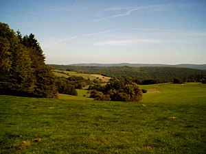
The Weickertshöhe is 546 m above sea level. NHN high mountain in the Spessart in the Lower Franconian district of Main-Spessart .
geography
The Weickertshöhe lies between Rechtenbach and Neuhütten , northeast of the Bischbornerhof . To the east of the summit, on the Weickertswiese , the boundaries of the community-free areas of Forst Lohrerstraße and Partensteiner Forst and the community of Rechtenbach meet. Other places nearby are Krommenthal , Partenstein and Lohr am Main . The federal road 26 runs south of the Weickertshöhe in the valley of the Bischbornbach . In the northeast, the Weickertshöhe goes flat to the Steckenlaubshöhe (542 m).

