
Triefenstein
| coat of arms | Germany map | |
|---|---|---|

|
Coordinates: 49 ° 48 ' N , 9 ° 36' E |
|
| Basic data | ||
| State : | Bavaria | |
| Administrative region : | Lower Franconia | |
| County : | Main-Spessart | |
| Height : | 180 m above sea level NHN | |
| Area : | 25.48 km 2 | |
| Residents: | 4373 (Dec. 31, 2019) | |
| Population density : | 172 inhabitants per km 2 | |
| Postal code : | 97855 | |
| Area code : | 09395 | |
| License plate : | MSP | |
| Community key : | 09 6 77 154 | |
| LOCODE : | DE TFS | |
| Market structure: | 4 districts | |
Market administration address : |
Rathausstrasse 2 97855 Triefenstein |
|
| Website : | ||
| Mayoress : | Kerstin Bettenbrock (Make us out of four) | |
| Location of the Triefenstein market in the Main-Spessart district | ||
  |
||

Triefenstein is a market in the Lower Franconian district of Main-Spessart .
geography
location

Triefenstein is located at the southern end of the Main-Spessart district in the Mainviereck . The Main divides the market. The topographically highest point of the municipality is at 303 m above sea level. NN (location) on Husarenberg, on the B 8 south of Tiefenthal , the lowest is in the Main at 138 m above sea level. NN (location) .
Geology / soil
On the right side of the Main there is fertile loess soil on sandstone, on the left side of the Main, the second layer of the Lower Franconian layered plain begins with the shell limestone. The nature of the soil is reflected in the use of the respective areas: on the right Main side of the Main, productive arable farming predominates, on the Left Main side, the shell limestone is used for viticulture. The cement works has been mining the limestone for over 100 years.
Community structure
The five officially named places were distributed over the four districts:
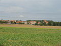
There are the districts Homburg am Main, Lengfurt, Rettersheim and Trennfeld.

Homburg am Main

Lengfurt
Rettersheim

Separating field


_1.jpg)
Neighboring communities
| City of Marktheidenfeld |
Commune Erlenbach bei Marktheidenfeld |
|
| Kreuzwertheim market |
.svg)
|
Remlingen market |
| City of Wertheim |
Municipality Holzkirchen |
Waters
history
Before the church was founded
Neuchâtel Castle , which was founded in the High Middle Ages , is a two-part castle consisting of a tower hill and main castle, is located about 750 meters north of the Triefenstein Monastery and has only survived as a castle stable in small remnants, but can be hiked along the Triefensteiner Kulturweg . Presumably founded by the Lords of Reinstein , ministerials of the bishops of Würzburg , it was destroyed twice in the 13th and 14th centuries and was only mentioned as Alt-Purgstal (expired castle) in the Pfinzing Atlas in 1594 .
The Triefenstein Monastery (with Rettersheim) and Trennfeld, founded in 1102, fell to the Counts of Löwenstein-Wertheim in the Reichsdeputationshauptschluss 1803 and came to the Principality of Aschaffenburg in 1806 . The Homburg office of the Hochstift Würzburg fell to Bavaria in return for a pension in 1803 and to the Grand Duchy of Würzburg in 1805 . In 1814/16 all of today's parts of the community came to Bavaria . In the course of the administrative reforms in Bavaria, the municipal edict of 1818 created the municipalities of Rettersheim, Homburg am Main, Lengfurt and Trennfeld. These were merged in 1978 during the municipal reform . For six centuries, its history is closely linked to the Augustinian canons of Triefenstein, which was the inspiration for the new name of the community.
Homburg, the castle high above the Main , first mentioned in a document in 993, represented an important outpost in the power politics of the Würzburg bishops. Lengfurt, the long ford , came into the light of history with the foundation of Triefenstein's monastery in 1102. Rettersheim , probably the early Franconian settlement of a "Radheri", became tangible in 1284. Trennfeld , formerly Trieffenvelt (the dripping field), was part of the basic equipment of the Bamberg diocese, founded in 1007, as an imperial estate .
The coat of arms of the Triefenstein market shows two crossed keys in the lower part. They are taken from the coat of arms of the monastery of the same name, whose church patrons are Peter and Paul. According to Catholic teaching, Peter was given the keys to the kingdom of heaven. The old and long-distance trade route Via Publica crossed the Main at the foot of the monastery - a key point, both in relation to the keys in the monastery coat of arms and to the Via Publica, which was probably built there as early as 839.
The first Main Bridge was built in 1904 near Lengfurt.
At least since the beginning of the 19th century there were Jewish families in the district of Homburg, which formed a Jewish community and built their synagogue in 1873 . It was only after the November pogrom of 1938 , on December 25th, that SA men burned down the church. A memorial plaque commemorates this event on the commercial building at Maintalstrasse 26, which was later built there.
Church planting
As part of the regional reform in Bavaria on May 1, 1978, the Homburg am Main market and the communities of Lengfurt , Trennfeld and Rettersheim were dissolved and merged into the Triefenstein market.
Population development
In the period from 1988 to 2018, the population increased from 3521 to 4380 by 859 inhabitants or 24.4% - the highest percentage increase in the Main-Spessart district in the period mentioned.
| year | population | Difference in% per year |
|---|---|---|
| 1961 | 4333 | - |
| 1970 | 3502 | - 2.1% |
| 1987 | 3530 | ± 0.0% |
| 1991 | 3754 | + 1.6% |
| 1995 | 4005 | + 1.7% |
| 2000 | 4201 | + 1.0% |
| 2005 | 4363 | + 0.8% |
| 2010 | 4340 | - 0.1% |
| 2015 | 4332 | ± 0.0% |
politics
mayor
Since May 1st, 2020, the first mayor has been Kerstin ceilingbrock (Make us out of four). In the runoff election on March 29, 2020, she was elected with 65.3% of the vote.
After the municipal reform , the former mayor of Lengfurt Friedrich Cremer (SPD) (1920–2010) became the first mayor of the Triefenstein market.
| mayor | from | to |
|---|---|---|
| Friedrich Cremer (SPD) | 1978 | 1981 |
| Rudolf Scheurich (Free Citizens) | 1981 | 1990 |
| Lothar Huller (SPD) | 1990 | 1996 |
| Jürgen Nolte (CSU) | 1996 | 2008 |
| Norbert Endres (CSU) | 2008 | 2020 |
| Kerstin Bettenbrock (Make us out of four) | 2020 |
Market council
The market council consists of the first mayor and the market council members.
The local elections from 2002 to 2020 led to the following allocation of seats in the municipal council:
| Party / list | 2002 | 2008 | 2014 | 2020 |
|---|---|---|---|---|
| CSU | 7th | 6th | 7th | 5 |
| Free citizens | 4th | 5 | 5 | 5 |
| SPD | 5 | 5 | 4th | 3 |
| We make four out of four | - | - | - | 3 |
| total | 16 | 16 | 16 | 16 |
coat of arms
The current coat of arms was approved in 1981 and has been the official coat of arms of the market town of Triefenstein since it was founded in 1978. The official description of the coat of arms reads:
"By a silver wavy bar divided by blue and red, above a golden otter fork, each accompanied by a silver heraldic rose with golden lugs and sepals, at the bottom a golden and silver key crossed at an angle."
The coat of arms contains elements of the earlier coats of arms of the communities and of the Augustinian canons of Triefenstein. The crossed keys can also be found in the coat of arms of the Triefenstein Monastery, which existed until 1803. Silver and red stand for the Würzburg monastery, to which the Homburg office belonged for a long time. The color blue can be found in many municipal coats of arms. From the coat of arms of the Counts of Wertheim, who ruled the village of Lengfurt until 1556, the heraldic roses were first included in the Lengfurt coat of arms and also in that of Triefenstein. The golden otter fork comes from the coat of arms of Trennfeld and Homburg. It indicates fishing in the Main and in the Klostersee. The Main, which flows through Triefenstein, is represented by the wavy bar in the middle of the coat of arms.
partnership
There has been a partnership with Vassy in France since 2013 , which Valdallière has continued since 2016 .
Architectural monuments
Economy and Infrastructure
Economy including agriculture and forestry

According to official statistics, there were six in the field of agriculture and forestry in 1998, 673 in the manufacturing sector and 95 in the trade and transport sector at the place of work. In other economic sectors 93 people were employed at the place of work subject to social security contributions. There were a total of 1503 employees at the place of residence subject to social security contributions. There were two companies in the manufacturing sector and six in the construction sector. In addition, in 1999 there were 56 farms with an agriculturally used area of 1100 ha, of which 956 ha were arable land and 105 ha were permanent green space.
traffic
Triefenstein can be reached via the federal highway 3 Frankfurt-Würzburg (junction Marktheidenfeld and Wertheim-Lengfurt).
education
There are the following institutions (as of 2018):
- Four day-care centers with a total of 246 places and 183 children
- An elementary school with 8 teachers, 6 classes and 115 students
Personalities
Associated with Triefenstein are:
- Burkard (683-755), was a monk from south-west England who was appointed the first bishop of Würzburg by Boniface in 742. He died in Homburg am Main in 755.
- Giuseppe Appiani (1706–1785), fresco painter in the Augustinian monastery church in Triefenstein
- Friedrich Cremer (1920–2010), doctor, mayor and councilor in Triefenstein
- Michael Fuchs (* 1982), badminton player, grew up in Lengfurt
- Armin Grein (* 1939), Bavarian politician (Free Voters), elementary school teacher in Trennfeld in the 1960s
- Löw Homburger (around 1722), Karlsruhe banker from Homburg
- Charles William Kahles (1878–1931), American comic book artist and author
- Emil Killinger (1851–1902), administrative lawyer from Baden
- Lino Salini (1889–1944), cartoonist, spent his last years in Homburg am Main.
- Erika Spann-Rheinsch (1880–1967), Austrian poet
- Folmar von Triefenstein , † 1181, early Scholastic theologian, since about 1147 provost of the Augustinian canons of Triefenstein
- Januarius Zick (1730–1797), late baroque painter, painted frescoes in the Augustinian monastery church in Triefenstein
Web links
- Markt Triefenstein - Website of Markt Triefenstein
- Entry on the Triefenstein coat of arms in the database of the House of Bavarian History
Individual evidence
- ↑ "Data 2" sheet, Statistical Report A1200C 202041 Population of the municipalities, districts and administrative districts 1st quarter 2020 (population based on the 2011 census) ( help ).
- ↑ a b districts. From: markt-triefenstein.de , accessed on April 25, 2015 .
- ↑ a b Notice. Archived from the original on May 3, 2020 ; accessed on May 3, 2020 (accessed from www.markt-triefenstein.de .).
- ↑ Path 1, panels 2–4 Roman origins - the Via Publica. From: tourismus-triefenstein.de , accessed on April 25, 2015 .
- ↑ Markt Triefenstein in the local database of the Bayerische Landesbibliothek Online . Bayerische Staatsbibliothek, accessed on July 3, 2020.
- ↑ a b c d Federal Statistical Office (Hrsg.): Historical municipality register for the Federal Republic of Germany. Name, border and key number changes in municipalities, counties and administrative districts from May 27, 1970 to December 31, 1982 . W. Kohlhammer, Stuttgart / Mainz 1983, ISBN 3-17-003263-1 , p. 763 .
- ↑ Memorial sites for the victims of National Socialism. A documentation, volume 1. Federal Agency for Civic Education , Bonn 1995, ISBN 3-89331-208-0 , p. 195
- ↑ Bavarian State Office for Statistics and Data Processing: Election of the municipal councils in the municipalities in Bavaria 2002 according to municipalities . ( online [accessed October 8, 2013]).
- ^ Municipality of Triefenstein: municipal council election . ( online [accessed September 23, 2013]).
- ^ Municipality of Triefenstein: municipal council election . ( online [accessed May 1, 2014]).
- ↑ Announcement of the final result of the election of the municipal council on March 15, 2020. Archived from the original on May 3, 2020 ; accessed on May 3, 2020 (accessed from www.markt-triefenstein.de .).
- ^ Municipality of Triefenstein: Partnership document signing . 2013 ( online [accessed August 31, 2013]).

Arnstein | Aura in the reason | Birkenfeld | Bischbrunn | Burgsinn | Erlenbach near Marktheidenfeld | Esselbach | Eußenheim | Skins | Frammersbach | Gemünden am Main | Gössenheim | Graefendorf | Hafenlohr | Hasloch | Sky city | Karbach | Karlstadt | Karsbach | Kreuzwertheim | Lohr am Main | Marktheidenfeld | Middle sense | Neuendorf | Neuhütten | Neustadt am Main | Obersinn | Partenstein | Rechtenbach | Retzstadt | Rieneck | Clearing | Rothenfels | Schollbrunn | Steinfeld | Thüngen | Triefenstein | Urspringen | Wiesthal | Zellingen
Municipality-free areas in the district of Main-Spessart
Burgjoss |
Forest aura |
Forest Lohrerstraße |
Frammersbach Forest |
Princely Löwensteinscher Park |
Haurain |
Herrnwald |
Langenprozeltener forest |
Partenstein Forest |
Ruppertshütten forest