
Roden (Lower Franconia)
| coat of arms | Germany map | |
|---|---|---|

|
Coordinates: 49 ° 54 ' N , 9 ° 37' E |
|
| Basic data | ||
| State : | Bavaria | |
| Administrative region : | Lower Franconia | |
| County : | Main-Spessart | |
| Management Community : | Marktheidenfeld | |
| Height : | 252 m above sea level NHN | |
| Area : | 20.06 km 2 | |
| Residents: | 987 (Dec. 31, 2019) | |
| Population density : | 49 inhabitants per km 2 | |
| Postal code : | 97849 | |
| Area code : | 09396 | |
| License plate : | MSP | |
| Community key : | 09 6 77 178 | |
| Community structure: | 2 districts | |
| Address of the municipal administration: |
Oberdorfstrasse 21 97849 Roden |
|
| Website : | ||
| Mayor : | Johannes Albert ( Voting Community Roden / Village Community Ansbach) | |
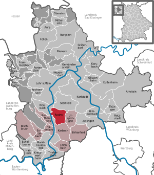
| Location of the municipality of Roden in the Main-Spessart district | ||
  |
||

Roden is a municipality in the Lower Franconian district of Main-Spessart and a member of the Marktheidenfeld administrative community .
geography
Geographical location

Roden is located between Aschaffenburg (52 km) and Würzburg (32 km) on the edge of the Spessart. It is 15 km to Karlstadt am Main (district town) and also to Lohr am Main. Roden can be reached from the A3 motorway (Frankfurt - Würzburg) via the Marktheidenfeld exit (no. 65). Then continue to Marktheidenfeld, there over the Main Bridge and at the end of the bridge turn left towards Karlstadt am Main. Roden is 7 km after Marktheidenfeld.
Roden is a wooded community (approx. 1000 ha) at the transition between Spessart ( red sandstone ) and Franconian plate ( shell limestone ).
Community structure
Roden consists of two parts of the municipality, on which seven settlements are distributed:
- Ansbach ( Kirchdorf )
-
Roden (Kirchdorf) (540 inhabitants)
- Brunnenmühle ( wasteland )
- Wood mill (wasteland)
- Neumühle (wasteland)
- Rosenmühle (wasteland)
- Schmittsmühle (wasteland)
Neighboring communities
Surname
etymology
The name Roden is a clearing name and means cleared land.
Earlier spellings
Earlier spellings of the place from various historical maps and documents:
- 1299 Rode
- 1319 clearing
- 1348 Rodin
- 1421 Rodan
history
Until the church is planted
Roden was first mentioned in a document in 1348 and was part of the Würzburg monastery for centuries . It fell to the Counts Löwenstein-Wertheim-Rosenberg in the Reichsdeputationshauptschluss 1803. From 1500 both belonged to the Franconian Empire . In 1806 Roden became part of the Steinfeld media office belonging to Baden, which in turn was ceded to Austria in 1816. In the general recession of Frankfurt in 1819, Roden came to Bavaria. According to the parish edict of 1818, today's parish was established there.
Incorporations
On June 1, 1976, the previously independent municipality of Ansbach was incorporated.
Population development
In the period from 1988 to 2018, the population increased from 918 to 968 by 50 inhabitants or 5.5%.
religion
Roden is shaped like a Catholic in terms of denomination . In the Dean's Office Lohr (Diocese of Würzburg) there is the Curate St. Cyriakus in the main town of the municipality and the Curate St. Hubertus in Ansbach.
politics
mayor
Mayor has been Johannes Albert (Voting Community Roden / Village Community Ansbach) since May 1, 2020; he was elected on March 15, 2020 with 93.3% of the vote. His predecessor was Otto Düming (* 1952, voter community Roden / Dorfgemeinschaft Ansbach) from May 1, 1990 to April 30, 2020.
Municipal council
The local elections in 2002, 2008, 2014 and 2020 led to the following allocation of seats in the local council:
| 2002 | 2008 | 2014 | 2020 | |
|---|---|---|---|---|
| Voting community Roden | 6th | 6th | 6th | 4th |
| Village community Ansbach | 6th | 6th | 6th | 4th |
| total | 12 | 12 | 12 | 8th |
Due to the decline in the number of inhabitants below 1000, the municipal council has only eight members since May 1, 2020.
coat of arms
The oak tree on the left side of the coat of arms indicates the abundance of forests in the community; on the right, the coat of arms of the Neustadt am Main monastery represents the historical origin of the village.
economy
Jobs
Small commercial enterprises only offer a small number of jobs on site. The majority of the population commutes to work in Lohr, Marktheidenfeld or Würzburg. The official statistics from 2017 show 90 jobs subject to social security contributions in the municipality, while 442 of the resident population are in an insured job and the number of out-commuters is 352 higher than that of in-commuters. Only nine residents were unemployed in 2017. There were 17 farms.
education
- On March 1, 2018, there were two day-care centers with a total of 55 approved places and 47 visitors.
- There are no schools in town.
Architectural monuments
The church of St. Cyriakus from 1710 has a tower from the time of Julius Echter (tabernacle 16th century) and an important crucifixion group made of sandstone from the former Neustadt am Main monastery (1586) in the cemetery.
Personalities
- Marion Kurz , mannequin and photo model
Web links
- http://www.roden.de/
- Entry on the coat of arms of Roden (Lower Franconia) in the database of the House of Bavarian History
Individual evidence
- ↑ "Data 2" sheet, Statistical Report A1200C 202041 Population of the municipalities, districts and administrative districts 1st quarter 2020 (population based on the 2011 census) ( help ).
- ↑ a b Municipality of Roden: bulletin . ( online [accessed June 8, 2014]).
- ^ Community Roden in the local database of the Bavarian State Library Online . Bayerische Staatsbibliothek, accessed on July 2, 2020.
- ↑ Verwaltungsgemeinschaft Marktheidenfeld: Development of the population since 1981 . 2014 ( online [accessed May 12, 2014]). online ( Memento of the original from April 29, 2014 in the Internet Archive ) Info: The archive link was inserted automatically and has not yet been checked. Please check the original and archive link according to the instructions and then remove this notice.
- ↑ a b Wolf-Armin von Reitzenstein : Lexicon of Franconian place names. Origin and meaning . Upper Franconia, Middle Franconia, Lower Franconia. CH Beck, Munich 2009, ISBN 978-3-406-59131-0 , p. 189 ( limited preview in Google Book search).
- ^ Federal Statistical Office (ed.): Historical municipality directory for the Federal Republic of Germany. Name, border and key number changes in municipalities, counties and administrative districts from May 27, 1970 to December 31, 1982 . W. Kohlhammer GmbH, Stuttgart / Mainz 1983, ISBN 3-17-003263-1 , p. 762 .
- ^ Diocese of Würzburg: All deaneries . 2014 ( online [accessed April 23, 2014]).
- ↑ Municipal Council from 2020 to 2026 , accessed on July 2, 2020
- ^ Roden parish: Crucifixion group in the Roden cemetery from 1586 . 2013 ( online [accessed June 18, 2014]).

Arnstein | Aura in the reason | Birkenfeld | Bischbrunn | Burgsinn | Erlenbach near Marktheidenfeld | Esselbach | Eußenheim | Skins | Frammersbach | Gemünden am Main | Gössenheim | Graefendorf | Hafenlohr | Hasloch | Sky city | Karbach | Karlstadt | Karsbach | Kreuzwertheim | Lohr am Main | Marktheidenfeld | Middle sense | Neuendorf | Neuhütten | Neustadt am Main | Obersinn | Partenstein | Rechtenbach | Retzstadt | Rieneck | Clearing | Rothenfels | Schollbrunn | Steinfeld | Thüngen | Triefenstein | Urspringen | Wiesthal | Zellingen
Municipality-free areas in the district of Main-Spessart
Burgjoss |
Forest aura |
Forest Lohrerstraße |
Frammersbach Forest |
Princely Löwensteinscher Park |
Haurain |
Herrnwald |
Langenprozeltener forest |
Partenstein Forest |
Ruppertshütten forest