Biberbach (Main)
| Biberbach | ||
|
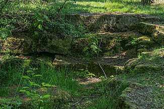
Biberbach spring |
||
| Data | ||
| Water code | DE : 241522 | |
| location | Germany | |
| River system | Rhine | |
| Drain over | Main → Rhine → North Sea | |
| source | north of Sonnenfeld -Bieberbach 50 ° 14 '44 " N , 11 ° 7' 34" O |
|
| Source height | approx. 350 m above sea level NN | |
| muzzle | at Michelau i.OFr. in the main coordinates: 50 ° 9 ′ 39 ″ N , 11 ° 7 ′ 6 ″ E 50 ° 9 ′ 39 ″ N , 11 ° 7 ′ 6 ″ E |
|
| Mouth height | approx. 265 m above sea level NN | |
| Height difference | approx. 85 m | |
| Bottom slope | approx. 6.4 ‰ | |
| length | 13.3 km | |
| Catchment area | 28.19 km² | |
The Biberbach is a thirteen kilometer long right and northern tributary of the Main in Upper Franconia . It is first mentioned as Biberbach in the 9th century.
geography
course
The Biberbach rises north of Sonnefeld - Bieberbach . Northeast of Michelau i.OFr. -Neuensee it flows through the Neuenseer Weiher and in Michelau itself it finally flows into the Mühlgraben, a branch of the Main.
Tributaries
Tributaries downstream:
- Eschenbach ( left ), 0.4 km, 327 m above sea level. NHN
- Maschenbach ??? ( right )
- Kohlgraben ( left ), 2.0 km, near Sonnefeld, 314 m above sea level. NHN
- Herrenkellerbach ( left )
- Dorfberggraben ( left )
- Ammersbach ( left ), 1.3 km, south of Sonnefeld, 305 m above sea level. NHN
- Rohrbach ( right ), 2.0 km, north of Weidhausen near Coburg, 301 m above sea level. NHN
- Krötenbach ( left ), in Weidhausen near Coburg
- Dorfbach ( left ), in Weidhausen near Coburg
- Sulzenbach ( left ), 2.3 km, into the Neuensee , 276 m above sea level. NHN
places
The Biberbach flows through the following places:
See also
Individual evidence
- ↑ a b Topographic map 1: 10000 Bavaria North
- ↑ a b List of brook and river areas in Bavaria - Main river area, page 21 of the Bavarian State Office for the Environment, as of 2016 (PDF; 3.3 MB)
- ^ Dieter George: Lichtenfels; The old circle . Historical book of place names of Bavaria. Upper Franconia. Volume 6: Lichtenfels. Commission for Bavarian State History, Munich 2008, ISBN 978-3-7696-6862-9 . P. 32.
- ↑ Lengths according to own measurements on BayernAtlas
- ↑ Name according to background map: First recording (1808-1864)
- ↑ a b mouth underground
- ↑ Name according to background map: First recording (1808-1864)
- ^ Name after Dorfbachweg
Web links
- Course of the Biberbach on the BayernAtlas
