Sun field
| coat of arms | Germany map | |
|---|---|---|

|
Coordinates: 50 ° 13 ' N , 11 ° 8' E |
|
| Basic data | ||
| State : | Bavaria | |
| Administrative region : | Upper Franconia | |
| County : | Coburg | |
| Height : | 316 m above sea level NHN | |
| Area : | 34.69 km 2 | |
| Residents: | 4622 (Dec. 31, 2019) | |
| Population density : | 133 inhabitants per km 2 | |
| Postal code : | 96242 | |
| Primaries : | 09562, 09266 | |
| License plate : | CO, NEC | |
| Community key : | 09 4 73 166 | |
| LOCODE : | DE NND | |
| Address of the municipal administration: |
Schafberg 2 96242 Sonnefeld |
|
| Website : | ||
| Mayor : | Michael Keilich ( CSU ) | |
| Location of the community of Sonnefeld in the Coburg district | ||

Sonnefeld is a municipality in the Upper Franconian district of Coburg .
geography
Geographical location
Sonnefeld is located on the southern edge of the Thuringian Forest on the B 303 halfway between Coburg and Kronach .
Community structure
The community of Sonnefeld is divided into eleven districts
|
history
Until the move to Bavaria
The first documentary mention of Sonnefeld took place in 1252 as "Hofstädten". In 1260 the Cistercian monastery "campus solis" was founded by Heinrich II. Von Sonneberg and built near the village of Ebersdorf . It was destroyed by fire 25 years later and rebuilt near Hofstädten. In 1299, the villages of Weidhausen and Trübenbach , which had previously been Bamberg , came to the Sonnefeld Monastery by exchange. In 1526 the monastery was closed as a result of the Reformation . The office of Sonnefeld came to Sachsen-Hildburghausen in 1705 . In 1769 the monastery church was rebuilt. In 1826 the office of Sonnefeld returned to the Duchy of Saxony-Coburg . Cantor Karl Herold founded the children's festival on May 1, 1851. On June 23, 1889, the monastery district of Sonnefeld and the neighboring market town of Hofstädten were given the common place name Sonnefeld. In the same year the war memorial was unveiled on the market square and the first railway line opened in 1901. On July 1, 1920, Coburg was annexed to Bavaria .
20th and 21st centuries
While 1400 inhabitants were counted before the Second World War , in 1966 there were 2782 who lived in 980 households and 556 houses. In 2016 the core town had 2767 inhabitants. As of December 31, 2015, the community had 4815 inhabitants.
Neu-Sonnefeld
In 1925 the religious settlement community "Neu-Sonnefeld" ( Quaker ) moved into a house with a horticultural company, a children's home and a publishing house. The Communards lived in community of property and without private property. The founder was Hans Klassen , but he left the house in 1928, which meant that many of the trains dissolved. The children's home was banned in the Nazi state in 1934 , the settlement continued to exist and was re-privatized in 1945.
Incorporations
| Former parish |
Residents (1970) |
date | annotation |
|---|---|---|---|
| Bieberbach | 144 | 07/01/1969 | |
| Gestungshausen | 795 | 01/01/1972 | |
| Hassenberg | 798 | 01/01/1972 | |
| News about the fire | 168 | 07/01/1971 | |
| Oberwasungen | 78 | 07/01/1970 | |
| Weickenbach | 34 | 07/01/1967 | Incorporation to Gestungshausen |
| Weischau | 80 | January 15, 1966 | |
| Woerlsdorf | 293 | 01/01/1975 | |
| Zedersdorf | 141 | 01/01/1971 |
Population development
In the period from 1988 to 2018, the population fell from 4,865 to 4,696 by 169 or 3.5%. A peak was reached on December 31, 1995 with 5459 inhabitants.
politics
Municipal council
As of 2020, the municipal council will have 16 members, four fewer than before.
The 2020 local election resulted in the following distribution of seats in the local council (compared to the 2014 election):
- CSU 5 seats (−3)
- SPD 5 seats (−2)
- Community of Independent Citizens (GUB) 4 seats (−2)
- Young Union 2 seats (+2)
mayor
The first mayor since 2014 has been Michael Keilich, who was the only candidate in 2020 and was confirmed. His predecessor was Rainer Marr, who was first elected in 2002.
coat of arms
Blazon : “Divided by blue and silver; above a silver church in side view with red roofs, below a rooted green tree ”.
Architectural monuments
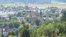
- The former Sonnefeld monastery with the monastery church
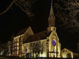
- The St. Moritz cemetery church
- The branch church St. Marien
traffic
The Sonnefeld station was on the Ebersdorf b.Coburg – Neustadt b.Coburg railway line , which has since been closed .
sons and daughters of the town
- Johann Friedrich Eusebius Lotz (1771–1838), lawyer and economist
- Friedrich Ludwig (1872–1945), engineer and industrialist
- Georg Alexander Hansen (1904–1944), resistance fighter during the Second World War, involved in the uprising of July 20, 1944
Others
Itzgründisch , a Main Franconian dialect , is spoken in Sonnefeld .
Individual evidence
- ↑ a b sheet "Data 2", Statistical Report A1200C 202041 Population of the municipalities, districts and administrative districts 1st quarter 2020 (population based on the 2011 census) ( help ).
- ↑ www.sonnefeld.de
- ^ Government Gazette for the Duchy of Coburg, June 29, 1889
- ↑ sonnefeld.de Figures and data
- ↑ Quaker News
- ↑ a b c d e f Wilhelm Volkert (Ed.): Handbook of the Bavarian offices, municipalities and courts 1799–1980 . CH Beck, Munich 1983, ISBN 3-406-09669-7 , p. 441 f .
- ↑ http://www.gestungshausen.de/chronik_ges_20.html
- ↑ http://www.sonnefeld.de/gemeinde-rathaus/gemeinde/ortsteile.php
- ^ Federal Statistical Office (ed.): Historical municipality directory for the Federal Republic of Germany. Name, border and key number changes in municipalities, counties and administrative districts from May 27, 1970 to December 31, 1982 . W. Kohlhammer GmbH, Stuttgart / Mainz 1983, ISBN 3-17-003263-1 , p. 679 .
Web links
- Homepage of the community of Sonnefeld
- Entry on the Sonnefeld coat of arms in the database of the House of Bavarian History
- Sonnefeld: Official statistics of the LfStat (PDF, 1.66 MB)


