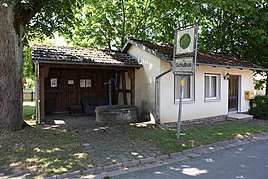
Oberwasungen
|
Oberwasungen
Municipality Sonnefeld
Coordinates: 50 ° 15 ′ 32 ″ N , 11 ° 7 ′ 16 ″ E
|
|
|---|---|
| Height : | 340 m above sea level NN |
| Residents : | 54 (June 30, 2018) |
| Incorporation : | July 1, 1970 |
| Postal code : | 96242 |
| Area code : | 09266 |
|
Village fountain
|
|
Oberwasungen is a district of the Upper Franconian community of Sonnefeld in the Coburg district .
location
Oberwasungen is about twelve kilometers east of Coburg . Communal roads lead to Aicha , Mittelwasungen , Bieberbach and Kleingarnstadt . The Wasunger Bach flows through the village.
history
Oberwasungen was first mentioned in a document in 1149 as "Wasunhen". The Würzburg Bishop Siegfried von Truhendingen confirmed that the newly founded Mönchröden Monastery had also been given the settlement by Hermann Sterker , Burgrave of Meißen and his brother, Count Sterker. In 1291 the settlement was called Wasungen majus. The place probably got its name from the Old High German word "waso", which means something like wet lawn or meadow. The location in a meadow valley was therefore decisive for the place name.
According to the hereditary book of Sonnefeld monastery from 1514, the village was in mixed rule. The monastery had three estates, three fields, three meadows and the tithe to the village and field.
In 1837 the village had 91 inhabitants, in 1871 there were 101.
In a referendum on November 30, 1919, a citizen of Oberwasung voted for the Free State of Coburg to join the Thuringian state , 30 were against. From July 1st, 1920, Oberwasungen belonged to the Free State of Bavaria . In 1925 the settlement comprised 254.49 hectares, 78 residents, of whom 75 were Protestant and 3 were Catholic, and 15 residential buildings. Like the church, the school was located in Fechheim, 1.8 kilometers away .
In 1969 the community sought a connection to Sonnefeld. The incorporation was completed on July 1, 1970.
Oberwasungen has been part of the Fechheimer Kirchsprengel for centuries. From 1967, the Spittelsteiner Group water association supplied the place with drinking water. This has been done by Stadtwerke Neustadt since 1986 . In 1987 the village had 59 inhabitants, 17 residential buildings and 19 apartments.
Population development
|
Web links
Individual evidence
- ↑ http://www.sonnefeld.de/gemeinde-rathaus/gemeinde/zahlen.php
- ↑ Horst GRASSMUCK: Place names of the county Coburg. Inaugural dissertation from the University of Erlangen 1955, p. 76
- ^ Walter Lorenz: Campus Solis. History and property of the former Cistercian abbey of Sonnefeld near Coburg . Verlag Kallmünz, 1955, p. 223
- ↑ Address manual of the Duchy of Saxony-Coburg and Gotha: 1837, p. 77
- ↑ Local directory of the duchies of Coburg and Gotha, compiled on the basis of the census of December 1, 1871, p. 15
- ^ Coburger Zeitung, issue no.280 from December 1, 1919
- ^ Localities directory for the Free State of Bavaria, based on the census of June 16, 1925, Munich, 1928
- ↑ http://www.sonnefeld.de/gemeinde-rathaus/gemeinde/ortsteile.php
- ↑ a b Bavarian State Office for Statistics and Data Processing (Ed.): Official local directory for Bavaria, territorial status: May 25, 1987 . Issue 450 of the articles on Bavaria's statistics. Munich November 1991, DNB 94240937X , p. 300 ( digitized version ).
- ↑ www.gemeindeververzeichnis.de
- ^ A b Michael Rademacher: German administrative history from the unification of the empire in 1871 to reunification in 1990. City and district of Coburg. (Online material for the dissertation, Osnabrück 2006).
