
Nickelsgraben (Main)
| Nickel trench | ||
 The Nickelsgraben flows into the Main |
||
| Data | ||
| location | Germany | |
| River system | Rhine | |
| Drain over | Main → Rhine → North Sea | |
| source | west of Margetshöchheim 49 ° 50 ′ 27 ″ N , 9 ° 50 ′ 3 ″ E |
|
| Source height | approx. 254 m above sea level NHN | |
| muzzle | Southeast of Erlabrunn in the Main Coordinates: 49 ° 51 '3 " N , 9 ° 51' 37" E 49 ° 51 '3 " N , 9 ° 51' 37" E |
|
| Mouth height | 161.6 m above sea level NHN | |
| Height difference | approx. 92.4 m | |
| Bottom slope | approx. 40 ‰ | |
| length | 2.3 km | |
The Nickelsgraben is a two-kilometer long stream in Lower Franconia , which, coming from the south-west, flows into the Main from the left .
course
The Nickelsgraben rises in the southwestern Maindreieck on the Marktheidenfelder Platte in the natural area 132.01 Eisinger Höhe from an intermittent spring at an altitude of about 254 m above sea level. NN . Its headwaters are located on the Schmaletplatte in the 15.2 hectare Bärnthal-Hüttenthal nature reserve in a small coniferous forest west of Margetshöchheim .
The Nickelsgraben initially flows a good five hundred meters in a north-easterly direction through the wooded Bärentalsgraben ( Berthalsgraben ), then crosses under the high-speed route Hanover – Würzburg and is then strengthened on its left by a source branch coming from the Hüttental from the northwest.
The Nickelsgraben now runs along the boundary between Erlabrunn and Margetshöchheim, accompanied by a strong tree gallery, through the open corridor, then passes a homestead at Hummelbrunn , then crosses under the St 2300 state road , crosses a small ditch accompanying the Main and finally flows into the 133.02 Main Valley natural area Veitshöchheim at an altitude of 161.6 m above sea level. NN a good seven hundred meters above the Erlabrunn barrage from the left into the Main flowing in from the southeast.
- Bachwiesengraben in the Margetshöchheim community forest

South of the Erlabrunn bathing lakes

Inflow Hüttental

Bridge on the high-speed line from Hanover to Würzburg
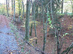
Bärentalgraben


See also
Web links
- The Nickelsgraben on the BayernAtlas
Individual evidence
- ↑ Bavaria Atlas of the Bavarian State Government ( notes )
- ↑ water level of the River Main between barrages Erlabrunn and sky city consistently noted both on the Bayern Atlas in blue.
- ↑ Own measurement on the BayernAtlas
- ^ Name on the parcel map
- ↑ a b Horst Mernsching, Günter Wagner: Geographical land survey: The natural spatial units on sheet 152 Würzburg. Federal Institute for Regional Studies, Bad Godesberg 1963. → Online map (PDF; 5.3 MB)