Breitbach (Main)
|
Breitbach left main upper course: Hirtenbach |
||
|
Breitbach at the town hall of Obernbreit |
||
| Data | ||
| Water code | EN : 2434 | |
| location | Germany | |
| River system | Rhine | |
| Drain over | Main → Rhine → North Sea | |
| origin | Confluence of the left Hirtenbach and a very short right upper course in Iphofen - Nenzenheim 49 ° 38 ′ 25 ″ N , 10 ° 17 ′ 8 ″ E |
|
| Source height | approx. 300 m above sea level NN | |
| muzzle | at Marktbreit in the Main Coordinates: 49 ° 40 ′ 8 ″ N , 10 ° 8 ′ 31 ″ E 49 ° 40 ′ 8 ″ N , 10 ° 8 ′ 31 ″ E |
|
| Mouth height | 178.5 m above sea level NN | |
| Height difference | approx. 121.5 m | |
| Bottom slope | approx. 5.8 ‰ | |
| length | 21 km with Hirtenbach | |
| Catchment area | 157.98 km² | |
| Discharge at the Marktbreit A Eo gauge: 152.05 km². Location: 1.2 km above the mouth |
NNQ MNQ 1976–2012 MQ 1976–2012 Mq 1976–2012 MHQ 1976–2012 HHQ (May 31, 2013) |
10 l / s 146 l / s 595 l / s 3.9 l / (s km²) 9.09 m³ / s 26 m³ / s |
|
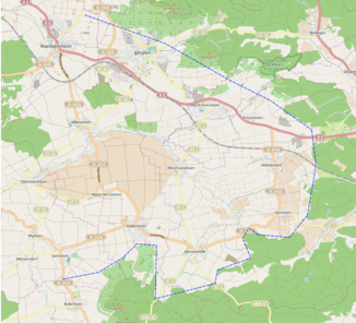
Map of the upper reaches in the Hellmitzheim Bay |
||
The Breitbach is a 21 km long, left and southeast tributary of the Main with its left main course upper course Hirtenbach .
geography
course
The Breitbach arises in Iphofen - Nenzenheim on the western edge of the Steigerwald in continuation of its left upper course Hirtenbach at an insignificant right tributary and initially runs to the northeast. It crosses the so-called Hellmitzheimer Bucht at the foot of the mountainous area, from which it receives some tributaries, in a wide left-hand arc , and then flows further west-south-west. After taking in its large tributaries Iff and Ickbach from the south in quick succession , it turns to the west-north-western lower reaches. It flows into the Main at Marktbreit at Mainkilometer 277 from the left, about one kilometer before the river bridge of the A 7 and the following barrage Marktbreit of the Main.
Tributaries
- Hirtenbach ( left main line upper course )
- Zettelbach ( right ), 2.5 km, approx. 2 km²
- Kirchbach ( right ), 6.3 km, 7.56 km²
- Moorseebach ( right ), 5.2 km, 9.08 km²
- Sparnbach ( right )
- Herrngraben ( left )
- Neuwiesenbach ( left )
- Iff ( left ), 19.8 km, 44.55 km²
- Ickbach ( left ), 10.7 km, 19.06 km²
- Steinbach ( left ), 7.6 km, 14.69 km²
Breitbach river system
places
The Breitbach flows through the following places:
See also
Web links
- Run and northern catchment area of the Breitbach on: BayernAtlas of the Bavarian State Government ( information )
Individual evidence
- ↑ Height queried (with right click) on: BayernAtlas of the Bavarian State Government ( information )
- ↑ Height according to the water level of the Main marked in blue above the Marktbreit barrage on: BayernAtlas of the Bavarian State Government ( information )
- ↑ a b List of brook and river areas in Bavaria - Main river area, page 71 of the Bavarian State Office for the Environment, as of 2016 (PDF; 3.3 MB)
- ↑ Flood news service of the Bavarian State Office for the Environment ( information ) With the new maximum runoff value from 2013, outside the runoff interval that is otherwise considered alone. Queryed on April 16, 2016

