
Schwarzach (Main)
| Schwarzach | ||
 The Schwarzach |
||
| Data | ||
| Water code | EN : 2432 | |
| location |
Steigerwald
|
|
| River system | Rhine | |
| Drain over | Main → Rhine → North Sea | |
| source | as Sägbrunngraben on the Stollberg in the Steigerwald 49 ° 53 ′ 6 ″ N , 10 ° 25 ′ 35 ″ E |
|
| Source height | 455 m above sea level NN | |
| muzzle | near Schwarzach am Main in the Main Coordinates: 49 ° 48 '18 " N , 10 ° 13' 25" E 49 ° 48 '18 " N , 10 ° 13' 25" E |
|
| Mouth height | 188 m above sea level NN | |
| Height difference | 267 m | |
| Bottom slope | 12 ‰ | |
| length | 21.4 km (including Handthaler Bach ) | |
| Catchment area | 179.1 km² | |
| Discharge at the Reupelsdorf gauge (42.6% of the catchment area) A Eo : 76.36 km² Location: 6.6 km above the mouth |
NNQ MNQ 1991-2006 MQ 1991-2006 Mq 1991-2006 MHQ 1991-2006 HHQ (2005) |
22 l / s 78 l / s 434 l / s 5.7 l / (s km²) 8.36 m³ / s 13.7 m³ / s |
| Discharge A Eo : 179.1 km² at the mouth |
MQ Mq |
869 l / s 4.9 l / (s km²) |
The Schwarzach is an approximately 21.4 km long left and eastern tributary of the Main in the Lower Franconian districts of Schweinfurt and Kitzingen .
Surname
The name Schwarzach is composed of the Old High German words swarz and aha together, meaning Black River. In the year 1003 the river name is attested as “Suarzaha. It went to the places Oberschwarzach , Stadelschwarzach , Münsterschwarzach and Stadtschwarzach . "
geography
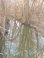
Schwarzachquelle

The highest source of the Schwarzach is that of the Sägbrunngraben on the Stollberg in the Steigerwald . As the Handthaler Bach it flows through the village of Handthal to Oberschwarzach .
However , a karst spring on the southeastern outskirts of Oberschwarzach is referred to as the Schwarzach spring ( 49 ° 51 '32 " N , 10 ° 24' 56" E , approx. 275 m above sea level ). The watercourse that begins there joins the longer Handthaler Bach after only about 200 meters . The spring funnel of the Schwarzach spring overgrown with water plants is popularly known as the "spring of spring" or "gypsum hole".
The average flow from this source is 5 l / s. The sulphate-rich spring water comes from the gypsum keuper .
course
The on the eastern edge of Oberschwarzach at an altitude of 272 m above sea level. NHN , which is united with the Handthaler Bach, now flows through the village and then one after the other through the villages of Bimbach , Brünnau , Neuses am Sand , Stadelschwarzach , Laub , Reupelsdorf and Düllstadt . It will be accompanied by Bundesstraße 22 from Neuses am Sand to Schwarzach a.Main .
Immediately north of the Münsterschwarzach Abbey , the Castellbach, which is almost equal in terms of its water flow, flows into the Schwarzach from the left.
Around 700 meters later, the Schwarzach finally flows out at an altitude of 188 m above sea level. NHN near Schwarzach in the Main.
Its course, together with the Handthaler Bach, about 21.4 km long, ends about 267 meters below the source of the Handthaler Bach, so it has an average bottom gradient of 12 ‰.
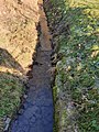
Handthaler Bach in Oberschwarzach, shortly before the confluence with the Schwarzach
Schwarzach near Oberschwarzach, shortly before the confluence with the Handthaler Bach
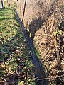
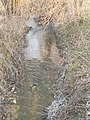
Schwarzach north of Düllstadt

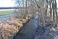
Bridge over the Schwarzach in Laub

.jpg)


Tributaries
| Surname | GKZ | location | Length (main line) [in km] |
EZG [in km²] |
muzzle | |
|---|---|---|---|---|---|---|
| place | Height in m. ü. NHN |
|||||
| Handthaler Bach | 2432-12 | right | 5.10 | 6.72 | Oberschwarzach | 272 |
| Breitbach | 2432-14 | Left | 5.74 | 9.28 | between Wiesenmühle and Greuthermühle | 259 |
| Brno ditch | Left | 2.06 | to Brno | 236 | ||
| Neudorfer Graben | Left | 2.95 | 16.42 | New on the sand | 228 | |
| Schönbach | 2432-16 | Left | 7.55 | Stadelschwarzach | 223 | |
| Solbach | right | 3.10 | Stadelschwarzach | 222 | ||
| Altbach | 2432-18 | Left | 7.60 | 10.9 | Stadelschwarzach | 220 |
| Sadelsbach | right | 3.95 | Stadelschwarzach | 219 | ||
| Marbach | right | 1.44 | leaves | 213 | ||
| Bernbach | Left | 1.70 | Reupelsdorf | 202 | ||
| Sea river ditch | right | 5.30 | Schwarzach am Main | 196 | ||
| Castellbach | 2432-2 | Left | 17.10 | 81.96 | Münsterschwarzach | 191 |
- Tributaries of the Schwarzach
The Schönbach
The Altbach

The Castellbach


Schwarzach river system
Use as a canal and hydroelectric power station
The Münsterschwarzach Abbey uses one of the 12/13 The canal was laid out in the 19th century and renewed in the 20th century to power the Schwarzach river. Electricity has been generated in an abbey-owned hydropower plant since 1960 . The return of the water into the Schwarzach takes place at the level of Schweinfurter Strasse behind Café Haun.
See also
literature
- Johann Kaspar Bundschuh : Schwarzach . In: Geographical Statistical-Topographical Lexicon of Franconia . tape 5 : S-U . Verlag der Stettinische Buchhandlung, Ulm 1802, DNB 790364328 , OCLC 833753112 , Sp. 240 ( digitized version ).
Web links
- Water level in Reupelsdorf , HND Bavaria
Individual evidence
- ↑ GeoFachDatenAtlas and water services of the Bavarian State Office for the Environment
- ↑ Flood Action Plan Main
- ↑ Flood news service of the Bavarian State Office for the Environment ( information ) (as of September 6, 2011)
- ↑ Sum of the level values Reupelsdorf (Schwarzach) and Atzhausen (Castellbach), increased by the drainage of the remaining catchment area (24.21 km²), approximated from the data for the levels Schweinfurt Neuer Hafen , Würzburg (Pleichach) , Sachsenheim , Wolfsmünster , Mittelinn , Brünnstadt , Reupelsdorf , Atzhausen , Marktbreit and Steinbach (Main) at the mouth
- ↑ Information board at the Schwarzach spring
- ↑ Homepage of the abbey ( Memento of the original from January 1, 2009 in the Internet Archive ) Info: The archive link has been inserted automatically and has not yet been checked. Please check the original and archive link according to the instructions and then remove this notice.