Erbacher head
| Erbacher head | ||
|---|---|---|
|
View over the Kiedricher Sandgrub vineyards to the Erbacher Kopf, including the building complex on the Hahnwald near Kiedrich, Scharfenstein Castle on the right edge of the picture , above the incision in the ridge line near Hausen vor der Höhe |
||
| height | 580 m above sea level NN | |
| location | Hessen , Germany | |
| Mountains | Taunus | |
| Dominance | 2.25 km → Cold hostel | |
| Notch height | 18 m | |
| Coordinates | 50 ° 4 '6 " N , 8 ° 2' 6" E | |
| Topo map | LAGIS Hessen | |
|
|
||
The Erbacher Kopf is a 580 m high mountain in the Taunus . The Erbacher Kopf is part of the Taunushauptkamm and, after the Kalten Herberge and with the Hallgarter Zange, is one of the three highest mountains in the Rheingau Mountains .
Geographical location
The Erbacher Kopf is located in the Rheingau-Taunus district in the Erbach district and is its highest point. One can assume that the naming is due to this fact. At the same time, the Erbacher Kopf is the highest point in the urban area of Eltville am Rhein .
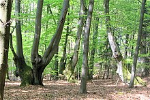
The Erbacher Kopf is a summit plateau with a thick coniferous forest and about 150 meters in diameter. It forms the eastern pillar of the highest part of the ridge line , which extends from here four kilometers to the southwest to beyond the Kalten Herberge , in which the Rheingau Mountains culminate. There is no point lower than 560 meters in this ridge section. To the south the Erbacher Kopf drops steeply to the Kisselbachtal with the Kisselmühle , the Gaisgarten and Eberbach Monastery .
The Erbacher Kopf is accessed through the Rheinhöhenweg on the right bank of the Rhine , which crosses the road from Kiedrich to Hausen vor der Höhe 1,500 meters further northeast at the Förster-Bitter-Eiche forest car park , from there it touches the summit plateau in the north and then via Kasimirkreuz to the one between Kalter Herberge and Hallgarter Zange lying forest car park Kreistanne leads.
Because of the dense forest, the Erbacher Kopf is not a scenic mountain. The closest vantage point is a forest aisle 1,500 meters further west at the Peerenboom hut , which offers a view of Erbach.
history
The Rheingau Gebück ran for centuries on the northern slope of the Erbacher Kopf at a height of around 500 meters . Relics of the Middle Ages from trees and hedges established natural border fortification that the 983 since the Archdiocese of Mainz belonging Rheingau from enemy attacks from the Taunus to protect, are in the forest district Wolf back still to be found. The names of the neighboring forest districts Bollwerk and Gebück also tell of this past.
See also
Individual evidence
- ^ Hessian Land Surveying Office: District map 1: 50,000 Wiesbaden - Rheingaukreis - Untertaunuskreis, 1969 edition


