
Because (Lahn)
|
Because Weilbach |
||
 The Weilquelle on the Great and Small Feldberg |
||
| Data | ||
| Water code | EN : 2586 | |
| location |
Taunus
|
|
| River system | Rhine | |
| Drain over | Lahn → Rhine → North Sea | |
| Weilquelle | in the Taunus , between Großemberg and Kleinem Feldberg , at the Kl. Feldberg fort , near Niederreifenberg 50 ° 13 ′ 36 ″ N , 8 ° 26 ′ 51 ″ E |
|
| Source height | approx. 738 m above sea level NHN | |
| muzzle | near Weilburg in the Lahn coordinates: 50 ° 28 '26 " N , 8 ° 15' 50" E 50 ° 28 '26 " N , 8 ° 15' 50" E |
|
| Mouth height | 128 m above sea level NHN | |
| Height difference | approx. 610 m | |
| Bottom slope | approx. 13 ‰ | |
| length | 46.6 km | |
| Catchment area | 247.9 km² | |
| Discharge A Eo : 247.9 km² at the mouth |
MNQ 2015 MQ 2015 Mq 2015 |
261 l / s 2.317 m³ / s 9.3 l / (s km²) |
| Left tributaries | Niedgesbach, Riedelbach, Cratzenbach, Bleidenbach , Weinbach | |
| Right tributaries | Lauterbach, Aubach, Laubach, Quadersbach, Wiesbach, Kuhbach, Ohmbach | |
| Small towns | Weilburg | |
The Weil im Taunus is a 46.6 km long, southern and orographically left tributary of the Lahn in Hesse. It flows through the Hochtaunuskreis and the Limburg-Weilburg district .
In relation to the measured value MQ , the Weil is the river with the most water in the Taunus. At the same time, it has the second longest course of the river after the Aar and it covers the greatest difference in altitude from the source to the mouth.
Surname
The name Weil is probably derived from the Latin word villa (= village), as the Kleiner Feldberg fort (Feldberg Fort ) was located near the source , the traces of which are still visible.
The Weil is the namesake of many villages on or near the river. This applies first to Dorfweil , then to three districts of Weilrod , namely Altweilnau , Neuweilnau and Rod an der Weil , and finally to Weilmünster , the largest town in the Weiltal. The city of Weilburg is not located on the Weil river, only near the mouth of the Weilburg.
geography
course

The Weil rises at about 738 m above sea level. NHN in the High Taunus in the Taunus Nature Park . The Weilquelle is located in the eastern part of the municipality of Glashütten , 3.5 km away from the town of the same name and far away from Weil, and 2 km southeast of the Schmitten municipality of Niederreifenberg on the common north-western flank of the large (approx. 879 m ) and the small Feldberg ( 825.2 m ); it is located a little northwest of half the air line between the two mountain peaks, which are 1.4 km apart. About 200 m west-northwest below the source are the ruins of the Kleiner Feldberg fort.
_in_Rod_an_der_Weil_-_10.jpeg)
The Weil runs mainly north-west. After a short run through the Reifenberger meadows near the source , it flows through Niederreifenberg and then through the Schmitten core town. In the further course it passes, among other things, Alt- and Neuweilnau and runs through Rod an der Weil and Weilmünster , for example .
It still passes Lützendorf , Ernsthausen and Essershausen and turns to the northwest at Freienfels .
Finally, the Weil flows into the urban area of Weilburg , whose core town is located away from the river, east of the Guntersau train station , at about 128 m from the left into the Lahn, a tributary of the Rhine coming from the north .
From Schmitten to the confluence with the Lahn near Guntersau, the Weiltal is usually very narrow and accompanied by steep valley slopes.
On its way from the source to the mouth, the Weil runs through an altitude difference of about 610 m, which corresponds to an average bed gradient of about 13 ‰.

Information board: Water for the Feldberg Fort : The Weilquelle
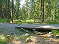
The Weil, about 200 m south of the Kleiner Feldberg fort
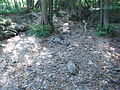
Because fallen dry

Fish table Bärenfichtenweiher halfway between Niederreifenberg and Schmitten

The Weil in Rod an der Weil


_in_Rod_an_der_Weil_-_14.jpeg)
Catchment area
The 247.9 km² catchment area of the Weil belongs partly to the High Taunus and partly to the Eastern Hintertaunus . The estuary area belongs to the Weilburger Lahntal . It is drained from it via the Lahn and the Rhine to the North Sea. The source and the upper reaches of the Weil lie in the Hochtaunuskreis , the lower reaches and the mouth area in the Limburg-Weilburg district . The highest point of the catchment area is the Großer Feldberg at around 880 m .
Your catchment area borders
- in the northeast to that of the small Lahn tributary Rauschenbach and the Grundbach , also a tributary of the Lahn
- in the east to that of the Iserbach and that of the Solmsbach , both of which flow into the Lahn
- in the southeast to that of the USA , which flows into the Main via the Wetter and the Nidda , and to that of the Urselbach Nidda river
- in the south to that of the Main tributary Liederbach
- in the southwest and west to that of the Lahn tributary Emsbach
- and in the northwest to that of the small Lahn tributary Leistenbach .
Tributaries
Diagram of the tributaries from 5 km (from the source to the mouth)

|
Stat. in km |
Surname | GKZ | location | Length in km |
EZG in km² |
MQ in l / s |
Mouth | Mouth height in m above sea level NHN |
Natural space
|
|---|---|---|---|---|---|---|---|---|---|
| 42.9 | Kellerborn | 2586-112 | right | 1.6 | north of Oberreifenberg | 510 | Horse head Taunus | ||
| 41.7 | Niedbach | 2586-116 | Left | 0.8 | east of Seelenberg | 467 | Horse head Taunus | ||
| 40.1 | Lauterbach | 2586-12 | right | 3.2 | 7.9 | in Schmitten | 434 | Horse head Taunus | |
| 39.5 | Leistenbach | 2586-132 | Left | 1.4 | northeast of Schmitten | 424 | Horse head Taunus | ||
| 38.25 | Struthbach | 2586-136 | right | 1.0 | in Dorfweil | 409 | Horse head Taunus | ||
| 37.5 | Aubach | 2586-14 | right | 5.0 | 5.4 | south of Brombach | 401 |
Feldberg-Taunuskamm horse head Taunus |
|
| 34.6 | Hasselbach | 2586-1918 | Left | 0.8 | west of Hunoldstal | 376 | Horse head Taunus | ||
| 33.2 | Meerpfuhlbach | 2586-1992 | right | 2.2 | east of the Landsteiner Mühle | 348 |
Hasselbacher Hintertaunus horse head Taunus |
||
| 32.8 | Niedgesbach | 2586-2 | Left | 5.8 | 8.7 | 99.0 | west of the Landsteiner Mühle | 342 | Horse head Taunus |
| 29.5 | Riedelbach | 2586-32 | Left | 4.1 | 6.2 | north of Neuweilnau | 303 | Horse head Taunus Hasselbacher Hintertaunus |
|
| 29.0 | Wohbach | 2586-332 | Left | 1.6 | northwest of Neuweilnau | 299 | Horse head Taunus Hasselbacher Hintertaunus |
||
| 27.2 | Cratzenbach | 2586-334 | Left | 2.5 | east of Rod ad Weil | 280 | Horse head Taunus Hasselbacher Hintertaunus |
||
| 26.05 | Eichelbach | 2586-34 | Left | 3.4 | 9.7 | in Rod ad Weil | 268 | Horse head Taunus Hasselbacher Hintertaunus |
|
| 25.0 | Welsbach | 2586-3? | Left | 0.8 | in Rod ad Weil | 265 | Hasselbacher Hintertaunus | ||
| 24.2 | Hirtenbach | 2586-3912 | right | 1.2 | north of Rod ad Weil | 254 | Hasselbacher Hintertaunus | ||
| 23.5 | Grünbach | 2586-3914 | Left | 1.5 | between Rod ad Weil and Emmershausen | 253 | Hasselbacher Hintertaunus | ||
| 22.3 | Emmershausen Bach | 2586-3916 | Left | 3.9 | in Emmershausen | 251 | Hasselbacher Hintertaunus | ||
| 22.0 | Bettenbach | 2586-3918 | Left | 1.1 | near Emmershausen | 242 | Hasselbacher Hintertaunus | ||
| 21.0 | Laubach | 2586-4 | right | 8.0 | 28.5 | 275.5 | at the Etzauer Mühle | 230 | Hasselbacher Hintertaunus |
| 20.25 | Quadersbach | 2586-512 | right | 1.7 | southeast of the Runkelsteiner mill | 229 | Hasselbacher Hintertaunus | ||
| 18.85 | Rimpelbach | 2586-51? | Left | 0.6 | in winds | 215 | Hasselbacher Hintertaunus | ||
| 18.2 | Leistenbach | 2586-52 | Left | 3.4 | 4.5 | west-southwest of the Utenhof | 212 | Hasselbacher Hintertaunus | |
| 16.0 | Langenbach | 2586-594 | Left | 2.7 | east of the Rosenhof | 203 | Hasselbacher Hintertaunus | ||
| 15.6 | Wiesbach | 2586-6 | right | 12.1 | 34.5 | 279.5 | south of Audenschmiede | 198 | Hasselbacher Hintertaunus Weilburger Hintertaunus |
| 13.9 | Lichterbach | 2586-7114 | right | 3.0 | at Dianenstein | 191 | Weilburger Hintertaunus | ||
| 12.0 (?) | Hambach | 2586-71162 | Left | 0.9 | Southern edge of Weilmünster | 199 | Hasselbacher Hintertaunus | ||
| 11.8 | Adamsbach | 2586-7192 | right | 1.9 | in Weilmünster | 180 | Weilburger Hintertaunus | ||
| 11.45 | Eppenbach | 2586-7194 | right | 2.1 | in Weilmünster | 177 | Weilburger Hintertaunus | ||
| 11.2 | Bleidenbach | 2586-72 | Left | 6.4 | 13.9 | 58.6 | in Weilmünster | 175 | Hasselbacher Hintertaunus |
| 10.6 | Foremost Höllgraben | 2586-7312 | Left | 1.0 | south of Lützendorf | 172 | Hasselbacher Hintertaunus | ||
| 10.5 | Vogelsbach | 2586-73? | right | 1.0 | south of Lützendorf | 172 | Weilburger Hintertaunus | ||
| 10.3 | Rearmost Höllgraben | 2586-73? | Left | 0.8 | south of Lützendorf | 171 | Hasselbacher Hintertaunus | ||
| 9.8 | Lützenbach | 2586-7316 | right | 2.0 | west of Lützendorf | 170 | Weilburger Hintertaunus | ||
| 8.7 | Steingrabenbach | 2586-73182 | right | 0.6 | in Ernsthausen | 170 | Weilburger Hintertaunus | ||
| 8.25 | Riedwiesbach | 2586-7392 | right | 2.6 | in Ernsthausen | 170 | Weilburger Hintertaunus | ||
| 7.8 | Laimbach | 2586-7394 | right | 2.2 | west of Ernsthausen | 169 | Weilburger Hintertaunus | ||
| 7.1 | Leimbach | 2586-7396 | right | 1.3 | between Ernsthausen and Essershausen | 163 | Weilburger Hintertaunus | ||
| 6.6 | Ratsbach | 2586-7398 | Left | 3.0 | east-southeast of Essershausen | 159 | Hasselbacher Hintertaunus | ||
| 6.4 | Sternbach | 2586-7912 | Left | 1.8 | east of Essershausen | 159 | Hasselbacher Hintertaunus | ||
| 6.0 | Gundersbach | 2586-7914 | right | 3.0 | in Essershausen | 159 | Weilburger Hintertaunus | ||
| 5.0 | Grabenbach | 2586-7918 | right | 1.1 | south of Edelsberg | 159 | Weilburger Hintertaunus | ||
| 4.2 | Halbach | 2586-7992 | right | 1.7 | between Freienfels and Edelsberg | 155 | Weilburger Hintertaunus | ||
| 4.0 | Ronsbach | 2586-7994 | Left | 1.6 | east of Freienfels | 155 | Hasselbacher Hintertaunus | ||
| 3.5 | Weinbach | 2586-8 | Left | 9.9 | 22.0 | 130.7 | in Freienfels | 149 | Hasselbacher Hintertaunus |
| 2.5 | Kuhbach | 2586-92 | right | 4.6 | west-northwest of Freienfels | 143 | Weilburger Hintertaunus | ||
| 1.6 | Ohmbach | 2586-94 | right | 1.7 | west-southwest of Kubach | 143 | Weilburger Hintertaunus | ||
| 0.0 | Because | 2586 | 46.6 | 247.9 | 2252.3 | near Weilburg | 128 |
High Taunus Eastern Hintertaunus Weilburger Lahntal |
Notes on the table
- ↑ Water code number , in Germany the official river code number with a separator inserted after the prefix for better readability, which stands for the common receiving water Weil .
- ↑ Designation after the field names Kellerbornswiesen and Kellerbornsfeld on the property map of the Hessenviewer (Geoportal Hessen) of the Hessian State Office for Soil Management and Geoinformation with property mapping ( notes )
- ↑ Designation after the field name Niedbach on the property map
- ↑ a b c d e f g Designation according to the property map
- ↑ Designation after the field name In der Hasselbach on the property map
- ↑ On the property map : Wobach
- ↑ a b c d e self-measurement on the Hessenviewer
- ↑ Also called Struthgraben
- ↑ a b opens into a side arm
- ↑ Length 5.3 km (with Eschbach 6.4 km)
- ^ Section name: Bornbach
- ^ Section name: Pfaffenhäuser Bach
- ↑ The data from Weil for comparison
Weiltalsperre
A concept of the Weiltalsperre for water supply was drafted in the 1950s and 1960s. A reservoir near Altweilnau and Neuweilnau with a barrier structure above Rod an der Weil was planned. It would have been about three miles long and could have held 20 to 25 million cubic meters of water. In the 1970s the idea of a reservoir was taken up again, but no longer as a water reservoir, but as a tourist attraction; later only the establishment of a wet biotope was thought of. None of the projects was implemented, partly due to a lack of funds.
Aquatic ecology
There are aquatic ecological studies of the Weil, and research has been carried out for a long time to determine the reasons for which the Weil becomes completely dry in sections in summer. A rehabilitation program aims to remove obstacles to ascent and descent, especially for migratory fish species.
In October 2017, the Weil was massively damaged by a slurry accident and many fish died.
traffic
The places in the Weiltal are connected from the source to the mouth, from Niederreifenberg to Guntersau, by the 3025 state road . The single-track Weiltalbahn , which was closed in 1969 and has since been dismantled, ran between Weilburg and Weilmünster and left the Weiltal in the direction of Grävenwiesbach from Weilmünster .
tourism
The Weiltal is a popular destination for hikers as well as cyclists and motorcyclists.
The Feldbergkastell circular route with several information boards leads through the source region of the river . Along the river runs the Weiltalweg , a cycling and hiking route that touches the areas of the communities Schmitten , Weilrod , Grävenwiesbach (all Hochtaunuskreis), Weilmünster , Weinbach and Weilburg (all districts Limburg-Weilburg ). It was set up by the Frankfurt Umlandverband (now the Frankfurt Planning Association ) and is maintained by the Taunus Nature Park .
During the summer months, the Weiltalbus transports cyclists and their bikes on weekends and public holidays from Bad Homburg vor der Höhe or Oberursel -Hohemark to Sandplacken and to Weilburg. This saves cyclists having to cycle the steep ascent to the Taunus ridge .
Web links
- Water profile and program of measures 2586.2 ( Memento from January 1, 2013 in the web archive archive.today ) ( Notes ) → Overview of all Hessian river systems (PDF, 1.7 MB) upper Weil
- Water profile and program of measures 2586.1 ( Memento from January 1, 2013 in the web archive archive.today ) ( Notes ) → Overview of all Hessian river systems (PDF, 1.7 MB) lower Weil
- Level at Rod ad Weil on the HLUG side
- Retention cadastre, Weil river basin code number: 2586 (PDF file; 5.50 MB)
Individual evidence
- ↑ Map services of the Federal Agency for Nature Conservation ( information )
- ↑ a b Topographic map 1: 25,000
- ↑ a b c d Water map service of the Hessian Ministry for the Environment, Climate Protection, Agriculture and Consumer Protection ( information )
- ↑ Rudi H. Kaethner: History. Weilrod municipality, accessed on February 16, 2020 .