Usa (weather)
|
Usa Us / upper reaches: Usbach |
||
|
Usa River System |
||
| Data | ||
| Water code | DE : 24848 | |
| location |
Taunus
|
|
| River system | Rhine | |
| Drain over | Weather → Nidda → Main → Rhine → North Sea | |
| source | near Neu-Anspach im Taunus 50 ° 17 ′ 18 ″ N , 8 ° 28 ′ 51 ″ E |
|
| Source height | approx. 458 m above sea level NHN | |
| muzzle | near Friedberg - Fauerbach in the weather coordinates: 50 ° 19 ′ 12 ″ N , 8 ° 47 ′ 4 ″ E 50 ° 19 ′ 12 ″ N , 8 ° 47 ′ 4 ″ E |
|
| Mouth height | approx. 123 m above sea level NHN | |
| Height difference | approx. 335 m | |
| Bottom slope | approx. 9.8 ‰ | |
| length | 34.1 km | |
| Catchment area | 184.5 km² | |
| Discharge at the Friedberg gauge (99.7% of the catchment area) A Eo : 183.9 km² Location: 1.5 km above the mouth |
NNQ (09/28/1973) MNQ 1962/2010 MQ 1962/2010 Mq 1962/2010 MHQ 1962/2010 HHQ (08/11/1981) |
80 l / s 231 l / s 1.13 m³ / s 6.1 l / (s km²) 18.4 m³ / s 66 m³ / s |
| Left tributaries | Wiesbach, Seebach | |
| Right tributaries | Arnsbach, Stockheimer Bach, Michelbach, Fauerbach | |
| Medium-sized cities | Bad Nauheim, Friedberg | |
| Small towns | Neu-Anspach, Usingen | |
| Communities | Ober-Mörlen | |
|
At Neu-Anspach |
||
|
A level near Friedberg |
||
|
Estuary of the USA in the Wetter bei Friedberg |
||
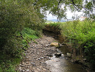
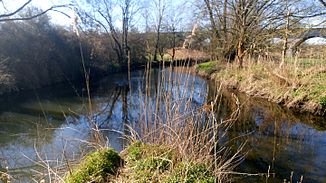
The United States , and Us and on the upper reaches Usbach called in Hesse Hochtaunuskreis and Wetteraukreis is a good 34 km long, orographic right and western tributary of the weather .
geography
course
The USA rises in the Hochtaunuskreis in the eastern Hintertaunus . Its source is between the villages of Rod am Berg in the north and Anspach in the south, about 2.5 km west-southwest of the city center of Neu-Anspach on the eastern flank of the Hardt ( 502.4 m above sea level ) at an altitude of about 458 m .
Initially, the USA crosses Neu-Anspach. The Arnsbach flows there . On the further way the Usa flows through Usingen and is reinforced by the Eschbach . Accompanied by the federal highway 275 , it breaks through a crossbar north of the Taunus main ridge and reaches Ober-Mörlen . Here the Fauerbach flows into the outskirts. The USA flows through Nieder-Mörlen in the Bad Nauheim area and passes the graduation towers there ; Here it still drives a water wheel, the movement of which was previously used for brine pumps. In the further course the Seebach flows north of Friedberg . There is a level near Friedberg (see web link).
Finally, after flowing eastwards past Friedberg and Fauerbach and crossing under the B 275, the USA flows south-southeast of Fauerbach at an altitude of about 123 m into the Nidda tributary Wetter .
Tributaries
The tributaries of the United States include (viewed downstream):
| Surname | GKZ | location | Length in km |
EZG in km² |
MQ in l / s |
|---|---|---|---|---|---|
| Ansbach | 248481120 | Left | 1.2 | ||
| Heisterbach | 248481140 | right | 1.3 | ||
| Arnsbach | 248481200 | Left | 4.0 | 10.8 | 98.3 |
| Bondenbach | 248481312 | Left | 0.7 | ||
| Schleichbach | 248481314 | Left | 1.9 | ||
| Schlichenbach | 248481316 | right | 1.3 | ||
| Mill moat | 248481392 | Left | 1.0 | ||
| Stockheim Bach | 248481400 | Left | 5.2 | 10.6 | 92.4 |
| Röllbach | 248481520 | right | 2.4 | ||
| Eschbach | 248481600 | Left | 5.0 | 9.0 | 64.7 |
| Dittenbach | 248481940 | Left | 2.4 | ||
| Michelbach | 248482000 | Left | 8.1 | 15.2 | 89.4 |
| Wiesbach | 248483200 | right | 6.7 | 15.5 | 132.1 |
| Holzbach | 248483400 | right | 6.1 | 7.8 | 65.2 |
| Detzelbach | 248485120 | Left | 1.2 | ||
| Forbach | 248485200 | Left | 4.3 | 8.0 | 35.7 |
| Vogelthal Bach | 248485360 | right | 2.4 | ||
| Schieferalbach | 248485520 | right | 1.2 | ||
| Aitzenbach | 248485600 | right | 4.3 | 4.1 | 31.6 |
| Hainbach | 248485800 | right | 1.9 | 3.1 | 17.9 |
| Fauerbach | 248486000 | Left | 9.7 | 17.2 | 79.5 |
| Blüßengraben | 248487120 | right | 2.1 | ||
| Säckelgraben | Left | 5¼ | |||
| Deutergraben | 248487940 | right | 4.0 | ||
| Seebach | 248488000 | right | 6.7 | 11.8 | 43.0 |
River systems
Own river system
Parent river system
nature and environment
Water management
The United States, with its 183.9 km² catchment area, has for the most part a water quality level II to III.
In the 1970s, the pollution of the stream used as a receiving water peaked. The wastewater treatment plants in Usingen, Bad Nauheim and Friedberg are essentially contributing to solving this problem . The outflow from the pond sewage treatment plant in the Butzbach districts of Münster and Fauerbach is fed to the USA via the Fauerbach. The actually clean Taunus water is impaired by the discharge of the sewage water. The Usingen sewage treatment plant is located between the Usingen and Ober-Mörlen districts and purifies the wastewater from the Usingen districts of Usingen, Kransberg and Wernborn as well as the Friedrichsthal district of Wehrheim. The wastewater treatment plant of the cities of Bad Nauheim and Butzbach and the municipality of Ober-Mörlen for the places (in the direction of flow): Wiesental (city of Butzbach), Langenhain-Ziegenberg, Ober-Mörlen, Nieder-Mörlen and Bad Nauheim is located between Bad Nauheim and Friedberg . Immediately behind the town of Friedberg and before the confluence in the Wetter, the purified Friedberg wastewater is discharged via the Friedberg sewage treatment plant.
However, the sewage discharges from the treatment plants are not the only problem. Especially in the Taunus, where a large amount of rainwater can accumulate in the sewer system within a very short time, rain overflows quickly give off contaminated water from surface runoff into the USA.
fauna
In the USA there are:
- Salmonids: grayling , brown trout , sea trout , rainbow trout
- Carp-like: bream , chub , minnow , gudgeon , hazel , nose , roach , rudd , loach , mirror carp , common carp
- Other fish species: eel , perch , bullhead , pike and catfish
- and also river mussel , noble and signal crab
Hydraulic structures
Mills
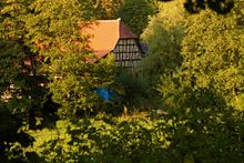
A large number of mills were located on the USA.
-
Ansbach :
- Hammer mill (oil mill, grain mill, 1611)
- Klingelsmühle (until 1929)
-
Westerfeld :
- Westerfelder Mühle (Oberschächtige Mühle, Pulvermühle, Mühlstrasse 10, in the south of Westerfeld)
-
Usingen :
- Seemühle or Segemühle (before 1449)
- Wage Mill
- Fulling Mill (1417)
- Schlappmühle or Kuhardtmühle
- Messemühle
- Grinding mill
-
Eschbach :
- Lower Hessenmühle
- Upper Hessenmühle
-
Wernborn :
- Locksmith's Mill (1417)
-
Kransberg :
- Small mill
- Herrnmühle
- Johannemühle
- Kreuzmühle
-
Langenhain-Ziegenberg :
- Herrenmühle
- Langenhainer mill
-
Ober-Mörlen :
- Oil mill
- Hüftersheimer mill
- Wage Mill
- Kremersmühle, also Krämersmühle or Frankertsmühle
-
Friedberg :
- Bridge mill
- Falcksche Mühle (Neumühle):
-
- The last so named Falcksche mill was listed building below the present Rosental viaduct , as it were at the entrance, outside the city walls, in front of the historic Usator at the foot of Castle Hill . In the 1980s, the remains that were no longer in use were destroyed by heavy construction equipment, and their half-timbered beams were secured by the Wetteraukreis and stored for an intended reconstruction. At the beginning of the 21st century, the legal dispute was settled and the site was otherwise developed.
- Vorbachs mill
- Hackenmühle (squat mill):
- There is historical evidence of the Hackenmühle , which stood a little above today's Gebrüder-Lang-Straße on today's Mühlweg, where the Falcksche Mühle was also located. The street name Mühlweg is associated with the former Mühlengraben .
Bridges (selection)
-
Ober-Mörlen :
- Usa Bridge ( Frankfurter Strasse )
- Three-arched structure, built in the middle of the 19th century
-
Bad Nauheim :
- Usa Bridge ( Parkstrasse )
-
- Single arch structure in basalt stone, built at the beginning of the 20th century
- Usa Bridge ( Lindenstrasse )
- Three-arched stone bridge from the 18th century
- Usa bridge ( Ernst-Ludwig-Ring )
- With a basket arch , erected in 1902/03
-
Friedberg :
- Usa Bridge ( Giessener Strasse )
-
- Natural stone vault bridge from 1880
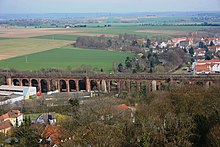
- Rosental Viaduct (railway bridge)
Web links
- Course of the USA on WFD Hessen
- Literature about USA in the Hessian Bibliography
- Level at Usingen- Kransberg on the HLUG side
- Level near Friedberg on the HLUG side
- Water profile and program of measures 24848.1 ( Memento from January 1, 2013 in the web archive archive.today ) ( Notes ) → Overview of all Hessian river systems (PDF, 1.7 MB) lower United States
- Water profile and program of measures 24848.2 ( Memento from January 1st, 2013 in the web archive archive.today ) ( Notes ) → Overview of all Hessian river systems (PDF, 1.7 MB) Upper USA
- Retention register for the Usa river basin at the Hessian State Office for Environment and Geology (HLUG) (PDF; 1.8 MB)
- City of Neu-Anspach: bodies of water / streams
- Image of the Falckschen Mühle
- Map of the eastern edge of Friedberg with the Hackenmühle and the forerunner of the Falckschen Mühle
- Surroundings of Friedberg 1911
Individual evidence
- ↑ Old name for the entire United States, today only used for the upper reaches
- ↑ a b TK 1: 25,000
- ↑ a b c d HMULV online map service for the implementation of the Water Framework Directive in Hesse
- ^ Yearbook: Level Friedberg / Usa
- ↑ River USA, fish stocks and general information , ASV Bad Nauheim EV
- ^ Entry on Schlagmühle in the " KuLaDig " database of the Rhineland Regional Council , accessed on December 9, 2018.
- ^ Entry on Klingelsmühle in the " KuLaDig " database of the Rhineland Regional Council , accessed on December 9, 2018.
- ^ Entry on Westerfelder Mühle in the " KuLaDig " database of the Rhineland Regional Council , accessed on December 9, 2018.
- ↑ The Seemühle on the map of the Prussian New Admission , 1877
- ↑ a b Duchy of Nassau 1819 - 29. Usingen. Historical maps. In: Landesgeschichtliches Informationssystem Hessen (LAGIS).
- ^ Entry on Lohmühle in the " KuLaDig " database of the Rhineland Regional Council , accessed on December 9, 2018.
- ↑ Entry on fulling mill in the database " KuLaDig " of the Rhineland Regional Association , accessed on December 9, 2018.
- ^ The fulling mill on the map of the Prussian New Admission, 1877
- ↑ The fulling mill on Schmitt's map of southwest Germany , 1797
- ^ Entry on Schlappmühle in the " KuLaDig " database of the Rhineland Regional Council , accessed on December 9, 2018.
- ↑ Schlappmühle. Historical local lexicon for Hesse (as of November 4, 2010). In: Landesgeschichtliches Informationssystem Hessen (LAGIS). Hessian State Office for Historical Cultural Studies (HLGL), accessed on December 9, 2018 .
- ↑ The Schlappmühle on the map of the Prussian New Admission, 1877
- ^ Entry on Schleifmühlchen in the " KuLaDig " database of the Rhineland Regional Council , accessed on December 9, 2018.
- ↑ Entry on Untere Hessenmühle in the database " KuLaDig " of the Rhineland Regional Association , accessed on December 9, 2018.
- ↑ State Office for the Preservation of Monuments Hesse (ed.): Hessenmühle In: DenkXweb, online edition of cultural monuments in Hesse
- ↑ Entry on Obere Hessenmühle in the " KuLaDig " database of the Rhineland Regional Council , accessed on December 9, 2018.
- ↑ Entry on Schlossermühle in the " KuLaDig " database of the Rhineland Regional Council , accessed on December 9, 2018.
- ↑ The locksmith's mill on the map of the Prussian new admission, 1877
- ↑ The locksmith's mill on Schmitt's map of southwest Germany, 1797
- ↑ Entry on Kleinmühle in the " KuLaDig " database of the Rhineland Regional Association , accessed on December 9, 2018.
- ↑ The small mill on the map of the Prussian new admission, 1877
- ↑ The small mill on Schmitt's map of southwest Germany, 1797
- ↑ Mr. Mill. Historical local dictionary for Hessen. In: Landesgeschichtliches Informationssystem Hessen (LAGIS). Hessian State Office for Historical Cultural Studies (HLGL), accessed on December 9, 2018 .
- ↑ The Herrnmühle on the map of the Prussian New Admission, 1877
- ↑ The Herrnmühle on Schmitt's map of southwest Germany, 1797
- ↑ The Johannemühle on Schmitt's map of Southwest Germany, 1797
- ↑ Grand Duchy of Hesse 1823-1850 - 14. Fauerbach. Historical maps. In: Landesgeschichtliches Informationssystem Hessen (LAGIS). Hessian State Office for Historical Cultural Studies (HLGL), accessed on December 10, 2018 .
- ^ State Office for the Preservation of Monuments Hesse (ed.): Herrenmühle In: DenkXweb, online edition of cultural monuments in Hessen
- ↑ Herrenmühle. Historical local dictionary for Hessen. In: Landesgeschichtliches Informationssystem Hessen (LAGIS). Hessian State Office for Historical Cultural Studies (HLGL), accessed on December 9, 2018 .
- ↑ Field name: At the Langenhainer mill
- ↑ a b Grand Duchy of Hesse 1823–1850 - 15. Friedberg. Historical maps. In: Landesgeschichtliches Informationssystem Hessen (LAGIS).
- ↑ The oil mill on Schmitt's map of southwest Germany, 1797
- ↑ State Office for the Preservation of Monuments Hesse (Ed.): Hüftersheimer Mühle In: DenkXweb, online edition of cultural monuments in Hesse
- ↑ The Hüftersheimer Mühle on Schmitt's map of southwest Germany, 1797
- ↑ The Lohmühle on Schmitt's map of southwest Germany, 1797
- ↑ Kremersmühle. Historical local dictionary for Hessen. In: Landesgeschichtliches Informationssystem Hessen (LAGIS). Hessian State Office for Historical Cultural Studies (HLGL), accessed on December 9, 2018 .
- ↑ The Frankertsmühle on Schmitt's map of Southwest Germany, 1797
- ↑ Brücken-Mühle , on the Friedberg map from 1895
- ↑ Falcksche Mühle
- ↑ Neumühle. Historical local dictionary for Hessen. In: Landesgeschichtliches Informationssystem Hessen (LAGIS). Hessian State Office for Historical Cultural Studies (HLGL), accessed on December 9, 2018 .
- ↑ a b Map of the Electorate of Hesse 1840–1861 - 93. Nauheim / 98. Dortelweil. Historical maps. In: Landesgeschichtliches Informationssystem Hessen (LAGIS).
- ^ Vorbachs-Mühle , on the Friedberg map from 1895
- ↑ Hockenmühle. Historical local dictionary for Hessen. In: Landesgeschichtliches Informationssystem Hessen (LAGIS). Hessian State Office for Historical Cultural Studies (HLGL), accessed on December 9, 2018 .
- ↑ State Office for the Preservation of Monuments Hesse (ed.): Usabrücke (Frankfurter Strasse) In: DenkXweb, online edition of cultural monuments in Hesse
- ↑ Usabrücke (Frankfurter Straße) , German digital library
- ↑ State Office for the Preservation of Monuments Hesse (ed.): Usa-Brücke (Parkstrasse) In: DenkXweb, online edition of cultural monuments in Hesse
- ↑ Usa-Brücke (Parkstrasse) , German digital library
- ^ State Office for the Preservation of Monuments Hesse (ed.): Usa-Brücke (Lindenstrasse) In: DenkXweb, online edition of cultural monuments in Hesse
- ^ Usa-Brücke (Lindenstrasse) , German digital library
- ↑ State Office for the Preservation of Monuments in Hesse (ed.): Usabrücke (Ernst-Ludwig-Ring) In: DenkXweb, online edition of cultural monuments in Hesse
- ↑ Usabrücke (Ernst-Ludwig-Ring) , German digital library
- ↑ Refurbishment: Usa bridge will not open again until the end of June , Gießener Allgemeine, April 8, 2013
- ↑ Alternatively, the Wetterauer Zeitung gives the 1930s as the construction period


