
Schieferalbach
|
Schiefertalbach Buchborn Bach |
||
 River system of the USA |
||
| Data | ||
| Water code | DE : 24848552 | |
| location |
Taunus
|
|
| River system | Rhine | |
| Drain over | Usa → Weather → Nidda → Main → Rhine → North Sea | |
| Buchenborn | in the Hintertaunus , southwest of Ober-Mörlen 50 ° 21 ′ 11 ″ N , 8 ° 39 ′ 26 ″ E |
|
| Source height | approx. 294 m above sea level NN | |
| muzzle | west of Ober-Mörlen in the USA Coordinates: 50 ° 21 '46 " N , 8 ° 39' 32" E 50 ° 21 '46 " N , 8 ° 39' 32" E |
|
| Mouth height | approx. 183 m above sea level NN | |
| Height difference | approx. 111 m | |
| Bottom slope | approx. 93 ‰ | |
| length | 1.2 km | |
 The Buchenborn with the beech in the valley floor in the middle left |
||
The Schiefertal- or Buchborn Bach is a one kilometer long right and southern tributary of the United States . It does not have its own catchment area .
geography
course

The stream rises in the Hintertaunus in the Hessian Wetteraukreis , west of Ober-Mörlen and east below the FFH area Eichkopf of Ober-Mörlen , on the northern slope of the Langer Berg . It flows into the United States to the west and above Ober-Mörlen, around river km 14.8. His bed is mostly of a muddy nature.

The source, the Buchenborn , lies at the foot of an old beech tree with an only partially preserved crown, about ½ km south and above the now wooded Geitzsteinwiese in corridor 28. It is a few meters lower than a crossroads in a species-poor Deciduous forest ( oak , beech , hornbeam , maple , elderberry and hazel along the wayside ; spruce and ash trees can be found in the flat and presumably leveled outlet of the valley, on the western edge of which traces of a former development can be seen ). Above the source a ditch runs upwards, which connects to a small pond in the forest. The stream runs in bends and a few meander loops in a V-shaped notch valley , a run or a run , through this deciduous forest initially to the north, into corridor 27. From the right, multiple flat groundwater outlets flow into the stream, from the left several dry ones Dig down the slope. At river km 0.45 the valley widens. The reason for the widening is a flat groundwater outlet, which has removed and washed away the silty material of the southeastern valley slope. Here, for the first time, a dry ditch flows into the Schieferalbach from the right . This trench accompanies a forest path that is currently still paved on its west side, the use of which is restricted by a barrier on the B 275 ; There is no sign of entertainment because it is no longer needed as an entrance to a former military facility. The Schieferalbach turns 90 ° to the left in a north-north-westerly direction of flow. The reason for this are rocks made of closely folded layers of Taunus quartzite , which had to be partially removed for the construction of the asphalt path, but are not affected by the low and negligible erosive power of the stream.

For the last 250 meters or so, the slate valley remains wide with a flat bottom, trough-shaped . To the east, rock formations made of folded Taunus quartzite protrude from the forest floor, to the west there are remains of old walls and buildings. Old aerial photos from around 1960 show that the valley was open and free of forest - and that the stream probably flowed almost 200 m eastward on the north side of the B 275, and then turned left down to the Usa. (The stream bed is not always clearly recognizable today in the Usa floodplain and the end of the valley.) At the end of the valley, where an asphalt forest path coming from the south-west and one from the south meet the B 275 and form a kind of parking lot between them Schieferalbach led into a structure and then a passage under the main road, into which the drainage ditch from the forest path from the southwest opens. On the north side of the B 275 facing the USA, the passage opens into a channel made of semicircular prefabricated profiles hidden behind vegetation. This continues, soon unpaved, about 150 meters east, accompanying the B 275. In the case of a meander of the USA directed southwards towards the gully and the road, the slate valley creek turns by 90 ° into a passage under an unpaved dirt road to the north and flows into a ditch lined with alder trees, which is connected to the USA after about 25 meters, like it the aerial photo suggests.
Usa River System
places
The slate valley lies exclusively in the district of Ober-Mörlen. The stream does not touch any town, but flows past near former military installations.
Historical
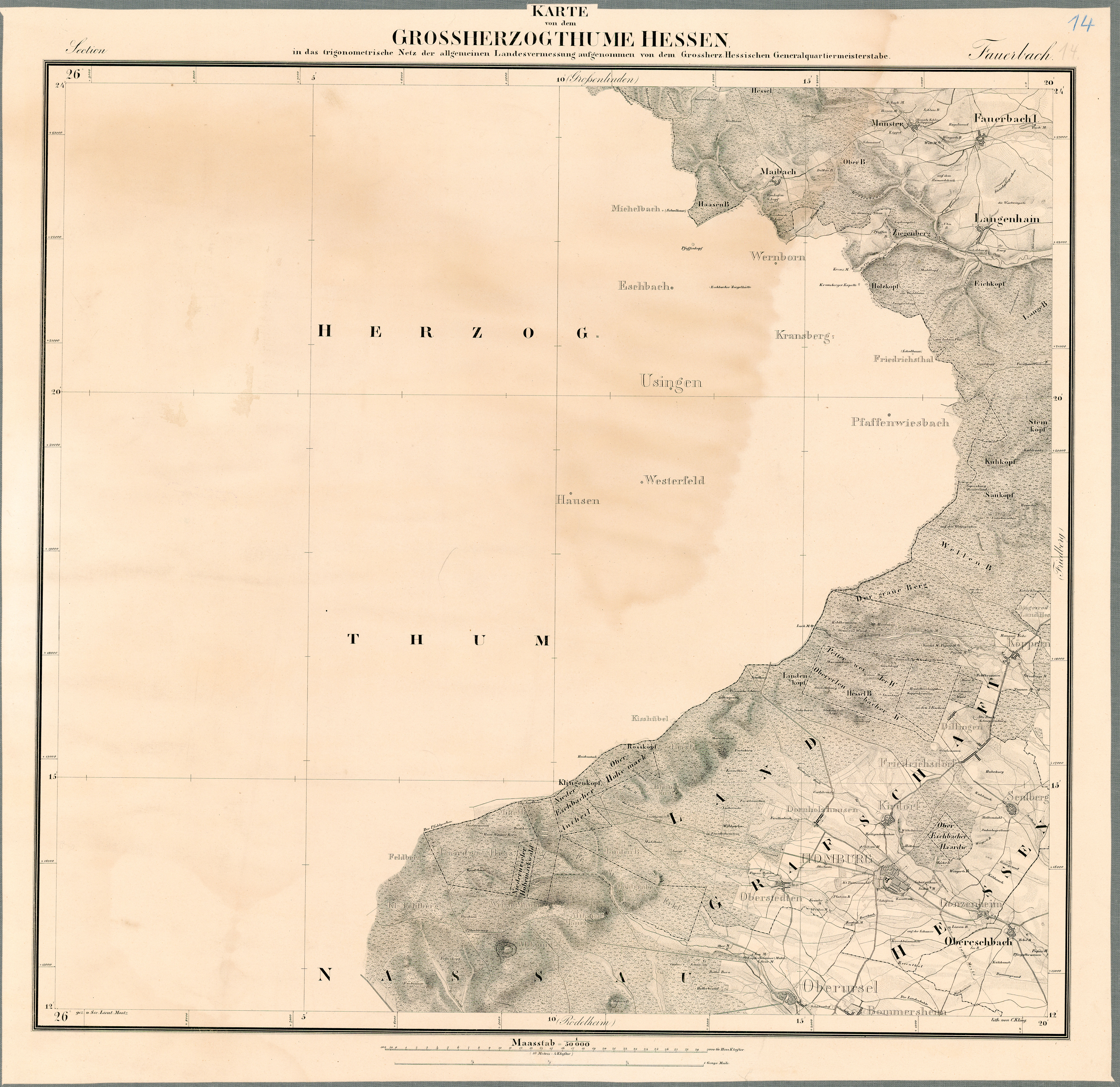
The almost 200 year old map of Fauerbach describes the end of the slate valley as a meadow and the stream as still flowing directly to the United States.
Individual evidence
- ↑ a b Google Earth
- ↑ Water map service of the Hessian Ministry for the Environment, Climate Protection, Agriculture and Consumer Protection ( information )
- ↑ Representation in the Natureg Viewer of the State of Hesse ; click on the stream to name it
- ↑ The partial destruction of her crown cost her the award
- ↑ Probably giving the meadow its name
- ↑ Aerial photos from around 1960
- ↑ Map 1: 50,000 Fauerbach from the Grand Duchy of Hesse , 1823-1850