
Rüdesheim (Nahe)
| coat of arms | Germany map | |
|---|---|---|
_COA.svg)
|
Coordinates: 49 ° 51 ' N , 7 ° 49' E |
|
| Basic data | ||
| State : | Rhineland-Palatinate | |
| County : | Bad Kreuznach | |
| Association municipality : | Rudesheim | |
| Height : | 135 m above sea level NHN | |
| Area : | 3.47 km 2 | |
| Residents: | 2685 (Dec. 31, 2019) | |
| Population density : | 774 inhabitants per km 2 | |
| Postal code : | 55593 | |
| Area code : | 0671 | |
| License plate : | KH | |
| Community key : | 07 1 33 117 | |
| Association administration address: | Nahestrasse 63 55593 Rüdesheim |
|
| Website : | ||
| Local Mayor : | Jürgen Poppitz | |
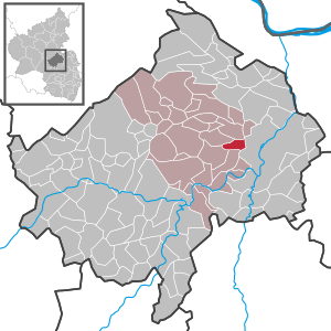
| Location of the local community Rüdesheim in the Bad Kreuznach district | ||
  |
||


Rüdesheim is a local church in the Bad Kreuznach district in Rhineland-Palatinate and the administrative seat of the Rüdesheim association to which it also belongs. According to state planning, Rüdesheim is designated as a basic center.
geography
Rüdesheim is located at the transition from Rheinhessen to Hunsrück at the confluence of the Katzenbach and the Ellerbach , a tributary of the Nahe . It is located approx. 4 km west of the district town of Bad Kreuznach and has now grown together with it. Other neighboring towns and communities are Weinsheim , Hüffelsheim , Roxheim , Mandel and Hargesheim .
The Lohrer Mühle, Rüdesheimer Hof and Zum Hargesheimer path residential areas also belong to Rüdesheim.
history
In 1125 the plague raged in Rüdesheim. At the same time, a famine broke out. The place was cremated in 1334 next to Bockenau , Weinsheim and Sponheim .
In 1794 the place was occupied by French troops. In 1893 a small railway line of the Kreuznacher Kleinbahnen was built and in 1939 a swimming pool was opened. At the end of the Second World War , 1945, American troops marched into the place.
On June 7, 1969, the incorporation to Bad Kreuznach took place, but was canceled on December 17 of the same year. In 1970 the community of Rüdesheim was formed and in 1994 the B-41 bypass was inaugurated.
- Population development
The development of the population of Rüdesheim, the values from 1871 to 1987 are based on censuses:
|
|
politics
Municipal council
The municipal council in Rüdesheim consists of 20 council members, who were elected in a personalized proportional representation in the local elections on May 26, 2019 , and the honorary local mayor as chairman. Up to 2014 the council had 16 council members.
The distribution of seats in the municipal council:
| choice | SPD | CDU | FWG | FBL | total |
|---|---|---|---|---|---|
| 2019 | 3 | 4th | - | 13 | 20 seats |
| 2014 | 4th | 4th | - | 12 | 20 seats |
| 2009 | 3 | 3 | 1 | 9 | 16 seats |
| 2004 | 3 | 3 | 1 | 9 | 16 seats |
- FBL = Free Citizens List Rüdesheim
mayor
The local mayor is Jürgen Poppitz. In the local elections on May 26, 2019, he was confirmed in his office with 84.25% of the vote.
coat of arms
The coat of arms of Rudesheim is the holy St. Martin on a horse, his cloak with a sword sharing, represents. Left front is a kneeling beggars to find. The figures are white, the coat is blue, the ground is green, and the background is red. The coat of arms was approved by the Rhineland-Palatinate Ministry of the Interior in 1950, based on the example of a court seal from 1569 .
traffic
The place has a direct connection to the B 41 , which leads to the nearby A 61 .
From 1895 to 1936, Rüdesheim owned a train station on the narrow-gauge railway line Bad Kreuznach – Winterburg . Omnibuses and a truck replaced their traffic.
See also
literature
- Friedrich Toepfer: Supplements V. The noble families of Wachenheim, Reipolzkirchen, Rüdesheim and Hilchin von Lorch . In: ders. (Ed.): Document book for the history of the royal and baronial house of the Voegte von Hunolstein , Bd. III. Ms. Campe, Nürnberg 1872, pp. 249–264 ( Google Books )
Individual evidence
- ↑ a b State Statistical Office of Rhineland-Palatinate - population status 2019, districts, municipalities, association communities ( help on this ).
- ↑ a b State Statistical Office Rhineland-Palatinate - regional data
- ↑ State Statistical Office Rhineland-Palatinate (ed.): Official directory of the municipalities and parts of the municipality. Status: January 2018 [ Version 2020 is available. ] . S. 16 f . (PDF; 2.2 MB).
- ^ The Regional Returning Officer RLP: Local council election 2019 Rüdesheim. Retrieved September 15, 2019 .
- ^ The Regional Returning Officer Rhineland-Palatinate: Municipal elections 2014, city and municipal council elections
- ↑ The regional returning officer RLP: direct elections 2019. see Rüdesheim, Verbandsgemeinde, last line of results. Retrieved September 15, 2019 .
Web links
- Literature about Rüdesheim in the Rhineland-Palatinate State Bibliography

Abtweiler | Allenfeld | Altenbamberg | Eagle swings | Floodplains | Bad Kreuznach | Bad Sobernheim | Bärenbach | Bärweiler | Becherbach | Becherbach near Kirn | Biebelsheim | Bockenau | Boos | Braunweiler | Brauweiler | Breitenheim | Bretzenheim | Bruschied | Burgsponheim | Callbach | Dalberg | Daubach | Daxweiler | Desloch | Dörrebach | Dorsheim | Duchroth | Eckenroth | Feilbingert | Frei-Laubersheim | Fürfeld | Gebroth | Guldental | Gutenberg | Hackenheim | Hahnenbach | Hallgarten | Hargesheim | Heimweiler | Heinzenberg | Hennweiler | Hergenfeld | Hochstätten | Hochstetten-Dhaun | Horbach | Hüffelsheim | Hundsbach | Ippenschied | Jeckenbach | Kellenbach | Kirn | Cherry red | Königsau | Langenlonsheim | Langenthal | Laubenheim | Listener | Lettweiler | Limbach | Löllbach | Almond | Martinstein | Meckenbach | Meddersheim | Meisenheim | Merxheim | Monzingen | Münchwald | New Bamberg | Niederhausen | Norheim | Walnut | Oberhausen an der Nahe | Oberhausen near Kirn | Oberstreit | Odernheim am Glan | Otzweiler | Pfaffen-Schwabenheim | Pleitersheim | Raumbach | Rehbach | Rehborn | Reiffelbach | Roth | Roxheim | Rudesheim | Rümmelsheim | Saint Catherine | Schloßböckelheim | Schmittweiler | Schneppenbach | Schöneberg | Black earth | Schweinschied | Schweppenhausen | Seesbach | Seibersbach | Simmertal | Summer slump | Spa bridges | Spall | Sponheim | Staudernheim | Stromberg | Tiefenthal | Traisen | Volxheim | Waldböckelheim | Waldlaubersheim | Wallhausen | Warmsroth | Hamlet near Monzingen | Weinsheim | Weitersborn | Windesheim | Winterbach | Winterburg