
Löllbach
| coat of arms | Germany map | |
|---|---|---|

|
Coordinates: 49 ° 41 ′ N , 7 ° 36 ′ E |
|
| Basic data | ||
| State : | Rhineland-Palatinate | |
| County : | Bad Kreuznach | |
| Association municipality : | Nahe-Glan | |
| Height : | 208 m above sea level NHN | |
| Area : | 4.94 km 2 | |
| Residents: | 201 (Dec. 31, 2019) | |
| Population density : | 41 inhabitants per km 2 | |
| Postal code : | 67744 | |
| Area code : | 06753 | |
| License plate : | KH | |
| Community key : | 07 1 33 060 | |
| Association administration address: | Obertor 13 55590 Meisenheim, Germany |
|
| Website : | ||
| Local Mayor : | Thomas Helfenstein | |
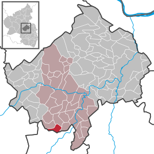
| Location of the local community Löllbach in the Bad Kreuznach district | ||
  |
||

Löllbach is a municipality in the Bad Kreuznach district in Rhineland-Palatinate . It belongs to the community of Nahe-Glan .
geography
The place is a typical clustered village and is located between Lauterecken and Meisenheim away from the major traffic routes in the North Palatinate Bergland at a height of about 200 meters.
The Alte Ölmühle and Altheckmühle residential areas also belong to Löllbach .
history
Finds near the place show a settlement since the Stone Age. In the Striedter Forest there is a “megalithic grave” from the Bronze Age. At the time of the Roman conquest, the Celtic-Germanic Treveri lived here. A stone of the four gods , which was found on Lochwiese in 1872, dates from Roman times . During the migration period, the area became part of the Franconian Empire and belonged to the Nahegau . Löllbach was first mentioned in 1319 as Leubilbach and belonged to the high court Sien on the Heide and to the official school building Sien-Löllbach within the territory of the Wildgrafen , then the Rheingrafen , through which Löllbach came to the Salm-Kyrburg line of the Salm family . In 1698 there were 18 households in the village; in the Thirty Years War and the wars with France in the 18th century the area multiple looting and destruction was suspended.
Due to the occupation of the area on the left bank of the Rhine (1794) in the First Coalition War and the occupation of the region triggered by the Peace of Campo Formio (1797) , Löllbach belonged to the French Republic from 1798 and was subordinated to the canton of Meisenheim in the Birkenfeld arrondissement in the Saardepartement . Through the Congress of Vienna (1815) the canton came to Hessen-Homburg as Oberamt Meisenheim . In 1866 the principality was inherited by the Grand Duchy of Hesse , which in the same year had to cede the Meisenheim exclave to Prussia after its defeat .
After the Second World War , the municipality of Löllbach within the French occupation zone became part of the Koblenz administrative district in the then newly formed state of Rhineland-Palatinate .
- Population development
The development of the population of Löllbach, the values from 1871 to 1987 are based on censuses:
|
|
politics
Municipal council
The local council in Löllbach consists of six council members, who were elected by a majority vote in the local elections on May 26, 2019 , and the honorary local mayor as chairman.
mayor
Acting local mayor is Thomas Helfenstein, who was last elected in the local elections in 2019 with 83 percent of the vote.
coat of arms
|
|
Blazon : "Divided by a wave cut obliquely to the left, above in gold a growing red lion, below in red a white mark in the form of a shaft with rear strut for the top of the head, all with circular ends." |
| Justification of the coat of arms: The lion refers to the former membership of the Wildgraves . |
Culture and sights
The Protestant church of the place contains building remains from the 12th or 13th century; the nave dates from around 1500. The church organ is a work by the Stumm house .
See also: List of cultural monuments in Löllbach
In Löllbach there is the "Perlbach" riding club, the Löllbach Fire Brigade Association and the Löllbach Community Association.
Economy and Infrastructure
The economy of the place is characterized by several small craft businesses. Part of the population commutes to work in the next larger towns such as Meisenheim.
Löllbach is on the state road 373 Meisenheim – Jeckenbach – Löllbach – Kappeln – Merzweiler. There is a bus connection to Meisenheim and Kirn .
Web links
- Löllbach on the website of the community of Nahe-Glan
- Literature about Löllbach in the Rhineland-Palatinate state bibliography
Individual evidence
- ↑ a b State Statistical Office of Rhineland-Palatinate - population status 2019, districts, municipalities, association communities ( help on this ).
- ↑ State Statistical Office Rhineland-Palatinate (ed.): Official directory of the municipalities and parts of the municipality. Status: January 2019 [ Version 2020 is available. ] . S. 23 (PDF; 3 MB).
- ↑ State Statistical Office Rhineland-Palatinate: My village, my city. Retrieved April 21, 2020 .
- ^ The Regional Returning Officer RLP: Local council election 2019 Löllbach. Retrieved September 27, 2019 .
- ↑ The Regional Returning Officer RLP: Direct elections 2019. Accessed on September 27, 2019 (see Meisenheim, Verbandsgemeinde, ninth line of results).

Abtweiler | Allenfeld | Altenbamberg | Eagle swings | Floodplains | Bad Kreuznach | Bad Sobernheim | Bärenbach | Bärweiler | Becherbach | Becherbach near Kirn | Biebelsheim | Bockenau | Boos | Braunweiler | Brauweiler | Breitenheim | Bretzenheim | Bruschied | Burgsponheim | Callbach | Dalberg | Daubach | Daxweiler | Desloch | Dörrebach | Dorsheim | Duchroth | Eckenroth | Feilbingert | Frei-Laubersheim | Fürfeld | Gebroth | Guldental | Gutenberg | Hackenheim | Hahnenbach | Hallgarten | Hargesheim | Heimweiler | Heinzenberg | Hennweiler | Hergenfeld | Hochstätten | Hochstetten-Dhaun | Horbach | Hüffelsheim | Hundsbach | Ippenschied | Jeckenbach | Kellenbach | Kirn | Cherry red | Königsau | Langenlonsheim | Langenthal | Laubenheim | Listener | Lettweiler | Limbach | Löllbach | Almond | Martinstein | Meckenbach | Meddersheim | Meisenheim | Merxheim | Monzingen | Münchwald | New Bamberg | Niederhausen | Norheim | Walnut | Oberhausen an der Nahe | Oberhausen near Kirn | Oberstreit | Odernheim am Glan | Otzweiler | Pfaffen-Schwabenheim | Pleitersheim | Raumbach | Rehbach | Rehborn | Reiffelbach | Roth | Roxheim | Rudesheim | Rümmelsheim | Saint Catherine | Schloßböckelheim | Schmittweiler | Schneppenbach | Schöneberg | Black earth | Schweinschied | Schweppenhausen | Seesbach | Seibersbach | Simmertal | Summer slump | Spa bridges | Spall | Sponheim | Staudernheim | Stromberg | Tiefenthal | Traisen | Volxheim | Waldböckelheim | Waldlaubersheim | Wallhausen | Warmsroth | Hamlet near Monzingen | Weinsheim | Weitersborn | Windesheim | Winterbach | Winterburg