
Summer slump (near Bad Kreuznach)
| coat of arms | Germany map | |
|---|---|---|

|
Coordinates: 49 ° 53 ' N , 7 ° 46' E |
|
| Basic data | ||
| State : | Rhineland-Palatinate | |
| County : | Bad Kreuznach | |
| Association municipality : | Rudesheim | |
| Height : | 246 m above sea level NHN | |
| Area : | 2.53 km 2 | |
| Residents: | 396 (Dec. 31, 2019) | |
| Population density : | 157 inhabitants per km 2 | |
| Postal code : | 55595 | |
| Area code : | 06706 | |
| License plate : | KH | |
| Community key : | 07 1 33 098 | |
| Association administration address: | Nahestrasse 63 55593 Rüdesheim |
|
| Website : | ||
| Local Mayor : | Thomas Hasslinger | |
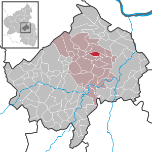
| Location of the local community Sommerloch in the Bad Kreuznach district | ||
  |
||


Sommerloch is a municipality in the Bad Kreuznach district in Rhineland-Palatinate . It belongs to the Verbandsgemeinde Rüdesheim .
geography
Sommerloch is located northwest of Bad Kreuznach near the Nahe valley , on the edge of the Soonwald amidst vineyards. Seven winegrowers grow vines on around 100 hectares .
The center of the village is the branch church of St. Giles from 1789. Neighboring communities are Sankt Katharinen , Braunweiler and Wallhausen .
To silly season also includes the living space house Schünemann.
history
The oldest surviving mention, as Sumerlachen in an inventory of the monastery Rupertsberg near Bingen , dates from 1158. The name originally referred to a damp hollow. Therefore, the place has nothing to do with a hole of summer , even though it was visited by media representatives during the summer pickle time due to its name. The oldest written evidence of viticulture in the region also comes from Sommerloch : A list of goods from the Lords of Weyerbach names a wingert in Summerlachen .
The place belonged to the Dalberg lordship . This was initially held by the noble von Weyerbach family as a fiefdom of the Bishop of Speyer . The family died out in the 14th century and was inherited by the family of the Chamberlain von Worms , later von Dalberg . In 1390 or 1400 the Dalberg lordship was finally in the possession of the new masters. In 1478 there was an exchange of territory between the treasurers of Worms called von Dalberg and the neighboring Count of Zweibrücken-Bitsch , during which the summer slump fell to the latter. However, the Dalbergers regained the village in 1492 as a fief of Zweibrücken-Bitsch and it belonged to the Dalbergers almost until the end of the old empire . It was not until 1784 that they pawned it for 36,000 guilders , which led to considerable but useless protests from the population.
- Population development
The development of the population of the community of Sommerloch, the values from 1871 to 1987 are based on censuses:
|
|
politics
Municipal council
The local council in the silly season consists of eight council members, who in the local elections on May 26, 2019 in a majority vote were elected, and the honorary mayor as chairman.
mayor
Local mayor is Thomas Haßlinger. In the local elections on May 26, 2019, he was confirmed in his office with 61.22% of the vote.
Economy and Infrastructure
The federal highway 41 runs in the south . In Bad Kreuznach there is a train station on the Bingen – Saarbrücken line .
See also
literature
- Eric Beres: The treasurers of Worms and their importance for the region around Wallhausen and Dalberg . In: Kurt Andermann (Hrsg.): Ritteradel in the Old Kingdom. Die Kämmerer von Worms called von Dalberg (= Hessische Historische Kommission [Hrsg.]: Work of the Hessische Historischenommission NF . Volume 31 ). Darmstadt 2009, ISBN 978-3-88443-054-5 , pp. 137-154 .
- K. Eckes: On the history of the village of Sommerloch and its church . In: 200 years of St. Giles. Summer slump from 1789 to 1989 . Sommerloch 1989, pp. 9-36.
- 200 years of St. Agidius summer hole. 1789-1989 . o. O. 1989
Web links
- Literature about summer slump in the Rhineland-Palatinate state bibliography
Individual evidence
- ↑ State Statistical Office of Rhineland-Palatinate - population status 2019, districts, communities, association communities ( help on this ).
- ↑ State Statistical Office Rhineland-Palatinate (ed.): Official directory of the municipalities and parts of the municipality. Status: January 2018 [ Version 2020 is available. ] . S. 16 (PDF; 2.2 MB).
- ↑ taz of August 8, 1995 and July 21, 2001
- ↑ Beres: The Chamberlain of Worms , p. 139.
- ↑ Beres: The Chamberlain of Worms , p. 138.
- ↑ Beres: The Chamberlain , pp. 137f.
- ↑ Beres: The Chamberlain , p. 137.
- ↑ Beres: The Chamberlain , p. 139.
- ↑ Beres: Die Kammerer , pp. 141f.
- ↑ Beres: The Chamberlain , p. 150.
- ↑ State Statistical Office Rhineland-Palatinate - regional data
- ^ The Regional Returning Officer RLP: Local council election 2019 summer slump. Retrieved September 16, 2019 .
- ^ The regional returning officer RLP: direct elections 2019. see Rüdesheim, Verbandsgemeinde, 23rd line of results. Retrieved September 16, 2019 .

Abtweiler | Allenfeld | Altenbamberg | Eagle swings | Floodplains | Bad Kreuznach | Bad Sobernheim | Bärenbach | Bärweiler | Becherbach | Becherbach near Kirn | Biebelsheim | Bockenau | Boos | Braunweiler | Brauweiler | Breitenheim | Bretzenheim | Bruschied | Burgsponheim | Callbach | Dalberg | Daubach | Daxweiler | Desloch | Dörrebach | Dorsheim | Duchroth | Eckenroth | Feilbingert | Frei-Laubersheim | Fürfeld | Gebroth | Guldental | Gutenberg | Hackenheim | Hahnenbach | Hallgarten | Hargesheim | Heimweiler | Heinzenberg | Hennweiler | Hergenfeld | Hochstätten | Hochstetten-Dhaun | Horbach | Hüffelsheim | Hundsbach | Ippenschied | Jeckenbach | Kellenbach | Kirn | Cherry red | Königsau | Langenlonsheim | Langenthal | Laubenheim | Listener | Lettweiler | Limbach | Löllbach | Almond | Martinstein | Meckenbach | Meddersheim | Meisenheim | Merxheim | Monzingen | Münchwald | New Bamberg | Niederhausen | Norheim | Walnut | Oberhausen an der Nahe | Oberhausen near Kirn | Oberstreit | Odernheim am Glan | Otzweiler | Pfaffen-Schwabenheim | Pleitersheim | Raumbach | Rehbach | Rehborn | Reiffelbach | Roth | Roxheim | Rudesheim | Rümmelsheim | Saint Catherine | Schloßböckelheim | Schmittweiler | Schneppenbach | Schöneberg | Black earth | Schweinschied | Schweppenhausen | Seesbach | Seibersbach | Simmertal | Summer slump | Spa bridges | Spall | Sponheim | Staudernheim | Stromberg | Tiefenthal | Traisen | Volxheim | Waldböckelheim | Waldlaubersheim | Wallhausen | Warmsroth | Hamlet near Monzingen | Weinsheim | Weitersborn | Windesheim | Winterbach | Winterburg