Caan
| coat of arms | Germany map | |
|---|---|---|

|
Coordinates: 50 ° 28 ' N , 7 ° 37' E |
|
| Basic data | ||
| State : | Rhineland-Palatinate | |
| County : | Westerwaldkreis | |
| Association municipality : | Ransbach-Baumbach | |
| Height : | 297 m above sea level NHN | |
| Area : | 3.44 km 2 | |
| Residents: | 705 (Dec. 31, 2019) | |
| Population density : | 205 inhabitants per km 2 | |
| Postal code : | 56237 | |
| Area code : | 02601 | |
| License plate : | WW | |
| Community key : | 07 1 43 007 | |
| LOCODE : | DE CAJ | |
| Association administration address: | Rheinstrasse 50 56235 Ransbach-Baumbach |
|
| Website : | ||
| Local Mayor : | Roland Lorenz | |
| Location of the local community Caan in the Westerwaldkreis | ||
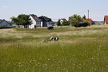
Caan is a municipality in the Westerwaldkreis in Rhineland-Palatinate . It belongs to the Ransbach-Baumbach community .
Geographical location
The community is located in the Westerwald between Koblenz and Siegen on the edge of the Kannenbäckerland .
history
The village was first mentioned in 1250.
Until it was renamed on January 1, 1975, Caan had the addition of "(Unterwesterwaldkreis)".
- Population development
The development of the population of the municipality of Caan, the values from 1871 to 1987 are based on censuses:
|
|
politics
Municipal council
The council in Caan consists of twelve council members, who in the local elections on May 26, 2019 in a majority vote were elected, and the honorary mayor as chairman.
mayor
In the direct election on May 26, 2019, Roland Lorenz was confirmed in office for another five years with 68.84 percent of the votes cast.
coat of arms
| Blazon : "Divided by a blue wavy bar, above three red eagles in gold, below a red jug in silver flanked by two red acorns." | |
Economy and Infrastructure
traffic
- The B 413 runs west of the community and runs from Koblenz to Hachenburg .
- The A 48 with the Höhr-Grenzhausen junction (AS 12) is eight kilometers away.
- The closest ICE stop is Montabaur train station on the Cologne – Rhein / Main high-speed line .
Attractions
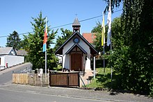
- Marienkapelle , chapel in the town center
- Caaner Switzerland , hiking route along the Caanwiesenbach to the Sayntal
- see also: List of natural monuments in Caan
Web links
Individual evidence
- ↑ a b State Statistical Office of Rhineland-Palatinate - population status 2019, districts, municipalities, association communities ( help on this ).
- ↑ Official municipality directory (= State Statistical Office of Rhineland-Palatinate [Hrsg.]: Statistical volumes . Volume 407 ). Bad Ems February 2016, p. 186 (PDF; 2.8 MB).
- ↑ State Statistical Office Rhineland-Palatinate - regional data
- ^ The Regional Returning Officer Rhineland-Palatinate: Local elections 2019, city and municipal council elections
- ^ The Regional Returning Officer Rhineland-Palatinate: Local elections 2019, direct elections


