Oberroßbach
| coat of arms | Germany map | |
|---|---|---|

|
Coordinates: 50 ° 39 ′ N , 8 ° 2 ′ E |
|
| Basic data | ||
| State : | Rhineland-Palatinate | |
| County : | Westerwaldkreis | |
| Association municipality : | Rennerod | |
| Height : | 528 m above sea level NHN | |
| Area : | 2.81 km 2 | |
| Residents: | 351 (Dec. 31, 2019) | |
| Population density : | 125 inhabitants per km 2 | |
| Postal code : | 56479 | |
| Area code : | 02667 | |
| License plate : | WW | |
| Community key : | 07 1 43 283 | |
| Association administration address: | Hauptstrasse 55 56477 Rennerod |
|
| Website : | ||
| Local Mayor : | Gerhard Semmelrogge | |
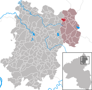
| Location of the local community Oberroßbach in the Westerwaldkreis | ||
Oberroßbach is a municipality in the Westerwaldkreis in Rhineland-Palatinate . It belongs to the Verbandsgemeinde Rennerod .
geography
location
The community is located in the High Westerwald between Siegen and Limburg an der Lahn . The village stream flows through the village . The actual Roßbach flows near the village and thus at the original settlement of the Oberroßbachers .
The highest point of the place is the 581 meter high Warth.
Land use
The area of Oberroßbach covers 2.81 km² . 51.1 percent of this is used for agriculture . 22.2 percent consist of forest . 21.7 percent are built-up settlement and traffic areas. The water surface in Oberroßbach is only 1.2 percent. (As of December 31, 2017)
Neighboring communities
Oberroßbach borders on Fehl-Ritzhausen , Zehnhausen , Niederroßbach , Hof and Salzburg . There is no direct and passable road to Fehl-Ritzhausen.
history
Oberroßbach was first mentioned in 1440 as Obern Rospach . The place was probably part of the parish Emmerichenhain since the late Middle Ages and with this the rulership of the Westerwald . A branch of the parish school existed by 1810 at the latest.
For the first time in 1534 a total number of residents, probably to be understood as heads of families, is given as nine. In 1569 14 houses are mentioned, in 1607 eight men, in 1660 34 inhabitants. In 1711 there were 15 families in Oberroßbach, in 1750 there were 104 inhabitants and in 1807 175.
- Population development
The development of the population of Oberroßbach, the values from 1871 to 1987 are based on censuses:
|
|
politics
Municipal council
The council in Oberroßbach consists of eight council members, who in the local elections on May 26, 2019 in a majority vote were elected, and the honorary mayor as chairman.
mayor
Local mayor is Gerhard Semmelrogge. In February 2012 he took over the office of Hans-Jürgen Kramer, who had been the local mayor of Oberroßbach since 1988. In the local elections in May 2014 he was re-elected with 98.2 percent and in May 2019 with 94.01 percent of the votes cast.
coat of arms
The talking coat of arms shows a blue sloping blue strip in gold, at the bottom five basalt columns rising from the edge of the shield and rising to the right, at the top a red jumping horse. The blue band marks the Roßbach, the pillars document the earlier significant mining of columnar basalt.
Culture and sights
Cultural monuments
see list of cultural monuments in Obererbach (near Montabaur)
Regular events
The clubs offer regular events. Every year there are festivals, including the slaughter festival, the annual airfield festival and the newly introduced Oktoberfest .
traffic
- The B 54 runs east of the municipality and leads from Limburg an der Lahn to Siegen .
- The next motorway junction is Haiger / Burbach on the A 45 Dortmund - Aschaffenburg , about 15 kilometers away.
- The closest ICE stop is Montabaur train station on the Cologne – Rhein / Main high-speed line .
literature
- Hellmuth Gensicke : Parish and court of Emmerichenhain . In: Association for Nassau antiquity and historical research (Hrsg.): Nassauische Annalen . tape 101 . Publishing house of the Association for Nassau Antiquities and Historical Research, Wiesbaden 1990, p. 231-254 .
Web links
Individual evidence
- ↑ State Statistical Office of Rhineland-Palatinate - population status 2019, districts, communities, association communities ( help on this ).
- ^ A b State Statistical Office Rhineland-Palatinate: My village, my city. Retrieved July 3, 2019 .
- ^ The Regional Returning Officer Rhineland-Palatinate: Local elections 2019, city and municipal council elections
- ↑ The Regional Returning Officer for Rhineland-Palatinate: direct elections for local and city mayors in 2019


