Luckenbach
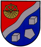
| coat of arms | Germany map | |
|---|---|---|

|
Coordinates: 50 ° 42 ' N , 7 ° 50' E |
|
| Basic data | ||
| State : | Rhineland-Palatinate | |
| County : | Westerwaldkreis | |
| Association municipality : | Hachenburg | |
| Height : | 290 m above sea level NHN | |
| Area : | 3.61 km 2 | |
| Residents: | 656 (Dec. 31, 2019) | |
| Population density : | 182 inhabitants per km 2 | |
| Postal code : | 57629 | |
| Area code : | 02662 | |
| License plate : | WW | |
| Community key : | 07 1 43 260 | |
| LOCODE : | DE LUC | |
| Association administration address: | Gartenstrasse 11 57627 Hachenburg |
|
| Website : | ||
| Local Mayor : | Dieter Bethke | |
| Location of the local community Luckenbach in the Westerwaldkreis | ||
Luckenbach is a municipality in the Westerwaldkreis in Rhineland-Palatinate . It belongs to the Hachenburg community .
geography
The place is between Hachenburg and Betzdorf in the valley of the Kleine Nister . Malberg is in the north- west of the village , Rosenheim in the north-east, Nauroth in the east, Atzelgift in the south and Limbach in the west . The Luckenbacher Ley residential area also belongs to Luckenbach.
history
Luckenbach was first mentioned in a document in 1366 when Johann and Albert von Gebhardshain received a piece of land from the Marienstatt Abbey . Luckenbach had nineteen houses in 1579 and twenty in 1793. Notable buildings have not been preserved; In 1950 the Gustav Adolf Chapel of the Kroppach parish was built. A mill, first mentioned in 1414, was located near the village. It can no longer be determined with certainty whether this was the mill location at the chapel, which is still known today, or whether it is more recent. An iron ore mine is guaranteed in the district of Katzenbruch in 1685.
- Population development
The development of the population of Luckenbach, the values from 1871 to 1987 are based on censuses:
|
|
|
politics
Municipal council
The municipal council in Luckenbach consists of twelve council members, who were elected by a majority vote in the local elections on May 26, 2019 , and the honorary local mayor as chairman.
mayor
Dieter Bethke became mayor of Luckenbach in November 2019. The election was made by the local council, as in the direct election on May 26, 2019, the originally only applicant did not achieve a sufficient majority.
Bethke's predecessor Karl-Heinz Kaiser did not run again in 2019 after having held the office for 20 years.
Attractions
There is an old boundary stone with the inscription HN / KP 25 in the district 250 meters northwest of measuring point 390.4 on the Nauberg site ; the Duchy of Nassau and the Kingdom of Prussia bordered here from 1815 when the County of Sayn-Altenkirchen came to Prussia. On one side it bears the inscription KP / GNRH / Nr. 25 , which means Kingdom of Prussia, district Nauroth, stone no. 25 , and on the opposite side the sign HN / GLKH / no. 25 , which means Duchy of Nassau, district Luckenbach, No. 25 . The annexation of Nassau by Prussia in 1866 made this boundary stone meaningless.
Natural monuments
700 m southwest of the village are five old oaks , some of which are already 200 years old ( natural monument ).
traffic
The federal highway 414 runs south of the village and leads from Hohenroth to Hachenburg . The next motorway junctions are in Siegen , Wilnsdorf or Herborn on the federal motorway 45 ( Dortmund - Gießen ), about 25 kilometers away. The station Luckenbach was due to a branch of the railway line Scheuerfeld-Emmerzhausen . The closest ICE stop is Montabaur train station on the Cologne – Rhein / Main high-speed line .
literature
- Hellmuth Gensicke : The parish of Kroppach. In: Nassauische Annalen 83. 1972, pp. 209-231.
Web links
- Internet presence of the local community Luckenbach
- Local community Luckenbach on the website of the Verbandsgemeinde Hachenburg
Individual evidence
- ↑ a b State Statistical Office of Rhineland-Palatinate - population status 2019, districts, municipalities, association communities ( help on this ).
- ↑ State Statistical Office Rhineland-Palatinate (ed.): Official directory of the municipalities and parts of the municipality. Status: January 2019 [ Version 2020 is available. ] . S. 74 (PDF; 3 MB).
- ↑ State Statistical Office Rhineland-Palatinate: My village, my city. Retrieved April 18, 2020 .
- ^ The Regional Returning Officer Rhineland-Palatinate: Local elections 2019, city and municipal council elections.
- ↑ a b Nadja Hoffmann-Heidrich: After 20 years as local chief: Kaiser says bye in Luckenbach. Westerwälder Zeitung, March 11, 2020, accessed on June 7, 2020 .
- ^ The Regional Returning Officer Rhineland-Palatinate: direct elections 2019. see Hachenburg, Verbandsgemeinde, 19th line of results. Retrieved June 7, 2020 .
- ^ Walter Kwasnik, Dieter Trautmann: Natural and cultural-historical monuments in the Westerwald: Kroppacher Switzerland and Hachenburg . Ed .: Westerwald Landscape Museum, Hachenburg (= Westerwald contributions . Volume 1 ). Montabaur 1981, ISBN 3-921548-07-1 , p. 68 .


