Heimborn
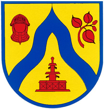
| coat of arms | Germany map | |
|---|---|---|

|
Coordinates: 50 ° 43 ' N , 7 ° 45' E |
|
| Basic data | ||
| State : | Rhineland-Palatinate | |
| County : | Westerwaldkreis | |
| Association municipality : | Hachenburg | |
| Height : | 220 m above sea level NHN | |
| Area : | 3.74 km 2 | |
| Residents: | 259 (Dec. 31, 2019) | |
| Population density : | 69 inhabitants per km 2 | |
| Postal code : | 57629 | |
| Area code : | 02688 | |
| License plate : | WW | |
| Community key : | 07 1 43 236 | |
| Community structure: | 3 districts | |
| Association administration address: | Gartenstrasse 11 57627 Hachenburg |
|
| Website : | ||
| Mayoress : | Katja Kruger | |
| Location of the local community Heimborn in the Westerwaldkreis | ||
Heimborn is a municipality in the Westerwaldkreis in Rhineland-Palatinate . The agriculturally structured residential community Heimborn belongs to the Verbandsgemeinde Hachenburg .
geography
The 220 m high community is located in the Westerwald between Limburg and Siegen , at the confluence of the Great and Small Nister rivers in the middle of Kroppacher Switzerland . The neighboring towns are Stein-Wingert in the north-west, Mörsbach and Kundert in the north-east and Heuzert and Kroppach in the south and south-west of the place.
Districts are Heimborn, Ehrlich and Lützelau. The Auenhof and Lützelauermühle residential areas also belong to Heimborn .
history
In 1346 the main town Heimborn was first mentioned in a document . The name of the place was possibly a spring well, because in 1455 it was still called "unterm Heymborn". In 1579 Heimborn had three houses and in 1793 their 13th. In 1837 an iron and steel works was to be built on the Nister . At the beginning of the 20th century there were also plans for a dam with a dam near Heimborn.
The village of Heimborn with the hamlet Ehrlich belonged to the parish of Kroppach and until the middle of the 17th century it belonged to the county of Sayn . After the introduction of the Reformation in the county of Sayn, the inhabitants were first Lutheran and later reformed. After the division of the County of Sayn in the 17th century, Heimborn was part of the County of Sayn-Hachenburg . In 1799 the county was inherited by the princes of Nassau-Weilburg . In connection with the formation of the Rhine Confederation , the region and with it Heimborn came to the newly established Duchy of Nassau in 1806 . Under the Nassau administration, Heimborn was assigned to the Hachenburg office. After the annexation of the Duchy of Nassau, the place came to the Kingdom of Prussia in 1866 and from 1868 belonged to the province of Hessen-Nassau and the Oberwesterwaldkreis . Heimborn has been part of the state of Rhineland-Palatinate since 1946 .
Ehrlich district
Like Heimborn, the small district of Ehrlich was first mentioned in 1346. The name comes from alder bushes ( place where alders grow ). A roof slate pit near Ehrlich has been handed down for 1685, another source mentions a slate mine from 1804 to 1818. Ehrlich had three houses each in 1579 and 1793.
Lützelau farm
In a westerly direction 250 meters northwest of the Lützelauer Mühle on the Hohlwiese is the former Hofgut Lützelau, a small moated castle with a farmyard. The lords of Lützelau appeared in documents as early as 1270. They belong to the relatives of the von Nister family. Later, the Lützelau farm belonged to the von Bicken , von Neuhoff, known as Ley , from Irmtraut , from Heddesdorf and from Holdinghausen. In the 18th century the court passed into the possession of the chancellery director Grün von Hachenburg, and in 1755 it was bought by the burgraves of Kirchberg , who resided in Hachenburg and later leased it.
The inner courtyard was surrounded by the house pond and in the direction of the Lützelauer Mühle there was a pleasure garden . The building was sold for demolition in 1826. During meadow improvement work at the end of the 19th century, the building ruins were razed to the ground. Only a few retaining walls can be seen on the Kleine Nister. In addition, some fragments from the 15th century were found.
Hof Heidenthal and Heidenmühlchen
300 meters northwest of Heimborn, on the bridge over the Nister, was a farm that was first mentioned in 1579. The farm often changed hands, it belonged to von Irmtraut, von Heddesdorf and von Holdinghausen. He then came with Hof Lützelau to the Grün family and in 1755 to the County of Sayn-Hachenburg . The courtyard house was sold in 1761, the land was sold in 1782. Today the field names "Hinter dem Heidenthal" and "Heidenheck" still remember the farm.
In the 18th century, the Heidenmühlchen building, which stood near the Heidenthal farm, was demolished and rebuilt in Heimborn. When the through-town was rebuilt, the building was finally removed; an oak spiral staircase came into the Kommern open-air museum . The Mühlengraben is still visible to some extent, it is reminiscent of the mill addition nor the Flurname "The uppermost and lowermost Mühlengraben".
Lützelauer mill
When a Vickers Wellington bomber crashed near Flögert (part of Helmeroth ) on May 30, 1943, the crew was able to save themselves by parachute . One of the soldiers landed injured between Heimborn and Lützelauer Mühle. Sergeant Joseph Sylvester was brought to his house and looked after by the then miller August Taxacher.
Population development
The development of the population of Heimborn, the values from 1871 to 1987 are based on censuses:
|
|
politics
Municipal council
The council in Heimborn consists of six council members, who in the local elections on May 26, 2019 in a majority vote were elected, and the honorary mayor as chairman.
mayor
Local Mayor Katja Krüger was confirmed in her office for another five years in the direct election on May 26, 2019 with a share of 73.08% of the votes.
traffic
The federal highway 414 runs south of the village and leads from Hohenroth to Hachenburg . The next motorway junctions are in Siegen , Wilnsdorf or Herborn on the A 45 Dortmund - Gießen , about 25 kilometers away. The closest ICE stop is Montabaur train station on the Cologne – Rhein / Main high-speed line .
Culture and sights
There are some well-preserved and partly renovated half-timbered houses in the village . The Lützelauer Mühle was built around 1575 by the von Holdinghausen family. In 1756 the building was expanded again and in 1834 an oil mill was built next to it. The mill belonged to the former Lützelau farm . As a grinding mill, it is no longer in operation today, but the hydropower is used to generate electricity. A Weymouth pine stands by the mill (1850, natural monument ). Other natural monuments are the thick oak ( pedunculate oak ) 800 meters northeast of Heimborn with a circumference of around five meters, it is said to be around 300 to 400 years old. Another, approx. 400 year old oak is located 400 meters northeast of the village on the old Kroppach-Heimborn-Mörsbach road.
literature
- Jens Friedhoff : Lützelau Castle near Hachenburg. A noble seat of the von Bicken and von Holdinghausen families in the Westerwald. In: Siegerland 85. 2008, pp. 3–16.
- Hellmuth Gensicke : The parish of Kroppach. In: Nassauische Annalen 83. 1972, pp. 209-231.
- Ralph Meutsch: 650 years of Heimborn-Ehrlich. Heimborn-Ehrlich 1996.
- Dieter Trautmann: The field names of the Heimborn district. In: Von Land und Menschen at the Nister 36. 2010, pp. 1–31.
Web links
Individual evidence
- ↑ State Statistical Office of Rhineland-Palatinate - population status 2019, districts, communities, association communities ( help on this ).
- ↑ State Statistical Office Rhineland-Palatinate (ed.): Official directory of the municipalities and parts of the municipality. Status: January 2019 [ Version 2020 is available. ] . S. 73 (PDF; 3 MB).
- ↑ a b c d e Landscape Museum Westerwald Hachenburg (ed.): Westerwälder contributions 1. 1981, p. 47 ff.
- ^ Daniel Schneider: The development of denominations in the county of Sayn in the ground plan, in: Heimat-Jahrbuch des Kreis Altenkirchen 58 (2015), pp. 74-80.
- ↑ For the historical development of the mills in the County of Sayn see Daniel Schneider: Das Mühlengewerbe in der Grafschaft Sayn-Altenkirchen , in: Heimat-Jahrbuch des Kreis Altenkirchen 59 (2016), pp. 219-237.
- ↑ Oliver Greifendorf: Westerwald theater of war. ISBN 3-938208-05-8 .
- ↑ State Statistical Office Rhineland-Palatinate: My village, my city - Heimborn
- ^ The Regional Returning Officer Rhineland-Palatinate: Local elections 2019, city and municipal council elections
- ^ The Regional Returning Officer of Rhineland-Palatinate: direct elections 2019. see Hachenburg, Verbandsgemeinde, eleventh line of results. Retrieved June 6, 2020 .
- ↑ WW-Kurier: The Westerwaldkreis has voted. MVV Medienverlag Westerwald-Sieg UG & Co. KG, Wissen, May 25, 2014, accessed on June 6, 2020 .
- ↑ For the historical development of the mills in the County of Sayn see Daniel Schneider: Das Mühlengewerbe in der Grafschaft Sayn-Altenkirchen , in: Heimat-Jahrbuch des Kreis Altenkirchen 59 (2016), pp. 219-237.


