Wolferlingen
| coat of arms | Germany map | |
|---|---|---|

|
Coordinates: 50 ° 34 ' N , 7 ° 51' E |
|
| Basic data | ||
| State : | Rhineland-Palatinate | |
| County : | Westerwaldkreis | |
| Association municipality : | Selters (Westerwald) | |
| Height : | 400 m above sea level NHN | |
| Area : | 8.24 km 2 | |
| Residents: | 488 (Dec. 31, 2019) | |
| Population density : | 59 inhabitants per km 2 | |
| Postal code : | 56244 | |
| Area code : | 02666 | |
| License plate : | WW | |
| Community key : | 07 1 43 085 | |
| Community structure: | 2 districts | |
| Association administration address: | Am Saynbach 5–7 56242 Selters (Westerwald) |
|
| Website : | ||
| Local Mayor : | Christoph Simon | |
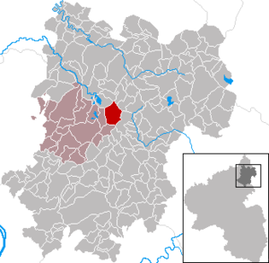
| Location of the local community of Wölferlingen in the Westerwaldkreis | ||
Wölferlingen (dialect: Wälferlinge ) is a municipality in the Westerwaldkreis in Rhineland-Palatinate . It belongs to the community of Selters (Westerwald) . Wölferlingen is a state-approved resort .
geography
Geographical location
Wölferlingen is located in the Westerwald between Hachenburg in the north, Westerburg in the east, Montabaur in the south and the Selters located about 8 km to the south-west . It is located directly south-southeast of the Westerwälder Seenplatte, a popular holiday and recreation area. The local Wölferlinger Weiher (1.02 hectare) is under nature protection and is known for its rare bird and plant species.
The Helleberg ( 491 m above sea level ) is located around 700 meters south-southeast of Wölferlingen and has been home to a lookout tower with a view of the Westerwald, among other things.
Community structure
The districts of the community are Wölferlingen and Düringen. Wölferlingen also includes the Berghof and Wölferlinger Kopf residential areas .
history
The community was first mentioned in a document (incidentally) in 1315. The spelling of the name changed over the centuries. In 1349 Wölferlingen was mentioned in a document as Wulferinc. In 1359 it is called Wolfferingin , later Wölfringen , Wolffryngen , Wulffringen , Wolfringen and since 1622 Wölferlingen . In 1399 a chapel was built on the site where the church stands today. In 1999 Wölferlingen celebrated two big birthdays - the (incidental) documentary mention of 1315 was not yet known. The 700th anniversary celebration is expected to take place in September 2015.
The parish church near the old Cologne-Frankfurter-Strasse is the example of a Protestant baroque preaching church both in its appearance with its east tower, pilasters and rounded corners, as well as its interior design with a pulpit on the altar side .
On November 7, 1970, the previously independent municipality of Düringen with then 71 inhabitants was incorporated.
politics
Municipal council
The municipal council in Wölferlingen consists of twelve council members, who were elected by a majority vote in the local elections on May 26, 2019 , and the honorary local mayor as chairman.
mayor
In the direct election on May 26, 2019, Christoph Simon was confirmed in office for another five years with 66.12 percent of the votes cast.
coat of arms
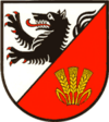
| Blazon : “ Slanted in silver and red on the left; in front a growing black wolf, red-armored and tongued, behind three golden ears. " | |
Culture and sights
To the north-northeast of the town there is a presumed astronomical-calendar stone setting at the edge of the forest . However, archaeologists could not clearly clarify whether this was a man-made stone setting. It is noticeable that the arrangement points to a point on the horizon where the sun rises in early April and early September. A year marking for sowing and harvesting is conceivable.
Economy and Infrastructure
economy
While Wölferlingen used to be an agricultural place, today it has almost developed into a residential community . At the moment there is still one full-time farmer and several agricultural part-time farms in Wölferlingen. Nevertheless, the approx. 800 hectare area of the community (including approx. 305 hectares of community forest) is still fully cultivated by these farmers. There are hardly any fallow land. The community forest used to be the community's main source of income. Today the importance of the community forest as a guarantee for keeping the air clean, as a water reservoir for the population and as a point of attraction for the general public is in the foreground.
traffic
- The community is east of the B 8 , which leads from Limburg an der Lahn to Siegburg .
- The next motorway junction is Ransbach-Baumbach on the A3 .
- The closest ICE stop is Montabaur train station on the Cologne – Rhein / Main high-speed line .
See also
literature
- Gerhard Schiller, The Maxsain ban in the 16th century. The effect of aristocratic competition on everyday rural life in the Westerwald in the early modern period. Münster / Westfalen 2004, 519 pp. [Zugl .: Göttingen, Univ., Diss., 2003], ISBN 3-00-013247-3 .
Web links
Individual evidence
- ↑ State Statistical Office of Rhineland-Palatinate - population status 2019, districts, communities, association communities ( help on this ).
- ↑ Hermann-Josef Hucke: Place names in the Westerwaldkreis in their dialect pronunciation as well as Ortsneckereien ( Memento from January 9, 2014 in the Internet Archive ) , 2010, page 18 (PDF; 132 kB)
- ↑ State Statistical Office Rhineland-Palatinate (ed.): Official directory of the municipalities and parts of the municipality. Status: January 2019 [ Version 2020 is available. ] . S. 80 (PDF; 3 MB).
- ↑ Association of Selters
- ↑ Official municipality directory 2006 ( Memento from December 22, 2017 in the Internet Archive ) (= State Statistical Office Rhineland-Palatinate [Hrsg.]: Statistical volumes . Volume 393 ). Bad Ems March 2006, p. 201 (PDF; 2.6 MB). Info: An up-to-date directory ( 2016 ) is available, but in the section "Territorial changes - Territorial administrative reform" it does not give any population figures.
- ^ The Regional Returning Officer Rhineland-Palatinate: Local elections 2019, city and municipal council elections
- ^ The Regional Returning Officer Rhineland-Palatinate: Local elections 2019, direct elections
- ↑ Information board of the Westerwaldverein at the stone setting


